.jpg)
Dimple Dell Park is a huge 630 acre park located in Sandy. The park boasts over 15 miles of trail. As of 2 years ago we can finally say we have done the park top to bottom, on various trails. However there are still some areas we have not explored. With avalanche conditions being fairly high right now we decided to stay low in the valley, and Dimple Dell is one of the best places to do that.

Quick Details:
Length: We did about 2.3
Trail Type: Out and back, loop options
Difficulty: DR3. DR4 if you push on to Sunrise Point
Elevation Gain: We did about 219 ft.
Restroom: Yes, however I believe they are closed for winter.
Dogs? Yes. Leash law strictly enforced.
Other Info: The park has a huge mess of trails. If it is your first time I recommend having a copy of the map which can be found on the SL County Parks page here (outside link).
To Get Here:
We used the Dimple Dell Road Trailhead located at 2879 Dimple Dell Rd. Take i15 to 106th S. Head east all the way to to where it end at 2000 E./Dimple dell Rd. Turn left. Go for about 1.3 miles, you will see the large parking lot on the left.
You can also access this segment from the Mount Jordan Trailhead.

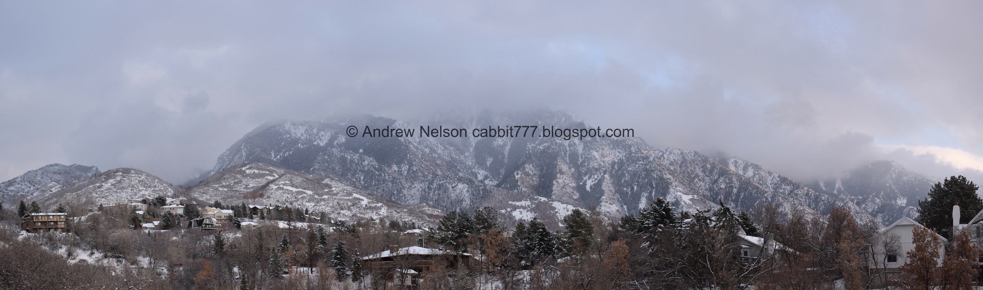
I love when the clouds are low enough to obscure the mountain tops. (Passenger Seat Photography (PSP)).
The Trail:

Mount Jordan from the trailhead.

The trailhead is 200 ft to the east of the parking lot. Of course you can go left as well.
This trailhead is located at just about the spot the canyon takes a 90 degree turn. So if you go left, you will head west mostly. If you go right, you will head north mostly.

Trail courtesy. This sign should be posted at all trailheads.

Mountains to the north with a storm.

We’ve had a fairly mild winter, so it’s kind of nice to enjoy a nice wintery hike.

The mountains again.

The restrooms.

Fun storm clouds.

Down into the gully.


There is something magical about the forest after a fresh snow.

Fun clouds over the western section.

A wall of clouds over the east end.

Nice little memorial park.

In 1976 this was dedicated as Dry Creek Bicentennial Park. However it was always known as the Dimple Dell Area. I wonder when they switched it back.

Fox Point. There is a loop trail up there that we haven’t done yet. This is the "elbow" of the canyon going north/south and switching to east/west.

The first of 2 bridges over some side creeks. I am not 100% sure, but I think they might be South Fork Dry Creek, and Middle Fork Dry Creek.

Associated canyons above.

Bell Canyon.
More of Mount Jordan.

What I am guessing is Middle Fork Dry Creek. Note, I could be very wrong, but it does seem to align.
Last time we were here we looped back to the west just after here heading for the little pond. Today we will continue north.

Huh. There appears to be another trailhead here called Walls Gate. There are even information signs posted.
After doing some digging around on google maps, I found that this trailhead seems to come off a private lane. I am guessing it was not always a private road? I don't know but it is weird.

Into the forest!

Tree with striking red bark.

Clearing.

Little heart shaped hole in the storm. Nature decided to give us a little valentine on Valentines Day.

Looking up canyon.

Cloud line just above the west canyon rim.

The dry creek bed of Dry Creek.

Looking towards the north end of the canyon again.

West side.

East side.

More forest.

The creek bed again.

The trail crosses to the other side of the creek. It’s dry, but there is a little bridge in case it is not. This is where the Dry Creek Trail ends, and you connect to the Sego Lily Trail. There is also a nice little picnic area here.

Corridor through the scrub oaks.

Where the canyon switches back toward the east.

Trail split. Left will lead you to the Mount Jordan Trailhead. We decided to head right to see if we could check out that small farthest east section we haven’t explored yet.

The far east section.

Thankfully, we were not the first ones to venture out this way.

View of the canyon again.


The creek below.

First view of what I always used to call the Bell Canyon Butt. But I recently renamed them to the Bell Bottom Twins because they are at the bottom of Bell Canyon.

Creek below.

More forest.

Mount Jordan and the Bell Bottom Twins again. You can also see that we are now on a definitely established trail.
Panoramic.

I really wasn’t in the mood for a climb today, but was hoping to reach the far east end of the park, so we climbed.

Mountains to the south.

After quite a bit of climbing, I realized this trail wasn’t leading where I was hoping it was leading. Eventually I realized that after this shorter up and down, the trail would continue quite steeply towards Sunrise Point. Probably another ~300 or so feet. I would have pushed on except for the snowy conditions. I don’t think this is an official established trail as recognized by the city, but it is pretty defined.

Looking back down into the canyon.

Can’t even really see Bell Canyon.

The mountains are so pretty today.

Heading back down.

Pretty sun rays.

We noticed this set of tracks following the creek bottom so we followed them. Note, don't do that. I should have known better.

Some of the creek.

Fun ice structures.

Old picnic table that doesn’t look like it has been used/useful for quite some time.

Eventually I realized I couldn’t tell if I was walking on land or ice. The creek is very small, but we still didn’t want to have a mishap, so we turned around.

The creek below. There must be some diversion just down creek from here.

The canyon just before it swings back to the south.

Fun lit up clouds.

Swinging back to the south.

More forest.

I couldn’t remember if the 2 trails connected again before the trailhead, but they do, so you can make a small loop here by staying on the Sego Lily Trail to the right (be sure to switch to the Mountain View Trail, before reconnecting to the Dry Creek Trail). Or return the way we came by crossing over the creek and taking the Dry Creek Trail.

Nice little picnic area.

Snowy hillside.


Pretty mountains.


More forest.

Looking up.

Back to the weird trailhead down a private lane.


More pretty mountains.

One of the open fields.

View of the canyon as it swings back west.

Flanders Point again.

Mount Jordan again.

South Dry Canyon.

Bell canyon.

Looking at Dimple Dell Canyon heading west.

Back to the pioneer monument.

Mountains to the north.

Forest.

Short limb back up to the trailhead.

Obscured mountain.

Final push.

Not the last car in the lot…. but the last to leave haha. Still isn’t dark yet.

Last of the sunset.

Little Cottonwood Canyon.

Dry Creek Middle Fork, Dry Creek South Fork, Dry Gulch, Rocky Mouth Canyon.
That was a great, safer winter excursion! we ony ran into a couple of people near the trailhead but after that the trail was completely quiet and deserted. I do enjoy the mountain views this trail offers as well. 8 out of 10 squirrels today.

As for difficulty, it was mostly flat, and you can keep it that way by turning around before the climb. However, there is a mild climb back up to the trailhead. DR3. If you push on to Sunset Point via the trail we use, I would bump it up to a DR4.
Dogs are allowed, leash laws strictly enforced.

No comments:
Post a Comment