.jpg)
Juniper Canyon is a small canyon located in Herriman. There isn’t a whole lot to it, however it does offer a pretty amazing view of the valley. Higher elevations are still pretty risky for avalanches so we didn't want to do that, and I was in the mood for something new to us today so we ended up here.

Quick Details:
Length: We did about 2 miles out and back, but the trail does keep going.
Trail Type: Out and back
Difficulty: DR4 there are quite a few steep parts.
Elevation Gain: We did about 500 feet.
Restroom: no
Dogs? Yes
To Get Here:
If coming from the north: Take the Mountain View Corridor to S. Palisade Rose Dr. Which is about a mile south of 13400 S. Palisade Rose Dr. becomes Juniper Crest Rd.Follow that for about 1.3 miles just past the Mormon church look for the blue sign on the right. There is an alternate TH before the church, but that appears to go up the ridge.
If coming from the south, Take Mountain View Corridor to Rose Crest Dr. Turn Left on Juniper Crest Rd. For about .79 of a mile and find the small blue sign on the left just after the Mormon church. There is an alternate TH before the church, but that appears to go up the ridge.

On the way out I spotted a red-tailed hawk. Passenger Seat Photography (PSP).
The Trail:

Mount Timpanogos from the TH.

You’ll know you are at the right place when you see the blue trailhead sign.

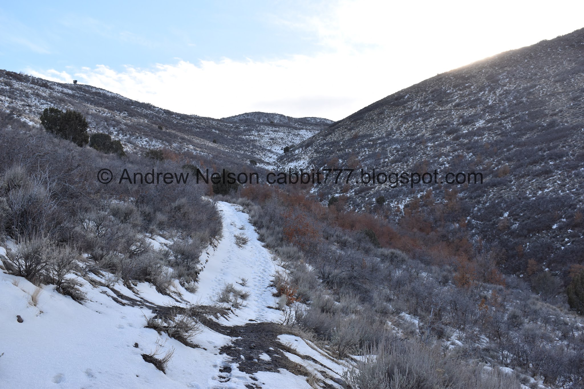
Looking into the canyon.

Hiking along the canyon bottom.

Whoops. It seems we have hit a dead end. There was a trail split a little ways back, so we turned around to head for that.

Neat rock.

Back to the trail split. It’s only maybe ~50 feet from the trail head you want to go left here. Although it’s probably only another ~50 feet to the small cliff if you go the wrong way like we did, it's not the end of the world.

That will lead to a dirt road.
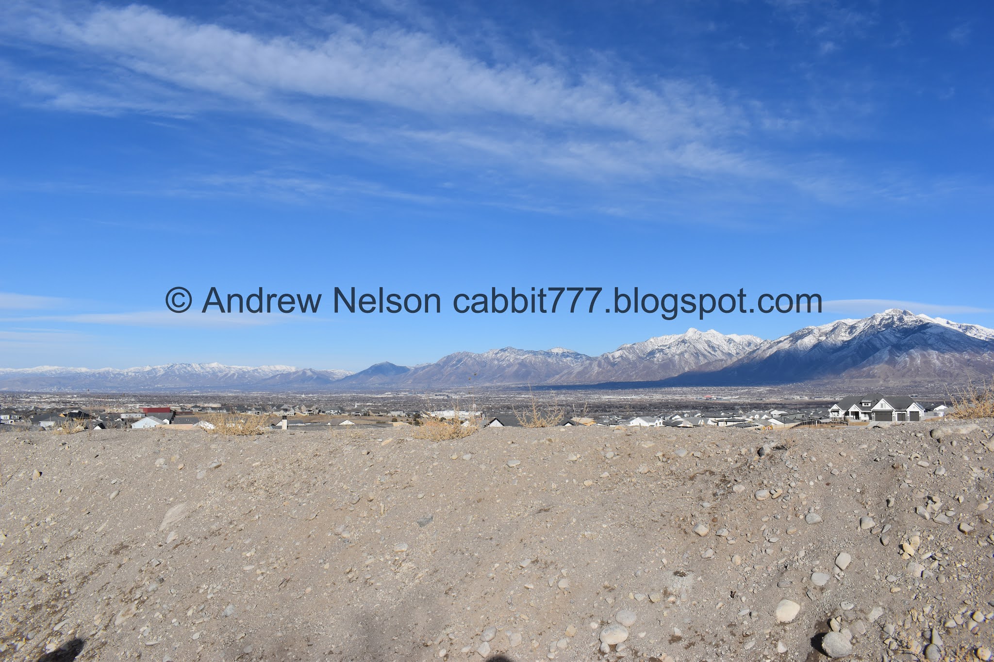
Nice view of the mountains. From right to left: Lone Peak, Twin Peaks, Mt. Olympus, Grandeur Peak.

Before long you will come to a cross roads. You will want to keep heading forward around the small reservoir.

Super muddy spot.

Not 100% sure, but I believe that leads to the top of the sub peak to the left here. It’s not what we were after today.

Here is the trail we want.

The canyon.

Looking back across the valley. Mount Olympus, Twin Peaks and Lone Peak.

The canyon again.

Whoever forged the ATV track was more interested in having a good time then getting somewhere (understandable I suppose). It goes up and down and back and forth. Luckily it seems a less wonky trail has been forged as well. We mostly used the smaller trail, but occasionally used the road for the beginning.

On the ATV track for a minute.

View down canyon.

A motorized paraglider. I am all for people enjoying their hobbies, but this guys hobby is intruding on my quiet hike. Luckily he moved on after a few minutes.

The ATV track and the smaller trail.

Another muddy section.

ATV track and the smaller trail again.

There is a mess of trails. I generally chose the trail that stayed near the bottom of the canyon. However, last time I did that I had to climb back up. So I decided to stay right here.

Crossing the ATV trail.

Looking down canyon again. Wow, you can see Downtown! Considering this is just about the furthest away from downtown you can get within the valley, that is kind of neat.

The canyon again.

I recently learned the term for the process that causes leaves not to fall is Marcescence (outside link). Oak trees are one of the trees that this is a normal process. From what I can tell, there are a few theories as to how this is beneficial. This year it seems a lot more leaves have been hanging on for a lot longer. I think the few storms we have had might be to blame.

Heading into the trees for a minute.
After here the trail switched back the other way. I was hoping to stay near the canyon bottom, but couldn’t see much of a trail. I might come back in the spring to see if I can continue up that way.

The snow storm we had last Friday was erm… particularly dirty. With the dry winter, the west desert, and salt flats are a little more dry than normal, and the high winds in the storm that blew through picked up a lot of dust and dropped it on us in the snow. I didn’t particularly notice at my house until we went to look at the cars on Saturday haha. But, here is some evidence of it as well. Car wash lines are still crazy.

Looking out again.

Well. Now our option is to keep going the wrong way and end up who knows where… or switch over to the ATV track. We chose the latter.

Oh boy, this is a climb!

Juniper tree.

More junipers.

More across the canyon. I guess we know where the name for this canyon came from.

Looking up canyon.

Fun clouds.


More dirty snow. You can see the clean, white snow beneath it.

View down again.

It’s kind of neat to see different snow lines depending on how much sun they get.

Steep climb.
Looking down again. The valley seems a lot more flat than I thought it was.

More fun clouds.
Short flat section.

Looking down into the canyon bottom.

More dirty snow.

Juniper Tree.

Are you freaking kidding me?!?!
We decided the effort wasn’t worth the reward. Yea, we might get a neater valley view, but meh. We called it and decided this would be our turn around point. Looking at the map, the ATV track only goes for another ~500 ft. So, that is a little frustrating, but, meh.

Looking towards the top of the canyon.

Looking down canyon.

The flat valley. Also, I am pretty sure that is Ben Lomond we are seeing way out there.

View from below the tree.

Downtown again.

Heading back down the steep ATV track. I started considering climbing up that little sub peak on the right there. Eh, maybe another time.

View down again. It still kind of weirds me out to see a horizon. I am used to having mountains in the way.

Dog tracks.

More fun clouds.

The sub peak again.

I think the smaller trail continues up to the sub peak. I debated it, but ultimately decided to continue taking that trail down.

Back to the thinner trail and some more dirty snow.

Back to the small scrub oak grove.

Lone Peak peeking out behind the ridge.

Looking down again.


Crossing the ATV track and looking either way. Like I said, they seemed more interested in having fun then getting to point B. Lots of up and downs. I am glad the thinner trails exists to follow.

The little sub peak.


More fun clouds.

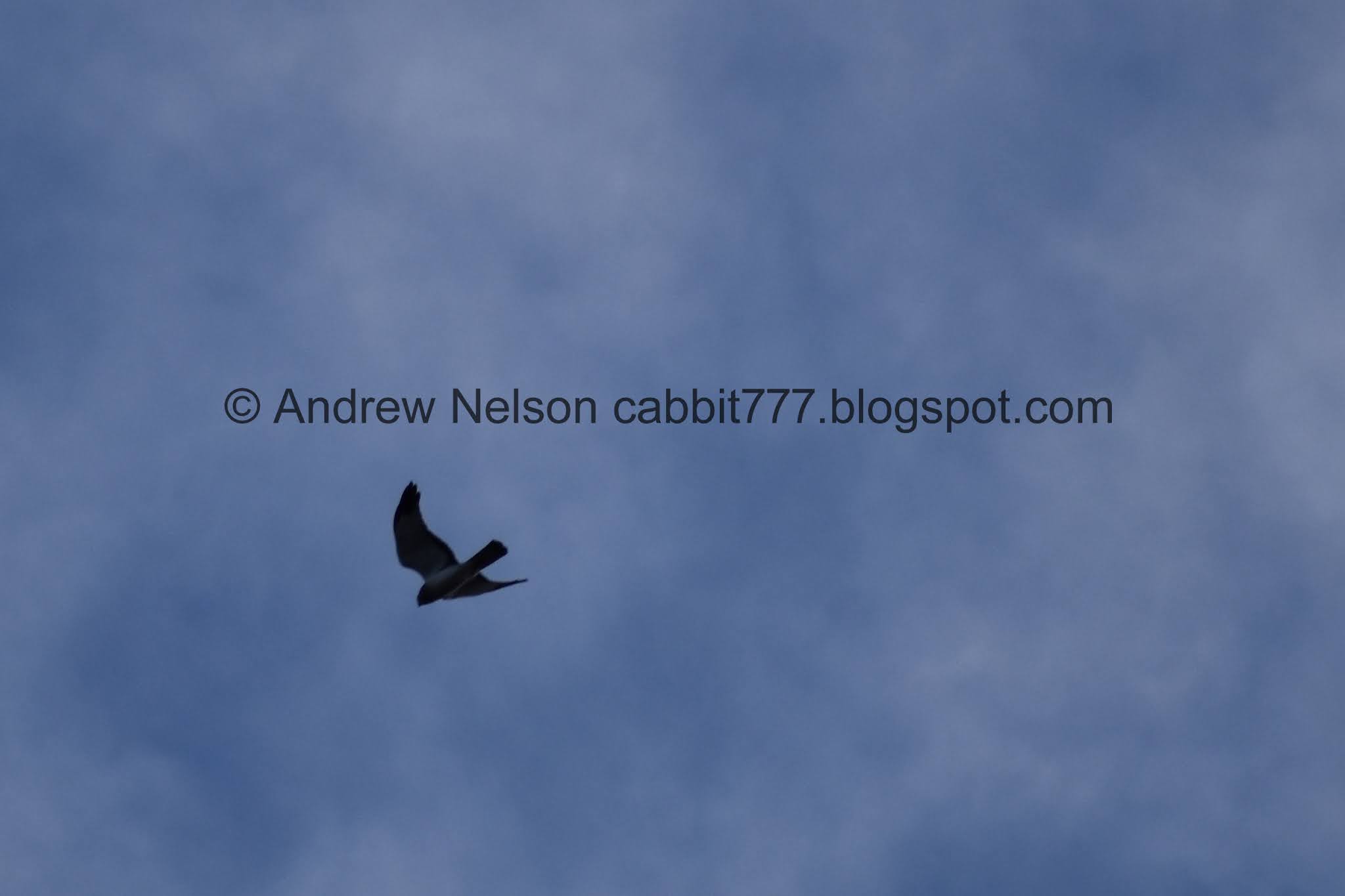
Spotted this hawk soaring above. With how far up it is, and the fact that I didn’t get much more than a silhouette I can’t really identify it.


More fun clouds.

Looking down canyon again.

Bottom of the canyon.

More clouds. I love days like this.

View down again. Now we can see Mount Olympus and Twin Peaks again.

Neat clouds.

Another spot the ATV trail randomly climbs and dips unnecessarily.

Luckily we still have the much more direct thinner trail.

Mount Olympus, Twin Peaks and Lone Peak (Mount Jordan).

Little zoomed out and we can add in Grandeur Peak and Grandview Peak.

These clouds look like they are tearing apart.

Looking back into the canyon.

The rip again.

More mountains.

Mount Olympus and Twin Peaks.

The little reservoir.

Panoramic of the valley below.

Mount Jordan, Box Elder Peak and Mount Timpanogos.

We took the ATV track from the reservoir on down to the road.

It really wasn’t much of a detour from the trailhead we used.

Mount Jordan, Box Elder Peak, and Mount Timpanogos again.

Ripped clouds again.

Little bit of a glow behind the ridge.

Twin Peaks and Lone Peak behind some new construction.

Mount Timpanogos.

The flat valley as we head home (PSP).

The Mountainview Corridor really does offer some nice mountain views (PSP). At least for now. I imagine they plan to develop this area eventually.
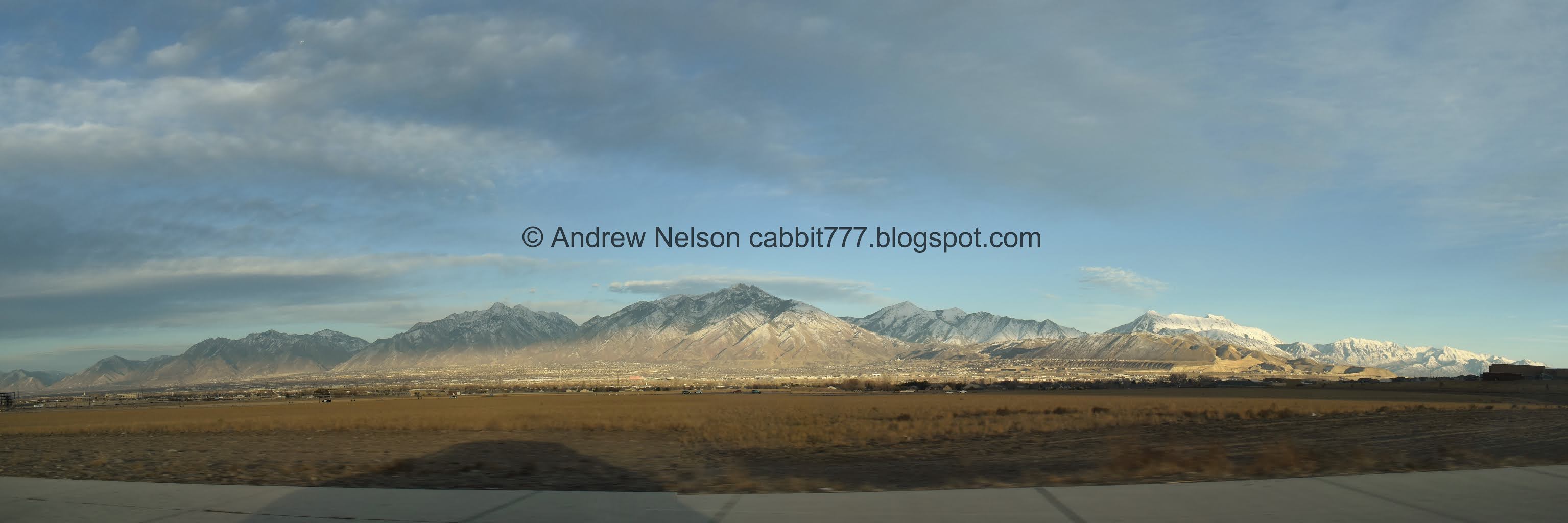
Panoramic (PSP).

Mount Jordan. It’s crazy to know that I have explored most of those canyons. Lets See. Bell Canyon, Dry Gulch, Rocky Mouth Canyon, Little willow Canyon, Big Willow Canyon, Bear Canyon, and then not pictured, but just to the right, Corner Canyon.
Eh, I didn’t love this trail, but I didn’t hate it either. The canyon is kind of meh, in and of itself, but I did enjoy the unique views it offered, the fun clouds we had today, and most of all that we didn’t pass a single soul (well, on the ground anyway). Going with 7 out of 10 squirrels. Might have to come back in the spring to see if we can bump that up.

As for difficulty, There were some definite climbs! and some muddy sections. DR4.
Dogs are allowed, leashed.

No comments:
Post a Comment