.jpg)
Quick Details:
Length: The sign says .75. My app put the east trail at .8 and the west trail at .9. Add .8 around the lake for a total 2.5 mile loop.
Trail Type: Loop or figure 8. Can also do out and back.
Difficulty: DR4. Its shorter, but it has some steep spots and some rocky spots.
Elevation Gain: 670 feet.
Restroom: No. The closest public restroom I am aware of is a little further up canyon by Silver Lake.
Dogs? No. Big Cottonwood Canyon is watershed.
Other Info: Watershed also means no swimming. Just a heads up.
To Get Here:
Head up Big Cottonwood Canyon. Past the Silver Fork Lodge. About halfway between mile marker 13 and 14 there will be a boulder on the left (north) side of the road. If you reach Solitude you went too far, but don’t worry. the canyon ends at a loop that will easily turn you around.

The mouth of Big Cottonwood Canyon (PSP (Passenger Seat Photography)).

The canyon seems greener than normal (PSP).

Mill D South (PSP).

Aside from the cars on the road that generally give the trail location away, if you come from the top of the canyon, you will see the 'Curve 25 MPH' sign. That is where the trail is. (PSP).
The Trail:

The trail marker is set back just far enough that I don’t think it is easily seen from the road.

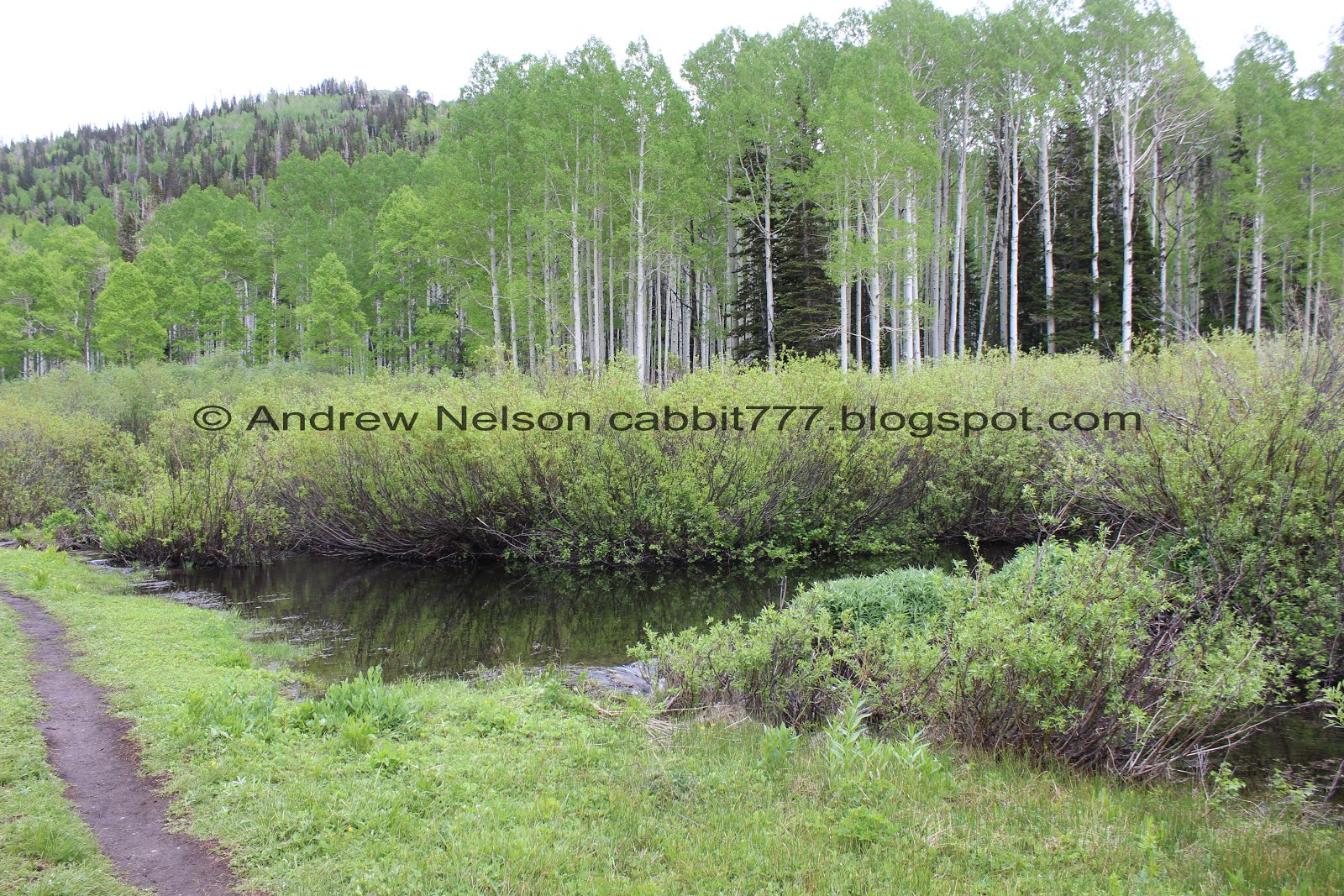
This pretty area was almost sold to developers to build who knows what (hence the trail name). Luckily the city was able to raise the funds to purchase the land and keep it wild and open to the public.

Just a little ways along the trail you come to the official trail sign.

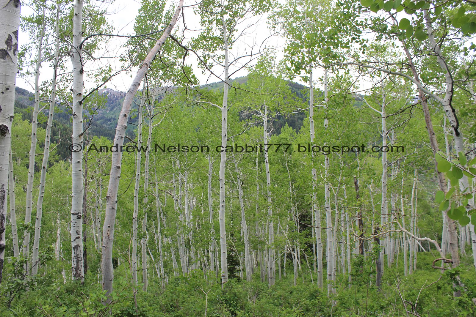
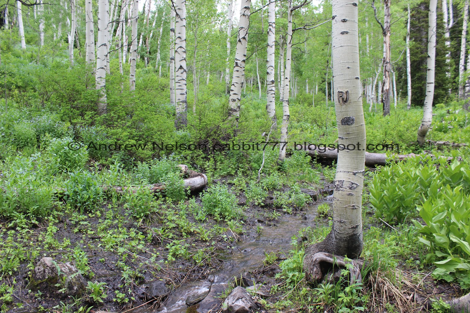
The beautiful forest.
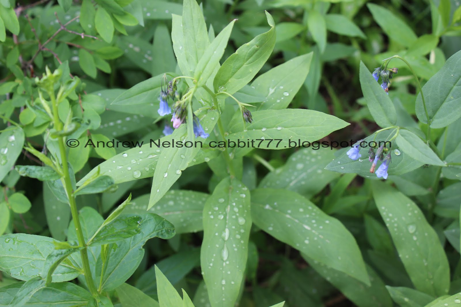
Bluebells. It looks like we just missed a little rainstorm.

Writhing mass of ants. Holy crap.

Wild snapdragon.

More bluebells. There are soo many on the trail right now. More than anywhere else I have seen. Now I am curious if trails I have seen a lot on before are just exploding with them.

About a tenth of a mile up there will be an offshoot to the left. Ignore the smaller first one. This one is just below where the trail starts climbing. It is just a smidge longer, but is quite a bit easier to climb.
So this is a little different, we can hear the creek flowing from here as well. That is not normally the case.

The “alternate” or west trail is pretty well established as well.

Geranium.

I wasn’t able to identify this one.

1 of 3 (or 5 if you go around the lake) creek crossings.

It really is higher than the last time we came through here.

Pretty trail, starting to climb.


Okay. This is just damn cute. I have seen some pictures floating around the internet that said bees like to take naps in flowers (and also like to hold hands apparently) but never expected to actually witness it myself. Yet, here we are. An adorable little bee napping away in a flower. I have never described a bee as adorable, or cute, but, then again, I have never seen one napping in a flower before.

Wow. If I crop it just a smidge you can see the pollen on him.

I think these are forget me nots.


Squirrels! There were a lot of these guys on the trail today.

Pretty aspens.

Eventually the trails joins a wider trail, that may be an old dirt road. Those sticks crossing the trail are new, and may not always be there so coming down this way is a bit more of a challenge. If you miss the turn off here, that trail continues down to a small neighborhood and will require a little walking along Big Cottonwood Canyon Road to get back to your car. But, it’s not too bad.

I think this is golden weed.

More of them.

Starting to get a glimpse of the mountains on the other side of the canyon.

More wild snapdragon.


Bluebells.

More geraniums.
Pretty aspens.

Mountains on the other side of the canyon.

Lupine.


The trail again.

Larkspur.

Aspens.

Just look how thick and green everything is.

Bluebells as far as you can see. This is crazy!

Squirrel!

I think this is Silver Fork out across the canyon.


More larkspur.

A little closer.

More bluebells.

Lots of wildflowers in this small clearing.

More aspens.

Loads more bluebells.

Small clearing. Getting close to the top.

2nd creek crossing.

Downstream.

Upstream.

More aspens.

Looking up.

Bluebells and aspens.

The big clearing. This is just below the lake, so you know you are almost there when you get to it.

I love these bald cone like peaks up here.

Peaks on the other side of Big Cottonwood Canyon.

Quick panoramic.

Another bald peak.

A small pond next to the east trail down. I remember the first time we hiked up here it was still covered in snow and we thought it might have been the lake and how disappointed we were for a second.

Looking back at the peaks across the canyon.

At about 9/10ths of a mile you will reach the split. The lake is just on the other side of the trees. Either direction will get you there, but I recommend going left, as you have more of a clearing to see the lake. To the right has a lot more foliage and only a few openings to see it. Although, if you decided to walk around the whole thing anyway, there could also be something said for ending on the nice beach.

First glimpse.

Panoramic.

The creek. Normally it is easy enough to just step across without getting wet, but not today.

There is a decent crossing just a bit upstream though.

Another squirrel.

Bluebell covered hill.

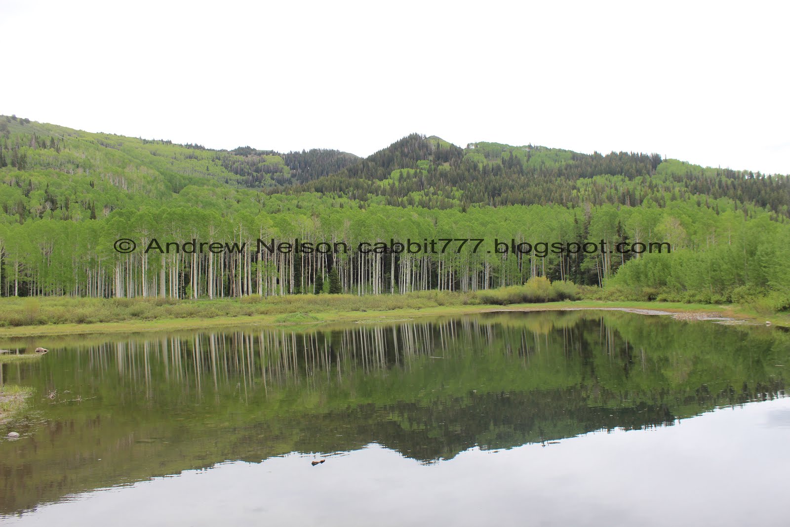
Willow Lake. No moose today unfortunately.
A little closer.


Buttercups.

A little further back.

Another panoramic.
We decided to walk around the lake. Mind you, this is a little different than most lakes around here, as it does not necessarily follow the lake shore. You will see why momentarily, but basically there is a large marshy area behind it the trail goes around.

Little canyon above. That leads to Dry Lake.

The mountains on the other side of the canyon looming above the lake.

Little better reflection.

Even the upper creek is flowing pretty good.

Whoa! The whole marsh is flooded. Crazy! We decided that if this extends back to the trail then we are turning back. Luckily it didn’t.

So green and pretty up here.

Back into the woods.

I don’t think I have fully conveyed the never ending bluebells up here have I?
The creek seems a lot smaller up here. You know, now that I think about it, I don't think I have seen the creek up here flowing before.

Aspens.

This is the trail that takes you back to Dry Lake. Considering how much water is coming down right now I would bet Dry Lake is probably not so dry right now. I considered going up to it today, but wasn’t up for it.


More aspens.

You get a couple glimpses of the lake back here.

The eastern creek. Again, I am not sure I have ever seen any water in this one before now too.

Looking downstream.

The trail follows the stream for a short while.

Some of the aspens up here are really big!

A long clearing between the aspens.

Pointy sister peaks.

Now we are on the east side of the lake. This has a lot of foliage, but there are a couple openings that allow you to see the lake.

With the peaks above.

I am still pretty sure that is Silver Fork.

Back down to the split. About 1.7 miles from the beginning. We decided to head back down via the east fork.

Panoramic of the peaks across the canyon.

The little pond in the big clearing.

Closer.

I think this qualifies as a hanging valley.

Looking down Big Cottonwood Canyon.

Into the woods again.


This is one of my favorite aspen forests. It is so thick!


Forget me nots.


Penstemon.

I had to come back and take a picture of this lighter blue one.

This flower hasn’t opened yet so hard to identify for sure, but leaning towards scarlet trumpet.

Wild snapdragon.

The less mature ones are green to white.

This trail seems to be a bit more overgrown than the western one. Which is odd as I would consider this to be the main trail.

Starting to hit the steeper, rockier sections. This was a little rough on the knees. I think future trips will be along the longer western trail up and down, even though I like the forest better on this side.

Bluebells.

Buttercups.

Back down to the trail split.

The less mature bluebells are pink.

Back down to the trailhead.

Across Big Cottonwood Canyon Road there appears to be another nature area. Might have to come back and explore that some time.

With the peak above.
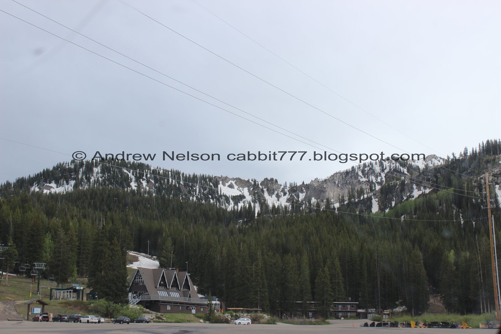
We decided to head on up to Brighton real quick before heading down. It's not that much further up canyon.

Snowy peaks above (PSP).

Quite a bit of snow still on Mt Millicent (PSP).
Even more up above Brighton towards Lake Mary (PSP). I don’t think the trail up to Lake Catherine is clear right now.

Heading down Big Cottonwood (PSP).

So pretty and green right now (PSP).

Back down to the mouth of the canyon (PSP).
I love this trail. I think we end up doing it at least once, sometimes twice each year. It’s always pretty. The wildflowers this year though are unreal! No moose today, but we have seen them several times on this trail. 10 out of 10 squirrels.
As for difficulty, its got some steep rocky parts but not too bad DR4.
Dogs are not allowed due to watershed rules. Please respect that, it is our drinking water.
