.jpg)

Quick Details:
Length: Main trail is 1.3 miles out and back. I ended up doing a 1.86 mile loop.
Trail Type: Out and Back, Connector, or Loop.
Difficulty: DR3 Little bit of a climb
Elevation Gain: Main trail is 220 feet I did 465.
Restroom: No. Closest would be a gas station on Harrison BLVD.
Dogs? Yes Leash required.
To Get Here:
From i15 take take the 12th St exit in Ogden. Take that to Harrison BLVD. After passing the Chevron on 2nd St , and when Harrison becomes Mountain Rd., look for the TH on the right located at about 1160 N Mountain Rd..
The Trail:

Area trail map.

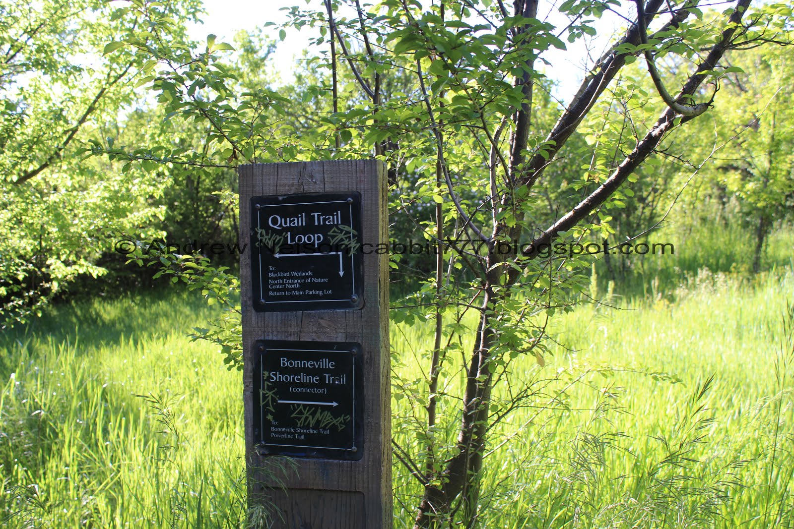
Another one of Ogden’s awesome trail signs. You will take trail to the right heading southeast.

There is a trail split just after the sign, and before the hill. I assumed the left split went to a picnic table I could see, so I took the right split. Just a heads up, the left split is MUCH better.


Beautiful wild snap dragons.

The trail up. Oi.

Some vetch.

Okay. This trail sucks butt.

View of the Ogden valley below.
I noticed a trail below that seemed a little easier, and even though I put this much effort into the climb, I decided that trail looked better. So, after returning to the split I reset my pedometer app and tried anew.

Pretty purple flower.

Ben Lomond.

This trail is a little bit thinner, but quite a bit easier.

More vetch.

A better view of Ben Lomond.

Like I said, thinner, but quite a bit easier.

Squirrel!

View across the valley.

Panoramic.

Reaching the crest I came to another helpful sign. It looks like both trails will get here, but the lower (left) trail is the much easier choice and avoids a little unnecessary elevation gain. Anyway, stay left to continue following the Power Line Trail.

After the climb the trail is fairly flat and not so bad.

Ben Lomond again.

Like the Quail Trail Loop below, this trail shows a lot of rocks that have fallen from the cliffs above.

Lovely hike along a bench.

Rock slide area.

Ben Lomond again.

Any questions as to why this is called the Power Line Trail?

More rock slide.

With the cliffs above.

For the most part this trail is alright.

Cliffs above.

Couple shady parts but for the most part this trail is full sun.

Another little climb up around another power pole.

Wider view of Ben Lomond than I am used to. At least one of those little canyons ought to have a trail, right?

Then we descend into the forest.


At about a half mile you will hit a split. Forward will continue along the power line trail. Left will connect to the Quail Trail Loop that I did earlier. Doing the 2nd option is the shortest route to explore both trails in one go. I am glad I did it the way I did, but that is another good option now that I know about it.

The forest again.

Little bridge.

Another power pole.

Eventually you pop out of the woods and get to enjoy sagebrush and Ben Lomond.

Sage brush. Also, I think that is the North Ogden Divide Canyon.
Finally a good un-obscured view of Ben Lomond.

Garner Canyon above.

Eventually I came to a dirt road. This is the end of the official Power Line Trail. But I decided to keep going up a little bit.

There are tons of dragonflies flying around. I didn’t think I caught them.

The road is kind of steep and rocky, but not too bad.

Neat cliffs near the top of the road.

Left is now considered the Canal Trail, Forward is now the Bonneville Shoreline Trail. I decided that this was a good spot to officially turn around. However, I did want to explore this area a little bit.

Pretty flowers.

The cliff again.

There is a little waterfall back there.

I climbed up the BST just a little bit to see if I could see the waterfall better, no, but here are the cliffs again.

View of the valley.

Little peak above.

Pink and white vetch.

Turkey vulture hunting above.

I went a little down the other direction along the BST and finally was able to see the little waterfall. It’s not much more than wet rock, but still neat.

With Garner Canyon above.
Okay, enough exploring I think it is time I head on back.

A last look at Garner Canyon.

The dirt road is now considered the Canal Trail. I am not sure how far it goes, but it is similar to the one found along nearby Jump-Off Canyon.

Gnarly tree.

Ben Lomond again.

Butterfly.

Back into the forest!

Weird mushrooms on a bridge.

I wasn’t up for regaining some elevation so I decided to return vie the Quail Trail Loop.


Pretty forest.
Now I have hit the Quail Trail. Since I just did that earlier, I didn’t take a whole lot of pictures through here.

More forest.

That is a pretty in-tact rib cage. I thought about taking it home but thought.. what the hell am I going to do with it? haha.

The cliffs above again.

Large scree fields.
I went a little further than intended but I am happy with what that got me today. This trail was a little tougher than expected, but not too bad. Lovely view along the way and not a ton of people. 7 out of 10 squirrels just cause it didn’t really offer a phenomenal end prize.
As for difficulty, it wasn’t bad at all, just a little bit of a climb at the beginning, and a little more if you continue up the road. DR3.
Dogs are allowed, but must be leashed.

No comments:
Post a Comment