.jpg)
This section of the Jordan River Parkway was surprisingly enjoyable. It it mostly wooded and far enough from houses. So it seems like a nice little forest in the middle of the city. Much of the trail is away from the river, but overall is is quite lovely.
Quick Details:
Length: About 2 miles out and back, or a 2.3 mile balloon.
Trail Type: Connector, out and back, balloon option.
Difficulty: DR2 - DR3.
Elevation Gain: About 30 feet.
Restroom: Yes, however it is closed during winter.
Dogs? Yes, leashed.
Other Info: Cities: South Salt Lake. JRP Mile Markers: 32
To Get Here:
Take i15 to 33rd South. Head west. Turn left on 7th west. Go about 3/4 of a mile turn right on Carlisle Park Ln. Follow that to the end to General Holm Park.
The Trail:

Trailhead sign.

The trail picks up at the west end of the park.

Looks like they rerouted the trail. Likely after the overpass bridge was installed, that connects to the previous section. It appears before that overpass was built you had to take your chances attempting to cross 40th S.

Historical Marker for the Carlisle Family.
In the 1850’s and 60’s 3 brothers settled in this area between the Jordan River and 7th west. They farmed, got into dairy, and silk worms. They founded a school that ran from 1905 - 1923.
And from what I can tell all that remains of their legacy is this sign. But hey, few people leave behind a legacy grand enough to warrant a historical marker. It’s just sad to see these old farms being developed.

The official paved trail to the right. Unpaved option to the left. I went right today, but I returned on the unpaved part.

Lovely wooded section.

Looks like there was a fire here.


Lovely forest. I might have to come back during the warmer months.


More.

Then it opens up to a meadow.
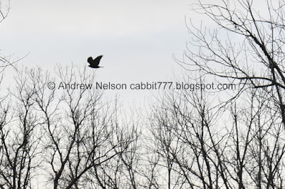
Some kind of hawk.

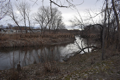
Finally able to see the river.

Better view.

I wonder why they reused the sign from the Little Cottonwood Confluence instead of making a new one for the work they did here? Oh well.

I think this is the part they restored.

Looks like the mountains are getting some snow.

South Salt Lakes benches are pretty basic.

Looks like I stumbled upon a UTA lot.

Bush full of birds.

The Tracy Aviary Jordan River Nature Center has a bunch of these plots of native, drought tolerant plants. Looks like they planted them on Earth Day 2021.

Drainage ditch.

Sign about helping keep stormwater clean.

Another meadow.

Back to the river. The trail stays next to it for the rest of the way.

Mile Marker 32.

Mountains and… is that a teepee?

More mountains.

Yup Definitely a teepee. That appears to be on the Salt Lake Valley Detention Centers property.

The river and the trail.

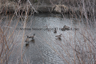
Geese.

A bunch of them hanging out in that field too.
Riverbend.

The Tracy Aviary Jordan River Nature Center. I thought it seemed somewhat newish, looks like it opened in 2020.

Well, this was my intended destination for the day, but it wasn’t much further to 33rd south.

The river again.

American coot.

The underpass under 33rd south. Alright, I think this is a good spot to turn around.

A couple of fishing docks here.

Trailhead sign. This is where I plan to pick up the trail for the next section.

The river.

I saw lots of evidence of beaver activity, but no beavers or lodge.

Back to the geese in the field.

Geese in the river.

Another riverbend.

I’ve seen these mounds on other sections of the trail. Ants? Gophers? Something else?

Panoramic.

Random chair in the woods.

Back to mile marker 32.

The river again.

Another bush full of birds.

Juniper tree.

Storms over the mountains.

Another riverbend.

Since I knew there was a side trail that connected at the beginning, I felt pretty confident that this would connect to it. So, I thought I would check it out and make a balloon. I ended up being correct with that guess and made it back just fine.

The river again.

Entering the wooded section again.

It is pretty back here.

Little hill.

More woods.


The river turns and bends quite a bit through here.
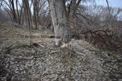
More signs of beavers.

Really enjoying my stroll through the woods.

This unpaved trail generally follows the river more closely.

Another riverbend.

Better view.

More beaver activity, and uh, the trail is a liiiiittle too close to the edge for my comfort.
The river again.

Downstream.

Riverbend panoramic.

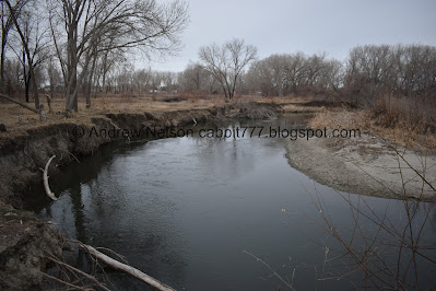
This is precisely why I was a little nervous about the trail being right next to the edge. o.O It didn't collapse under me, some time before, but yeah, definitely shows it is possible. Lucky for me, there was nothing forcing me to stay on the trail so I was able to scooch a bit to the side.

I think this can be considered an oxbow

Panoramic.

One side.

The other.

Another panoramic.

Looks like another burn area.

Lots of trail splits through here. I was generally keeping to the right so I would stay near the river.


Forest.

Ran into a couple cement stones. I wonder if they are left over from the old Carlisle Farm.


More forest.

Another burned area.

One last view of the river.


More forest.

Huge tree next to the river.

Back to the main trail.

I didn’t notice this monument last time I was here.

Oh, this is who the park is named after. Major General George P. Holm. He served in the military from 1938 to 1971 and fought in 3 wars.
He was the driving force in creating the Utah State Veterans Memorial Park and Cemetery. The Utah State Veterans Nursing Home, and this park, which honors the second world war.
The monument again.
Like I said, I really enjoyed this section a lot more than I thought I would. I might might need to return in the warmer months. I didn’t see a single person on the way north, and only a couple people on the way back, on a holiday no less. However the weather wasn’t the best. 8 out of 10 squirrels today.
As for difficulty, if you stay on the paved part its pretty much a DR2. DR3 if you decide to do the unpaved loop.
Dogs are allowed, but must be leashed.
