.jpg)
Perry’s Hollow is a nice little hollow located in the Avenues above Salt Lake City. It has been acquired and been made a preserve by Salt Lake City. It features some great views of the valley below, wildlife, and a very odd and unique thing. There are at least 9 wrecked cars along the way. I don’t know what the history on that is, but it appears that, judging by the look of the cars, in the 70’s this was a spot to dump your cars, possibly by pushing it off from above. We just did this trail a few weeks ago, but all the wrecks were covered in snow, so since it’s been a minute since we got any snow I thought we would try again. I don't often return to a trail that quickly, but I thought the timing was good.
Note: This trail is directly below and connected to The Bobsled Trail (and it appears most people consider the entire thing to be The Bobsled Trail) which is a popular fast downhill bike trail, and they will continue down through the preserve. They might even tell you it is a downhill bike trail only. That is false. The city has designated it to be hiking. But, be aware they are there. Keep your eyes and ears open. I probably wouldn’t plan on doing this trail in the warmer months due to that (and lack of shade). We actually didn’t end up seeing a single one today.
Quick Details:
Length: I believe the hollow ends at the BST at about 3/4 of a mile or 1.5 out and back. If you keep going up the Bobsled (not recommended), the whole thing is about 3.2 miles out and back. We did 3 today.
Trail Type: Out and back
Difficulty: DR3.
Elevation Gain: Looks like the full thing is 922 ft. We did about 800.
Restroom: No.
Dogs? Yes, leashed.
Other Info: Keep your eyes open for fast downhill bikes. Particularly if there isn’t any snow.
To Get Here:
Take i80 to 7th east. Head North, eventually get in the middle lane because on South Temple you will turn left, then IMMEDIATELY turn right on I St. Take that up to 11th Ave and turn right. Go about a half mile and turn left onto Terrace Hills Dr. Turn right onto Chandler Dr. go about 3/10ths of a mile and park on the street. You should see the hollow on the left.

It’s a little hazy today (Passenger Seat Photography (PSP)).

From somewhere in The Avenues (PSP).
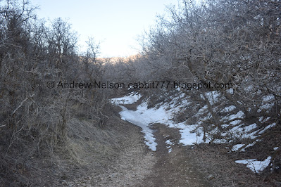
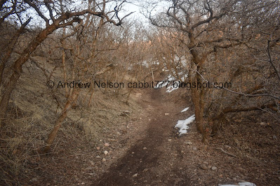
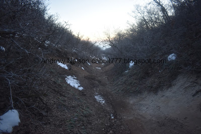
The Trail.

View of downtown through the haze from the trailhead.

And the valley. Yuck.

Panoramic.

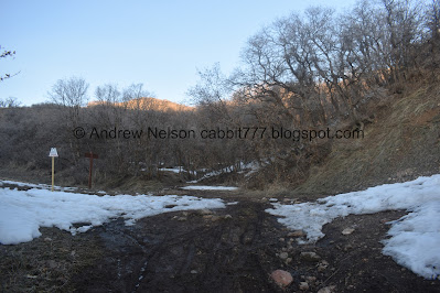
The trailhead currently isn’t signed. However, there is evidence the city is working on this trail system, so that may change soon.

Looking into the hollow.

Downtown again.

There was a little frozen pond here last time, now it’s all dried up.

I am 100% positive this was not here last time. We’ve seen these on several trails, its a device that counts how maybe people pass by. They typically use these to determine how much different trails are being used. So, that is one of the things that clued me into the city looking into this trail.

Some of the crazy bike paths.

So we noticed this animal at the top of the hill. I was pretty sure it was a dog but pulled out the telephoto anyway….

After putting the telephoto lens on, I snapped a picture and then I dismissed it as a dog. But now that I am looking at this photo.. uhm… I’m pretty sure that’s a coyote. I am kicking myself for dismissing it as a dog so quickly. In my defense, there are houses up there.
We also realized the “weird sounding dog” we heard barking on the way down was a coyote. We’ve only ever heard them howl before, never barking. In fact I never knew they barked until now but we found a video that shows it. (not mine just some youtube video).

This trail is the only one that I am aware of that has 1/10 of a mile markers. I kind of like it. Easy to tell how much further it is.

A rather high bike jump.


Deer!
After we saw the “dog” I made an off-hand remark that it was probably looking for deer. Now that I am pretty sure it was a coyote it most certainly was! Which explains why these guys were so skittish.

I feel bad that we made them nervous. We were not approaching them, just trying to get by on the trail.

Hi cuteys!

Back to the trail.

The weird dam thingy that isn’t damming anything. Both trails get you up, but the one on the right is the easier, safer option. Less chance of a biker not seeing you on a jump.

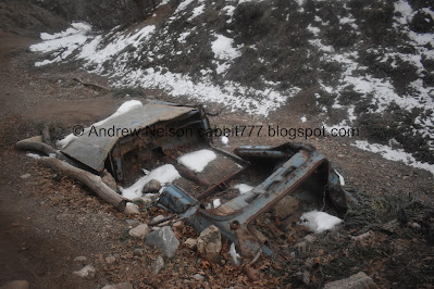
The 4/10ths mile marker. Here is where the 1st car wreck is.

Its a little hard to see through the trees.
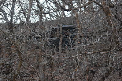
But it is definitely a car.
Nice to be able to confirm that, since I was doubting myself from the last time.

Cars 2,3, and 4 are up here.

Car #3 is upside down.

Car #4 is my favorite.

It still has it’s steering wheel.


Car #3 again.


Car #2 This one is pretty neat too.
They are all solid metal cars and appear to be as old as the 1970’s, or possibly older. But, I am not a car guy by any means.
Like I said, I don’t know what the deal is, if they tried driving up and got stuck, fell down the hill, or if it was just a fun spot to dispose of cars, similar to Farmington Canyon, although there I have confirmed at least some where accidents.

Car #3 again.

Back to #4.

From the back.

From the front.

Starting to really hit the snow, and I can see evidence the bikers are still using the trail. Luckily we did not run into any today though.

They’ve turned some of these wrecks into jumps!

Car #5 which is conveniently next to the 5/10 mile marker. I think it is weird they made this a bike jump. I mean, if you miscalculate it, you’re going to need more than a tetanus shot. o.O

Neat rock.

Man the mountain bikers are crazy!

Hood, which matches the color of the next car.

Car #6.

Hood full of rocks.

Looks like someone has used it as a shelter recently.

This one still has its steering wheel too.

From the back.

Car # 7.

Also a jump, also pretty dangerous looking.

Icy foot print.

Car #8.

This one is quite mangled.

Car #9, which is the last one that we have found.

Continuing up.

The Bonneville Shoreline Trail (BST). I am pretty sure the is the end of the Preserve, and continuing forward is The Bobsled Trail. This is about 3/4 of a mile up. As far as I can tell there are no more car wrecks above this anyway.

This wasn’t here last time we were here, but it is another confirmation that the city has defined the area as multi use and we are allowed to be here.
However, now that I seen the majority of this trail, I don’t think I would ever much go further than a mile. The trail gets very narrow and I would not want to get kablammed by a bike. So it is probably better left to the cyclists.
Starting to narrow some.

Peaks above.

Up to the 10/10ths trail marker. This is where we turned around last time, but we decided to push our luck with not seeing any bikes yet and keep going.


Continuing up.

11/10ths.

Starting to get pretty narrow.

Starting to hit more snow.

12/10th of a mile.

Starting to alternate between ice and mud.

13/10ths of a mile.

View up again. It is really starting to get narrow and windy.

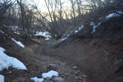
Narrow and shallow gully.
Pipeline scar. Looking back, this is probably the absolute highest I would go, but honestly would probably turn back sooner. It gets a lot thinner, windier, and steeper after this.

After the pipeline scar it starts getting pretty steep.
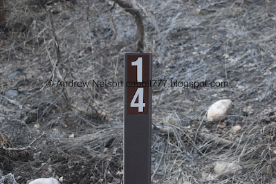
14/10ths.

Really narrow and steep. I am glad we did not run into any bikers.

It was starting to really alternate between ice and mud up here, on top of being steep and narrow. I really thought about turning around here, but we agreed to push on to 1.5 miles. Kind of regretting sticking to that though.

The last little bit was a struggle, but we made it to 1.5 miles. Phew! I am kind of kicking myself for not going the last ~1 or 2 tenths of a mile to the top, particularly since I don’t think we will do this part ever again. But, it was too icy and muddy so we called it and started to head back down.

Last view up.

Heading back down.
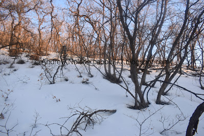
Snowy forest.
Narrow and windy.

The inversion funk.

I climbed a little ways up the pipeline scar to get a better view.
Yuck!

More yuck.
More narrow trail.

The inversion again.

Back to the BST.

In a weird turn of events, the sign that was there at the BST on the way up disappeared before we returned to it. o.O Not sure if it was placed early, or if it was stolen. I would have thought I was going crazy if I didn't have photographic evidence. Really weird.

Back down to car #9.

Car #8.

Car #7.

#6.
#5.

We realized they used the cars tires and rocks to build up the ramps.

Cars 4,3, and 2.
There are a couple of roads above that people could have accessed this hollow from, but I suspect E Perrys Hollow Rd was a big one.

Car #1 lost amongst the trees.

The weird dam thing.
The SLC.gov page for the preserve says the following:
“In 1945, a cloudburst flood altered the landscape of the hollow, and traces of the event can still be seen.”
However it does not expand on it or mention what to look for, so I kind of wonder if this might be one of them?

The deer were still hanging out. I like the silhouettes on the ridge.

Another shot.
After hear the weird barking earlier, and now that I am certain it was coyotes, I can see why these deer seemed to be a little extra skittish today.


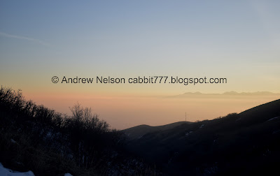
Little bit of sunset color.

Looking back up the hollow.

The last little climb up to the road.

Little sunset above downtown.

Panoramic of the valley below.

Trolley Square.

The valley lighting up as the sun sets.

Downtown.

Looking south.
Well that was a fun adventure, and I am glad we got to experience most of the hollow without running into any fast downhill bikers. And even though there was snow, we were able to see the car wrecks today. 10 out of 10 squirrels for the preserve. 6 for the upper trail and I think going forward I will leave the upper trail to the bikers.
As for difficulty, the preserve part is super easy going DR3. Above the preserve it starts getting a bit steeper. DR4 for that.
Dogs are allowed, but must be leashed at all times.
