.jpg)
Perry’s Hollow is a nice little hollow located in the Avenues above Salt Lake City. It has been acquired and been made a preserve by Salt Lake City. It features some great views of the valley below, wildlife, and a very odd an unique thing. There are at least 8 wrecked cars along the way. I don’t know what the history on that is, but it appears that, judging by the look of the cars, in the 70’s this was a spot to dump your cars, possibly by pushing it off from above.
We tried to do this trail a couple of months ago, and only got a little ways up before a mountain biker informed us this was a fast downhill bike only trail. I since confirmed on the Salt Lake City .gov page that is not the case. It is a hiking trail. It is however below the Bobsled Trail which is a fast downhill bike trail, so I suppose I can understand the confusion. I decided to return in winter thinking there would be a lot less bikes. I am glad we did, and it was a neat first adventure of the year.
Quick Details:
Length: The main preserve is about 1.5 miles out and back But the extended trail looks like it is about 3.2 miles out and back. We did 2 today.
Trail Type: Out and back
Difficulty: DR3.
Elevation Gain: Looks like the full thing is 922 ft. We did about 430.
Restroom: No.
Dogs? Unknown.
Other Info: Keep your eyes open for fast downhill bikes. Particularly if there isn’t any snow.
To Get Here:
Take i80 to 7th east. Head north, get in the middle lane because on South Temple you will turn left, then IMMEDIATELY turn right on I St. Take that up to 11th Ave and turn right. Go about a half mile and turn left onto Terrace Hills Dr. Turn right onto Chandler Dr. go about 3/10ths of a mile and park on the street. You should see the hollow on the left.

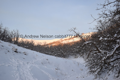
The mountains look amazing with a fresh dusting of snow (Passenger Seat Photography (PSP)).


Couple of deer hanging out on the hill just before the trailhead (PSP).
The Trail:

Nice view of Downtown SLC from the trailhead.

A look into the hollow from the trailhead.

Tiny little pond below.

Downtown again.

Deer tracks.

Only seeing 1 bike track. I think we should be okay today.

The hollow again.
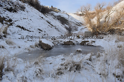

The itty bitty pond.

The hollow.

Hitting some sunlight. Woo!

Is that a bike jump? That seems awfully high for one.

Really high.

Loads and loads of deer tracks.

The hollow.

Looking back down.

Some kind of dam looking thing. I wasn’t sure what was behind it and the trail split here. More tracks seemed to go to the right, so we did that.

Looking back down.

I really have no idea what this structure is, there isn’t a reservoir back here.

Nice forest.

I kept seeing these numbers along the way. It took me until 5, before I thought I knew what they were. My pedometer app announces the half mile. So at 5 I thought they were 1/10th of a mile markers, and confirmed it at 6. Weird, before now the smallest increment I had seen was quarter miles.

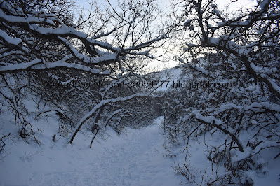
Heading through the scrub oak.
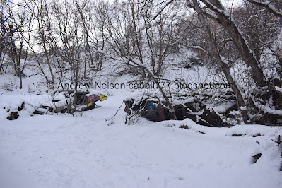
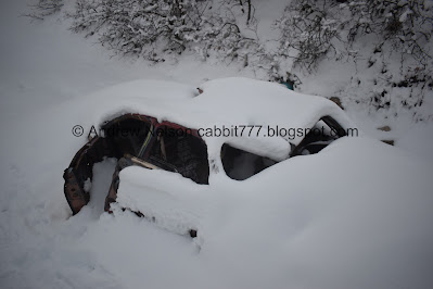
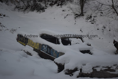
The first group of cars. Actually, there is one below here that we didn’t notice until the return trip.
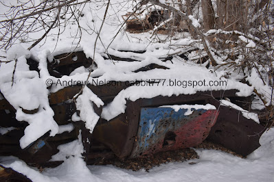
This one is super rusted.

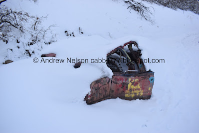
I think this one is my favorite. I am going to refer to it as the upper car (or car #4).

This lower one (#2) is pretty cool too.


Back to the middle car (#3).

The upper one (#4).

Inside.
Like I said, I have no idea what happened here. It is a lot like Farmington Canyon. I know some of the wrecks in that canyon were accidents, but I think a lot of them, and pretty much all of the ones here were just pushed off for fun.

Closer to the lower car (#2).

Inside.
This was my general intended destination today, but we decided to keep going.

Front of the upper car (#4).

Back into the woods.
View up canyon.

The hollow.

Starting from the one we didn’t see on the way in, this will be car #5. Which happens to be at the 5/10ths mile marker.

Can’t see it too well with all the snow. I’m going to have to figure out if I can come back without snow sometime.

Fun rock.

Car #6. Looks to be an old SUV.

Through the woods.

Fun little archway.

I was surprised to see someone up on the ridge above us. I guess that is the Bonneville Shoreline Trail (BST).
Car #7.

Inside.

Continuing up.

Car #8.

Wheel well icicles.


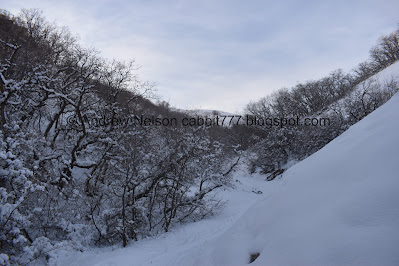
Lovely snowy forest.

Car #9. This one is caught in the trees a bit above the trail.


More forest.

4 way trail split. The BST crosses from right to left, and then the trail continues forward. I am not 100% sure, but I think this is leaving the Preserve and going on the Bobsled Trail. There are signposts, but no signs at the moment so.. yeah. This is about 3/4 of a mile up.

View down.

View up.


Continuing up.
View up.

Little S curve.

View down again.

Scrub oak.

View up again.


More scrub oak.

View up again.

Due to getting a later start, we decided we would turn around at a mile, or if the trail started to get too steep (which some of the trails in this area tend to do). 10/10ths of a mile = 1 mile. So we called it. From my understanding the trail continues up for about a half mile.

View down.

Back down through the scrub oak.

View down again.

Down to the S curve.

Heading down.

Trees and sky.
Snowy forest.

Back down to where the trail crosses the BST. You can see the signposts, but no signs, at least not yet.


Snowy trees.

The ridge above.

Tangled mess of trees.

Car #9.

Trees and sky.

Car #8.

The hollow.

Car #7.

I love a snowy forest.


Car #6.

Undisturbed winter scene.

View down.

Car #5.

The ridge again.

Down to the cluster, cars # 4, 3, and 2.

Car #4.

Cars 3 and 2.

Starting to get a nice sunset.

Car #1 that we did not notice on the way up. But now I am kind of wondering if that is a car for sure. If it is, it is interesting that the 1st and last cars are suspended by trees above the trail.

Not a great picture, but we decided to go down on the other side of the weird dam thing. The original way we went is better as this side has 2 hills.

View down.

Again.

The random high jump.

The hollow with some sunset.

More sunset.

The little pond again.

With some sunset.

More sunset.

The trail ends with a little bit of a climb up to where the road crosses the hollow.

Sunset.

Worst time to view downtown. It’s not lit up yet, and the sun is down.

Panoramic view of the valley below.

The hollow again.

Sunset.
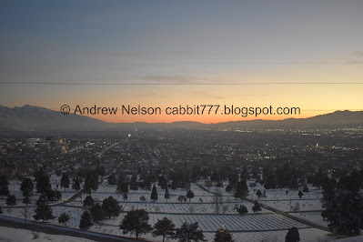
The valley. you can see all the way across to the Jordan Narrows.

Another panoramic.

Mountains to the east.

Fading sunset.

Downtown starting to light up.
This was a fun trail! I like exploring old car wrecks. And it was nice to do without worrying about fast downhill bikes. However, I would like to see the wrecks without all this snow and need to figure that out sometime. It was not terribly busy today, which is a nice bonus. Going with 8 out of 10 squirrels.
As for difficulty, what we did was pretty mild, made a little harder tromping through snow. DR3.
As for dogs, I am not sure. Nearby trails they are allowed, but when I am unsure I lean towards erring on the side of caution and not bringing them.
No comments:
Post a Comment