.jpg)

Quick Details:
Length: About 2.7 miles for the full loop and spur.
Trail Type: Loop with spur, slightly shorter out and back option.
Difficulty: DR3. It’s a good climb, that’s for sure, but not too bad.
Elevation Gain: About 500 feet.
Restroom: They have a porta-potty at the trailhead.
Dogs? Yes. Off-leash for the main loop. Leash required, at the beginning and on the spur.
To Get Here:
Take exit 288 for 14600 So. Keep left at the fork. Turn right on Traverse Ridge Rd, turn right on Deer Ridge Dr . Take that to the end. You will hike the old dirt road over the chain.
The Trail:

The trail is the old dirt rd.

Once you pass through this you can take your dogs off leash. Please follow all the rules and clean up after your furry friends.

Heading up this little gully. Nice wide trail.

That is the peak we are heading towards. It really seems much further away that it is.

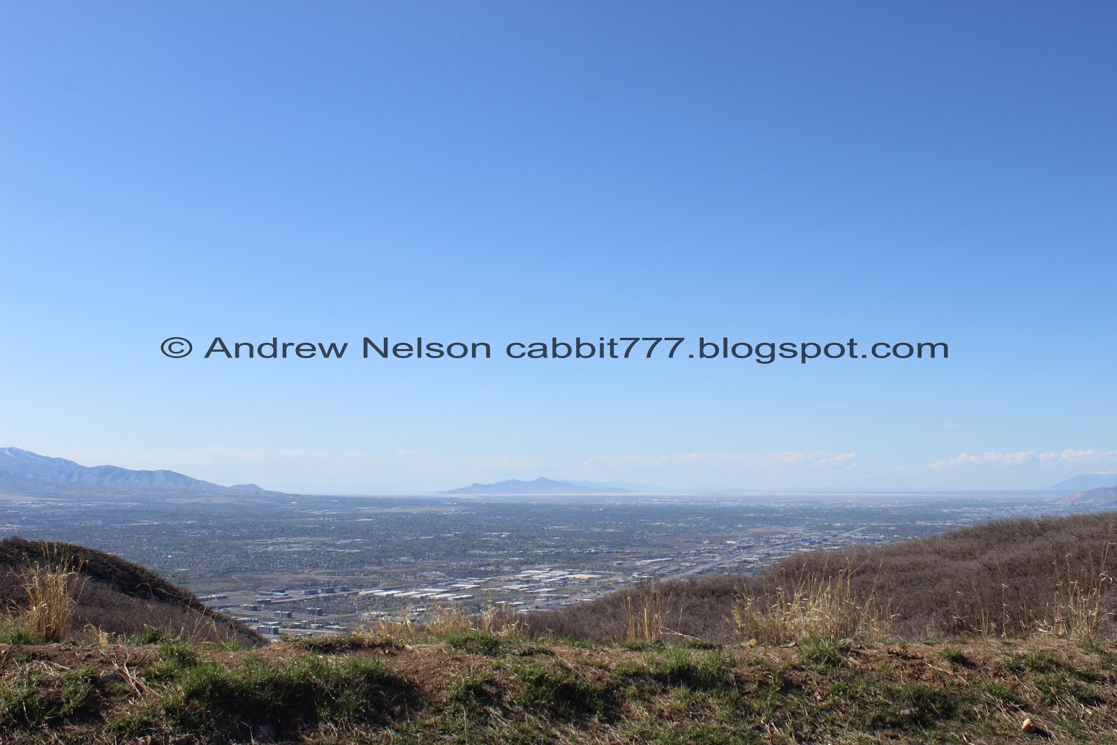
View into the Salt Lake Valley.

On the other side of the road, a view into Utah County.

Back to the Salt Lake side.

Oh look you can see the Aquariums giant claw.

At about 4/10th of a mile you will come to the main loop split. Left is just a smidge shorter, but a little bit more steep. However, both are a climb. We opted to go right.

Working our way up this little gully.

The Salt Lake Valley.

Woo boy. More of a climb than I remembered it being.

I am not sure where this offshoot goes. It is not on Drapers trail map.

You get a break from the climb for a minute and can enjoy a nice flat section.

Before long you will come upon the next trail split. Left will loop you back to the trailhead, right will take us up to Alien Tower.

If you had your pups off-leash you will need to leash them back up here. Following these rules will help keep the lower loop open as off-leash.

The peak we are heading towards. Couple people coming down, but not too crazy.

Back to climbing. I think this is the steepest part.

Heading up the ridge.

Looking back towards Mount Jordan.

Okay, maybe this was the worst of it.

Looking east.

Quick panoramic. We ended up climbing the lower peak to the right on the way down. And I am not 100% sure, but it looks like that trail split I didn’t know where it lead, might lead to the peak on the left.

Another look into the Salt Lake Valley.

Heading up the ridge. It is super wide and has plenty of room. I'm kind of a wuss when it comes to heights and I have no issues on any part of this trail.

Looking into Utah Valley.

Last push.

Mount Jordan again.

Mount Timpanogos.

Alien Tower. As I mentioned I am pretty sure this is the remnants of an old Telegraph Tower. Why do I think this? Well, at the trail head, there is another trail heading down this mountain called Telegraph Hill Trail. So, educated guess based on nearby information, but I have yet to confirm, and could be wrong.

Panoramic of the north east view. Mount Jordan, Box Elder Peak, and Mount Timpanogos.

The tower again.

Utah Lake is looking lovely today.

South view.

Northwest view.

Heading back down.

Utah Lake again.

Every time we have done this trail I think about adding that lower, unnamed peak and just never had. It seems super short so I thought, today was the day! But first we need to get back down there.

We saw some of these the first time we did this trail (albeit smaller ones). I did some digging and I think it is a Greater short horned lizard.

Really neat lizard. It very strongly reminds me of one of my favorite dinosaurs the Ankylosaurus.

Down to the trail split to the shorter peak.

It was uh… super steep haha. But it was short enough it wasn’t too horrible.

Before long we were at the top.

Looking back towards Alien Tower. That’s actually kind of a cool view. Glad we made it up here. It added less than 1/10th of a mile.

Utah Lake.

Mount Jordan.

Another shorter peak to the south west. As I mentioned earlier, I think the first off-shoot from the loop trail will get you there. There might even be a faint trail out that way from here, but if there is, I didn’t notice it.

Alien Tower again.

I did notice a trail down from this peak on the north side, but I couldn’t see where it lead so we went back down the way we came up. I know now that it will connect you back to the main trail.

Back on the main trail.

The side trail that leads to the north side of the lower peak. It seems somewhat less steep from here, but I don’t know for sure.

Back onto the main loop, and off-leash area.
Looking into Salt Lake County.

On the main loop area, you will see sewer grates, drainage, and even electrical boxes. As I mentioned, this was starting to be developed into housing. However the developer wanted to put in more houses, and Draper wanted more open space. So the developer threw a hissy fit and abandoned it. It might still get developed one day, but so far Draper is holding firm on wanting open space so developers don’t seem too keen on the area. Greedy fuckers.

The split off to get back down is a little faint. But don’t worry, if you miss it, there is a stronger one maybe ~60 feet further and the trail will dead end about in ~150 feet, so not too bad to have to backtrack if you miss it.

The little side canyon.

Back down to were the trail splits off.

Some wildflowers starting to come up.


Nearing the end.

Passing by Potato Hill on the way back (PSP).
I really like this trail system. For the cold months anyway. I don’t think it would be great on a hot sunny day as there isn’t much shade. It’s a pretty easy to reach peak, and the views of both Salt Lake and Utah Counties are pretty amazing. Plus it was not particularly crowded today. 9 out of 10 squirrels.
As for difficulty, yes this is a constant climb but its not too bad. DR3.
Dogs are allowed, and can be off leash on the main loop, but must be leashed at the beginning and final spur.
