.jpg)

Quick Details:
Length: If you just do the loop it is about 7/10 of a mile. But we added some extra and did 2.58.
Trail Type: Loop, Balloon, or out and back options as well.
Difficulty: DR3. Pretty easy peasy.
Elevation Gain: Just the loop about 95 ft. We did about 200 ft.
Restroom: Yes. But I think it is closed right now (wouldn’t use it right now even if it wasn’t).
Dogs? Yes, leash required.
Other Info: Handy trail map can be found here (external link).
To Get Here:
From i15, take the 106th south exit. Take that east to 2000 east, turn left. Pretty quickly the road will sharply curve to the right, going east again and becoming Dimple Dell Rd. Go about 1.1 miles and there will be a large parking lot on the left.
The Trail:

This is the first time we have used this trail head. We saw the sign saying Dimple Dell Park and well, turned in. It appears to possibly be an overflow lot, or maybe a future overflow lot? Either way, there were no signs barring parking here so we went with it. The main parking lot just a little further east. Our silly little mistake actually helped us to socially distance so it worked out in the end.

There is trailhead information, and it is listed on the main map, so that reinforced that we were good. It does add about 900 - 1000 feet each way though.

Lovely views.

When you come to the 4 way intersection you are at the official loop. We decided to go forward and do the loop counterclockwise.

The main parking lot.

The leftover snow in that canyon looks like a waterfall.

Heading down into the gully.

Dry side creek.

Found a lovely resting area.

With accompanying plaque. It would appear Dimple Dell Park was originally called Dry Creek Bicentennial Park.

Hrm. Didn’t get a picture of it, but to do the short loop, you wanna swing left after the boulder. I wanted to do a little more trail today and thought I would work our way down to the pond so we continued down a little further.

Crossing over the side creek. That is Fox Point in the background.

Another dry creek bed.

We'll take that next fork to the left to head down towards the main creek. Forward will take you along the Dry Creek Trail up back towards the Mount Jordan Trailhead.

The most direct route to the pond will be to take that next left fork, over the small bridge. If you hit the main creek bed, you went too far and will have to back-track like we did. Some of these smaller trails are not on the map.

We kept hearing a lot of buzzing, like we were on a bee farm, or maybe there was a drone flying above us. Finally located the source, it would seem this swarm of bees is migrating.

The main creek bed. It's not called Dry Creek for nothing.

Back on the trail I mentioned earlier, crossing one of the dry side creeks.

Before long we made it to the pond.. which appears to be empty.

Yup. Empty.

Panoramic of Mount Jordan.

I think that is the Mountain View Trail up there. We’ve done a lot of that trail, but not that particular section.

If you are just doing the Centennial Loop you will head up to the left here. We decided the weather was beautiful so we would get some more trail in so we continued down the Dry Creek Trail.

To stay on the Dry Creek Trail you will take the thin trail to the left of the bridge. Crossing the bridge will take you to the Mountain View Trail.

Dry Creek is well, dry.

Enjoying the gully.

Looking back at the mountains.

With less snow it is a lot easier to follow the trail.

Eroding cliff.

Narrow gully.

Wider gully.

Messy web of trails.
Well, we went about a mile and a half, and I remembered we had to climb back out of the gully so we decided to head on back.

Coming back offers a nice view of the mountains.

The creek bed.

Back to the wider wood chip lined path.

Back to the split that will bet us back to the trailhead.

This pathway will take you by the Dimple Dell Amphitheater.

Uhm. I didn’t know horses could go up stairs. o.O

Up into the amphitheater.

Panoramic.
I have tried to figure out why all of our parks seem to have an amphitheater and never found a good solid answer. Like, it makes sense in state and national parks for ranger programs, but, outside of those areas, I have never seen one being used.

This one isn’t even that old. According to this it was built in 1998. Maybe they used them more back then?

Last climb up out of the gully.

View of the mountains, and the 4 way split for the loop. It would make more sense for us to cut across the grass to the right here, but we decided to be good and stay on the trail. Not too much back tracking.

Panoramic.

Another of the random teepee looking structures. Although this one is not as elaborate as the others I have seen.

Some deer on the other side of Dimple Dell Rd.

Another one hanging out by the trailhead we are heading back to.
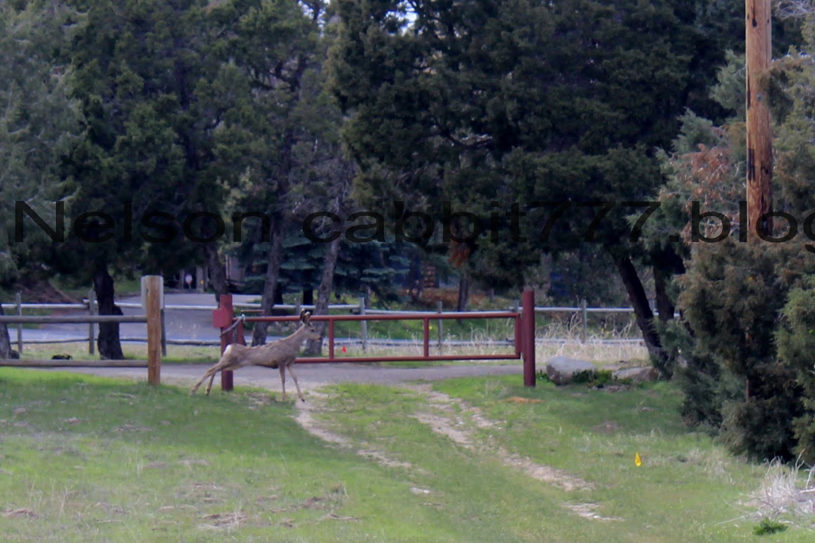
I think this is the first time I have seen a deer stretch.

Oh. there are quite a few here. Sorry to disturb yall. Just passing through.
That was a fun little trail. The Centennial Loop, while offering a quick easy option and a taste of the gully is not terribly exciting. And we have done the Dry Creek trail before. But it was still lovely and we did see some new stuff that we hadn’t seen before. Erm.. 7 squirrels out of 10 today.
As for difficulty, it’s pretty easy going DR3.
Dogs are allowed, but must be leashed at all times.

No comments:
Post a Comment