.jpg)
Catherine Pass is a high elevation pass that connects Little Cottonwood and Big Cottonwood Canyons. It can be reached on either side, but so far we have only done it from the Little Cottonwood Side. The trail features loads of wildflowers, and great views. You also have a chance of seeing some wildlife. I hear that moose like to hang out in the meadow, though I have not seen them there myself. It's been a few years since we have done this one so I thought we'd check it out again.

Quick Details:
Length: The sign said 1.5, but my pedometer app put it closer to 1.6, so 3.2 round trip.
Trail Type: Out and Back, or Connector with shuttle.
Difficulty: DR4. There are a couple long climbs.
Elevation Gain: About 820 Ft.
Restroom: Yes there are pit toilets at the trailhead.
Dogs? No. Little Cottonwood Canyon is watershed.
Other Info: Fee area. $10.00 to use the summer rd. (otherwise add at least 1.5 miles each way). This is as of 2021. The fee has gone up at least twice over the last 2 or 3 years.
To Get Here:
Head to the top of Little Cottonwood Canyon. Stop at the ranger station and pay your dues. Continue about 2 miles up the summer road to the Catherine Pass Trailhead.

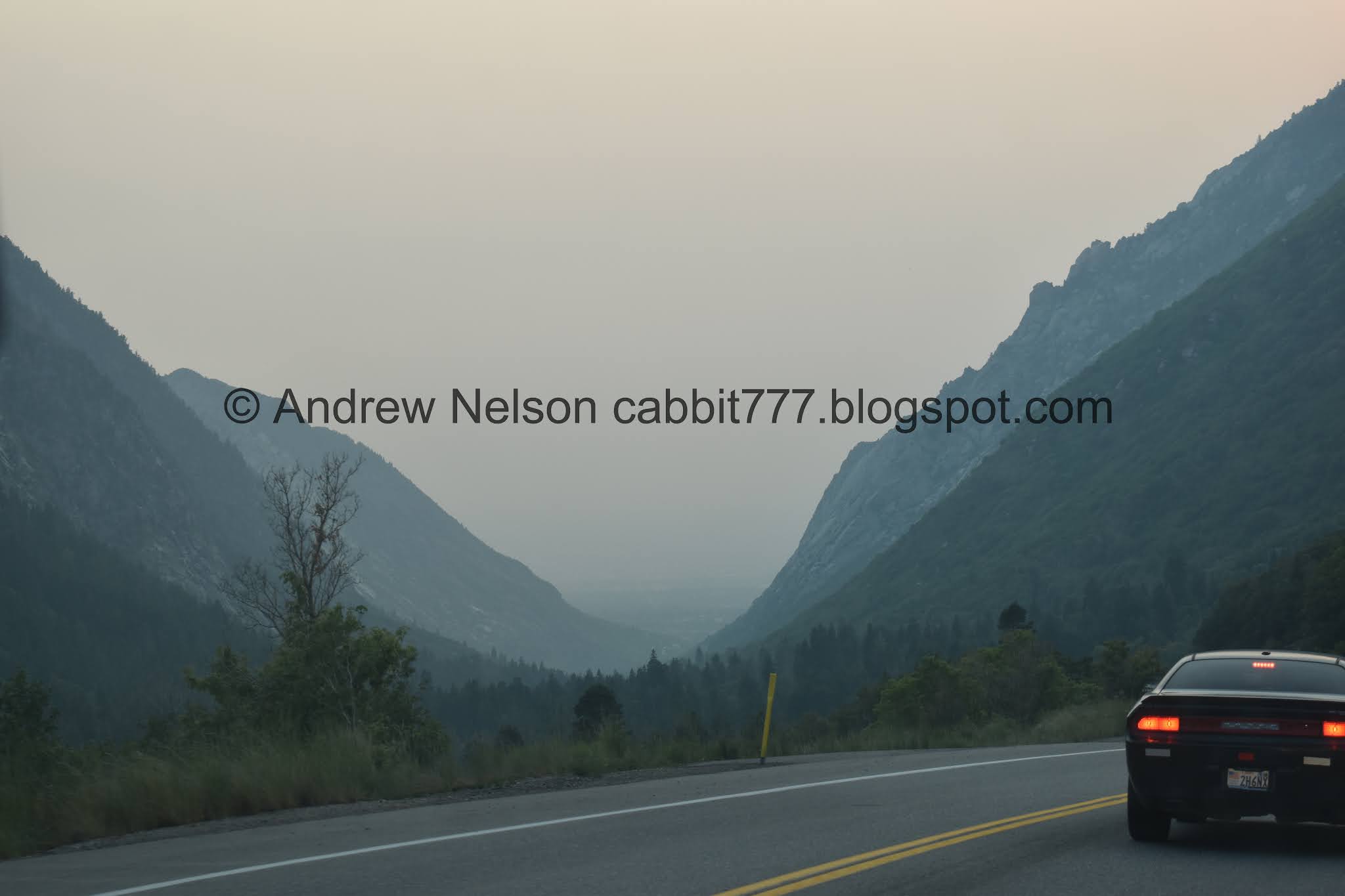
With all the smoke blowing in from the Pacific Northwest fires, you cant even see the mountains from across the valley (Passenger Seat Photography (PSP)).

At about 7th east I can just barely start making them out (PSP). This is crazy.

Nearing the mouth of the canyon (PSP).

Nearing the Albion Basin (PSP) I didn’t think we would escape the smoke, but I was hoping it would be a little better up here, sigh.

On to the summer road (PSP).


As far as high elevation, narrow dirt roads go, it’s really not so bad (PSP).

The Albion Meadows below the Catherine Pass Trailhead seem to be pretty lackluster as far as wildflowers go.
The Trail:

As you can see, you can take the trail all the way down to Brighton if you had a shuttle pick you up at the other end. Or I think there is a longer loop option to come up over Twin Lakes Pass. Not sure how long that is though.

I am not 100% sure, but I believe this is cut leaf balsamroot.

Paintbrush.

More balsamroot.

I always just dump all of these style flowers into the daisy group. They could be fleabane as well though so... eh I guess I don't really know.


More balsamroot.
Granted, I did not walk down into the Albion Meadows, but I think we are getting a better display of flowers up here on this trail.

The beginning part of the trail does not offer any shelter from the sun as you traverse this boulder field.

Buttercup.

More daisies.

More paintbrush.

Western coneflowers. Occasionally you might see some tiny yellow petals around the base of the cones, but generally, this is just what they look like.

Devils Castle and Sugarloaf Peak.

Mount Baldy peaking up through the pass.

Another daisy.

Some kind of mint.

With some paintbrush.

I think this is the Albion ski lift.

Parts of the trail go over solid granite. Luckily they are short and you pick up the trail again pretty quickly.

You can even see some evidence of glaciers scraping across it.

More of the trail.

More mint.

With some daisies.

Yellows and purples. Unidentified, and mint.

Geraniums.

Paintbrush.

Corn lily.

Woo! Fireweed!

Chipmunk!

Another one.

Looks like they tried to harvest this rock. You can learn more about this at the Temple Quarry Trail at the bottom of the canyon.

Wildflowers in a crack.

A crack full of skyrocket. Nature never ceases to amaze me.

Little closer.

Fireweed.

Pretty deep little gorge you cross over. I wonder what this is/was. Maybe it was a mine?

Lupine.

Short section with some water coming down the trail.

Daisies, geraniums, and lupines.

Looks like the water is coming out of a spring.


Fireweeds.

Fireweed, daisies, and paintbrush.

Lots of wildflowers.

Looking across towards Devils Castle and Sugarloaf Peak. Boy it sure is smoky.

Down canyon.

This is the only part of the trail that made me a little nervous, and really it was more I was working myself up and making it seem worse than it actually is, well, until I got here. I don’t like thin trails on steeper slopes. But, this was that bad at all. I just got myself psyched up for a minute.

Devils Castle and Sugarloaf Peak again.

Panoramic. Lets see, Devils Castle, Sugarloaf Peak, Mount Baldy, and Greenly Hill.

I wasn’t having any luck with the butterflies today, until these beautiful guys stayed still for a minute. I believe these are silvery blues. I generally see these guys in the lower canyons, around May, and typically around water, so I am a little doubtful.

Lots of wildflowers.

The first of 3 good climbs.

You will be following this dry creek bed for a little while now.

Little break from the climb.

Mine.
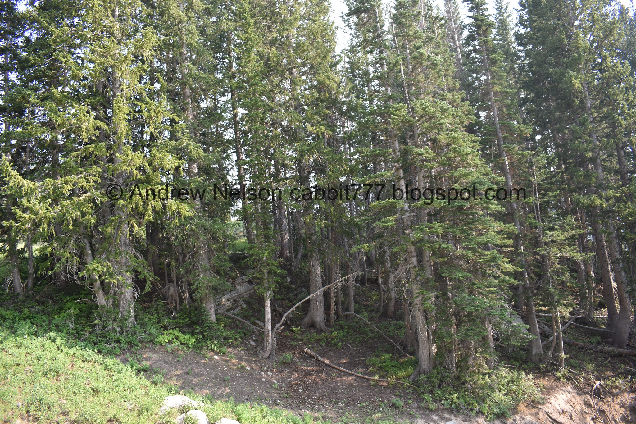
Lovely forest.

Crossing the dry creek.

Geraniums. You can also see that one of the leaves is starting to change color already. I know it is a drought but that still seems a bit early.

Looks like you can access the pass from the campground. Looks like it might be a little bit longer though. Anyway, hang left here.

Elk weed, pre bloom.

Short steeper part.

It is so pretty up here.

Thistle.


Looking up under a patch of pines.

Lots of elk weed.

Lots of paintbrush.

Mint and paintbrush.

Yellows and purples.

The beginning of the middle climb. This one is the toughest.

Terrible shot of a hummingbird.


Different varieties of paintbrush.

More of the climb. We were definitely feeling the smoke in the air today, so we were trying to take things a little more slowly today.
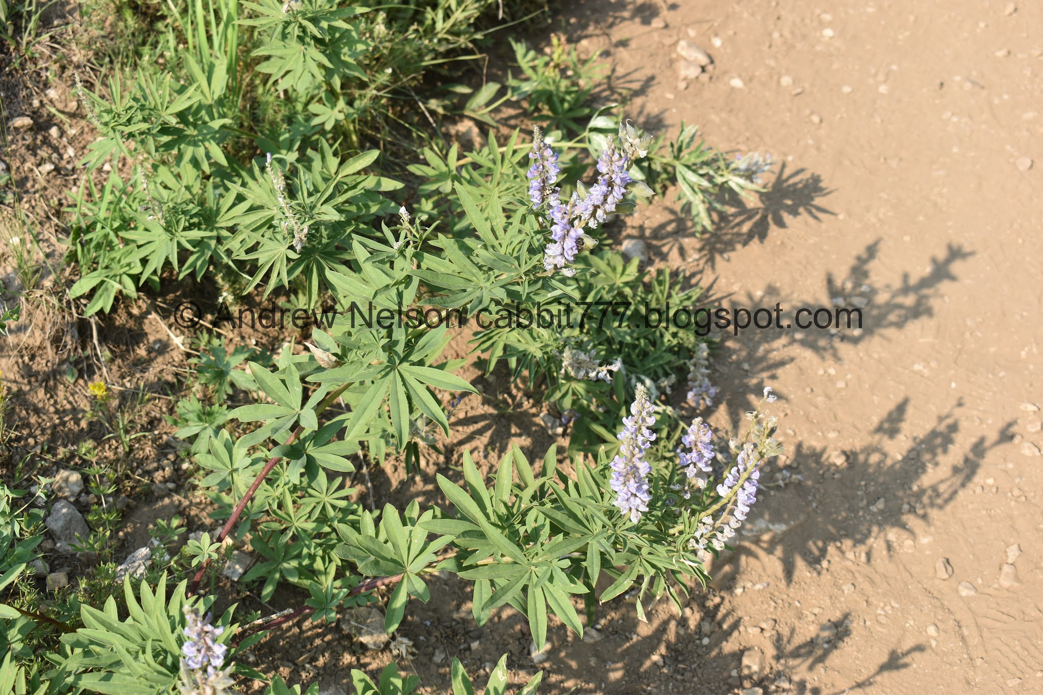
Lupine.

Whoa!!! Look at all that elk weed! This is apparently a good year for them.

Paintbrush.

Mixed flowers.

Geraniums and a bee.

Another little spring.

Paintbrush.

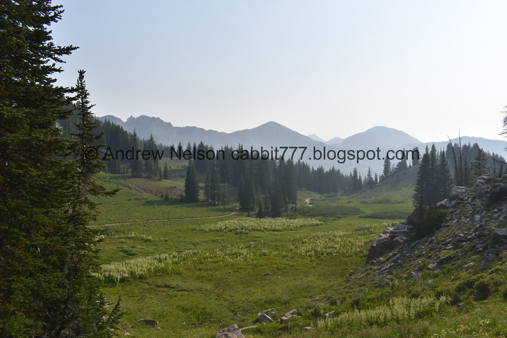
We made it to the meadow, phew! You get a nice break from the climb through here. Also, as I mentioned earlier, apparently you have a good chance of seeing moose here.

Whoo! I found a elkweed with a bloom.

The meadow. I am not 100% sure, but I believe that is Mount Wolverine too, with Mount Tuscarora on the right.

Another blooming elkweed.

Lots of blooms on this one.

Lots of elkweed.

From the other direction, a frickin ton of corn lilies!

Back to the elkweeds.

Penstemon.

Looking towards the pass.

Looking back towards the meadow.

A couple of elkweeds standing sentinel before entering the final climb.

Back into the forest.

Neat cracked rock.

Lovely forest.
Looking back down at the meadow.

The first of 3 switchbacks. They are pretty easy going as far as switchbacks go. But, it is the final climb.

Paintbrush.

Geranium with a bee. I noticed the bees seemed quite fond of the geraniums today.

Looking down.

The 2nd switchback.

Daisies and paintbrush.

The 3rd and final switchback. Honestly the switchbacks are not bad at all. They are not particularly steep, and it’s not super high up.

The meadow below.

Some kind of fritillary. Shame this guy seems damaged.

View down again.

More paintbrush.

The final push.

Fireweeds.

Just through these trees.

We made it to the pass! Woo!

Sunset Peak.
Lake Catherine below Pioneer Peak.

Panoramic.

Mount Tuscarora and the ridge between canyons. Little Cottonwood to the left and Big Cottonwood to the right.

The other direction towards Sunset Pass. That trail is a little thin and steep for my tastes. Maybe I could work myself up it, but, I don’t know for sure. Just looking at it kind of makes me nervous.

Another panoramic.

Lake Catherine below Pioneer Peak and Sunset Peak.
We actually had the pass the ourselves this time, so we decided to kick back and enjoy the solace.

Some lupine.

Lake Catherine.

One foot in Little Cottonwood Canyon, one in Big Cottonwood.
After a while we decided to head on back.

I thought there was a little pond in the meadow! I just didn’t notice it on the way up.

Mixed flowers.

Squirrel!

Geranium.

View across the canyon.

Mixed flowers.

Geranium with a turning leaf.

Almost back down to the meadow.

Lovely forest.

Loads of corn lilies.

Paintbrush.

Elkweeds.

The meadow again.

Panoramic. I think Mount Wolverine in the middle and Mount Tuscarora on the right.

Elkweeds.

Elkweed and paintbrush.

Elkweed bloom.

The meadow again.

Approaching the steeper section.

Loads of elkweed.

Paintbrush.

Paintbrush and mint.

More balsamroot.

Heading down.

Mint.

View across the canyon.

Mixed flowers.

View down canyon.

Devils Castle, Sugarloaf Peak, and Mount Baldy.

Fun striped rock.

Flowery hillside.

I think this is phlox.

Back to the mine.

Geranium.

Yuck!


Sugarloaf Peak, Mount Baldy and Greenly Hill.

Devils Castle and Sugarloaf Peak.

Balsamroot.

Neat stripe across the rock.

Fireweed.

I think these ones are arrow leaf balsamroot, and some mint.

Daisies.

Mint and paintbrush.

I love these deep scarlet paintbrushes.

So pretty.

Daisies and paintbrush.

Back down to the bridge.

I wonder what this weird looking one is. With a little help from a new book: Wildflowers of the Cottonwood Canyons, and a Facebook group, I think this is a Sulfur Buckwheat.

It comes in other colors too.

Cornlily.

Devils Castle and Sugarloaf Peak.

Mount Baldy peaking up behind Sugarloaf Peak and Greenly Hill.

The sulfur buckwheat again. I recently picked up a new flower guide called Wildflower of the Cottonwood Canyons and it has been really helpful. It helped me identify this, but I still had some doubt so I double checked with a wildflower group and confirmed my suspicion.

Western coneflower.

Daisies and mint.

Now we just have to cross this rocky area.

Well hello there cute little fellow!

Glacier scrapes.

Another cute little fella, checking out his surroundings.

Keep an eye out for this trail marker, keep right to head back to the trailhead. Left will get you down as well, but in a more roundabout way.

Devils Castle.


More balsamroot.

Paintbrush.

The Albion Meadows again. It was really, oddly.. busier when were were leaving compared to when we arrived.


Heading back down the summer road (PSP).

Well hello Mr. porcupine (PSP)!

Into the bushes he goes. This is only my 4th? ish porcupine sighting. Really rare to see these guys in the wild.

Whoa! What do we have here? (PSP).

A momma and baby moose! Yay!
You aren’t supposed to stop on the summer road anywhere, but luckily we knew there was a small parking lot not far from here, so we parked and hiked back up a little ways.

Baby moose is looking pretty big. Probably close to being able to veer off on it’s own.
PSA: Moose in general can be very aggressive, this is double so with a momma moose. Be sure to keep your distance. All photos are digitally cropped, or taken with a telephoto lens.

They are super majestic though and a treat to enjoy.

Look at that adorable little calf!

Mom and baby. I’m not 100% sure, but I thought I spotted a 2nd baby for a split second before it went back behind the bushes.

Better view of mom.

Better view of the baby.

She’s been collared.


I like this last one.

Eventually they worked their way back into the bushes. So we decided to keep heading down.

Looking back up towards the Albion Basin.

There are a lot of people wanting to head up. There were even more a few minutes earlier. I wonder why. We got a late start for the day, so daylight is definitely dwindling.

Heading back down (PSP). Oof, that smoke is bad.
 |
I love this spot along the road that offers a perfect view down the canyon (PSP).
I really enjoyed the trail today, smoke filled skies aside. I love the view from the pass, I really enjoyed the wildflowers we saw today, and most of all I enjoyed the wildlife sightings we had today. It is also enjoyable that we can reach the high elevation pass and it isn’t super steep and scary. We also didn’t pass a whole lot of people today. 10 out of 10 squirrels.
As for difficulty, There are a couple longer climbs, so DR4.
Dogs are not allowed in Little Cottonwood Canyon due to watershed restrictions. So be sure to leave Fido home.
