.jpg)
Devils Castle is a fascinating peak soaring above the Albion Basin. There is a loop trail that take you up to the base of it. The trail features excellent views, loads of wildflowers, and even some wildlife. We were forced to park at the Catherine Pass trailhead, so we added the upper Albion Meadows. With the loop we did this adds about a mile. We do this one fairly often, but its always super pretty.

Quick Details:
Length: We did about 3.2 with the combined trails. If you just do the Devils Castle Loop it’s 1.8 miles.
Trail Type: Loop, with balloon option.
Difficulty: DR4. There is a bit of a climb!
Elevation Gain: We did about 700 Ft. The loop by itself is about 460 ft.
Restroom: There are pit toilets at both trailheads, and within the campground.
Dogs? No. Little Cottonwood Canyon is watershed.
Other Info: Fee area: $10.00 as of 2021. Last year it was $8.00. I don’t think they are running the shuttle again this year.
To Get Here:
Head up to the top of Little Cottonwood Canyon. Stop by the ranger station and pay for your parking pass ($10.00, up from $8.00 last year). Head up the summer road. If you can park at the Cecret Lake trailhead, that will shave at least a mile off your hike. We had to park at the Catherine Pass trailhead.
There used to be an option to take a shuttle up, last time we used in, in 2019, it was $5.00 per person. They discontinued the shuttle during the 2020 pandemic, and from what I can tell, they have not started it back up yet.

Heading into Little Cottonwood Canyon (Passenger Seat Photography (PSP)).

Waterfall off to the side (PSP).

Possible avalanche damage (PSP).

Big fluffy clouds above the Albion Basin (PSP).

Collins Gulch (PSP).

Entering the summer road (PSP). As far as high elevation dirt roads go, this one is not too bad.

Getting up there (PSP).
The Trail:

The Albion Basin.

Loads and loads of yellow flowers.

A couple of paintbrushes.

The Upper Albion Meadows Reroute. This is a newer trail that has only been here for a year or 2. We have not done it yet, but it appears to be the best way to enjoy the wildflowers.

This is brand new! Cool, we don’t have to walk along the road.

I don’t know for sure what these are but I always like to check them for napping bees.


Geraniums.

Lupine.

Paintbrush.

More geraniums.

Some kind of mint.

Devils Castle and Sugarloaf Peak.

What in the world?

Ack holy crap. So I looked up “beetles that like lupines” and came up with blister beetles. I think it particular this is a lytta, AKA Spanish fly, or possibly an Oedemerinae.

Corn lilies before they have bloomed.

Devils Castle.

Eventually the trail connects to a maintenance road.

Devils Castle again.
I didn’t take a picture, but I noticed a side trail that said it was closed for maintenance. So I think they are continuing the trail up to direct people off of the summer road. But we did have to walk up the Summer Road for a little ways.

Blue bells.

I have a hard time identifying many petal, yellow wildflowers, because there are just sooooo many of them. However, I do believe this is cutleaf balsamroot.

Yellows and blues.

Pretty sure this is skyrocket.

Penstemon.

Penstemon and paint brush.

Walking up the Summer Road.

WHOA!!! I have never seen soo many elkweeds in one spot before.

Even more on the other side of the road.


I love elkweed.

Super pretty.

So many of them.

About a half mile later, we reached the Cecret Lake Trailhead.

Columbines and paintbrush.

Whoa! That is a huge patch of columbines. I don’t think I have ever seen so many in one spot. Wow. We are having a good wildflower day.

Little closer.
I can’t decide which is my favorite, but my top 5 favorite flowers are elkweed, columbines, paintbrush, elephant head, and fireweed. We saw 4 of the 5 today.

Little Cottonwood Creek. It’s so little up here.

Columbine with a slight blue tint.

You can pick up the loop just off of the Cecret Lake Trail, but I find it easier to ensure I end up where I intended by going up through the Albion Basin Campground.

The creek again.

Another large batch of columbines.

Paintbrush and bluebells.
I didn’t get a picture this time, but at the back end of the campground, the road continues up to some private cabins. You want to keep going that way.

Sugarloaf Peak.

Devils Castle and Sugarloaf Peak.

Devils Castle.

I think these are a buttercup.

Fun rocks and Sugarloaf Peak.

An elkweed in full bloom.

Super pretty.

Columbine and elkweed.

Forest, and I think Mount Wolverine.

Another columbine.

A little ways past the cabins, you will want to look for this trail split, and head right. BTW, most of the tough climb is behind you now.

Some leftover snow.

Hitting some forest.

Looking up.

Trees.
Devils Castle.

Little closer.

More pretty columbine.

Sugarloaf Peak.

More columbines.

Nearing the top of the Albion Basin.

It is so pretty up here.

Lupine.

The basin again.

Devils Castle.

The lower patch of snow usually persists for much of the year, if not all year. I would be curious to see how late it hangs on this year.

Fun rocks.

Devils Castle again.

Another patch of snow.

More buttercups.

It really is just stunning up here. I think this is becoming one of my favorite trails. The wildflowers and views are great, and it is absolutely overlooked by the nearby Cecret Lake Trail so it is almost always pretty quiet.

Before long you will reach the scree field.

What in the world happened to these trees? Our best guess is that maybe there was a mud flow?

Almost directly beneath the peak.

Mine tailings.

The mine is somewhere up there.

Butterfly.

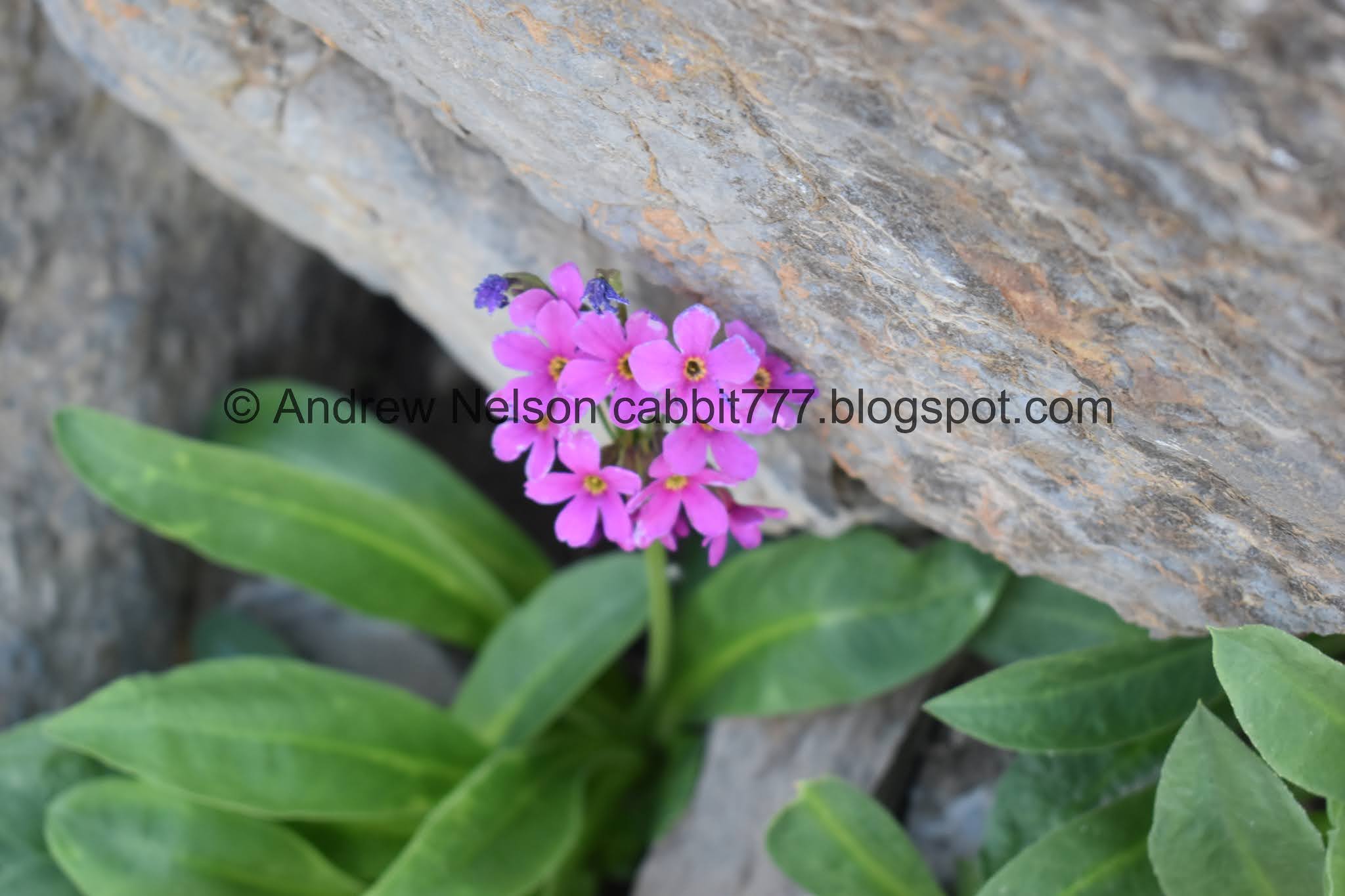
Parry primrose.

The Albion Basin.

Panoramic.

Paintbrush.

The top of the mine tailings. This is approximately the mid point, as well as the highest point on the loop.

The giant debris field.

Another elkweed.

Looking up at the castle. It looks funny from this angle.

I could hear pikas but wasn’t have any luck seeing them, that is until I spotted this guy keeping an eye on us.

Look at him mean dogging us.

Parry primroses.


Back to the pika.

All puffed up. Ahh! They are so cute.

It looks like the path has shifted a bit since the last time we were here.

I think this is a phlox.


Elkweed.

A pair of marmots.

Little closer.


Cute little fellas.


Just as the first two went into hiding, we spotted a 3rd one. Yay.


More parry primrose.

The scree again.

Another tailings pile.

Giant flat boulder, or as I just dubbed it: Utah's baby half dome. This is a popular climbing crag. This is the first time I have been able to explore it without bothering climbers.

Another pika.

The 4th marmot of the day. I am pretty sure we have never seen that many on one hike before.

Little closer.

The pika again.

More parry primrose.

Pika.

More parry primrose. I think they are pretty, and this is the only trail I can think of that I see them on.

Old mine shaft.


The climbing crag again.

Looking back towards Devils Castle.

Mine shaft and rock wall.

Can you spot the pika?

Looking across the basin towards Katherine Pass.

More columbines.

Heading back into the forest.

Paintbrush.

Penstemon.

Thistle.

Devils Castle.


Pretty forest.

As the trail gets close to the Cecret Lake Trail, you can hear the cacophony of the crowds on it. There is a reason I like this trail a bit more. Don’t get me wrong, Cecret Lake is absolutely beautiful, but I think it has become a weekday trail due to increasing popularity.

The steep strait away down. We haven’t ever come up this way, so I can’t say how rough it really is, but it does seem a little more steep.

Pretty forest.

More steep downhill.


More forest.

One of the many springs in the Albion Basin that create the headwaters of Little Cottonwood Creek.

Downstream.

More forest.

Trail split. I am pretty sure we have done both at some point, and I don’t think it really matters which one you take. We went right today.

Another spring.

Little bit bigger patch of the parry primrose.

Giant boulders that I am sure came down from Devils Castle.

Devils Castle again.

Eventually we hit the Cecret Lake Trail. If you parked at that trailhead, go right here. I know from experience that the thin forward trail will get us back to where we are parked. Also, it passes by an area we have seen moose a few times, so I decided to go that way.

More lovely woods.

Some pretty paintbrush.

I didn’t get a ton of pictures of the thinner trail, but it eventually connects to this slightly wider trail.

More columbine.


Wildflowers and the creek.

Pretty.

Elephant heads and….

Hello moose!

He’s a big one.

Came around the corner in time to watch him walk away.


He decided to pose all majestic like for us before ambling away.

Then he just slipped away into the trees. It was a short encounter, but a fun one.

White bog orchard.

Woo, quite a few of them up here.

With some elephant head.

Lots of elephant heads.

Lupine.

Spring.

Monkshood.


Elephant heads.

Daisies.

Columbines.

Crossing the creek.

Little waterfall.

Deer off in the distance.

You can return to the trailhead using the Upper Albion Basin Reroute, which will be to the left here. We opted to return via the service road, right.

Wildflowers.

View across the canyon.

Devils Castle and Sugarloaf Peak.

Looking towards Catherine Pass.

Moody clouds coming in.

We hit the new trail heading back to the trailhead.

The peaks again.

Greely Hill.

Paintbrush.

Some kind of mint.

Flowery ridge.

I kind of wish we had come up the Upper Albion Meadows Reroute.

Cutleaf balsamroot.

Penstemon.

More cutleaf balsamroot.

The final rock stairs that lead to the parking lot.

The skies are getting super moody.

The Upper Meadows.

Heading down the summer road (PSP).

Loads of wildflowers on the hillsides (PSP).

View down canyon (PSP).

Looking back up into the basin.

Yellow monkey flowers.

Fun storm clouds. Hrm, maybe we ought to get our butts down out of the canyon haha.


Paintbrush.

Penstemon.

Storm over Devils Castle.

Geraniums.

Super moody, we decided it was time to get out of the canyon.

View down (PSP).

The canyon is super pretty and green.

I love this spot that offers the view all the way down the U shaped canyon (PSP).
I absolutely love this trail, and enjoyed our unexpected addition to it today, cause we ended up seeing a moose. So, great wildlife day, great wildflower day, and not a ton of people on the trail. 10 out of 10 squirrels.

As for difficulty, there is a long climb, so DR4.
Dogs are not allowed in Little Cottonwood Canyon. Be sure to leave Fido at home.

No comments:
Post a Comment