.jpg)
Heughs Canyon (AKA Heugh's Canyon) is a steep canyon on Mount Olympus in Holliday. The trail features wildflowers, a creek for most of the way, and a waterfall. It’s been about 5 years since we have come here, so I thought we would check it out again. Last time we did it, I described it as “fairly easy going with a steep section at the end” I don’t know what crack I was smoking. I guess most of the trail appeared to be easier compared to the last segment? Maybe we were doing tougher trails that year? Or maybe it was just warmer today. I don’t know, but this trail is a relentless climb. They have severely limited parking on Canyon Cove Dr. and have added a new trailhead Parking lot on Wasatch Blvd. This added 2/10ths of a mile each way.

Quick Details:
Length: About 3.4 Miles out and back.
Trail Type: Out and back.
Difficulty: DR4, and if you cross the boulder field, DR5.
Elevation Gain: 1236 ft.
Restroom: No.
Dogs? Yes, Leashed.
Other Info:
To Get Here:
Take i215 to exit 6 Head east on 6200 S. for about 7/10’s of a mile turn left on Wasatch Blvd. Follow that for about half a mile and you will see the trailhead parking on the right.
Then, you will walk up Canyon Cove dr. You will take the 2nd left on Oak Canyon Dr. Then take the first right on Canyon Winds Dr. So far the city has yet to put in signs to direct you and it has been long enough I didn’t remember right. Lucky nice people directed us, so we didn’t wander aimlessly.

I didn’t even think about it when I took this picture, but uh, that is where we are heading (Passenger Seat Photography (PSP)).

We’ll be hiking up that canyon on the right (PSP).
The Trail:

No trail access here. I’m not sure if they plan to add it in like they did at Rocky Mouth Falls, or if this homeowner just happened to put in similar looking stairs haha.

Heading up Canyon Cove Dr.
We had just about passed Oak Canyon Dr. when a homeowner in the area drover by. She rolled down the window and shouted “Go left! Then right!” I yelled back a thanks and started to cross. I mean, we are obviously hiking, we had our water packs on, hiking sticks, she obviously seemed to recognize where we intended to go. Landis wasn’t so sure though, so a quick glance at google maps and a hiker coming up behind us confirmed that. Thanks lady! You saved us who knows how much random wandering.

Turn left on Oak Canyon Dr. (It is the second left).

Heading across Oak Canyon Dr. This is about where it suddenly started to look familiar.

Turn right on Canyon Winds Dr. (first right).

There is a gate across Canyon Winds Dr. now, but there is a pedestrian opening on the right.

You have to cross this home owners driveway to reach the trail. I wonder what kind of, if any, arrangements the home owner has with the city for that.

But then you are officially on the trail.

It is a absolutely beautiful day.

Nice and green.

Taper tip onion.

Forrest.

Little slide area.

The creek below.

Nice and clear.

Super pretty through here.

Pretty flowers. I identified this as dogwood last time, and that seems to be accurate.

Little side stream.

Spring.

Crossing the little side stream again.

Super green and pretty.

So, either there is a spring here, or somewhere the pipeline might dip into the creek. We confirmed it is broken and dry further up.

The main creek.

See, the pipe is completely severed and dry.

Mossy rock.

This didn’t capture it too great, but the first steeper part. I am just going to say, if you struggle here, you might want to just call it and turn around. It gets a bit worse.


At the top you get a nice view of the canyon.

Forget me nots.

Looking up towards Mount Olympus. I don’t think you can see the peak from here, but that's the mountain.

Spring coming down the middle of the trail, and the creek to the right.
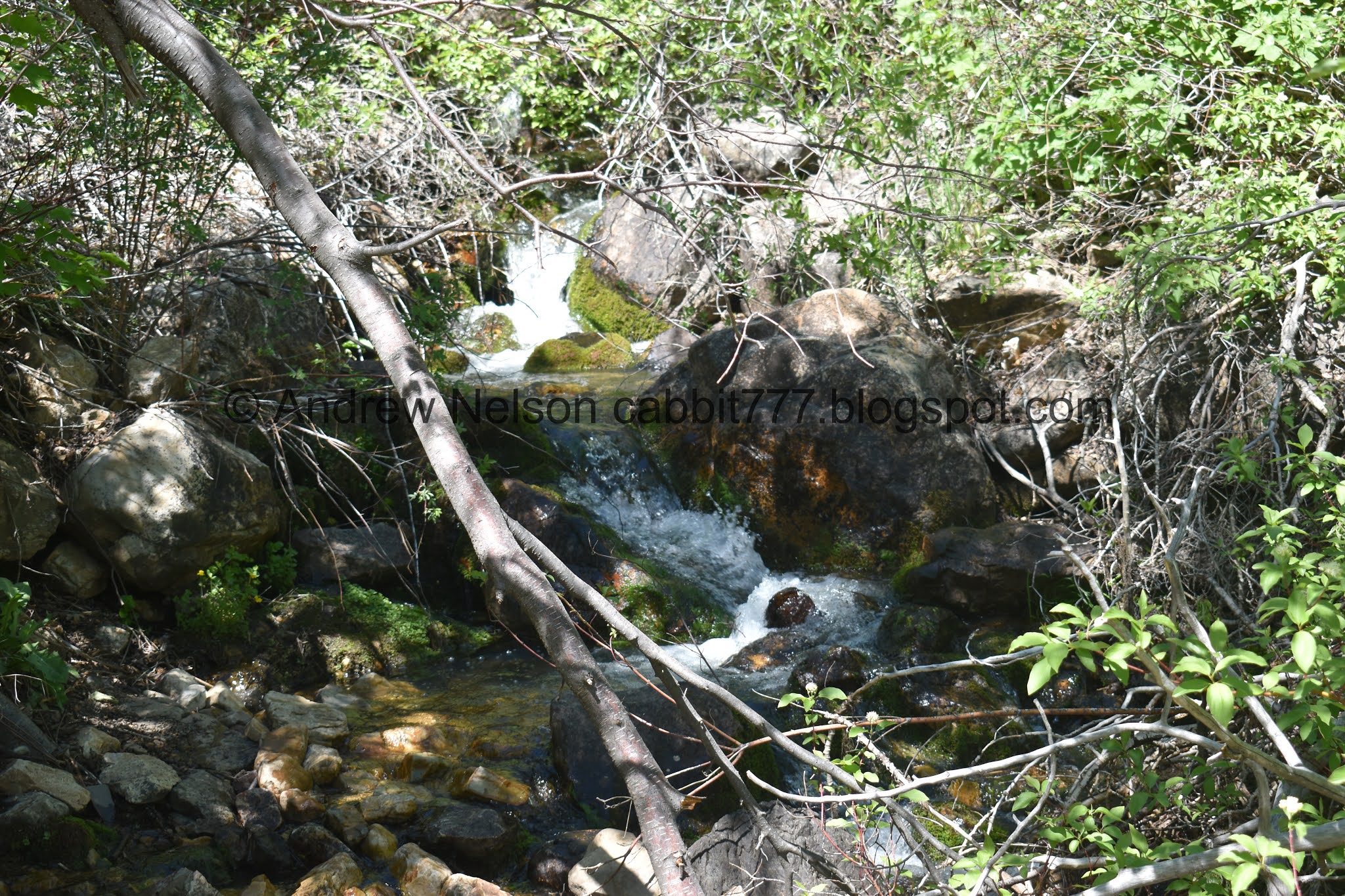
Cascades in the creek.

Spring taking up the trail.

At almost exactly a mile you will reach the Bonneville Shoreline Trail.. We actually got to see trail workers cutting the trail last time we were here. Currently, it appears to only head north from here, not south yet.


The trail is quite overgrown.

Pretty flowers.

Fun looking peak.

Super green!

Some more cascades.

Pretty forest.

Oh, they upgraded the first bridge. Nice.
Also, the climb gets quite a bit steeper after this.

Looking upstream.

More climb.


Pretty purple flowers. Last time I identified them as annual honesties, which does seem to be correct still.

Forest.


The upper bridge. This means you are almost there. This also means the trail is going to get REALLY steep.

Looking upstream.


My pictures just fail to show how steep it really is.

At the top of the steep scramble you will meet the boulder field. As I will show on the return trip, you don’t necessarily have to scramble across to see the waterfall. However to get to the waterfall, you have to boulder scramble.

Fun ridges above. I was taking a much needed breather before continuing.

Crossing the boulder field. We have found a route that is mostly okay, but there are 1 or 2 sketchy parts. Plus the whole fear that the entire field could shift make it quite the adrenaline fueled experience. Obviously that is not the case for everybody, see the guy above us just cruising through. I will say it again, it is traversable, but of course, do so at your own risk.

Last little leg.


Then we just have to follow along through this narrow area between the cliffs and the trees. You have to walk through the water, but it is fairly shallow.
Then, boom. Waterfall.

Super pretty!

Vertical panoramic.
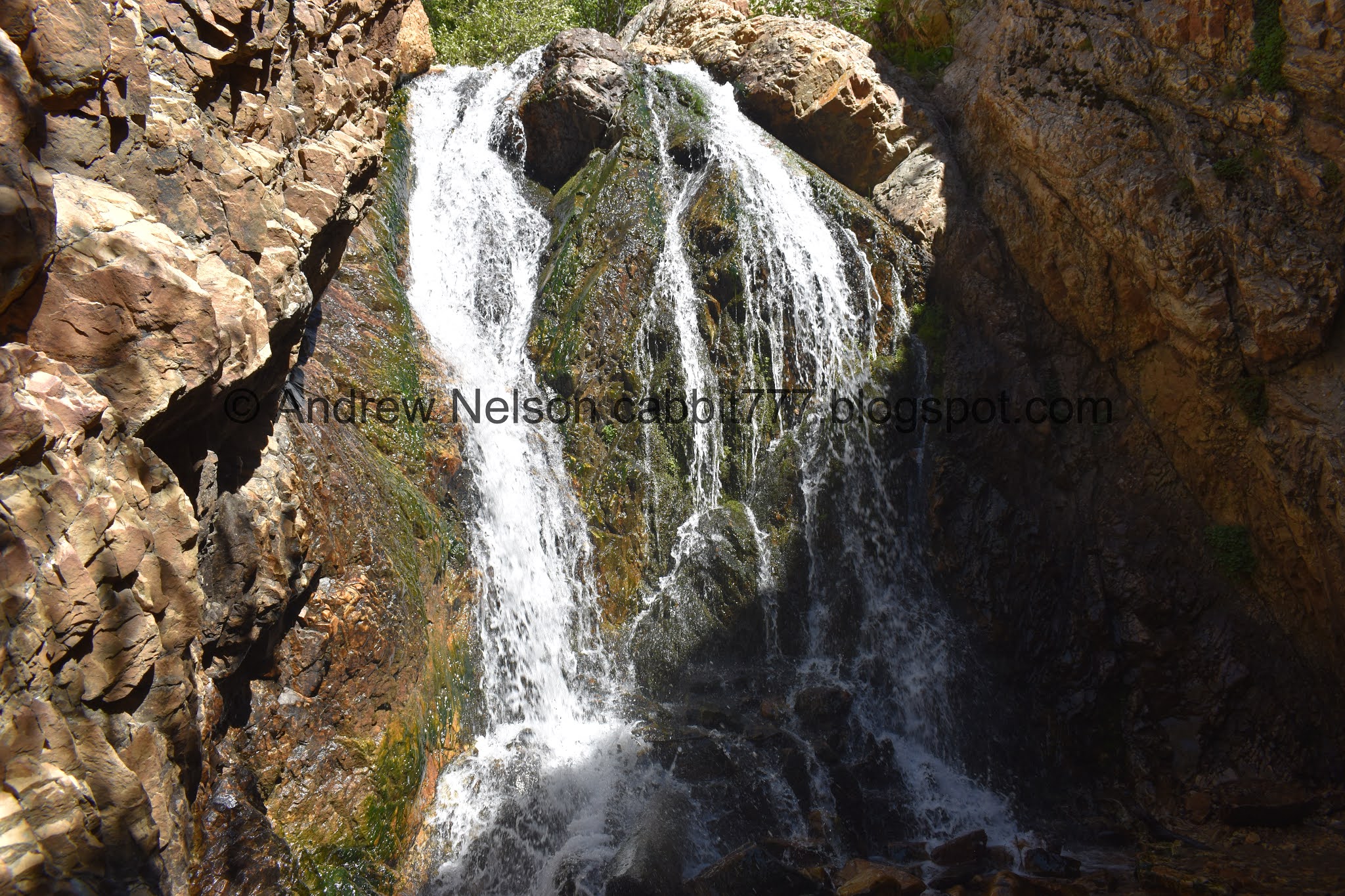
It is a great little waterfall.

From the far side.


Random tunnel. It probably has something to do with the old pipeline.

Super pretty.

With the ridge above.

Plants growing in the cliff walls.

Lovely waterfall.

One last parting shot. The couple who got here before we did gave us space, and I decided the couple that arrived after us deserved the same space.

Following the stream along the cliff back. I originally thought the creek fanned out to here, but now I am thinking there must be an additional spring.

Cliffs above.

Weird spiders.

The boulder field.

The cliffs above the falls.

If you come a little earlier in the season you can see the waterfall before this tree greens up. Otherwise you might have to scramble up a bit further.

Heading back down.

Steep and rocky.

Back down to the upper bridge, and with it, the absolute worst of the trail behind us. Phew!

The creek.

Pretty purple flowers.

Lush overgrown forest.

Various trees.

Back down to the lower bridge. That means the trail will be a lot less steep.

The creek.


Forest.

Weird hollow root.

Cascades.

More overgrown trail.


More flowering trees.

Super overgrown.

View across the canyon.

The spring taking over the trail.

Little mine. Missed this on the way up. It looks a little steep, and filled with water, so it doesn’t feel like it is safe to enter it.

Across the canyon again.

More flowers.

Looking down canyon.

Across the canyon again.

Forest.

Old pipeline.

Forest.

Some kind of flowers getting ready to bloom.

Side stream.

Thimble berry flowers.

Another spring.

Little waterfall.

It’s got quite a plunge pool.


Silvery blue butterflies. I love these guys.

The slide section again.

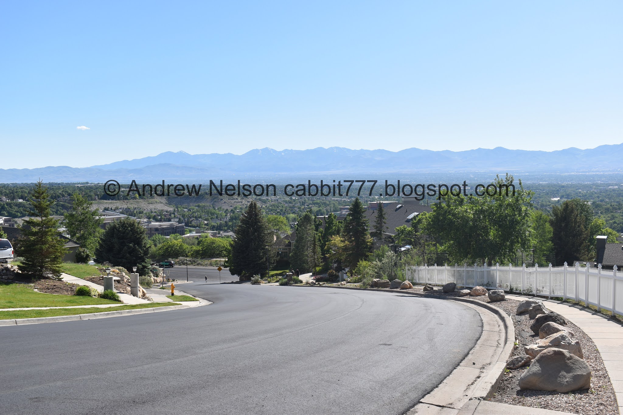
Starting to be able to see the valley below.

Neat little horn.

Better view.

I didn’t want to be too invasive, so I only took a picture of the far edge. The home owner at the trailhead has done a wonderful garden that appears to feature local wild flowers. It’s likely very drought tolerant too. I think that is amazing, and it blends into the natural area quite impressively.
Heading down Canyon Cove Dr.

Water tank.

Back down to the new trailhead.
Like I mentioned, this hike ended up being quite bit more tough than I remembered, and it just seemed like it got more and more steep the entire way. However, it was nice and green and lush. The wild flowers are popping, and the waterfall is really pretty. So I am glad we came back to do this one again. The parking lot was full, but I didn’t feel like we passed a ton of people, particularly on this holiday weekend. I am taking 1 squirrel for the difficulty, and 1 for the removed trailhead. 8 squirrels.

As for difficulty, This is quite the climb! DR4. And if you decide to cross the boulder field, DR5.
Dogs are allowed but must be leashed. However, consider the boulder field. I cant even fathom trying to get a dog across that.
