.jpg)
This section along the Jordan River Parkway was actually quite enjoyable. It follows next to the river for most of the way, and feels pretty wild. There is a section that goes behind some houses, and I walked by some people enjoying their yards, which normally is very off putting to me, but even through that part the other side of the trail felt wild so, I donno it was just better. Plus I had some fun bird sightings.

Quick Details:
Length: The map said 2.1 one way but I ended up doing 4.4 out and back.
Trail Type: Connector, Point to Point, or Out and Back.
Difficulty: DR2. Its practically flat and paved.
Elevation Gain: About 80 feet.
Restroom: Yes, at Willow Park
Dogs? Yes, leashed
Other Info: JRP Mile Markers: 1,2, and 3. Cities: Lehi
To Get Here:
Take i15 to the Thanks Giving Way exit. (exit 284). Turn right on Triumph Blvd. Triumph Blvd will become 2300 W. Follow that about 5 ish miles. Turn right on 300 N. Follow that to the end. Be aware Willow Park has a one way loop road. Parking and trailhead will be the first right you can take.
Or if coming from the south take the Lehi Main St. exit. Head west. Turn right on Willow Park Rd. Then Left on 300 N.
The Trail:

The trailhead kiosk, where we left off from Last Time.

Mile Marker 3.


Willow Park is quite lovely.

I was confused as to which way I should go for a second here, but you want to continue forward through the gate.

Little farm with chickens and cows.

Mount Timpanogos.

I’m not 100% sure, but I think that might be Flat Top Mountain.

Tunnel under main street.

Inside.

Trail marker. I don’t think I am going to quite make it to Saratoga Springs today.

This part of the trail is just lovely.

The river veered back towards the trail.

Downstream.

Upstream. This might be why my mileage tends to always seem a bit longer than what the map says, I tend to veer off on side trails

Oh. What do we have here?

Hello pretty! I think it is a red-tailed hawk. However, it is a bit harder to tell for sure from the side.
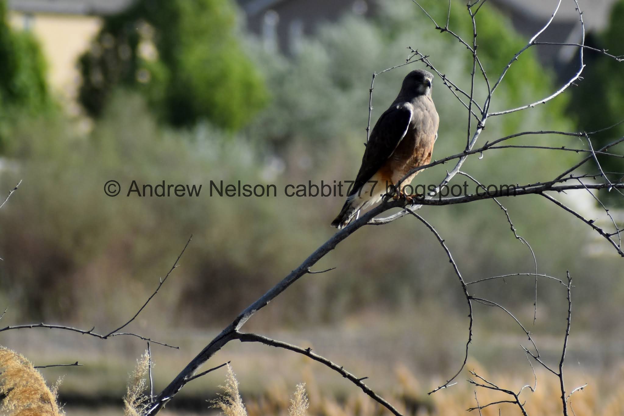
Handsome fella.

Uh oh. He’s spotted me!

And he is off!

Swamps and mountains.

The river again.


Powell Lake.
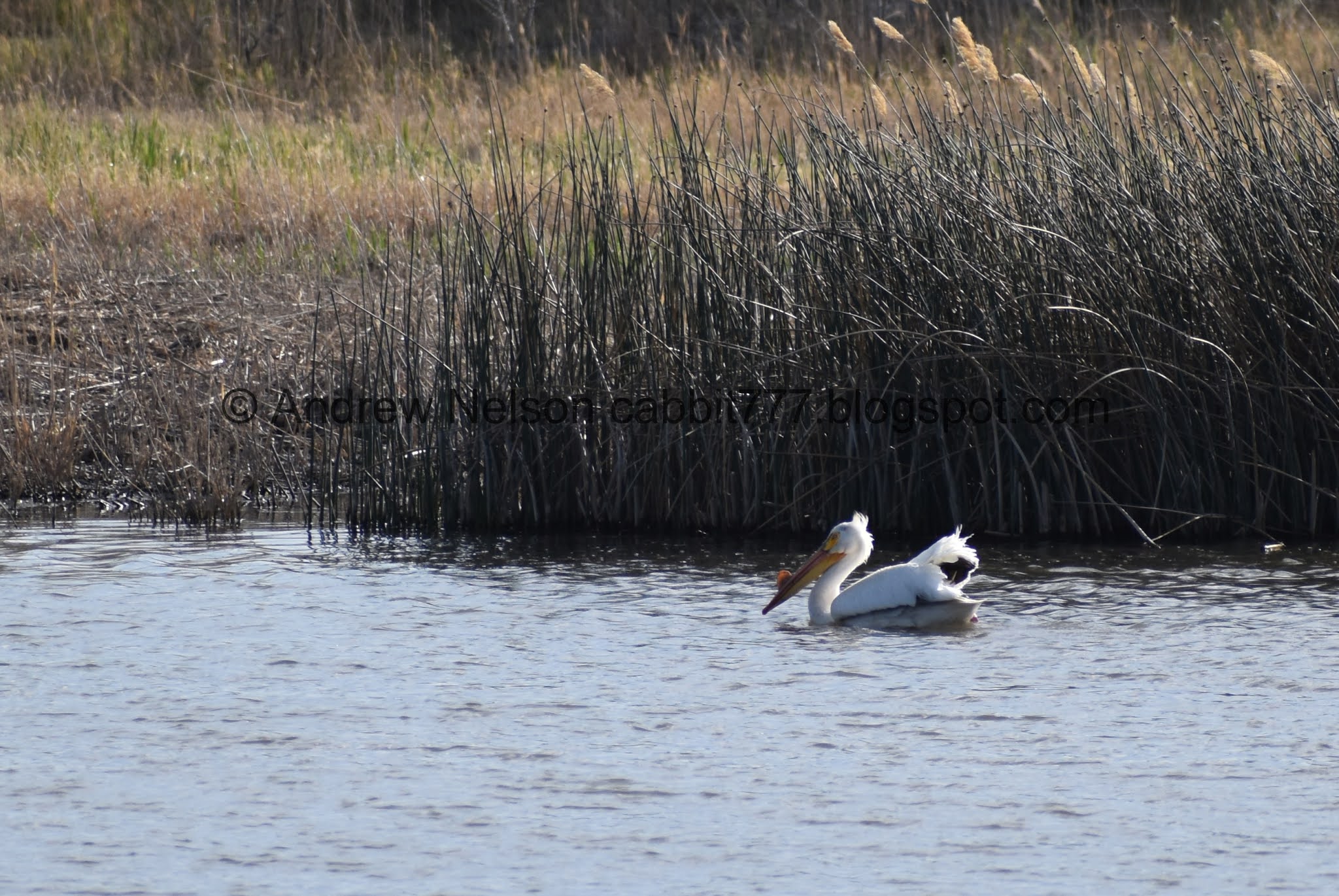
Pelican.


Rocking a gnarly mohawk.

The lake again.

Bat box.

Nice forest.

Now at the far end of the lake.

With the mountains above.

The river again. Oh, and I didn’t notice this at the time, but it looks like I caught evidence of beavers.

Starting to hit some neighborhood area, but see, it’s still pretty wild.

The river.

I got super exited thinking I might have seen a Bullock’s oriole, but now I am not so sure. Leaning towards probably a yellow-headed blackbird. But, it is hard to tell from what little I can see of it.

Red-winged blackbird.

The alternate mile marker system in Utah County. I wonder if I will figure this out doing the last leg.

The river.

Little fishing dock.

Mile Marker 2.

Fun bent tree.


So, totally not judging at all, but uhm. A lot of these properties seem to be using the property between their fence line (assumed property line) and the trail. I wonder if they are technically allowed to do so. I mean, most of them are done well, so it technically beautifies the area, but like, are they encroaching upon the JRPs property? Maybe they have permission from the city, so who am I to judge? Just seems a little weird to me.

Cows enjoying the river.

Nice area across the river.

The cows again.

Ducks!

Riverbend.

It really is nice seeing the river in what appears to be it’s wild state. Twists and turns and all.

Riverbend again.

Wild river bottoms.

The river.

The trail and the river.

Again, the winds make the river appear to be flowing backwards. Not sure if it has anything to do with the canal diversions in the Jordan Narrows.

Back to a more wild area.

Another riverbend.

Mountain views.

River again.

Just lovely through here.

The trail gets pretty close to Pioneer Crossing through here, which is a bit loud.

Phragmites.

A bit closer.

I honestly did not anticipate seeing Mile Marker 1 today. But, here we are. And I have not quite hit my intended destination. I was very tempted to push on to the end, with just an extra mile to go, but ultimately decided against it. The final leg will be just a bit shorter.

Well, this is the next trail split, and my intended destination of the day. This appears to be a neighborhood connector, cause I can’t find anywhere to park. And I don’t think I would be comfortable just pulling over on Pioneer Crossing. So.. yeah. I think I will do the last leg from the other direction.

I decided to keep going until I reached Pioneer Crossing.

Tunnel underneath.

I typically only do these city trails in the colder month, so its kind of exciting to actually see the cliff swallows, rather than just their nests.

Little closer.
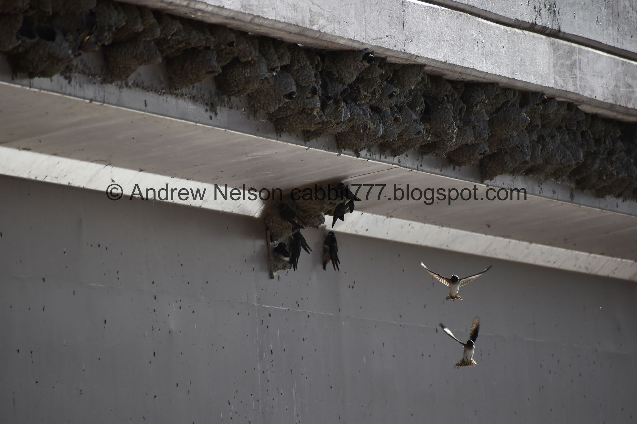

Neat!

And they're off!


It’s kind of fun watching them. I am not sure if they are building their colony, feeding, or both.

Alright, time to head on back.

The side trail leading to Pioneer Crossing.

Mountains.

Back to mile marker 1.

Again, not the oriole I was hoping it was, but another yellow-headed blackbird.

Mount Timpanogos above Pioneer Crossing.

The alternate mile marker system you see along the trail in Utah County. It was a bit confusing until I realized it was separate.
Riverbend.

The river.

Steep riverbank. I would NOT want to fall in here.

The other side. I don’t think it will be too long before there is a new neighborhood over there.

Riverbend.

Fun little islands.

Another yellow-headed blackbird. The home owner suggested that might be what it was, and I, still thinking it might be the oriole, added that maybe it was that. Sorry homeowner, you were totally right. Hope I didn’t make you doubt yourself.

Then a pair of sparrows joined us.

The yellow-headed blackbird again. Super handsome bird.

Back to mile marker 2.

Mountain views.

A pair of doves.

The alternate mile marker system is a little more than a mile longer than the main one.

Mount Timpanogos.

Back to Powell Lake.

Nice forest.

Pelicans.

Heading back under Main St.

Mount Timpanogos.

Heading back into Willow Park.

Back to mile marker 3.

Back to the trailhead.

Willow Park is quite lovely.
This is weird. Normally when trails pass closely behind people yards, I tend to not like them. Particularly when I pass by people in their yards. However, I really enjoyed this section of the trail. Maybe it was the bird sightings. Maybe it was because it felt more natural and wild for more of the way. I don’t know. But I liked it today. 8 out of 10 squirrels. And I am super stoked to be one more trip away from saying I have completed the south half! Wewt.

As for difficulty, it is paved, and mostly flat. DR2.
Dogs are allowed, but must be leashed. Please clean up after your furry friends.

No comments:
Post a Comment