.jpg)
The section on the Jordan River Parkway between Wildlife Park and Thanksgiving point was alright. The trail stays close to the river for most of the way. There is a portion that is a little close to peoples homes which always feels a little weird. There was some good birding today too. The previous section was a long section between trailheads, followed by a shorter one. So I combined them, and split it in half which kind of ended at a random spot. So today I am doing the other half of it from the other direction.

Quick Details:
Length: It should have been 4.5 miles but I pushed a little further I guess and ended up doing 4.7 out and back.
Trail Type: Connector, Point to Point or Out and Back.
Difficulty: DR2. Its paved and fairly flat with 1 or 2 small gradual hills.
Elevation Gain: About 118 ft.
Restroom: Not at the TH I used, but there is one at the Thanksgiving Point TH that you will pass, and I am fairly sure there is one at Olympic Park that you will pass as well.
Dogs? Yes, leashed.
Other Info: Jordan River Trail Mile Markers: 5,6, and 7. Cities: Lehi
To Get Here:
From the north: Take i15 to the Thanksgiving Point exit. turn right on Triumph Blvd. turn right on 1500 N. Go about 3/4 of a mile and look for the parking lot on the left. It is very narrow, and almost seems like you are driving on the parkway trail for a second. If you cross the river, you went to far.
The Trail:

There is this neat old truss bridge at the trailhead.

Neat old bridge.
I know the city is just trying to cover their butt, but I do take these warnings seriously. 1) I don’t want to get hurt if it really is dangerous. 2) I certainly don’t want a fine!
Come to think of it. I think this might be the notorious bridge that was in the news a couple years back that used to be a popular diving spot, until someone drowned. BRB checking google.
Found it. Yes, it was this bridge. Oh, interesting. I thought that incident inspired the no trespassing signs, but they were already up. Super sad.

Trailhead Sign.
Wildlife Park is actually south of here, so I will probably go through that next time.

Crossing 2100 N.

Traverse Mountain and Box Elder Peak.

Horses, a goat, and a sheep.

Mile Marker 5. Wow, that means I have just under 5 miles left to the southern end! Wewt!

Floodplain.

The other side of Steep Mountain.

Lone Peak and Box Elder Peak.

Mount Timpanogos.

First glimpse of the river.

Crossing under 2100 N.

The river is crazy wide here!

Pidgeon's.

The river again.

Raven.

The river again.

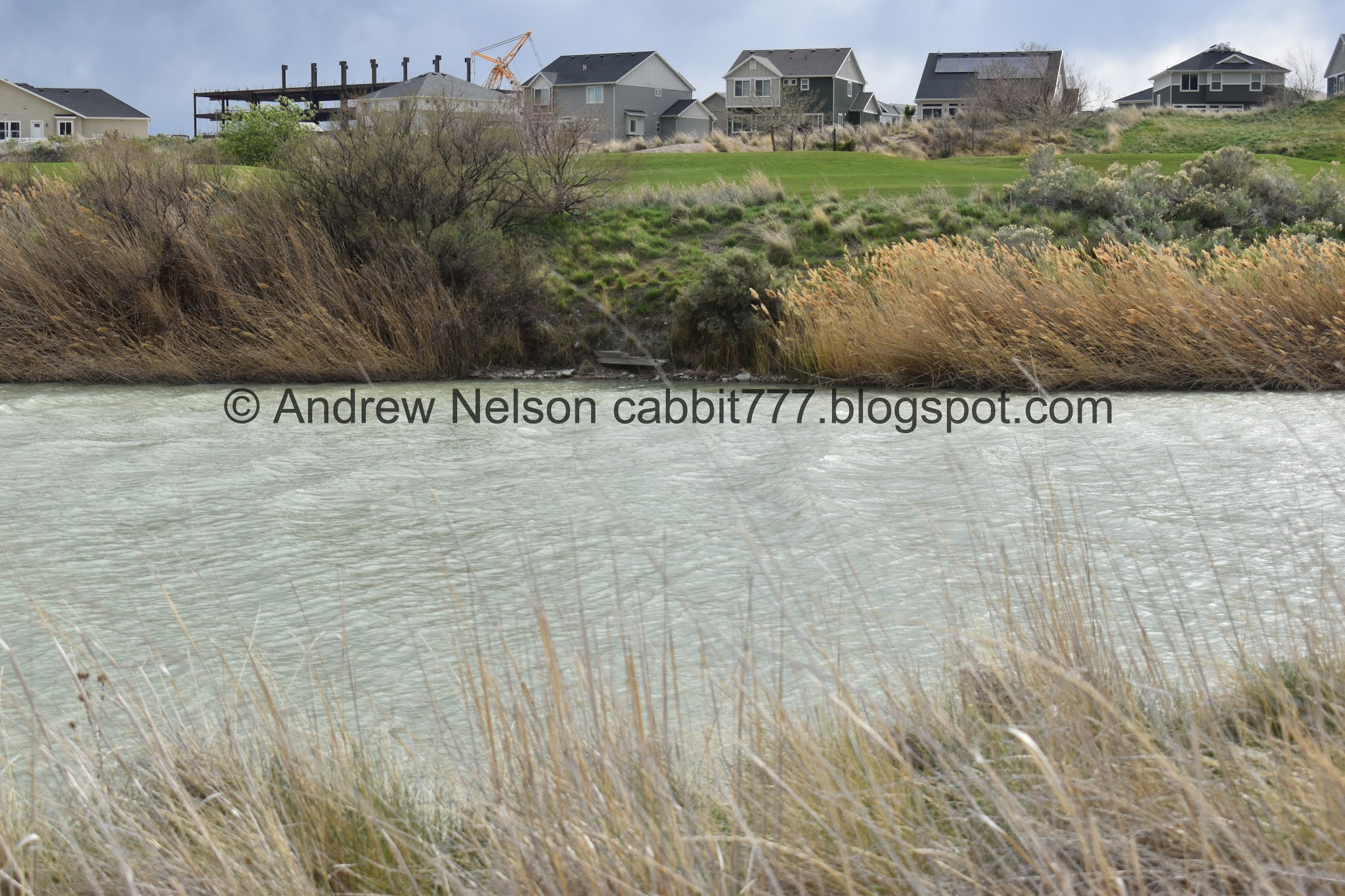
Private golf course bridge.

Fun clouds.

Entering a swampy area.

Wow, mile marker 6 already. That seemed a bit quick.

Bend in the river.

Meep!

The alternate mile markers along the trail in Utah County. I am curious where this system starts. As I mentioned last time, it is a bit confusing until you realize it is a separate trail marker system.

The river again.

River bend.

Looking back towards the south.

With the winds today, the river appears to be flowing the wrong way.

Looking back. Lone Peak, Box Elder Peak, and Mount Timpanogos.

A hawk soaring above.

Eventually I hit a section that was along rich peoples back yards. I always feel a bit intrusive on trails like that.

Not a hawk, not a seagull. I am leaning towards an ibis or something along that line.


The river again.

You can see the windmills above the Jordan Narrows.

The wind makes it appear to be flowing the wrong way.

Eventually we hit the Thanksgiving Point property, indicated by the white fence.

Eventually I hit the Murdock Trail split.

Mileage in either direction.


The river.

Approaching a riverbend.

More fun clouds.

Fun clock tower on what I assume is the Thanksgiving Point Golf Course Clubhouse.

Mile marker 7. I did not anticipate hitting 3 of them today. I know I am doing more than 2 miles, but still. I guess it can happen when you start right next to one of them.
If I had realized how close I was to it, I probably would have made this my “about halfway” point last time.


Riverbend.

The alternate mileage system, that I have no idea where it originates. It was super confusing until I figured out it is an alternate system.

Another private golf course bridge.

River and mountains.

The clubhouse again.
Whelp, I went a smidge past my 2.25 miles, just to make sure I crossed the point where I left off last time.

Traverse Mountain.

Riverbend.

Robin.

Back to Mile Marker 7.

Stumbled upon a not very old marker that is kind of almost already lost to time.
Fox Family Farm springs
1891 - 1995
Five Generations
Alfred Marshall Fox
Iasac William Fox
Eldred Winn Fox Family

Clouds are starting to look a little angry. Luckily I did not end up being rained on.

The river again.

Another riverbend, and entering the expensive home section again.

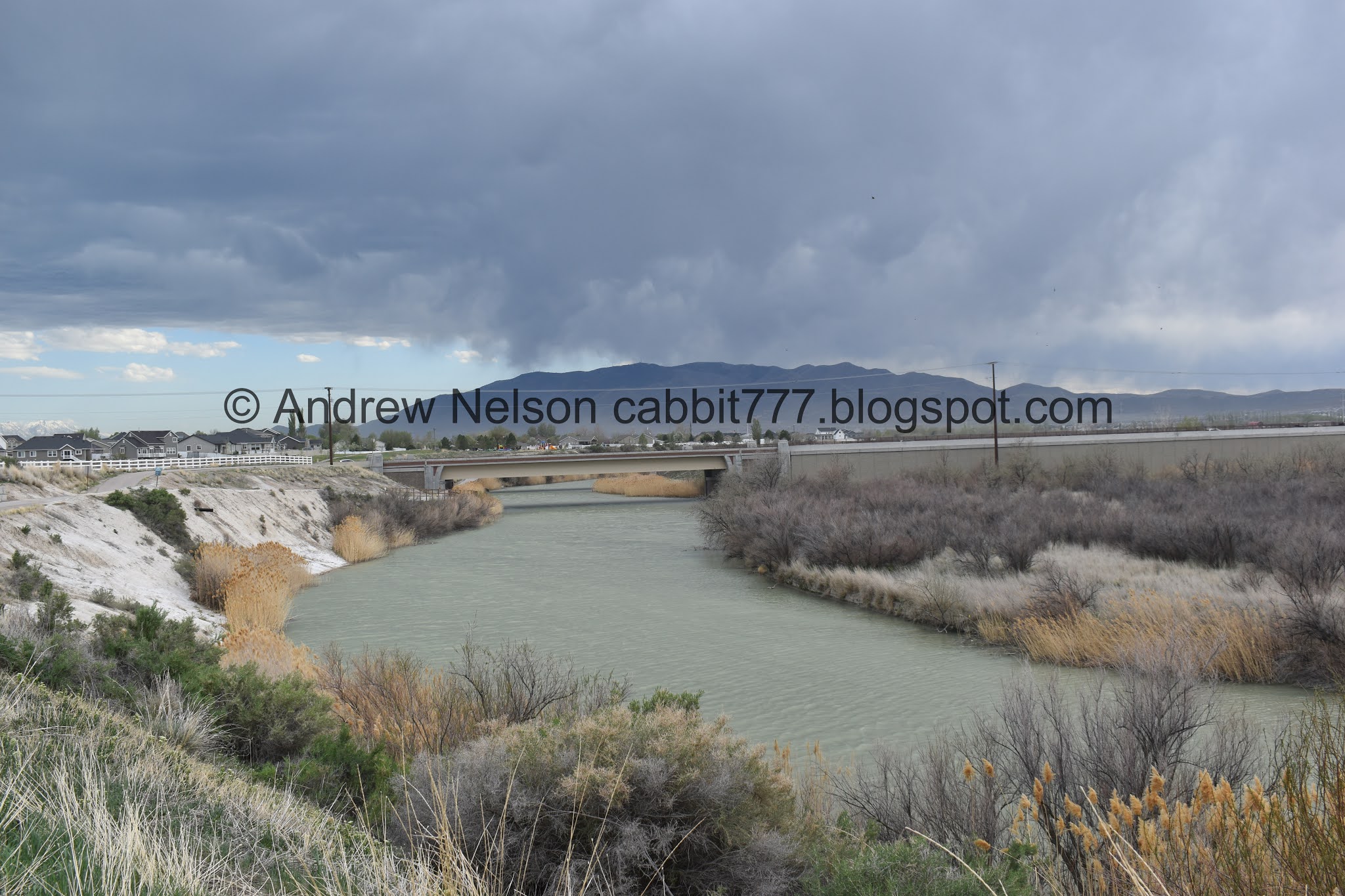
The river and some angry clouds.

Angry clouds.

Clouds above American Fork Canyon. That is a fun scenic drive to do the Alpine Loop or Timpanogos Cave.

Mount Timpanogos over the Jordan River.

Some of the trail crumbing away. This is in the “danger drop off zone”
The river again.

The super wide river.

Aww. A fun little fishing spot with a plea to keep it clean.
Enjoy fishing here
But please keep it clean
Do not leave any trash
Including
Fishing line that birds can get entangled in
Thank you.

Little island.

Cattails and phragmites.

Mile Marker 6. Just a smidge over a mile to go.

Red winged blackbird. These guys have a particularly lovely call, but they tend to hide in the cat tails.
As the winds get a bit higher I am noticing some higher waves on the river. Very similar to the waves on Utah Lake. I wonder if the lake affects the wave on the river through here.

Another private bridge on the golf course.

The river.

Heading under 2100 North again.

Dust being kicked up from the wind.

Pidgeon's

.The river again. It is super wide!

With some fun clouds.

Bat box.

Looking back towards the Jordan Narrows.

One last look at the river before we depart it.

Angry skies.

Floodplain.

Back to Mile Marker 5. It is a little crazy to realize I have just under 5 miles to go to the southern end of the trail! I am hoping to do that before it gets too hot this year, while understanding that may not happen.

Crossing 1500 N. again.

Back to the Wildlife Park trailhead.

The neat old bridge again.

Turkey vulture. Huh. I usually only find these guys near the foothills. This is the first time I have seen one this far from the mountains. Wait, that isn’t quite right, first time in the SL valley. I did see some away from the mountains in Vernal.
Well, this section wasn’t as pleasant as I thought it would be, however it did follow the river closely for the most part. And I got to enjoy a couple bird sightings, and see the old truss bridge. Plus not a whole lot of people. DR7.

As for difficulty, its paved and generally flat with a couple mild hills. DR2.
Dogs are allowed, but must remain leashed.

No comments:
Post a Comment