.jpg)
The Old Red Pine Road is a nice trail at the top of Millcreek Canyon. It features a nice mixed forest, a creek, and some nice views. I didn’t really have a solid plan today and after driving to the top of the canyon we looked at the several trail options here and decided this one looked nice! And, well it was, for the most part.

Quick Details:
Length: I guess the whole thing is about 2 miles one way. We went 2.29 out and back, so I guess just over halfway.
Trail Type: Out and back. There also appears to be a loop option.
Difficulty: DR3. It was pretty mild but a little bit of a climb.
Elevation Gain: The map says 800 feet. We did about 580.
Restroom: Yes there are pit toilets at the trailhead.
Dogs? Yes. Off leash on odd days, leashed on even days.
Other Info: Fee area: $5.00 per car paid as you leave the canyon. Note: this is above the winter gate which is closed to vehicles Nov 1st to July 1st.
To Get Here:
Drive to the top of Millcreek Canyon and park in the upper Big Water parking lot. The trailhead will be at the northeast corner, across from the restrooms.
Note: If the winter gate is closed, it will add about 4.5 miles each way.
The Trail:

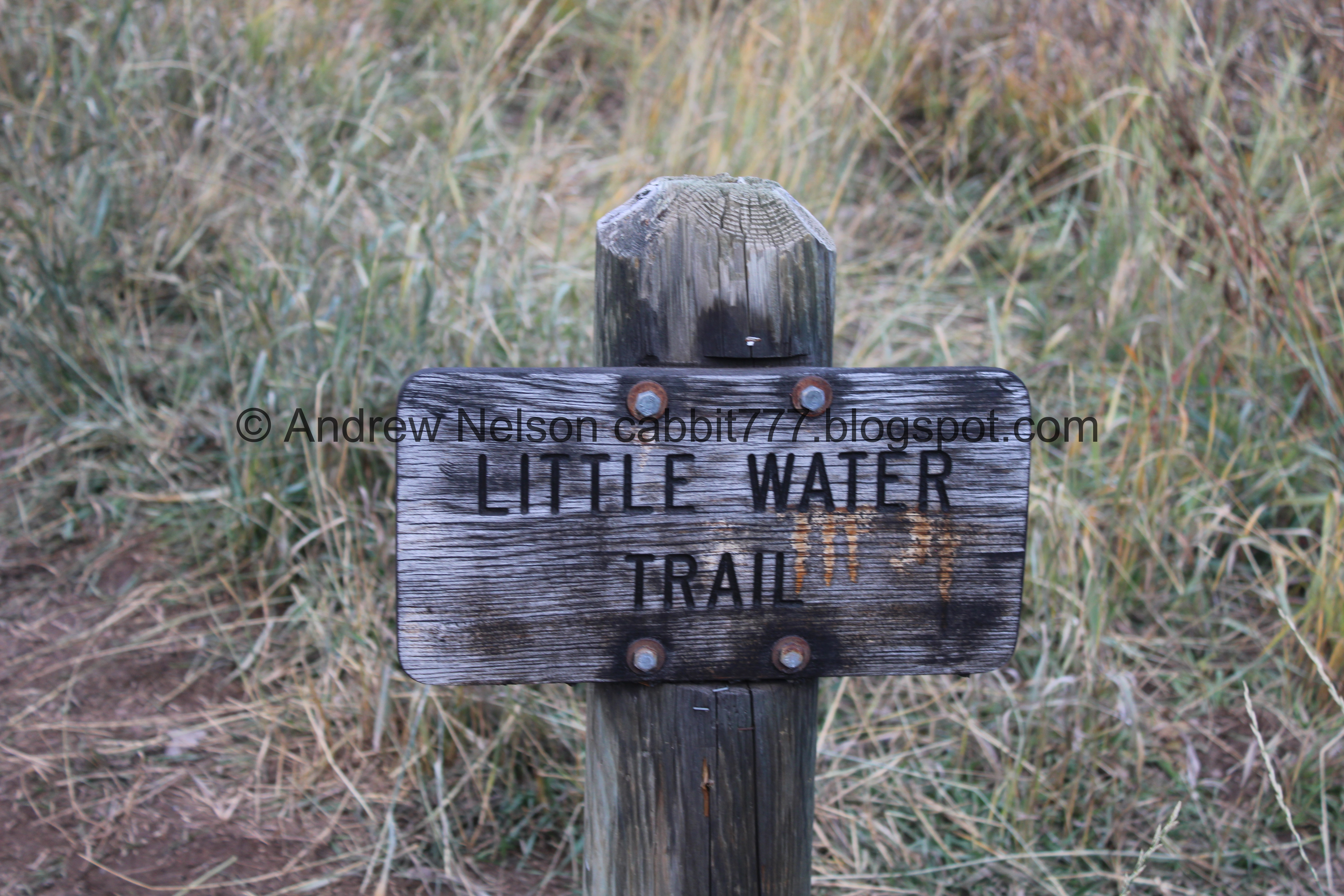
Trailhead sign, which is signed for Little Water Trail. The trail we took splits off of that trail just ahead.

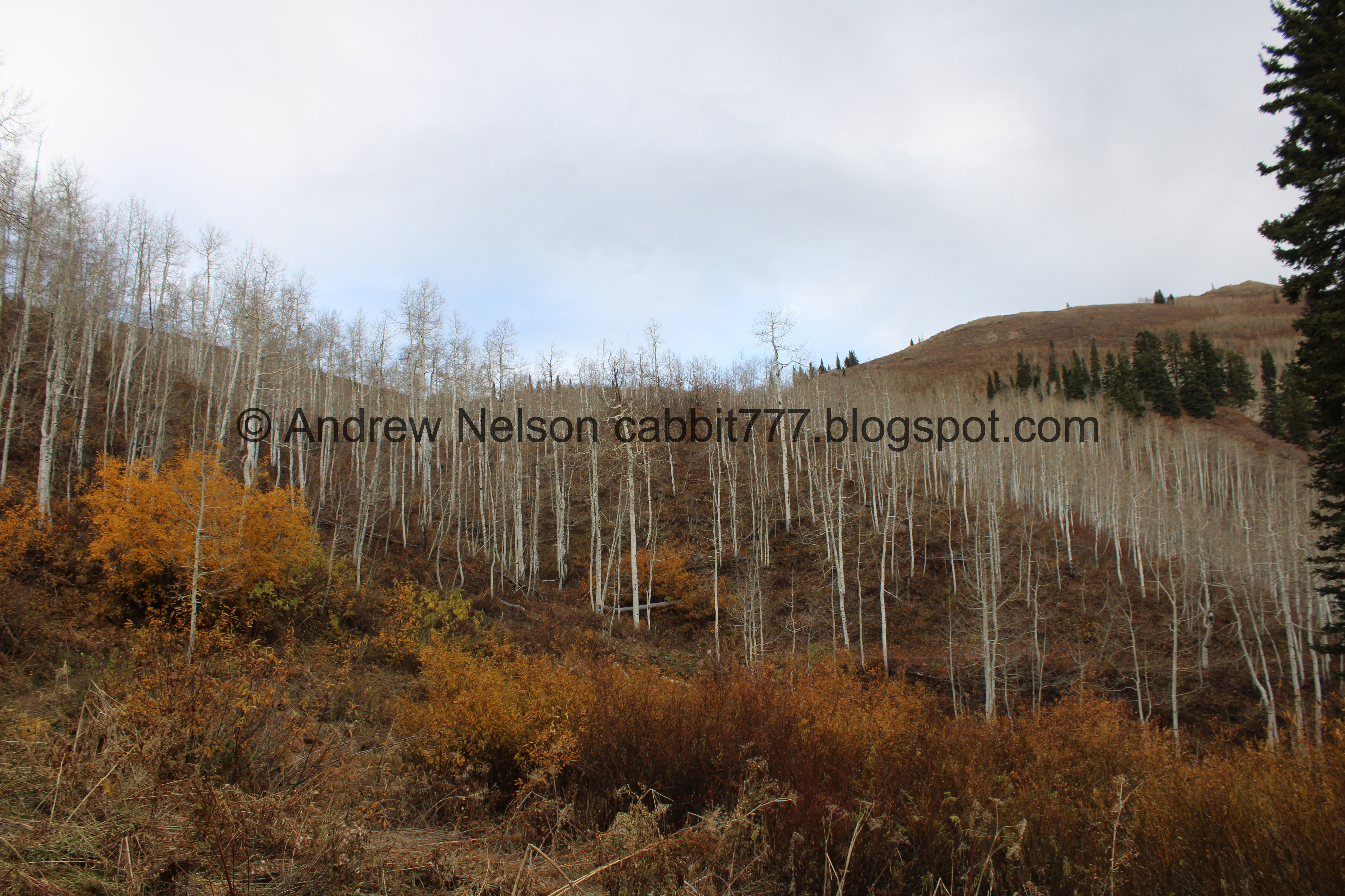
Mixed forest.

Into it.

I think we need to come back in early fall sometime. I bet it is fantastic.

Some of the underbrush is colorful though.


Trail Split. We just kind of randomly decided to go left towards the Old Red Pine Road Trail.

The creek.

Upstream.

Lots of nekkid aspens. Yup, definitely need to come back earlier in the year.

Heading into them.

Aspens and blue skies.

Mixed forest.

More aspens.


Love me a good aspen forest, even when they are nekkid.

Some bright underbrush.

Little bit of color.

More aspens.

Some orange against a blue sky.

Starting to see some snow.

More aspens.

For the most part the trail has been a pretty mild climb.

Little clearing where we can se the Little Water Trail climb up the other side along a side stream.

It was hard to get a good shot of the stream through the trees on this side.

I don’t know what these are, but they are pretty.

With the aspens.


Different shades.

More aspens.

The conifers. Some of these are absolutely massive!

I wonder how old these fence posts are.


We found a small patch of aspens with some color left. Wewt!

Leaf littered trail.

More conifers.

More nekkid aspens.

Small side stream.

Which appears to come from a spring.

More forest.

Some clover.

Little bit more color.

Another little spring.

Crossing over the trail.

A pair of small switchbacks. Ruh roh.

Well, not so bad so far.

More forest.

Clouds taking over the blue skies.

Pretty burgundy leaves.


Additional shades.


Reaching another switchback. I almost turned around here, but we decided to take a quick break.

Peaks a little ways down canyon (west).

Gnarly fallen tree.
.jpg)
Looks like it took out half of the branches from the tree next to it on its way down.

Okay, I decided to give it another go. I struggle on thinner trails that go along the side of a hill, but the cross slope doesn’t look so bad.

The peaks below again. I THINK one of them might be Big Water? But I am not sure.

Continuing up the trail. I was a bit hesitant, but it wasn’t too bad.

More nekkid aspens.

The next switchback, which ended up being the last one we did. I am not sure if there are any more a little higher than we went.

Still doing alright.

Some more colorful underbrush.

A peak to the east. Again, not at all sure, but it might be Murdock Peak.

Peak to the south. Again, not at all sure, but I think this is Little Water Peak.

Some oak leaves.

Changing geranium leaves amongst fallen leaves.

More forest.

Big ol wasp nest.
Nekkid aspens and colorful underbrush.

Some daisy-like flowers still hanging on.

Looking towards what I think might be Murdock Peak again.

Found a little pond.

Colorful tree.

Little bend. With a culvert built in.

Not a whole lot, but a little water is the side stream.

What I think might be Little Water Peak again.

Peaks to the west.

Looking up canyon again.

Aspens against the conifer backdrop makes them loo like veins and arteries.

Alright, the trail is starting to sketch me out. It is getting a little higher up there and the cross slope is getting pretty steep.
I took another break and then decided to see if I could make it through, with the hopes that it is just a short spot.

Cool rocks.

Peaks to the west again.

Well, I managed to push myself a little bit further, but the trail just seemed to be getting higher up, and I was getting in worse shape with my fear of heights, so I called it, and we decided to head back. We went about 1.2 miles. Looking back at the maps it looks like maybe if I had toughed it out just a little further I might have been okay, but I donno. I did enjoy what we did up to here though.

Another wasp nest.

Mountains to the west again.

Grasshopper.

More colorful underbrush.

Random berries. I bet they taste like burning.

Peaks to the west again.

To the south, what I think might be Little Water.

Fun side effect of hiking this time of year.

Little bit of yellow.

Some yellow on what I think is Little Water.

Looking back toward the east again. I am not 100% sure, but I think that pass is where the trail was taking us.

Colorful bush.

The little built up culvert under the trail for the side stream.

More color.

The little pond again.

Little closer.

Looks like it is the result of another spring.

Another giant conifer tree.

What I think might be Little Water again.

Back east towards what I think might be Murdock Peak again.

Colorful underbrush.

Peaks to the west.

To the south and what I think it Little Water again.

Oak leaves.


Aspens.

Conifer covered hill.


Some colorful underbrush.

Mill Creek below.
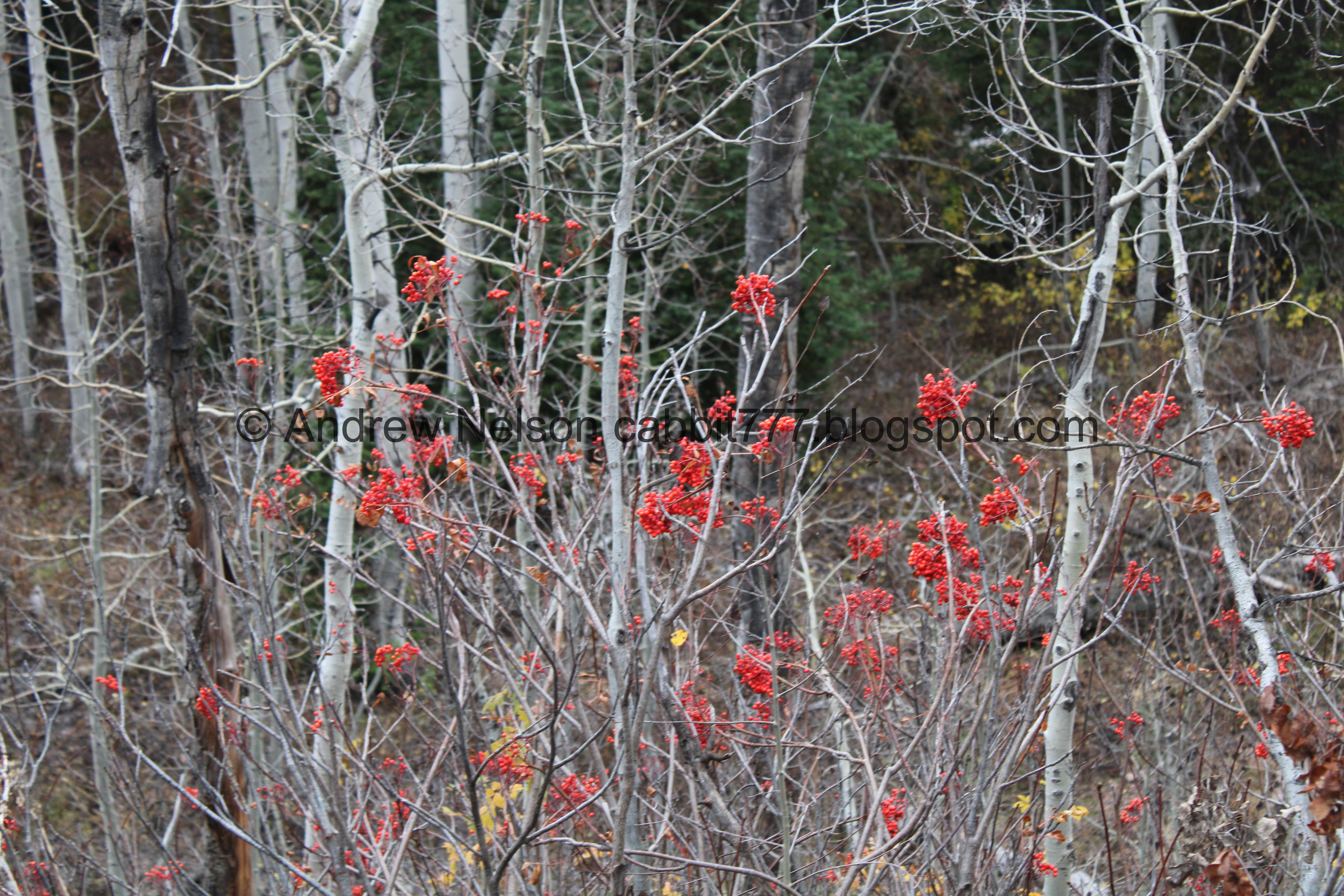
Some more random red berries. Not sure what these are either, but I am sure they are also poisonous.

Pretty forest.

Geranium leaves.

Looking up.


One of the springs again.

Heading down to the creek.

There is a little trail down towards the creek we decided to check out.

The stream from the spring fanning out.

Big old trees.


Mill Creek.

Hill full of nekkid aspens.

Little color.

Back on the main trail.

Interesting puff balls.

Back to the patch of aspens hanging on.


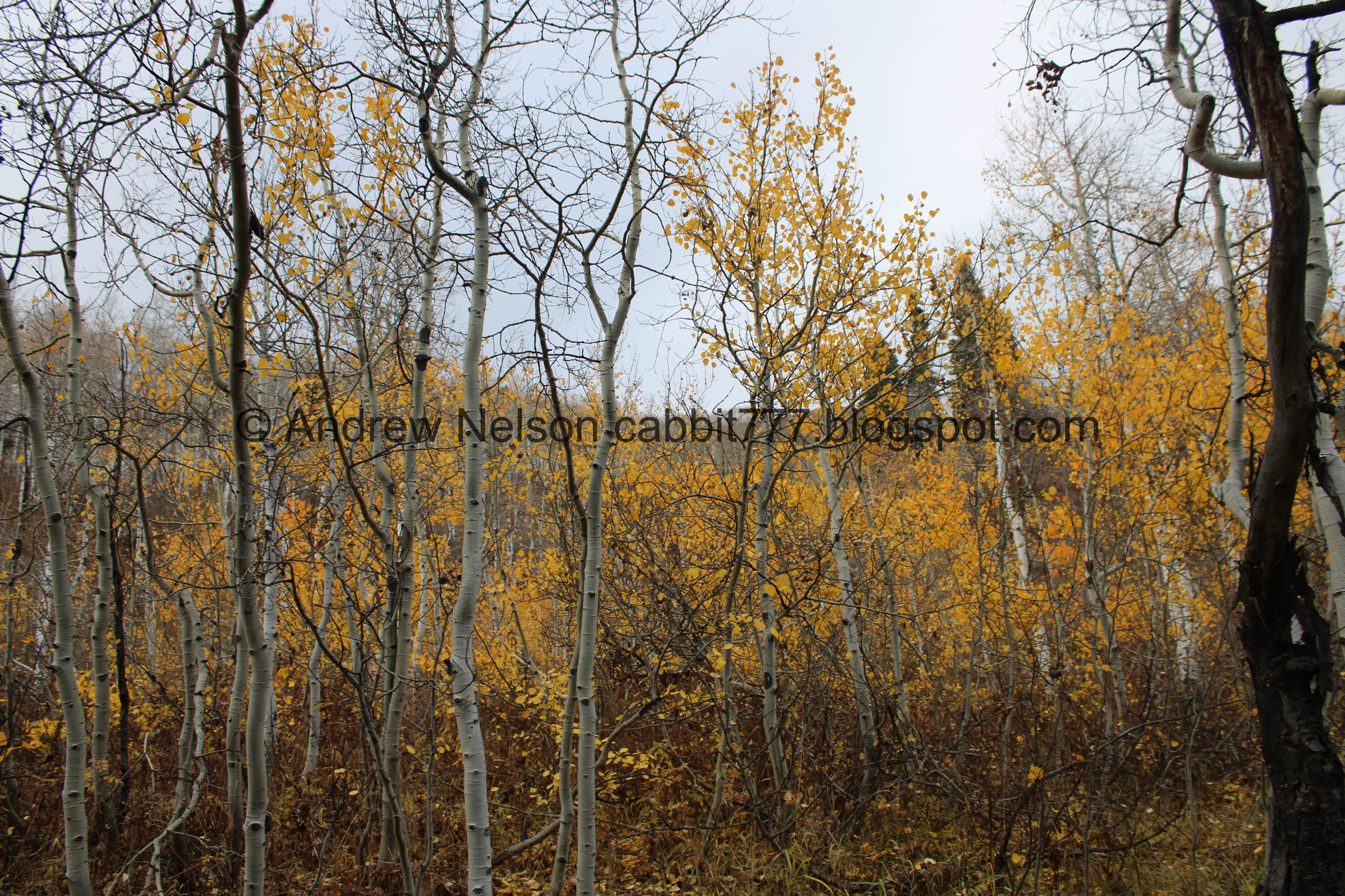
Nice to get some pretty aspens in.

Conifers.

A particularly tall one.
.jpg)
Forest panoramic.

More aspens.

Back to where the side stream comes down with the Little Water Trail.


More aspens.

Looking up.

Continuing down.


Again, I just love me an aspen forest.

Fiery underbrush.

Down canyon.

Back down to the bridge over Mill Creek and where the 2 trails split.

Mill Creek.

Downstream.

The creek fans out pretty widely here.


More forest.

Almost back to the parking lot.

Clearing.
Old trail sign.

Back to the parking lot.
Well, that was a nice trail. No incredible end prize, at least for us. As I understand it, the ridge will offer a view into Park City. But, it was just a lovely stroll trough the woods, and I liked it enough to come back and check it out a little earlier in the year. We only passed a few other people, so not a super busy trail either. I think I am leaning towards 7 squirrels today.
As for difficulty, it was pretty easy going, even the switchbacks. DR3.
Dogs are allowed! Off leash on odd days, on leash on even days.

No comments:
Post a Comment