.jpg)
Millcreek Canyon is a scenic canyon near Salt Lake City. It’s not as busy as our other nearby Cottonwood Canyons. Nor is it as steep. It is quite thin and windy though. The canyon features several picnic areas, hiking trails, as well as a few restaurants and weddings venues.

Scenic Drive Details:
Length: The canyon itself is about 17 miles out and back from the fee station.
Time Needed: About an hour, plus whatever exploring you do.
Road Conditions: Paved 2 lane road, with it being quite thin towards the top (meaning you may have to pull over to let opposing traffic pass).
Summit: Just over 7600 feet.
Restrooms: Several along the way.
Interesting Things: Several picnic areas, lots of hiking options, a few restaurants.
Other Info: Fee area: $5.00 per car, paid on the way down.
To Get Here:
I215 from the north, take the 39th S. exit (east side). Turn Left, turn Left on Wasatch. Take the first right on 3800 S (signed as Millcreek Canyon. Continue up to the fee station and up the canyon.
i215 from the south, take the 4500 S/3900 S. Exit (east side). Keep left and turn left on Wasatch. Turn right on 3800 S (signed as Millcreek Canyon. Continue up to the fee station and up the canyon.
The Adventure:

Mount Olympus as we head towards the canyon (Passenger Seat Photography (PSP)).

Entering the canyon (PSP).

The color is just about done but there are still patches to be found (PSP).


The canyon (PSP).

Neat rock formations (PSP).

Entering national forest (PSP).

More rock formations (PSP).

Passing by Rattlesnake Gulch (PSP). I got a better shot of the newly redone trailhead on the way down.

Little more color (PSP).

More fun rocks (PSP).

It is a narrow, super windy road, but as far as canyon drives go it’s not bad at all (PSP).

Little bit of color (PSP).

Thick forest (PSP).

I think now we are past the winter gate, on the upper road, which is closed during winter (PSP).

The road is considerably narrower and windier up here (PSP). Believe it or not its gets worse.

A bright yellow tree (PSP).

Mixed forest (PSP).


The upper, upper road is super narrow (PSP). Go slow and be cautious, you might need to pull over to let a car pass.


The Upper Big Water Trailhead (PSP). As far as you can drive up the canyon.

Mixed trees.

The Big Water Yurt.

There are a couple of trailheads up here, here is the Little Water Trail.

Another section of The Great Western Trail (we just did another part of that trail a few weeks back).

Another trail map. Looks like this also leads to Big Water, which is another way to get to Dog Lake.

Well, this is a new sign. I would love to see a moose today, but not too closely right now I guess.

Ultimately we decided the Little Water Trail looked nicer today, so we did that, but then split off to the Old Red Pine Road Trail.

Better look at the Big Water Yurt.


The Big Water Trail.

The trailhead is just above 7600 feet (I walked down a smidge to grab a shot of the sign).

View down canyon.

The moon coming up.

Heading back down (PSP). I mentioned the road is quite thin up here. But I guess that is being addressed over the next few years, so I am glad we came up one last time before the construction happens.

It’s a little dark so a lot of the Passenger Seat Photos on the way down will be a little blurry (PSP).

Super narrow (PSP).

Before long the road opens up a little bit (PSP). Looks like this is near Wilson Fork.

Continuing down (PSP).

Thousand Springs kind of snuck up on us, so we had to turn around real quick to the pull out that is above it.

One of the springs joining Mill Creek.

Super green hillside.

A few springs.

Right now this one right in the middle seems to be most active.

Little closer.

The green hillside again. I mean, I sure didn't go poking around to see for sure, but there seems to be far fewer than a thousand here.
Not much further down there was an additional pullout near a pond so we pull over there too.

It’s kind of a pond, but more just a part of the creek that has has fanned out a bit.
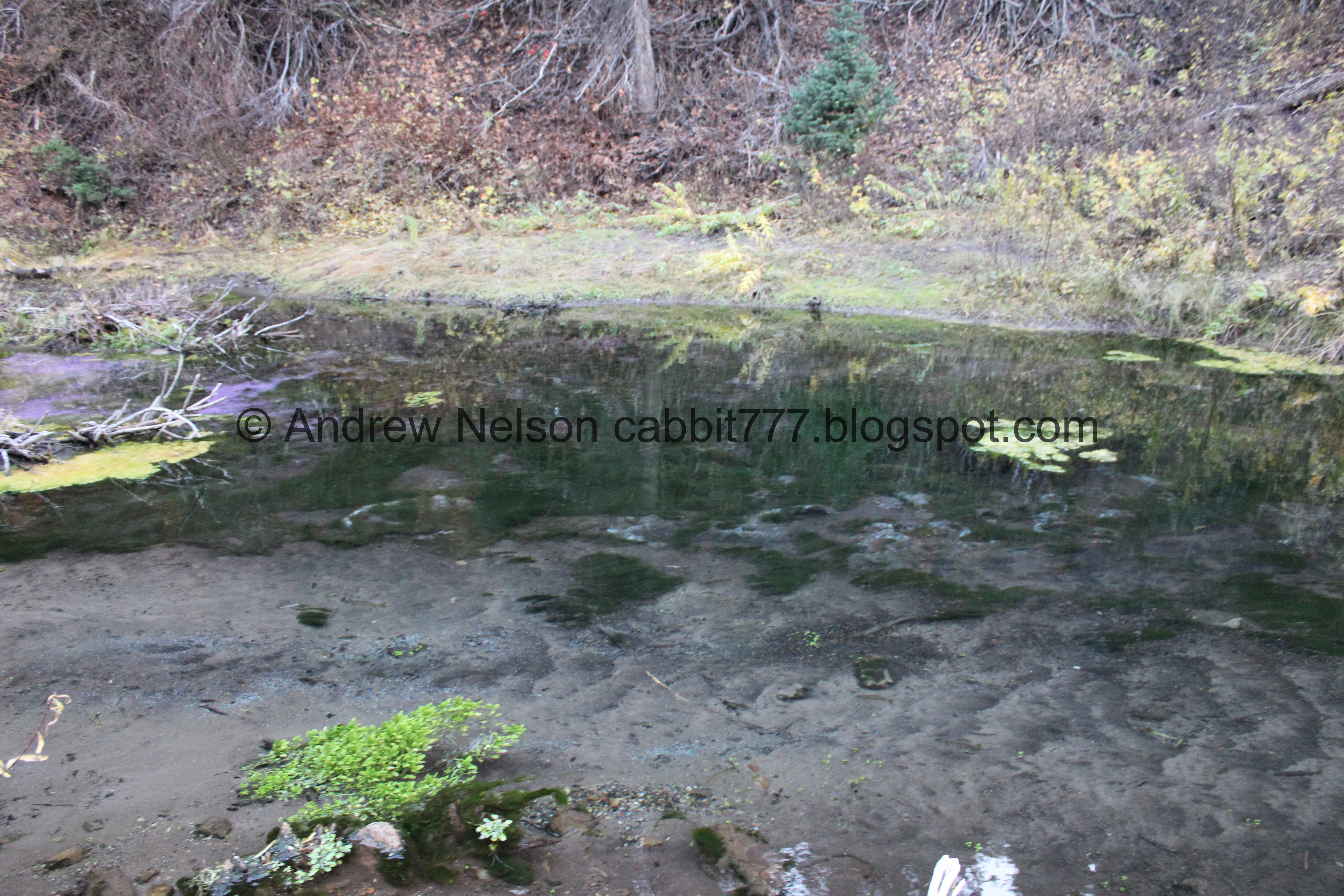
The water is pretty clear though.

A look down the canyon. With some neat rock formations.

A little upstream it is covered with clovers.

The little pond again.

Random red berries. I have no idea what they are but I am pretty sure they are not edible.

Continuing down the road (PSP).


Super pretty up here (PSP).


Little pops of color (PSP).

Passing by the winter gate (PSP). There are a couple of trails here including Terraces to Elbow Fork.

Starting to get a bit of sunset (PSP).


Some more color (PSP).

More sunset (PSP).


More color (PSP).

The new and improved Rattlesnake Gulch Trailhead (PSP). This came out a bit more blurry than expected.

More color (PSP).

Leaving Wasatch Cache National Forest (PSP).

Color (PSP).

Nearing the mouth of the canyon (PSP).

The fee station (PSP). Normally it is $5.00 per carload, but today we got lucky and it was closed. Wewt!

The moon over Mount Olympus (PSP).
That was a fun scenic drive, with a fun hike added as well. Most of the color is unfortunately done, but there were some patches. It was pretty busy today, but not completely nuts. 7 out of 10 squirrels today.
No comments:
Post a Comment