Killyon Canyon is a pretty canyon located in Emigration Canyon. I features a creek, lovely mixed forest, wildflowers and some great views. It is mostly a pretty mild climb with a few steeper spots, but the last quarter mile is quite a climb! we took the main trail to the ridge where there is a 4 way crossing that will lead to various other destinations. we’ve done this before, but it’s pretty lovely so I thought we’d do it again.
Quick Details:
Length: 4.5 miles round trip with additional options.
Trail Type: Out and back, connector.
Difficulty: DR4. There was quite a climb at the end, but for the most part its pretty calm.
Elevation Gain: About 860 ft.
Restroom: No. There is one at the mouth of Emigration Canyon in Rotary Park.
Dogs? Yes, leashed.
Other Info: The last, tougher, quarter mile does not have much shade. So not a great option on a hot day.
To Get Here:
Head approximately 7 miles up Emigration Canyon. At the first hairpin turn there is a road called Pinecrest Canyon Rd. on the left. About 3/10’s of a mile down that rd. you will see a small parking area on the right (signed), and a little overflow area just up on the left (not signed). This is just before where the road forks.
You will take the rd on the right (Killyons Ln.) and continue up for about 6/10ths of a mile before reaching the trailhead. You cannot park anywhere on Killyons Ln.
The Trail:
Note: My new camera is in for repair (super thrilled about that) so I am using an older model at the moment.
The official trail parking lot.
There are way too many many petal yellow flowers. I always give it a good try, but I can never confidently say yes, that's what it is, with a few exceptions of course. With a little help I got I think this one is cutleaf balsamroot.
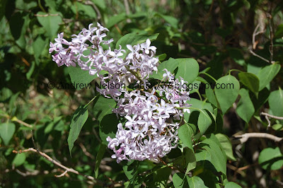
Lilac.
Heading up Killyons Ln.
Emigration Creek.
Little waterfall.
Eventually the road turns to dirt.
Bunny!
What? Are they actually building a parking lot at the trailhead? No way.
I was a little excited about the idea of a parking lot, but then I thought, wait, no. One of the reasons I like this trail is that a lot of people won’t put in the effort to get to it so it’s not busy.
Actually, that is a super weird shape…. and wouldn’t fit more than 4 cars.
I got my answer on the way down. I’ll share the picture here.
It’s a turn around, a freaking expensive turn around too.
The actual trailhead. Now set back a couple feet.
Cutleaf balsamroot.
Forget me nots.
Burdock leaves. They are massive!
Snapdragons.
Forest. Also, the first quick steep climb.
I think these rocks are new.
The creek.
Another little waterfall.
Lupine.
Geranium.
Aspens.
The preserve dedication.
Area rules, as well as another poop fairy sign. I love these.
The lower bridge.
Little pool in the creek. As we approached we watched a dog run up and just plop him/her self right down in it haha. Poor pup really needed a cool down.
Taper tip onions.
The trail is quite overgrown.
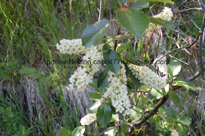
Choke cherry.
The creek.
The upper bridge.
Up stream.
Down stream.
Another short steeper climb.
This spot makes me a little nervous as there are 2 land slides right next to each other. But its not super high up. Still would hate to be there when the middle section goes.
Trail split.
The left fork leads to a pretty shaded canyon.
The right fork leads to all of these things, but I don’t know how far they all are. But I know they are beyond the ridge we made it to today.
I originally planned on doing the main route to the right today, but started wondering if we should do the left fork instead, since I knew it was more shaded. We ultimately decided to stay on the main trail, which may not have been the best option today haha. But we still had fun.
Pretty green hills.
The 2nd of 2 short easy switchbacks.
Super green.
More of the balsamroot. Its all over the place up here!
Trail user counter. It just counts how many people pass by. They place these to see how much certain trail systems are being used, for various reasons.
Green hills.
The trail here has worn down quite a bit.
Lots of balsamroot.
Another big ass tree.
Another short steeper climb. After this, there really is not a whole of of shade.
Looking behind us.
More green hills.
Pretty forest.
Lots of balsamroot.
Little clearing.
Not the best shot, but I love these silvery blue butterflies.
Here the trail follows what I call a run-off channel. Not sure if there is an actual name for it but I see these occasionally, usually higher elevation, and assume that’s what they are.
Aspens.
Bigger clearing.
The run-off channel gets pretty deep in spots.
This is one I believe is mules ear.
The final steep climb. This one is a little longer than the previous ones and a little rougher.
We made it to the ridge, phew!
4 way trail split.
Penstemon.
From the crossroads, North leads to Lookout Peak.
South leads to Little Mountain.
East leads to Big Mountain, East Canyon, etc.
Lastly, west back the way we came, towards the trailhead.
After finding a spot of shade and cooling down a bit we decided to head on back.
Heading on down.
View down.
Really hard to show how steep it actually is.
Pretty forest.
Cutleaf balsamroot.
Forest.
Deep channel.
Back down to the upper clearing.
Aspens.
Pretty green hills.
I think this is camas, in a young stage.
The fir trees towering above the rest of the forest.
Geraniums.
Another camas.
Closer to the big firs.
Cutleaf balsamroot.
At some point the trail was rerouted. I think this is the top of the switchbacks.
Pretty green hills.
Pretty forest.
Taper tip onions.
Looking up at the huge fir tree.
Nice view.
Caterpillar nest.
Pretty forest.
Back down to the trail split.
I wandered over to the creek real quick.
Lovely view.
Then there is this. I have no idea what this is.
Back to the upper bridge.
View downstream.
Chokecherry.
More lovely forest.
The creek.
The lower bridge.
Forest.
Pretty flowers.
Lupine.
Some of the biggest clover I have seen in Utah. Almost as big as the clover I have seen in Oregon.
More forest.
More balsamroot.
Back down to the turn around.
Back to the dirt road part of Killyons Ln.
The bunny is still hanging out on this part of the road. Hi buddy!
Man, he is fast!
Bluebells.
Down to the paved part of Killyons Ln.
I still really like this trail, but yeah, I think we would have been better off doing the left fork today. We got a little hot towards the end. But it was pretty, the wildflowers are starting to pop, and there weren’t a lot of people. The part we did isn’t a particularly great destination, but the journey to it is lovely. 8 out of 10 squirrels.
As for difficulty, as I mentioned it is a mostly mild climb with a couple short steeper spots, and then the last quarter of a mile is a bit more steep, with not much shade. DR4.
Dogs are allowed, but must remain leashed.
.jpg)


No comments:
Post a Comment