.jpg)

Quick Details:
Length: 3.1 miles out and back.
Trail Type: Out and back, but there are several loop options as well.
Difficulty: DR3 some ups and downs, but not too bad.
Elevation Gain: 465 ft.
Restroom: There are pit toilets at the TH.
Dogs? Yes, leashed.
Other Info:
To Get Here:
Option 1: Head up Ogden Canyon, all the way to the top, continue forward at the dam. Turn right on SR 226 (Old Snowbasin Rd). Take that all the way to the Art Nord TH. From what I can tell, that is the end of the road. Not sure if that is seasonal, or always, but it seems like the gate is always closed (google maps says closed Nov. To Mar, but it’s May and still closed, might be another Covid-19 casualty). Word of warning, Old Snow Basin Rd is super windy and thin. Take it slow.
Option 2: Go up Weber Canyon. Take exit 92 towards SR 167 (follow signs for Snowbasin) Turn left to stay on 167. Continue pass the the turnoff to Snowbasin all the way to Pineview Reservoir. Turn Left. turn left on SR 226 (Old Snowbasin Rd). Take that all the way to the Art Nord TH. From what I can tell, that is the end of the road. Not sure if that is seasonal, or always, but it seems like the gate is always closed (google maps says closed Nov. To Mar, but it’s May and still closed, might be another Covid-19 casualty). Word of warning, Old Snow Basin Rd is super windy and thin. Take it slow.
Note: You cannot reach this TH by car via Snowbasin, at least not right now. Trust me, we tried.
Heading up Weber Canyon (Passenger Seat Photography (PSP)).

Heading up SR 226 (PSP).

Pineview Reservoir (PSP).

Heading up Old Snowbasin Road (PSP).
I didn’t get any more pictures of the way up this road as I was too busy holding on for dear life haha. It’s not the worst mountain road we have done, but oh boy is it thin and windy. It’s kind of pretty though.

Oh I did get one more, just below the pass heading down into the valley we will be hiking (PSP).
Failed Trail: East Fork

I think this is a turkey vulture. Not 100% sure only getting a silhouette.

Pretty valley.

East Fork.

Wheeler Canyon.

My original plan today, East Fork, well crap. Alrighty then, off to our 2nd choice.
If I had really thought about it, I would have continued walking up the road, but we went back the way I was familiar with.
The Trail:

You will take this trail down to the left of the information kiosk.

This valley is really pretty.

After crossing the creek the trail heads back uphill.

You will pass a couple tiny side creeks.

Looking down Wheeler Canyon.


Pretty flowers.

Looking back out across the valley towards the trailhead.

More flowers, these guys are everywhere up here.

More pretty flowers.

Starting to get a view of the peaks above Snowbasin.

Flower lined trail.

Pretty peaks.

Lovely forest.

Before long you are in the next meadows with a great view of the peaks.

More flowers.

The trail is thin, but for most of the way it was pretty easy to step off the trail to allow social distant passing. Only a few short sections where that would have been tough. Lucky we didn’t pass anybody there.

Lovely view of the peaks. Looking at Snowbasins map we have here: Strawberry Peak, Demoisy Peak, Needle, Mount Ogden, Allen Peak and No Name. Mt Ogden being the tallest.

Lovely little peak. There is a connecting trail to the road here, I didn’t get a picture because people. But it’s there.

Amazing view!

Now the trail starts heading downhill again.

I really am loving this view.

Panoramic.

Hiking down next to a small side creek.

Second little bridge.

Lovely green hills.

Third bridge.

Another glance at the map, and I am pretty sure this is the middle fork just before it joins the main creek and heads down Ice Box Canyon.

Heading back uphill, and into a pretty forest.


At about 1.2 miles we have reached the Ice Box Canyon junction. I considered doing that one again, but didn’t want to do that long of a trail today, so we stayed on the Wheeler Creek trail.

More forest.

Ice Box Canyon again.

This part of the trail is a little rocky.

Well, I don’t think I have ever seen this flower before. It kind of looks like a glacier lily, but I am certain it isn’t that.
After a lot of digging, I think it is a camas.

Another little meadow.

Little better view into Ice Box.

At just a smidge over 1.5 miles we reached the middle fork junction. We decided this was a good spot to turn around.


More flowers.

Little peak.


Back down to the little patch of camas.

Looking back down towards the trailhead.

Ice Box Canyon again.

Aspens.

Middle fork.

Little tiny side stream.

Pretty green hills.

Looking back to enjoy this great view. I don’t know what it is, but the rolling green hills with the snow capped jagged mountains is just really lovely.

After passing a rather large family that was refusing to make any attempt to distance from us, we decided to take the little trail out to the road, and walk down the road. At least that is wide enough that we should have some space.

The amazing view again.

Looking down the old road.

Swampy area.


More aspens.

View down Wheeler Canyon.

Moody clouds over Wheeler Canyon.

Clouds over the unnamed peak.

East fork.

Heading back up over the pass, the wildflowers are amazing! (PSP).

Heading back down Old Snowbasin Rd (PSP). Oi.

Although, it does offer a nice view of Pineview Reservoir (PSP).

Heading back up SR 226 (PSP).

Back down after the pass (PSP).

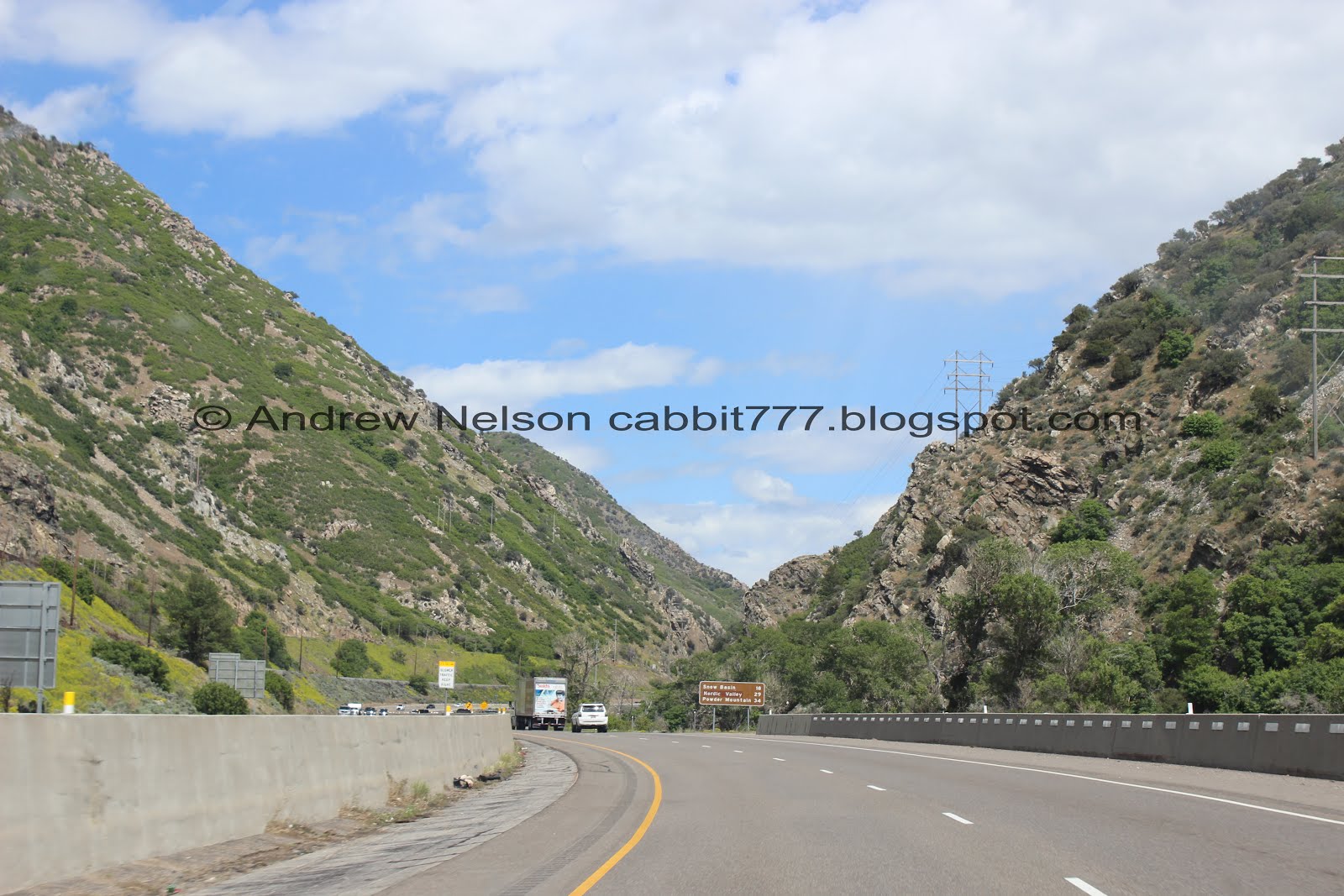
Heading down Weber Canyon (PSP).
Well, it was not the trail I wanted to do today, and I really didn’t care for the Old Snowbasin Rd. But, it was still pretty, and offered great views. I wanted something that was not too crowded today, and, well we got that, and still had room to safely distance. Not my particular favorite Memorial Weekend adventure, but it was alright. 7 out of 10 squirrels today.
As for difficulty, it goes down, up, down, up, and then back again, but it is pretty gentile, DR3.
Dogs are allowed, leashed.

No comments:
Post a Comment