From The Archives
Somehow, with the hustle and bustle of the fall season I have always missed out on the wonderfully photogenic drives we have around here during the fall season. I finally managed to fit it in, although a bit late, it was still absolutely stunning and beautiful.
Our scenic drive started with a long drive south to the Highland/Alpine exit. There are a lot of great things to see in the Highland/Alpine area but I wanted to get up into the mountains so we passed all that and entered the canyon. Apparently we were not alone in our idea for our adventure today as a smidge up the canyon we got stuck in a traffic jam at the ranger station to pay fees. Lucky for us we had the Golden Eagle Pass which allowed us to get in free, and by pass about 10 minutes wait time. W00t. I really like this canyon. It is really one of the least molested canyons in our general vicinity. Yes there are picnic areas, and of course the trail head to Timpanogos Cave has a ranger station, but there are no houses up this canyon. It is all National Forest Land so it is much more natural than some of the other canyons. I wish I had taken more pictures on the way up because it was gorgeous, but I was really excited to see Cascade Springs and was worried about losing light so I just kept going.
This particular drive was, well scarier than most as about halfway up the road narrowed to a tiny as road with barely room for two crossing cars to pass, and huge drop offs. Landis was getting mad at the car behind us at one point and pulled over. So I took the opportunity to snap a few shots of the scenery.
This is the tiny road I was talking about. Plus the nekkid Aspens. Almost all of which within 2 feet of the road seem to have been marked.
Quite a bit further down the scary ass road, we came across the Deer Creek lookout.
A bit more driving and we arrive at Cascade Springs. We had picked up lunch before our drive up anticipating a chance to eat here in the scenery, only to find posted signs banning such activity. Apparently they want to preserve the pristine waters. Not a big deal, and understandable as you will see later, so we ate in the car. Now keep this in mind, there were also posted signs the whole way up, and in the parking lot that said you must display your paid pass if you stop. So we are eating and we watch a ranger come by and ticket a car who had not posted their pass. Then we see a couple come up the trail looking.. a mix between confused and pissed. And they see they have been ticketed, and proceed to confront the ranger. Really? I think they did a good job of forewarning you, dumbass.
Now to the trail.
This is a really pretty, scenic trail that is paved so it is an easy hike. Unlike Silver Lake it probably could not be traversed on a Jazzy but it is still easy. We parked at the upper parking lot which at first look on the trail seemed to be a detriment, but upon second look back was an advantage as you start at the source and see the results next.
Random splash of color
The source springs. I really tried to research just how many springs feed this area and I could not locate it. I counted at least 5. But either way, this is the top of the water source, I started the trail above, and there is no water above that tree line. (this will be shocking in a moment)
The trail above the springs, with cute Aspens.
the first bridge. I felt a little bad here. I went to take a picture and there was a couple on the bridge. I waited patiently for a photo, saw them snap it and then moved in to take mine. Only to see they were taking more, and I probably was in their shot. Meh. The yellow trees represent the top of the springs so this is your first idea of how much the springs are pouring out.
This is the 2nd bridge a little lower down. Here you can really see the full force of the springs. Apparently they release up to 7 million gallons per day and here it shows how evident that really is. I again felt bad as I was on the bridge trying to set my camera to take an in motion shot, and Landis, bless his heart notified me that people were waiting to cross the bridge, so unfortunately I did not capture what I wanted, but this is still pretty.

Finally was able to calibrate the camera to capture what I wanted… a little too much motion (over exposed) but still good.
I loved this area the beautiful blue pool with a stream bubbling in.
The water is so clear you can see the fish without any effort.
A pretty shot of the cascades.
We then hiked back to the car, and enjoyed more scenery. I really, really love this area. It is so fascinating to me. To think a few sprigs can release this much water is awesome, and it is so beautiful. I love it. If I could somehow manage to live here I would without any remorse.
We then proceeded down the Alpine Scenic Route towards Heber when we see this:
They were not kidding, dirt road that was pretty rough for 5 miles. It sucked donkey balls.
meh. Not particularly proud of this picture, but it shows the perdy autumn colors.
Random Covered bridge. I don’t have pictures to prove it, but I have decided that Midway was founded by the Dutch, as there was a lot of Dutch imagery around this town.
From Midway we finally found our way to Heber, and then to Park City, and home.
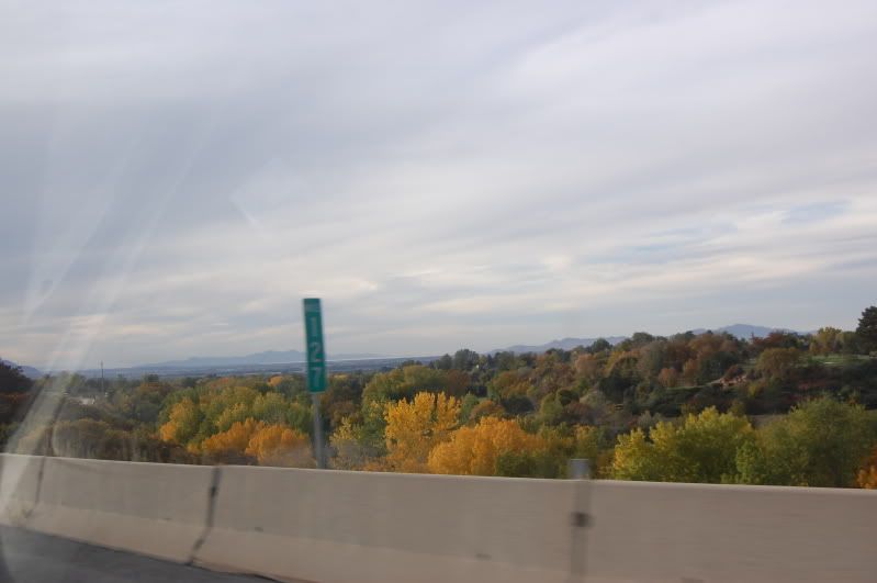
We finally hit familiar territory with Salt Lake.
It was a beautiful drive and I would love to do it again a little earlier next year. I also intend on hitting Timpanogos Cave during the summer one year… oui.
The Drive: 9 squirrels out of 10 because, well there were scary parts, and un paved parts.

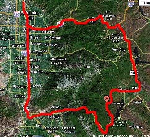
This is the general path we followed. It was cool coming back into the valley and seeing all the peaks we drove around.
Cascade Springs: 10 Squirrels out of 10. The first to achieve a perfect score. It is beautiful, and fascinating. I have never seen such an awesome force of water emitting from springs. Even though it is a DRIVE and it is pretty crowded, it is absolutely amazing. Best local nature spot yet.
Normally I add a quick how to get there but I think my map covers it nicely. :) Although in order to avoid the gravel road, go through Highland/Alpine.
.jpg)


