.jpg)

Quick Details:
Length: The sign says Lake Mary is a mile up, but I think it is closer to 1.2 miles. With the 3 lakes we did it came out to 3.74 miles.
Trail Type: Out and back with loop options
Difficulty: DR4. This one is a CLIMB and there is not much shade for the first half.
Elevation Gain: About 892.
Restroom: No. Closest one is at Silver Lake,
Dogs? No. Big Cottonwood Canyon is watershed.
To Get Here:
Drive to the very top of Big Cottonwood Canyon go around the loop rd past the Solitude Nordic Center and Silver Lake to the big Brighton Parking lot that is at the back end of the loop. You should see a large Kiosk, park near that.

Heading up Big Cottonwood Canyon (Passenger Seat Photography (PSP)).
The Trail:

The giant Brighton kiosk. The trail is behind it.

Information sign.

The trail starts out fairly wide, but oh boy is it steep.


Holy columbines, Batman. I thought last year was a good columbine year but HOLY CRAP I have never seen so many of them in one area.


Loads of wildflowers.

I cannot believe how many columbines are up here! Columbines are one of my absolute favorite flowers. Up until last year, they seemed to be a rare treat. Last year I saw a bunch of them, but nothing like I am seeing here right now! Wow!

Lupine.

More flowers. Lupines and corn lilies.

Squirrel!

More columbines.

Geraniums, I think.
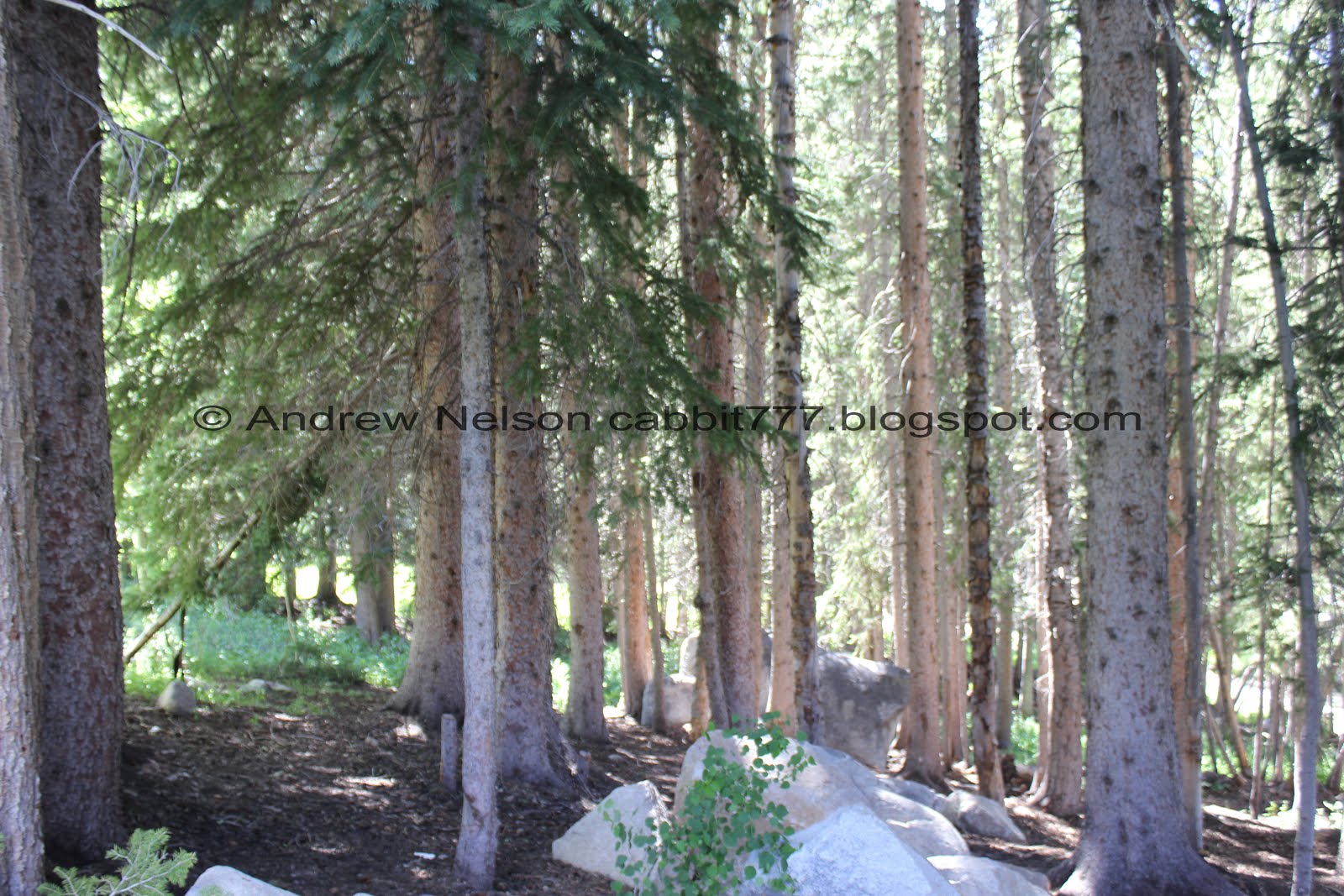
Lovely forest patch.

More flowers.

Spearmint.

Indian paintbrush. I guess it is a little early for them as there weren’t a a whole lot of them up here yet.

View across canyon towards Scott Hill.

Flowers.

Pretty Indian paint brush.

A pretty columbine with a hint of purple on the outer petals.

So many columbines!

The trail follows a ski lift for most of the way.

Mount Millicent.

Mount Tuscarora on the right.

Little river of

Another favorite of mine, elephant heads.

With some paint brush.

More flowers.

Pretty set of peaks.


Some nice lupine and paintbrush.

When you reach the big boulder, you finally get a break from the climb.

Pretty blue hill.

So much lupine.

Corn lily getting ready to bloom.

Small side creek.

Nice flatter trail for a minute.

Pretty forest.

Gnarly burl on this twin tree.

Back to the climb.

More pretty forest.

Rocky trail.

View of Brighton below.

Eventually, you will come to the Dog Lake junction. We decided to do that on the way down.

Crossing the creek that comes out of Dog Lake, and now that I think of it, probably what comes out of Lake Mary too.

I love some of the old gnarly trees up here.

The Twin Lakes trail split. I have never done that, but I do know you can add that, as well as Lake Solitude if you feel so inclined. No sure how much longer that is though.

Super rocky steep segment.

The creek.

The smaller spillway. I can’t fathom the purpose of this.

Just above that you will get your first view of the Lake Mary Dam.

A little closer.

The section below the dam is quite a bit thinner which makes distancing a little tougher. We got lucky and didn’t have to pass by anyone though here.

Looking back down.

Overflow pipe.

Mount Tuscarora and Mount Millicent looming above the final climb.
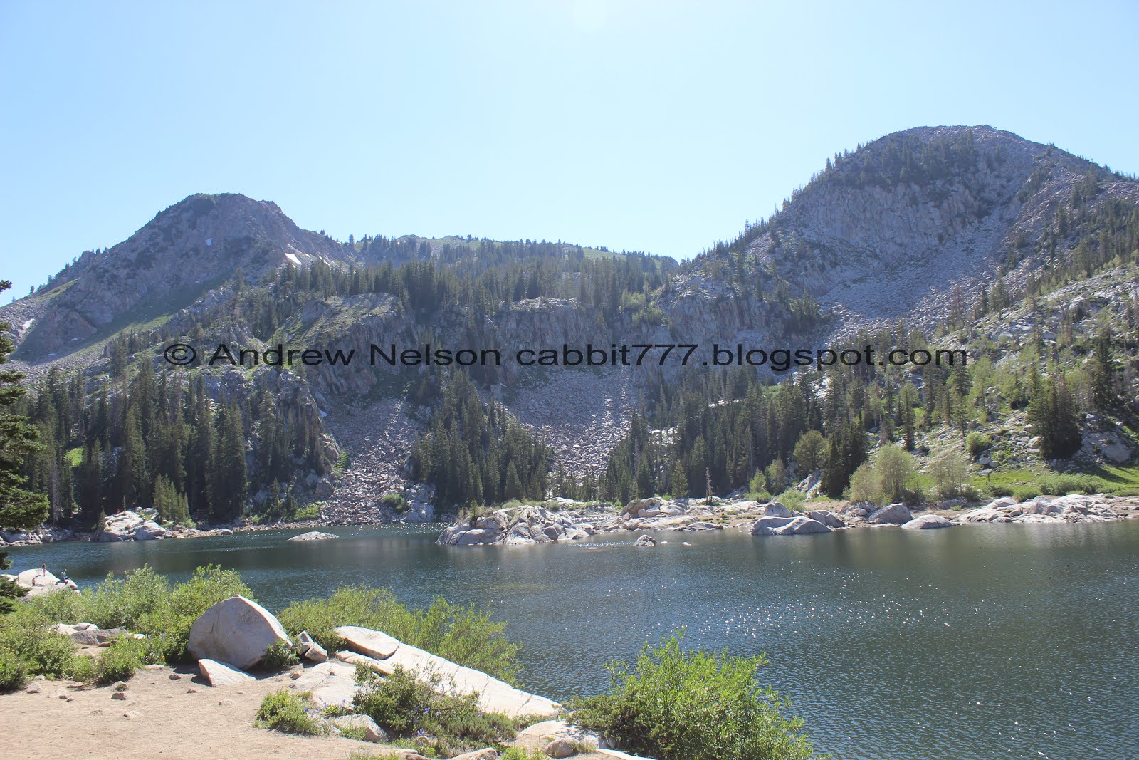
Lake Mary. With Mount Tuscarora and Mount Millicent.

The other end.

Lake Mary.

The back of the lake with Sunset Peak and Mt. Tuscarora.
Fun fact, the deepest part of this back section was originally Lake Phoebe. I guess they decided to change the name when they expanded the lake with a dam.

Another panoramic.


Flowers.

With the lake.

Another look at the back end of the lake.

Continuing along to Lake Martha. The trail is a little thinner, but not a whole lot of people go beyond Lake Mary.

There is one spot that is a little iffy to get through. Just take your time and figure out the best path.

The back end of the lake.


Into the woods again. Oddly enough, the mosquitoes were the worst through this section.
Short of going up to Lake Catherine, this is the best overlook of Lake Mary.

Panoramic.

Mount Tuscarora.

More fun in the woods.

Sunset Peak.

Lake Martha below Mount Tuscarora.

Little bit thinner trail down to it.

Lake Martha and Mount Tuscarora.

Some paintbrush.

Big patch of lupine.

Down to the shores of Lake Martha.

Panoramic.


Nice clear water.

More wildflowers.

The lake and Mount Millicent.

I love the little island in the lake.

Sunset Peak.
Lake Martha is quite lovely, and Lake Catherine isn’t much further, just more of a climb. However, we decided we would head back down the trail. Kind of kicking myself for not continuing to Catherine as I heard there were 5 moose up there! Oi.

More paintbrush.

Forget me nots.

Not sure what this is, possibly some type of phlox.

Getting back down to Lake Mary.

Lupines, paintbrush, and a few other things.

Lake Mary again.

Pretty forest.

Lake Mary and Mount Millicent.

The lake again.

Some people just can’t follow the rules. Despite what you can see here, swimming is not allowed. This is our drinking water.

There are tons and tons of yellow flowers with many petals that I really have trouble identifying them. However, I think this might be an arnica of some sort.

Some pretty penstemon and some other flowers.

The back end of Lake Mary.

This random rock formation fascinates me. It’s can’t be natural right? I suspect they had some trouble with the cement mixer while building the Lake Mary Dam and dumped off a load. That is a total guess, I have no idea honestly.

More pretty paintbrush.

The overflow from Lake Mary.

I think this might be a white crowned sparrow.

Squirrel.

The lower diversion pond again.

Lupine.

Forget me nots and paintbrush.

We decided to add the short sprint out to Dog Lake. Not to be confused with the nearby Dog Lake.

The left fork goes towards Clayton Peak. We haven’t done that one yet, right will go to Dog Lake.

Field of lupines.

Crossing the small creek coming out of Dog Lake.

More flowers.

Lupine and paintbrush.

Pioneer peak.

First glimpse of Dog Lake.


Elephant heads.One of my favorites! They really do resemble elephants!

Pioneer Peak again.

Dog Lake.
You can walk around Dog Lake, but we weren’t up for that today so we decided to head on back.


More flowers.

Chipmunk!

View into the valley below.

More columbines.

More flowers.


Lupines.

Whoa! Holy elephant heads, Batman!

Scott Hill.

This rock looks like a dinosaur with a mouth full of flowers.


More flowers.

Mount Millicent from the parking lot.
The Brighton Lakes are magnificent! Unfortunately, the trails are very popular, and a lot of people don’t think the rules apply to them, which is a little frustrating. However, the wildflowers are pretty great, and will probably be absolutely amazing in another week or so. Going with 9out of 10 squirrels.
As for difficulty, this is quite the climb on a mostly unshaded hillside. DR4.
Dogs are not allowed in Big Cottonwood Canyon due to watershed rules.

No comments:
Post a Comment