.jpg)
This will have been my third week in a row doing the Albion Meadows. I really had other plans today, but the line to go up the Summer Road was quite long. We learned from the previous week that when the parking lots are full they stop letting cars go up until other cars have come back down. Anyway, since this is the 3rd time in a row, I’ll try to be brief. Today we decided to walk up the Summer Road and do the alternate route. So 3 weeks in a row, but 3 different ways. You can do what we did today, or start from the Albion Base, or Start at Catherine Pass and do the Reroute.

Quick Details:
Length: You have loads of options to explore the meadows we did a 4.4 mile balloon today.
Trail Type: Balloon, out and back.
Difficulty: DR3. There is a bit of a climb.
Elevation Gain: We did about 800 today.
Restroom: There is one at the Cecret Lake TH or if you drive down to the Albion Base.
Dogs? No. Little Cottonwood Canyon is watershed.
To Get Here:
Drive to the top of Little Cottonwood Canyon. Park below the Summer Road, then start walking up the Summer Road.

Fun clouds in the canyon (Passenger Seat Photography (PSP)).
The Trail:

Long line of cars waiting to head up the Summer Road.

Heading up the Summer Road.
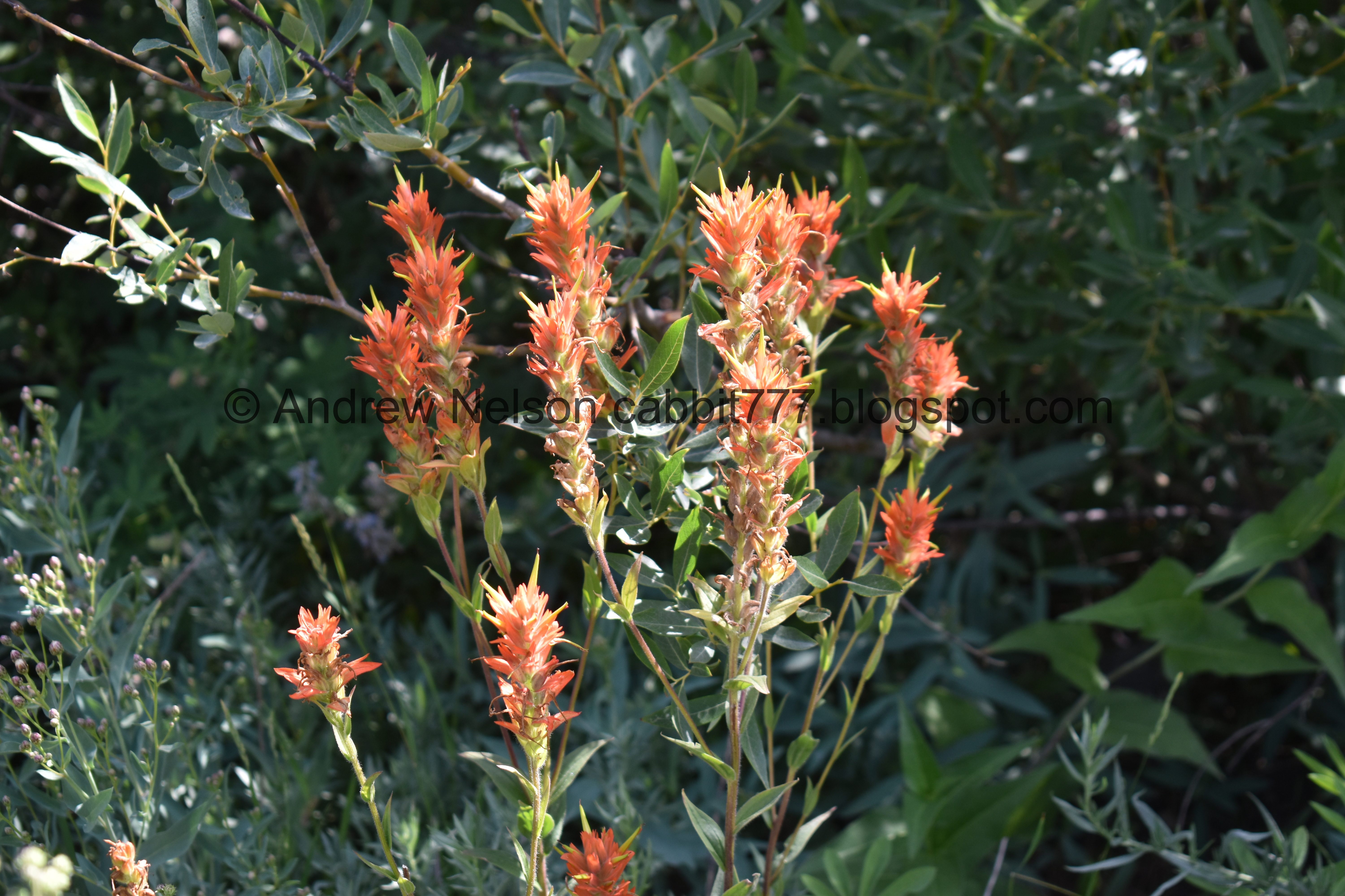
Some different looking paintbrush.

More of the Summer Road.

Fireweed.

At about a half mile you will see the trail off to the right. I think it is pretty obvious, but just in case it is just before the first hairpin turn.

Paintbrush.

Microwave tower.

Then you will walk across this service road for a bit.

Greeley Hill.

Monkshood.

The Catherine Pass trailhead is up above that ridge.

Before long the trail will connect with the main trail. You will want to stay left and continue heading up.

It’s a little rocky and steep.

However very shortly, just before after the trail swings to the left again, there is this side trail that leads to the south trail. I have decided I much prefer going up that way.

Then take the left fork again.

Devils Castle and Sugarloaf Peak.

This trail has been rerouted quite a bit, and they are trying to regrow vegetation in the older trail, so be sure to stay on the new route.

A pretty purple penstemon.

The peaks again.

Lots of lupine.

Geraniums.

Paintbrush.

Some arnica.

View down.

Fireweed.

Peaks again.

The hill above. The flowers are fading fast, but there are still a couple patches.

It’s a little blurry, but I am stoked I caught one of the humming birds. They are super speedy up here!

Paintbrush.

Greeley Hill.

Caught another hummer.

Peaks above again.

More arnica.

Western coneflowers.

Where the north and south trails connect again.

Alf’s Restaurant.

More of that pretty purple penstemon.

Daisies.

The creek again.

Nearing the Cecret Lake Trailhead. This is a good spot to loop back using the Catherine to Cecret Connector Trail. However, I was still set on going with my original plan of doing the Devils Castle Loop. We’ve done it from the trailhead before so I thought, no biggie. But, I forgot about Landis’s hurt foot. Anyway, we went up a little further along what I call the Scenic route to the right here.


 |
Monkshood.

Twin spring pools.

Split rock.

Fireweed.

Elephant heads.

Little bridge over the creek.

This section of trail has been rerouted as well.

Looking back at the little clearing.

Into the woods!


More daisies.

.More pretty forest.


More paintbrush.

Larkspur.

We made it to the Cecret Lake Trail. I was still intending on continuing along the Devils Castle Loop, but Landis was not up to it. He’s got a problem with his foot, and it was starting to hurt him. So we decided we would make a loop of it here, go back down to the Cecret Lake trailhead, and then the new Catherine to Cecret Connector trail.

Speaking of Devils Castle.

This lower stream has dried up.

Devils Castle again.

Chipmunk!

More forest.

Little Cottonwood Creek.

We made it to the Catherine to Cecret Connector.

Heading back to the meadows.

More paintbrush.

Bridge.

Over a tiny stream, which eventually joins Little Cottonwood Creek.

Looking towards Catherine Pass.

There are several smaller drainages that they used rocks to allow the water through, but still walkable.

Devils Castle and Sugarloaf Peak.
The trail reaches the Summer Road, and you will go left there, and then take the first left down the service road.

Heading down the service road.

Yellow, orange and red paintbrush.

Yellow paintbrush.

A nice patch of fireweed.

I considered taking the 2nd half of the Catherine to Cecret Connector, and then going down the Albion Meadows Reroute again, but I figured going down to the Albion Meadows Trail would be more direct, and easier for Landis today.

Larkspur.

Continuing down the service road.

Fireweed and larkspur.

The old trail they are trying to revegetate. We both wondered why the “Not a” part was so much smaller than the “Trail” part of the sign. It’s a little confusing.
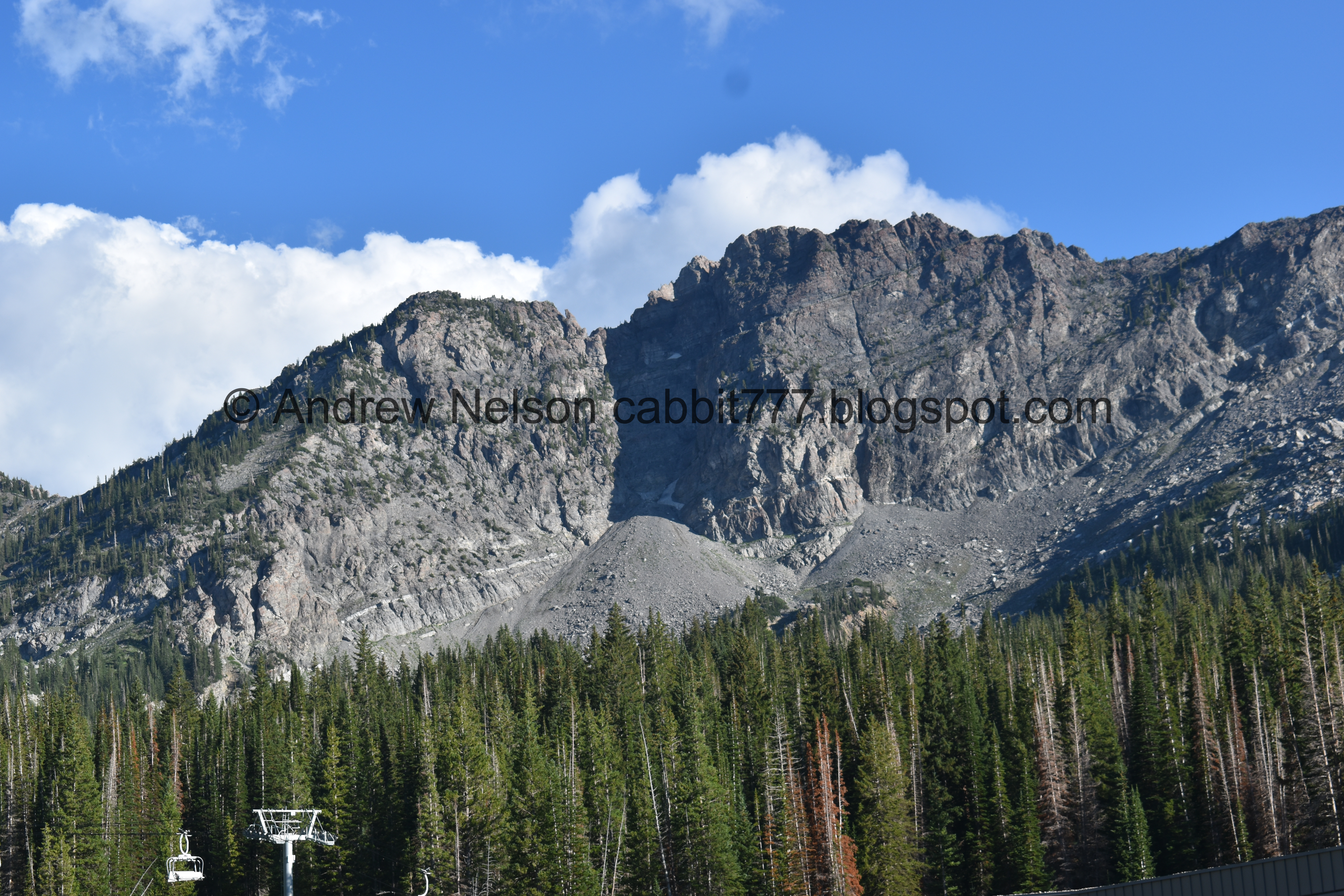
Devils Castle again.

Just below Alf’s Restaurant is the trail split for the north and south Albion Meadows Trail. We came up the south, so we will go down the north.

More fireweed. I’ve mentioned these are one of my favorites right?

The meadows are just about spent.

But there are still some flowers to be found.
Flowers and peaks.

Looking up towards the Catherine Pass trailhead.

Passing the Albion Meadows Reroute. This leads to the Catherine Pass trailhead.

Looking back towards the peak.

Lupine and paintbrush.

Paintbrush.

Orange and magenta paintbrush.

View across the canyon, and the rocky trail. This is why I prefer to come up the other way.

Grizzly Gulch.

Forest.

The split off to head towards the Summer road is forward. Left will take you down to Albion Base.

Game trail.

A particularly stunning paintbrush.

Back to the Summer Road.

View down canyon.


More paintbrush.

Nearing the ranger station. Look at that line of cars waiting to come up!

Devils Castle with clouds and the moon.

WHOA!!! Hello there handsome. (PSP).

We swung around to the other side of the road so we could observe him from a safe distance.

I was getting good shots, but I decided to pull out the telephoto and get better shots.

This is the best moose sighting we have had in a minute.


Getting it’s munch on.

Judging by those antlers I would say this guy is a youngling.

He did look at me a few times, but I think it was just curiosity while he chewed (you can see his mouth is open in this shot). He would immediately resume what he was doing, so I don’t think I was too close. All the warnings I have read state if they stop what they are doing and look at you then you are too close. Besides I was behind the car with the door open so I could hop in if he made a sudden movement towards me.

Back to foraging.

It’s fun to watch them forage.

This really made my whole day!

Off to find something else to eat.

Guess something in this dead tree was worthwhile.

Then, a particularly loud motorcycle spooked him.

Bye handsome! It was super fun watching you eat for a minute.

The view down the U shaped canyon (PSP). I love this view and always take a picture of it.
Well, it was not where I was planning to go today, but I do love the trails around Alta. It was nice to get another visit through the meadows while there were still some wildflowers to be enjoyed. I also really enjoyed the moose encounter today. We’ve now done the meadows 3 different ways in the last few weeks. It’s incredible all of the different options you have. Going with 9 out of 10 squirrels today.
As for difficulty, it’s a bit of a climb, but it’s not too bad.
Dogs are not allowed in Little Cottonwood Canyon due to watershed restrictions. Be sure to leave Fido home.

No comments:
Post a Comment