.jpg)

Quick Details:
Length: 4 mile loop, with option to keep going.
Trail Type: Loop or Out And Back. With additional loop options.
Difficulty: DR3. For the most part you hardly notice you are climbing its pretty gradual.
Elevation Gain: About 600 feet.
Restroom: There is a pit toilet at the trailhead.
Dogs? Yes. Please clean up after your furry friend.
Other Info: There is a handy map available here (External link).
To Get Here:
Oh boy. From i15 take exit 289 for Bangerter Highway. Go about 5 miles and turn left on 13400 S. Go about 3 miles and turn left on 6400 W,/Rose Canyon Rd. .6 miles later turn right to stay on Rose Canyon Rd. 1.4 miles later turn left to stay on Rose Canyon Rd. About 2 miles later will be the trailhead parking.
From there, cross the bridge over the creek and take the right fork. Or you can hike up the dirt road on the right (north).

As you head west you can see the MASSIVE Kennecott mine (PSP).

Getting closer to it (PSP).

The canyon road isn’t bad at all (PSP).
The Trail:

TH sign and map (same map as linked above).

The 2 creeks merge here at the trailhead.. I was a little confused if Yellow Fork and Rose canyon were one and the same, or what but I now see Rose Canyon is to the left, South and Yellow Fork to the right, North.

You will cross the bridge over the Rose Creek and immediately go right.

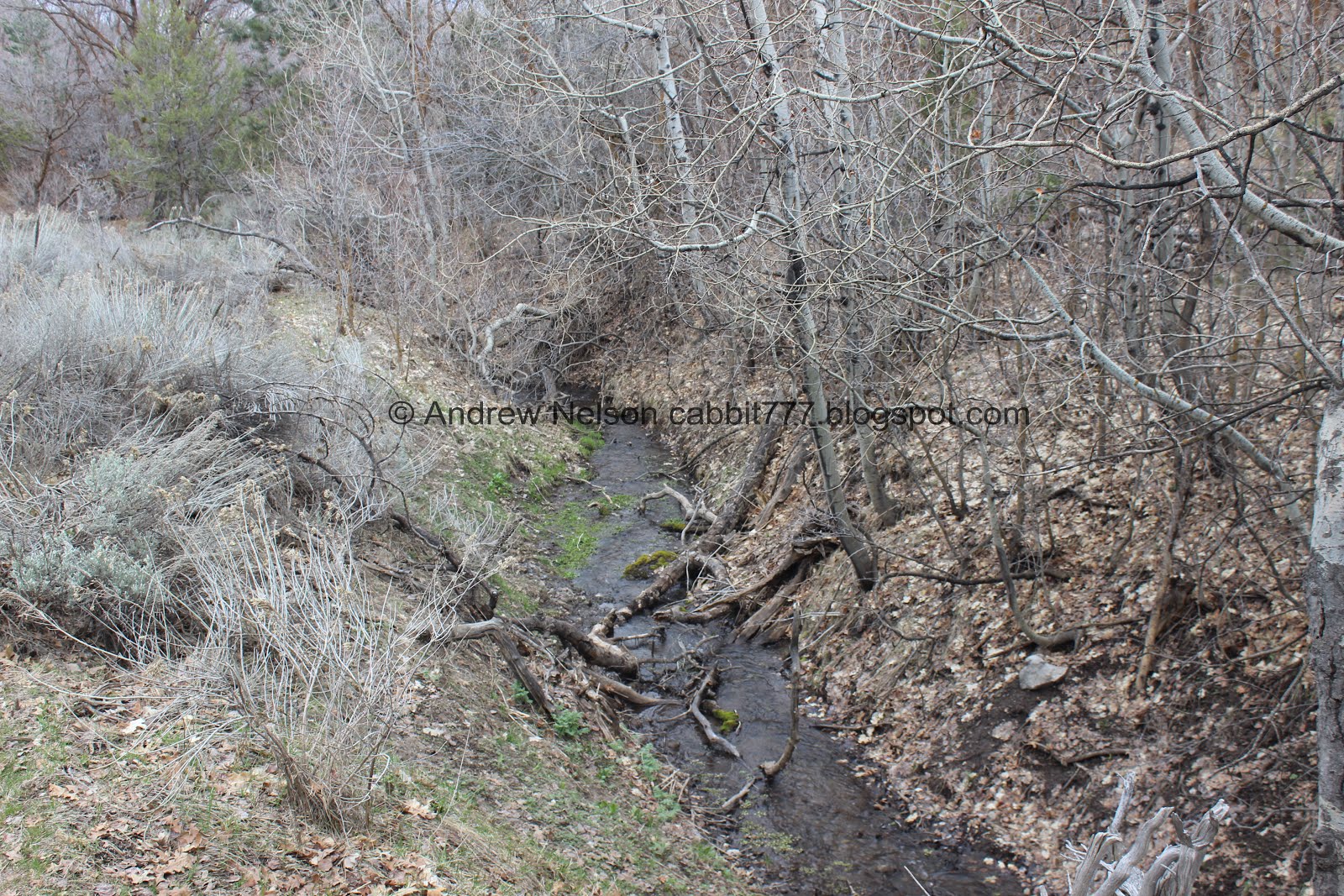
Rose Creek.

Yellow Fork Creek.


Already in a lovely forest that is starting the green up for the year.

The trail is nice and comfortable.

The creek is in a fairly deep gully here.

Just enjoying the trail.

Little clearing with the gully in the middle.

Looking up canyon.

All the trees have the rust red coat on them. I think it might be dried moss.

You know, all of our canyons are unique, and have their own personality but between this one, and Rock Canyon that we did last week we are seeing some of the more unique ones we have around here.

Looking back down canyon.
The creek again.

The forest again.

Gnarly old twisted tree.

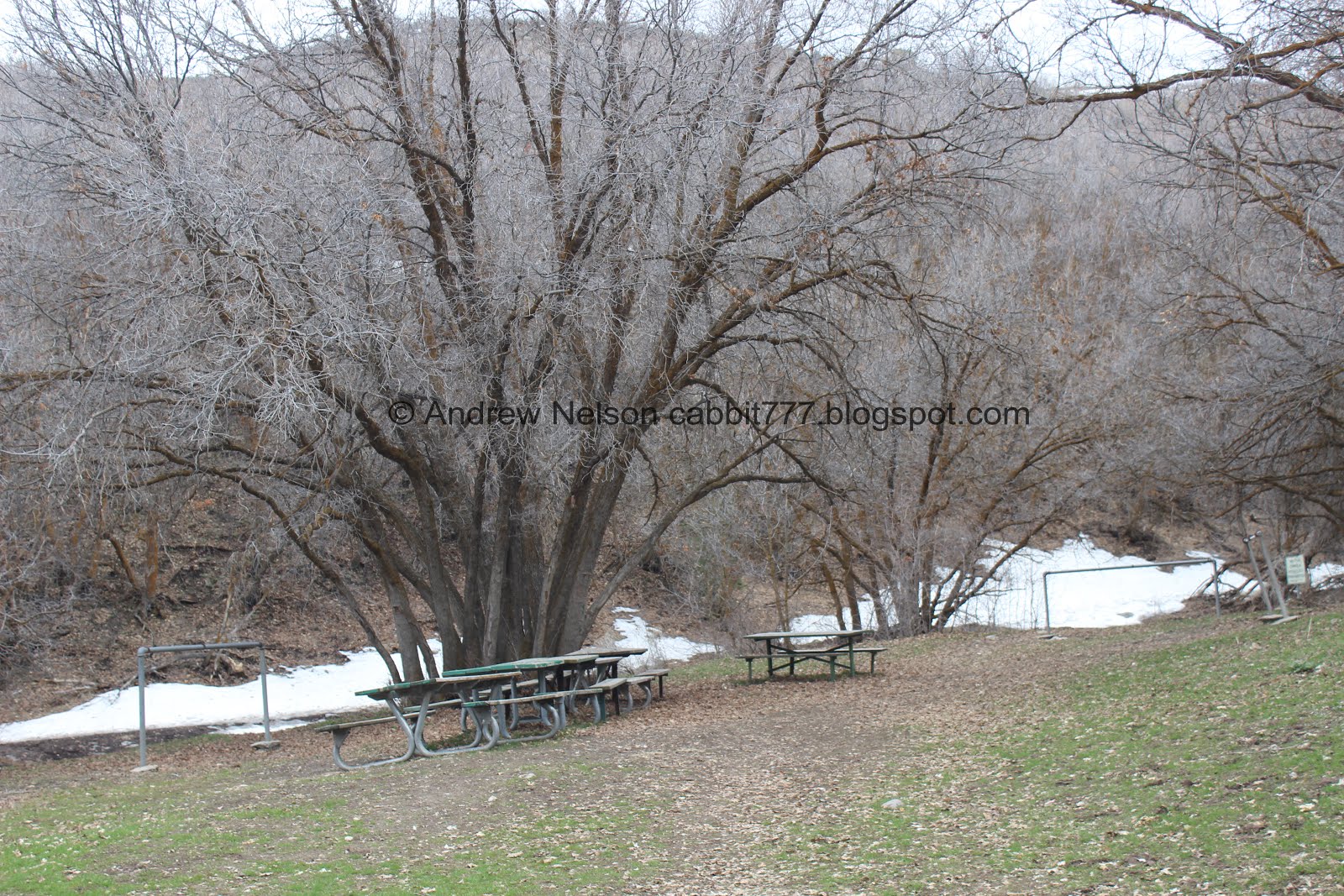
At about a half mile up you will see the first picnic area.

As well as a trail split. I wanted to keep following the creek so we went right. Looking at the map this is the Big Rock Trail and you can do a balloon loop with the Yellow Fork Trail.

Now the creek is not in such a deep gully.

In fact it barely had a bed at all in some spots.

Looking back down canyon.

Now we are hiking along the old road. There is a thin trail to the left but eh, its right next to the road so, whatever.

The creek again.

The creek is back in a gully.

A couple of the glacier lilies have started to bloom.

Here the road crosses the creek. Trail stays to the left.

There are random picnic tables all over the place up here.

The creek.

Amazing forest.

I think these are birch trees.

Into the the thick woods again.

Neat yellow trees. I wanna say they are willow but I’m not sure.

Another trail split. Again, just keeping to the trail that follows the creek.

Creek again.

The peaks near the top of the canyon.

Little patch of snow.

Sagebrush.

A good example of the rust red bark.

The creek.

At about 1.5 miles there is a small picnic area. We took a little break here deciding if we wanted to keep going or not.

We kept going, but we decided to go back to the road, which is also shows 1.5 miles.

The road was a mistake as there were quite a few patches of snow and mud.

But it is still lovely.


More forest.
Almost exactly 2 miles later we have reached the upper picnic area.

The trail does continue up towards the Bonneville Shoreline Trail and eventually to the Butterfield Canyon Road. But we didn’t do that.

Mountains across the valley.

Horse hitching post.

At the south end of the picnic area it connects to the Big Rock Trail which will make a good loop, though that will probably add at least a half to maybe a full mile extra. I kind of wish we had done that, but we saw the snow and were just like, nope. So, we turned back. Maybe another time.

I swear you can’t see a sign too far up any canyon without bullet holes in it.

The creek again.

The mountains across the way again.

Oh! It’s Timpanogos! I thought it would be Lone Peak or further north.

Fun forest.
The creek again.


Trees.

For the most part we hiked up on the south side of the creek, so we decided to stay to the North side of it for as much as we could on the way down. I can still call it a loop even if the road and trail aren't that far apart right?

More forest.

Don’t forget to look up!
We actually ended up getting sprinkled on a little bit here, but nothing too bad.

Some juniper trees.

The creek again.

Back down to the single picnic area.

I think this is the Turkey Hollow Trail.

Now we are on the road again to stay north of the creek.

Lovely view of the canyon.

The creek below.

Rolling hills of sage.

This appears to be an alternate trail up to the BST.

Back down to the open meadow.

A HUGE raven flew overhead. This thing was as big as the ones we have seen down in Bryce Canyon!

Looking back towards the top of the canyon.

Into the woods again!

The lower single picnic table. I noticed they were approximately every half mile.

Nice little sitting area.

The creek in its shallowest bed.

The lower group picnic area again.

The side canyon that the Big Rock Loop comes out of.

Trees.

Couple of ravens.

Looking down canyon.

The deep gully the creek is in.

Closer.

Some neat rock formations on the cliff above. I’m glad we came down this way because we couldn’t see this from the other trail.

I have absolutely no idea how I spotted them, but there are a couple deer on that hillside. We’ll get a better look at them momentarily.

Back down to the gate.

I wasn’t sure if it the road was closed to ATV’s for winter, or what the deal was. Guess that answers that. Sounds pretty well, permanent. I don’t know, but I think it’s good. Nice to know you can enjoy the canyon without the noise and fumes of ATV’s.

Back to the deer, we are a little closer to them, but they are still dots.

This is what the trusty telephoto lens is for. I don’t normally bother with it for deer, but we were back to the TH and I was waiting for Landis to use the restroom so, why not.

Oh, I think there’s a baby.

The mountains below (PSP).

It’s a little weird to see Lone Peak next to Mount Timpanogos like this (PSP). They are by each other, but point of the mountain is typically in the way.

Twin Peaks and Lone Peak (PSP).
That was a fun little hike, and a welcome easier option after last weeks grueling climb. It was super pretty, but the trail we did didn’t offer a particularly grand end prize. I do know that there are a couple viewpoints a little further up though. I did enjoy the adventure. Yellow Fork Canyon is definitely a unique experience. Not too many people either. Even though it is seriously out in BFE I am definitely interested in returning to explore Rose Canyon and maybe more. 8 out of 10 squirrels, losing one for being out in BFE, and 1 for lack of signage.
As for difficulty, for the most part the trail seemed fairly flat and I barely noticed we were climbing. DR3.
Dogs are allowed! Please clean up after your furry friends.

No comments:
Post a Comment