The Jordan River Parkway is a ~45 mile long (now complete if I understand it correctly) that connects to Utah County and all the way through the Salt Lake Valley and then connecting to the Legacy Parkway Trail in Davis County. I am slowly doing smaller segments. This segment goes through a golf course and then a subdivision.
I took the week off work so it was just me and the pups today. When its just me, I like to do these city paved trails as there is a smaller chance I will get hurt, and if I do, a higher chance someone will come along.
Quick Details:
Length: About 3.3 Miles out and back.
Trail Type: Point to Point or Out and Back.
Difficulty: DR2. Paved and practically flat.
Elevation Gain: 16 feet ish.
Restroom: I saw one at the Shields Ln. Trail head, but not at 90th S.
Dogs? Yes, leashed.
Other Info: Cities: West Jordan, Sandy, South Jordan. Mile Markers 21 and 22
To Get Here:
Head to 90th S. There is a golf course/driving range on the south side of 90th south just west of 7th west. This is where I parked, as far west as I could. For this segment you will head west and then south.
Note: I assume its okay to park here for the trail as it is a main trailhead on the official map, and there were no signs barring the action. But, if you don’t agree simply park at the Shields Ln. trailhead and do it backwards.
The Trail:
Nice view of Mount Jordan from the parking area.
Note: The way I did the previous segment, 78th to 90th and today I skipped about 600 feet of the Parkway Trail. But I mean, its pretty much walking next to the parking lot so no big loss.
While in the golf course section, pay attention to the signs. There is a mess of intersecting trails, some of which are private property. And keep your head up for golf carts!
My walking buddies, excited to be out and exploring.
The first time you cross over the Jordan River.
Duckies!
The river looking north.
South.
Entering Sandy City.
Heading south now. Golf course on the left, river on the right.
Black capped chickadee. I think. I also saw a northern flicker, but wasn’t quick enough with the camera. Not the end of the world, I get both of these in my backyard.
More wooded section.
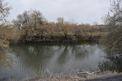
The river is mostly hidden by vegetation, but there are a couple spots to view it.
Mile marker 22.
1.1 miles to go.
This bridge is for the golf course, and you will not cross it. I didn’t get a picture but there is a sign saying keep arms and legs in golf cart while crossing. You can see the tire marks, it would seem they barely fit!
Another view of the river.
Snort. They thought they were real. You know I think my dogs are generally pretty smart, but they spent an awful long time staring these silhouettes down.
Then we will cross over the Jordan River again.
Looking north.
More duckies!
South.
Duck on a rock.
Wait… another crossing? Oh! Duh. This is the North Jordan Canal.
More duckies.
Judging by nearby street names I am going to wager this is Trimble Creek.
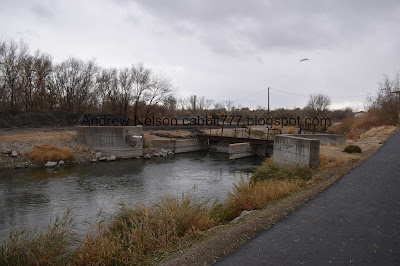
Water gates.
Two more gates. Ah! I just learned where the North Jordan Canal splits off! The first gate we saw controls the canal, and both of these control the Jordan River.
Entering South Jordan.
After crossing into South Jordan you enter a more suburban environment.
Bend in the river.
The river is (obviously) much wider before the canal split!
More ducks.
The river again.
Random picnic table next to a neighborhood connector trail.
This little farm had a couple of these signs along the fence line.
“Hi! My name is FINCHER. I am a palomino gelding. I love visits, but please don’t feed me. I’m on a special diet.”
What a wonderful way to say interreact, but don’t feed. Unfortunately Fincher was tucked away in his barn. However, I did get to see him on the way back. Which was nice because I had no idea what a palomino gelding is (it’s a type of horse).
Some leaves still hanging on.
I guess South Jordan has their own mile markers? Or maybe this is another one of those Gold Medal Miles kind of things?
More of the trail.
Another neighborhood connector.
There seemed to be less benches through this segment, but a few do exist.
American coots. By the way, that weird bird call you hear randomly through here, likely these guys haha. There are a lot of different birds that have different calls but these are weird.
More of the trail.
Well that is an interesting looking house. Kind of looks like a squat lighthouse.
More trail.
Mile Marker 21.
Tunnel under Shields Lane.
Inside.
We made it to the intended destination, Shields Lane Park. Considering we are starting to see some snow flurries I decided to just about face here rather than explore the park.
Back through the tunnel.
More ducks!
The trail.
More American coots.
Ducks too.
Little sandbar that the ducks like.
This little creek coming out of a private residence. I am pretty sure it is a spring as it just seemed to start in the middle of their yard. But I don’t know.
I think these are phragmites. An invasive plant.
Fincher decided to allow me to get a peek at him.
Some fall color left over.
The river again.
Riverbend.
As you can see the snow if becoming more constant.
Another little creek. Not having any luck finding it’s name.
Back down to the water gates and the beginning of the North Jordan Canal.
I don’t know why they decided to congregate here, but uh, watch out duckies, we’re coming!
Okay, there they go. I always feel bad startling animals off, but I really don’t have much of an option here.
Safely in the water.
Crossing back over the North Jordan Canal.
Crossing back over the Jordan River.
Looking south.
North.
Back to Sandy.
They alerted to the metal cut-outs again haha.
Almost back to the trail head.
I was wondering what in the world that strange noise was. Its totally the power lines.
The weather forecast really screwed me this week. It said the snow was supposed to taper off before I went out today, and instead it got a lot worse! Then a few days later it said it was supposed to rain so I decided against doing another walk, and it didn’t Oi. Can’t win.
Back to the first river crossing.
The river again.
Back to West Jordan.
Back to the parking lot. Not a moment too soon! The snow was starting to stick to my hair!
This section of the parkway was pretty nice actually, and had the bonus of seeing where the North Jordan Canal splits off. The further south I went the more I enjoyed it. Not too busy on a random weekday either. 7 out of 10 squirrels.
As for difficulty, it is basically flat, aside from the bridges, and paved. DR2.
Dogs are allowed, but must be leashed.
.jpg)


No comments:
Post a Comment