.jpg)
Donut Falls AKA Doughnut Falls is a really unique waterfall located in Big Cottonwood Canyon. The new lower trail through the Cardiff Meadows features a nice meadow with a creek, wildflowers, beautiful mixed forests and finally a neat waterfall that flows through a hole in solid rock!
Last time we were up in the canyon it looked to me that they had finally finished and opened the new boardwalk through the Cardiff Meadows, so I thought we would come check it out.

Quick Details:
Length: The new Cardiff Meadows (lower section) is about .92 miles 1 way. Then with the upper trail still rerouted it is an additional .68 miles to the narrows. Add some exploring and we did 3.67 out and back today. You can also cut off the lower trail by parking at the upper lot, but parking is limited and they ticket often.
Trail Type: Out and back, normally you have a balloon and a shorter loop option as well.
Difficulty: DR3. There is some climb, but its not too bad.
Elevation Gain: 730 feet.
Restroom: Yes, flush toilets at the lower TH and pit toilets at the upper TH.
Dogs? No. Big Cottonwood Canyon is watershed.
Other Info: The main upper trail is still closed and is detoured to the old dirt road.
To Get Here:
From the mouth of Big Cottonwood Canyon drive up approximately 8.9 miles to the Mill D South trailhead on the right. Park and walk towards the restrooms. It is about 9/10ths of a mile more to the upper trailhead.
If you want to try and save yourself 1.8 miles out and back, you can try your luck up at the upper trailhead by driving up about 3/4 of a mile up Cardiff Fork Rd. Be advised: Pay very close attention to where you can and cannot park up there. They are pretty serious about ticketing.

Luckily they have continued to suspend the construction during holidays and weekends (Passenger Seat Photography (PSP)). Sadly it sounds like this might be the last weekend they are doing that. :(
The Trail:

The new lower trail starts next to the restrooms. I thought it would have been next to the creek just down the hill a little bit. Good thing I needed a potty break. Also, notice they built a trail up the the restrooms. Nice little bonus.

New trailhead sign.

New trail.

The new bridge. Below Kessler Fork (AKA Mill D South) between Reed and Benson Ridge and Kessler Peak.

Over the very clear Big Cottonwood Creek.
Just as I feared, it looks like this construction project scared off the beavers that had built a dam and lodge here. Sad.

Upstream.

The new boardwalk is quite lovely.

It even has a couple of benches to just enjoy the meadows.

View of Big Cottonwood Canyon.

Then onto the new trail.

Super pretty up here.

Crossing the road that leads to the Jordan Pines Campground. It's not a busy road at all, but you know, road crossing safety still applies.

Some arnica.

Into the woods.
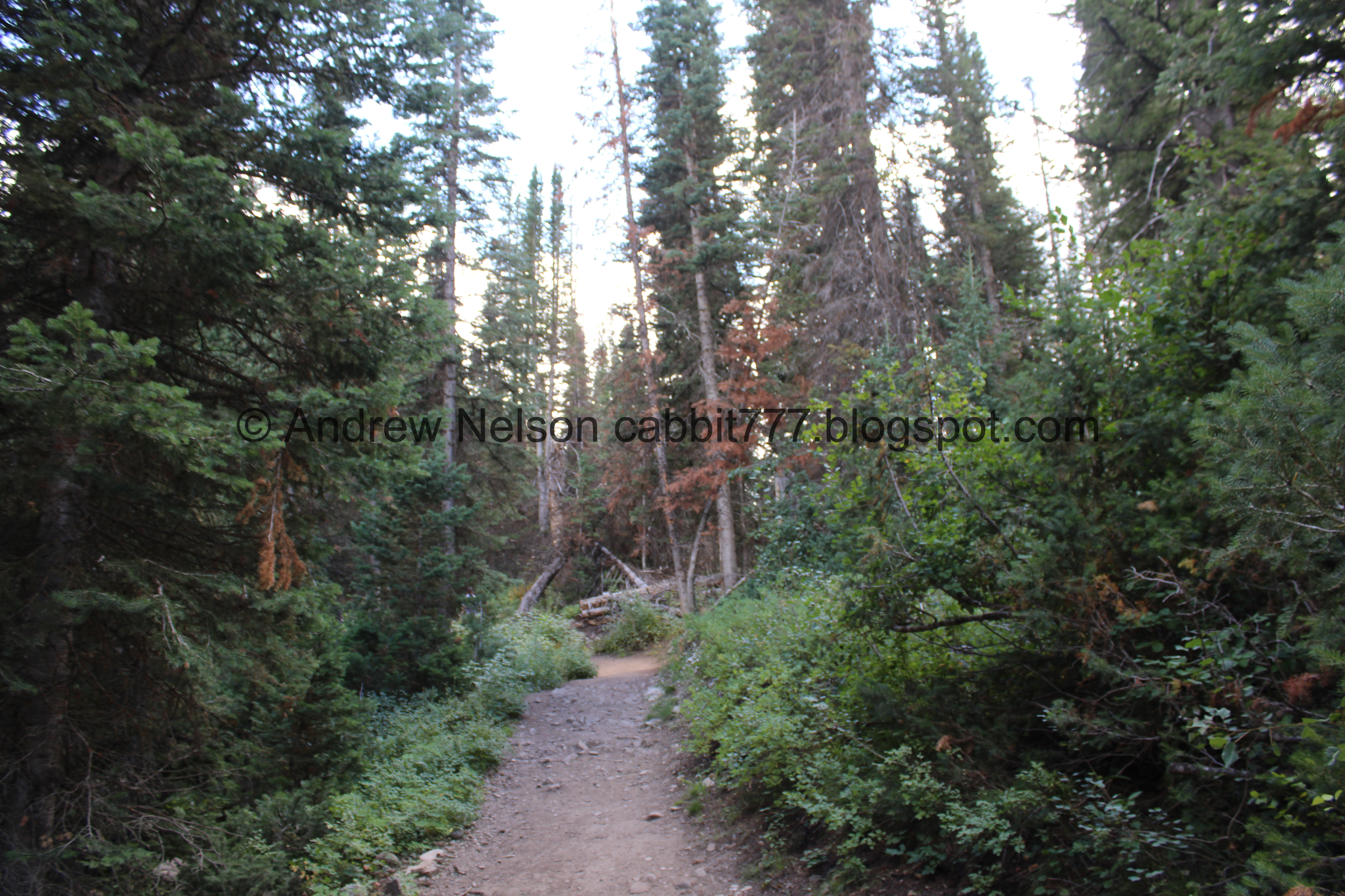
It is still super green and lush up here.

Looks like the forest service has been busy cleaning up downed trees.

Reed and Benson Ridge.

Clear cut for power lines.

Where the trail from Spruces Campground (left) connects to the main trail (right). You can see some slash piles the forest service has gathered.

Lots of them.

Bright red berries that I am pretty sure are poisonous.

Some daisy-like flowers.


More pretty forest.

Before long you can start to see the overflow parking for the upper trailhead.
They did a really good job routing this trail. I know we passed behind several cabins, and I was even looking out for them this time, and not a sight of one of them.

View across the canyon.

Cute little stone bench.

With a view.


More forest.

Kessler Peak.

Looking up.

I really enjoy a nice stroll through a thick forest.

More forest.

About 9/10ths of a mile later we reached the upper trailhead.

Well, poop. It looks like the upper trail is still closed. Luckily there is a detour. It’s only a smidge bit longer.

Down through the parking lot.

Another detour sign.

The creek.

You will pass by this gate keeping cars out.

I love this sign. We need more of them.

The road is pretty rocky in spots.

Some leaves getting an early jump on autumn.

Then, the trail starts to level out a bit.

The creek below.

Then the trail goes through a very narrow gully that barely fits the stream and the thin dirt road.

Super narrow.

The creek.

Large leaning tree.
You know, this section was a LOT more enjoyable without the large snowdrifts that brought a fear of sliding into the creek.

Where the main trail connect to the dirt road. I am glad they have re-enforced the detour here.

The washed out bridge, I am pretty sure that is the reason for the detour, but there could be other hazards I haven’t seen.

More daisy-like flowers.

Continuing up.

Geranium.

More forest.

Trail split. You want to go left here.

Kessler Peak.

Aspens.

Avalanche chute.

It is about 1.6 miles to the narrows. Then there is a sketchy boulder you have to make your way down.

Into the narrows.

The creek.

I love the way some of the trees hang out into the narrows.

First view of the falls. It is so neat to see the water just disappear into the doughnut hole.

The narrows, with lots of people!

The falls.

Closer look at the doughnut.
We both decided we would not be scrambling up to the cave today, so we didn’t bother getting much closer and more wet.

Portrait mode.
Closer look.

The narrows again.

The waterfall again. As you can see, at any given moment there are numerous people scrambling up and down it.

Another portrait.

One final shot before we head on back.
I hope that one day I can muster the courage to go up to the cave again. I have done it, so I am pretty stoked about that, but I would like to do it again.

The creek.

Looking downstream in the narrows.

Little waterfall.

Downstream again.

The boulder you have to shimmy down to access the narrows, and shimmy back up to get out. It’s not too bad, but I am not a fan. I honestly don’t know how people get their kids across this.

Winter berries.

Some cliffs on Reed and Benson Ridge.

The avalanche chute again.

Western cone flowers.

We found a small side trail down to the creek that offered this obscured view of a small waterfall.

The creek.

Trail down.

Back to where the main trail connects to the road.

The washed out bridge again.

Into the narrow gully again.

Another little waterfall.

Little rapids.

The narrow gully again.

Again.

More arnica.

More forest.

The narrow canyon again.

The hillside.

Some more leaves getting an early start.

The creek below.

Mixed flowers.

The stream fans out here just above the upper trailhead.
.jpg)
Panoramic.

Back to the upper trailhead.
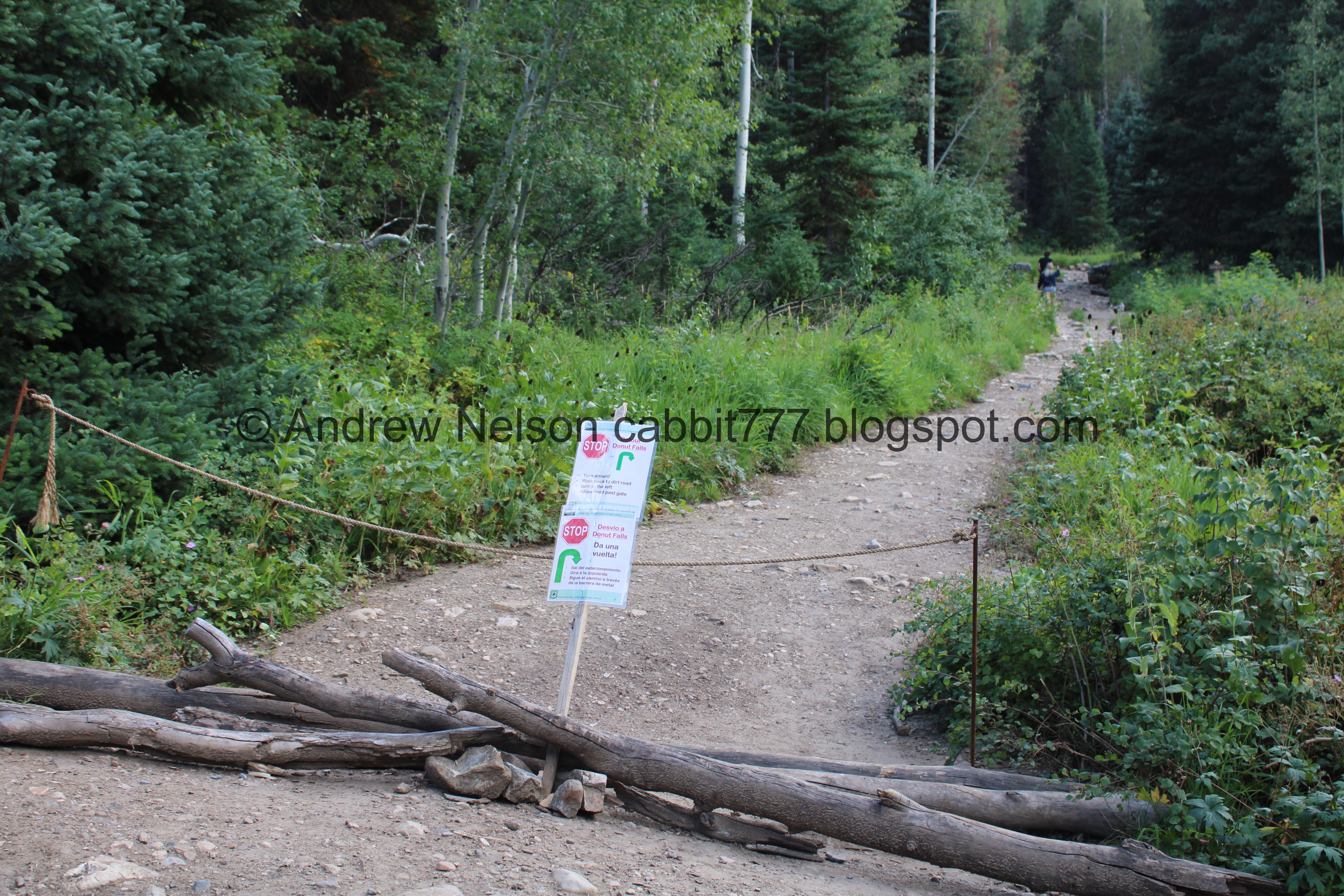
Somebody fixed the detour sign on the main trail. yet, there are still idiots that ignored the sign, the rope, and the piled trees. Well, I hope they managed that damaged bridge alright.

Trail split back down to the Cardiff Fork Trailhead (right).


Pretty forest.

Pretty purple mint.

View across canyon.

1st switchback.

Immediately followed by the 2nd.

Trail use counter.

Squirrel!

Trail split for Spruces Campground. You want to hang a left here.

Lots of slash piles.
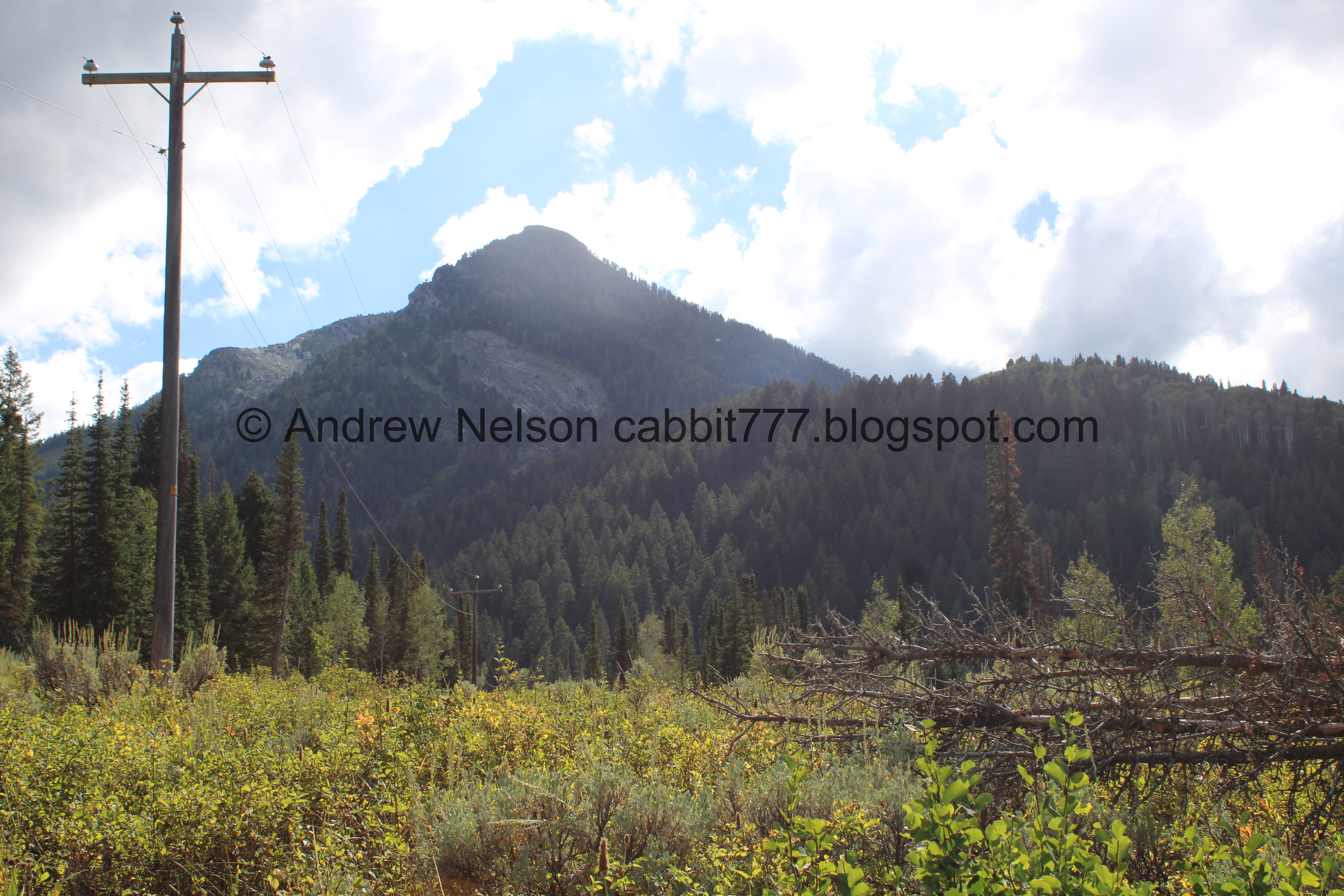
Kessler Peak.

Peak across the canyon. Not sure if it is named.

Pretty forest.

The 3rd switchback.

Briefly followed by the 4th, and last. As far as switchbacks go they aren’t bad at all.

One of several connections to the Jordan Pines Campground.

More forest.

More arnica.

Paintbrush.

Pretty sure these are dying sulphur flowers.

Daisy-like flowers.

Crossing the road down to Jordan Pines.

Twin trees on either side of the trail.
.jpg)
Vertical stitch.

Nearing the Cardiff Meadows.

More daisy-like flowers.

The fork down to the meadows to the right. Currently, the trail that connects to the road is still accessible. However, the whole reason for this new trail is to provide a safer alternative to walking up the road, so I expect it to close eventually.

The new boardwalk.

View up canyon.

More boardwalk.

The bridge.

Downstream Big Cottonwood Creek.

Upstream.

Looking back at Cardiff Fork.

The last push up the the trailhead. It’s pretty gentle.

I decided to walk down to check on the beavers and confirm my suspicion. Yeah, it looks like the dam has breached, and the pond drained. Super sad. It was a pretty impressive dam!
Landis asked if I thought the forest service did that on purpose, and while possible, I think really the beavers just moved on. No beavers to maintain the dam, it can breach.

Drained pond.

Cliffs on the other side of the canyon.

Heading back down the canyon (PSP).

The roadside sunflowers are going crazy (PSP)

Storm Mountain (PSP).
Well that was fun! I really like the new lower route through the Cardiff Meadows, however I am sad that the construction scared off the beavers. It was busy, like usual, but not too bad today. We managed to get a nice view of the falls without getting too wet as well, which was nice. We went a little earlier than usual to avoid getting rained on, and that worked out for us today too. 9 out of 10 squirrels today.
As for difficulty, there is a bit of a climb, but it isn’t too bad. DR3 today. DR4 to get into the narrows, and DR5 if you decide to scramble up to the cave.
Dogs are not allowed in Big Cottonwood Canyon due to watershed restrictions. So be sure to leave Fido home today.

No comments:
Post a Comment