Rocky Mouth Waterfall is a stunning waterfall in Sandy. The short, but tough trail takes you through a neighborhood and then through a lovely forest that follows a creek for a while before leading to a particularly stunning waterfall in a tight rocky alcove. It is a super short trail, but it is quite pretty and we tend to do it often. In fact we did just a few months ago. I had other plans for the day, but we had some rainstorms come through that forced a last minute change. We managed to squeeze this hike in between a few storms.
Quick Details:
Length: .84 miles out and back.
Trail Type: Out and back.
Difficulty: It’s a bit of a tough climb, but it is short. DR3.
Elevation Gain: About 500 feet.
Restroom: No. There is one south at Hidden Valley Park, or north at Bell Canyon Preservation Trailhead.
Dogs? No. This is in restricted watershed.
Other Info:
To Get Here:
From the north take i15 to 90th south. Head east to Wasatch Blvd, turn right. Go about 2.1 miles and the trailhead will be on the left.
From the south, take 123rd south and head east and turn right on Wasatch. Trailhead will be on the right.
Note: Do not park in the neighborhood. Use the small parking lot off of Wasatch. 11248 S Wasatch to be precise.
My original idea was something up Big Cottonwood Canyon (Passenger Seat Photography (PSP)). But, we realized we were just chasing the rainstorm up and eventually turned around.
When we got back down to the valley it seemed like there was a little break from the storms, so I thought we would just head to Rocky Mouth Falls (PSP).
Storm clouds and Kennecott (PSP).
I found an itty bitty little stream draining from a puddle in the parking lot.
Gloomy clouds.
The Trail:
The trail starts with this first staircase of doom! This one is at least set appropriately so you can use them like normal stairs, for the most part.
After the first staircase you walk along a neighborhood for a minute. At least it is a good break from the climb.
The canyon and the switchbacks for the Bonneville Shoreline Trail (BST) heading towards Big Willow Canyon.
Before long we reached the original trailhead. I guess all the McMansion owners didn’t like people parking on the street so the new lower trailhead was put in. Luckily it doesn't add much to the trail.
Water coming down the trail.
The 2nd staircase of doom! Seriously these stairs are quite the climb. These one are also not so evenly spaced and it's a bit of a crapshoot if you going to switch legs, or repeat legs for the lift part.
View across the valley.
At the top of the stairs you get a nice break from the climb.
Trail split. Forward will lead to the falls, right will take you along the BST towards Big Willow Canyon. Eventually the BST should continue left from around here somewhere as well.
There weren’t very many, but we did found a couple wildflowers still holding out.
The little water diversion doohickeys doing their job.
Nearing the mouth of the canyon.
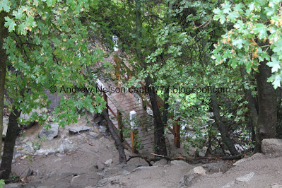
A bridge below. It’s actually kind of a neat bridge.
The creek.
Into the woods.
Little cave.
The creek again.
Mossy rock.
The creek is running down the trail today.
First glimpse of the waterfall.
The cascade below.
A short .42 miles later and we made it! Phew!
Normally this late in the year it is a much thinner trickle, but I imagine the rain is hefting it up some today.
I have been hiking up to this waterfall since I was a kid. It is still one of my favorites, even if it can be busy at times. Today however, we actually got the falls to ourselves for a bit.
Super pretty.
The lower tier.
Vertical stitch.
The top.
Another vertical stich.
The middle.
The top.
The bottom tier.
From the side.
Inside the deep recessed alcove.
Portrait mode.
Looking down the little gully.
The narrow alcove.
Cliff dwelling plants.
From the right angle you can see an additional drop near the top.
I am fully enjoying having it to ourselves for a minute.
The steep side trail to continue up. I might be crazy, but it looks like there might have been a slide here not too long ago.
This “dead” stump appears to be bringing new life.
The waterfall again.
From another angle you can see even an additional tier at the top!
The waterfall again.
Alright, we had our fun, but it appears the rain is coming back so time to head on back.
Back down the creek swollen trail.
The old mine, that has been sealed off.
The little cave.
The creek below.
Flowers growing out of rock.
The neat bridge below again. We probably would have checked it out again except that the rain had started back up.
View across the valley.
Someone had to have placed these boulders to make these perfect steps, right?
Little aster of some sort.
Perfectly aligned with some street. If I had to guess, I would say it is 114th south, but you know, don’t quote me on that.
Back to the upper stairs of doom.
Looking back towards the canyon.
The lower stairs of doom.
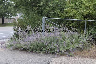
Lavender, I think.
After our short hike we stopped and had some dinner before heading home.
Fun lighting on the west mountains.
The sun setting beneath a large wall of clouds.
Well, it is so not what I had planned today, but I do love this trail, even if it kicks our butts a little bit. I also really enjoyed that we got to have it to ourselves for a few minutes, on a weekend no less! So I am going with 10 squirrels out of 10 today.
As for difficulty, it’s quite the climb! But it is short so it’s not too bad. DR3.
Dogs are not allowed due to watershed restrictions. So be sure to leave Fido home for this one.
.jpg)


.jpg)

.jpg)


No comments:
Post a Comment