.jpg)
The Big Cottonwood Trail (formerly Big Cottonwood Canyon Trail) is a short trail that goes from the mouth of the Big Cottonwood Canyon in Cottonwood Heights down to Knudsen Park just below i215 in Holladay. The trail features a creek, mountain views, and a bunch of historical markers to things that mostly are no longer there. It is a good option to do in winter with it being paved, and a pretty mild climb. I noticed the trail had been slightly extended recently so I thought we would come check it out again.

Quick Details:
Length: About 4 miles out and back. Closer to 4.22 miles out and back with a short detour currently.
Trail Type: Out and back, connector, small balloon option.
Difficulty: DR3. It is completely paved and a gentle climb, but there are quite a few hills.
Elevation Gain: About 390 feet.
Restroom: Yes, at each end. The Park and Ride lot on the east side they are open year round. I am not sure about the ones on the west end at Knudsen Park.
Dogs? Yes, leashed. Please clean up after your furry friend.
Other Info: There is currently a short detour due to some construction. The detour is on the shoulder of Big Cottonwood Canyon Road.
To Get Here:
There are 3 trailheads. One at Knudsen Park, one in the middle off of Big Cottonwood Canyon Road, and one at the Big Cottonwood Canyon Park and Ride. We opted to start at the Park and Ride.
Take i215 to exit 6, 6200 south. Head east on 6200 S/Wasatch BLVD for about 2 miles. Turn left into Big Cottonwood Canyon, then left into the Park and Ride lot. The trail is on the west end of the parking lot.

Snowy mountains (Passenger Seat Photography (PSP)).
The Trail:

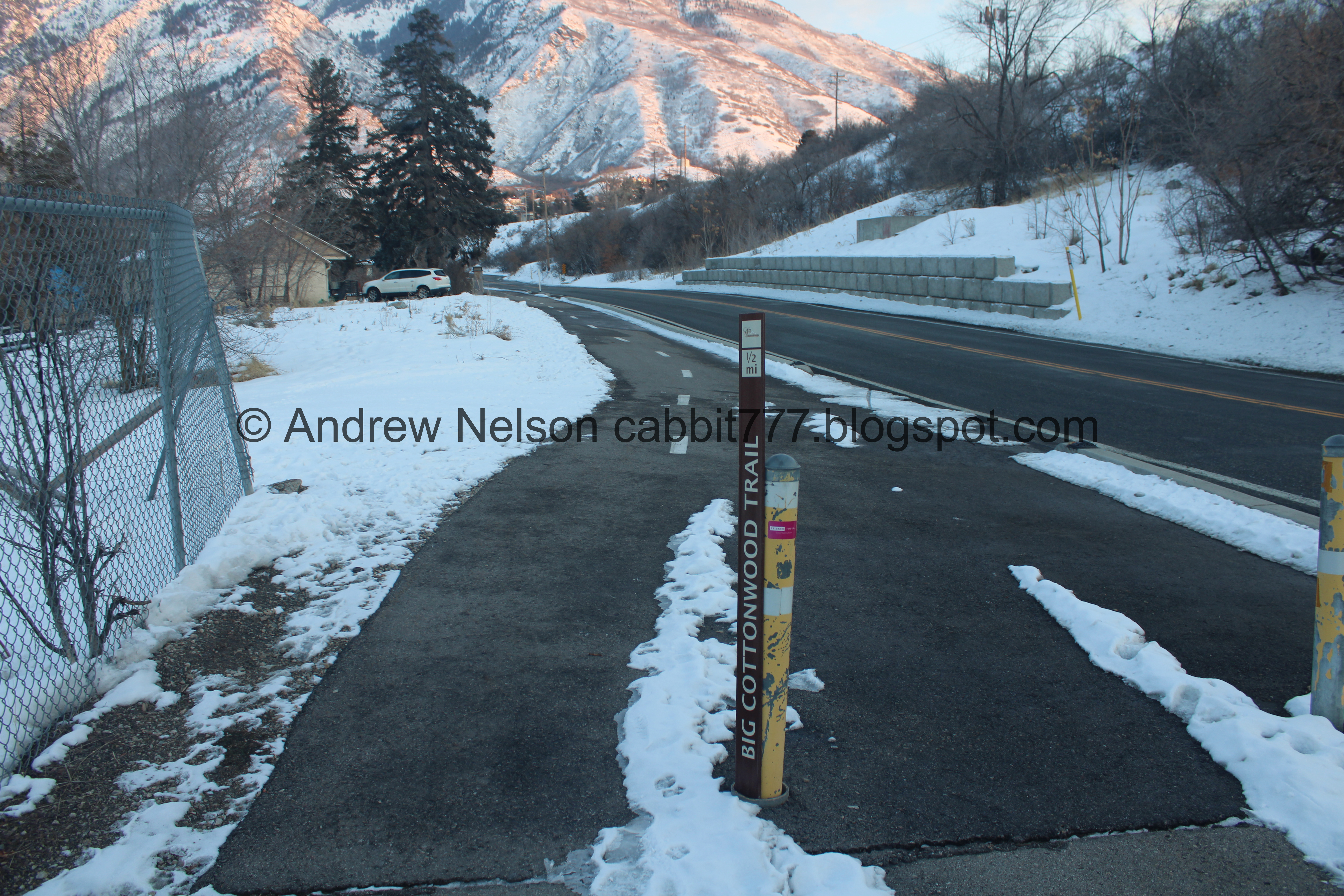
Trailhead sign, which is confirming that they dropped Canyon from the trail name. I think it makes sense as the trail isn't really in the canyon like the Little Cottonwood Trail is.
Also, Google maps seems to think this trail is called the Big Cottonwood Creek Trail or The Old Mill Bike Path depending on where you look. But both cities call it the Big Cottonwood Trail.

The Park and Ride lot at the mouth of the canyon.

Oh boy. We should have used the ramp haha. But I just kept a firm grip to the railing. Neither of us slipped at all on the stairs here. But, as you will see on our return trip, there is a ramp and these stairs can be avoided.

Heading under Wasatch Blvd.

The trail is next to the creek for most of the way, which is nice.


I don’t know if there is a more specific term for these or not, but I call these ice skirts. Generally I tend to find them near rapids.

Tall skinny tree.

A lot of snow on the trail right now.

Small waterfall.

Some old ruins of some sort.
From here the trail veers away from the creek for just a quick minute.

These wayfinding signs are new. And also confirming the updated trail name. Also new is they have added 1/4 mile markers. I seem to have missed the first one though.

When we first did this trail, there was not really a trail through this section, it was just the shoulder of the road. Luckily they have since updated it.

What it looked like in 2016. It was a little sketchy so I am glad they updated it.

Continuing along.

Horses.

The quarter mile marker we saw confused me for a second. as it says 1 1/2 miles and we had only gone about 1/2 mile. I eventually put together that it was put in backwards.

Another wayfinding sign. I think I would have appreciated these the first time we did this trail.

The first street crossing, Canyon Creek Rd. It’s not busy at all and not too much of a concern, but you know, basic road crossing safety and all still apply.

Continuing along. As far as next to neighborhood trails go, this is not the worst.

3/4 mile. Okay, that much more closely aligns to what my pedometer is saying. Again, reinforcing the new trail name.

Someone built a random cairn in this persons rock garden. I don’t know how I feel about this. On the one hand dude, that is someone's property! On the other hand, it is on the outside of their fence… so meh.

The Hog Wallow is very, very busy today! But, if you want to pop in for a bite and a pint, it is an option. Though, maybe not today.

Crossing Big Cottonwood Creek. Now the trail follows it for a little more.
The Old Mill as we know it or the Cottonwood Paper Mill I guess is it’s official name. Last I heard a developer has threatened to tear it down. I am hopeful that enough of the community is absolutely outraged at that idea that maybe it doesn’t happen. But, you know Utah. Money speaks, history doesn’t matter.
I didn’t get a shot, but the trail crosses Big Cottonwood Canyon Road here. Its just a marked crosswalk, but the road is not super busy so it’s not a big deal, again, standard road crossing safety practices apply.

From the other side. I will be super, super upset if this is torn down. It is a neat old building. I get that it is old and unsafe, but it is history! Not to mention the only historic building remaining along this trail.

Continuing down.

The creek.

Icicles.

Little open field.

Another wayfinding sign.

The creek.

Pedestrian covered bridge. This is one of four pedestrian covered bridges I have found around here. I have yet to find one that was built for cars. I am not sure if the trend just never came to Utah, or if it did, none of them exist anymore.

Inside. This crosses the creek to connect to a neighborhood connector trail, or a loop around the reservoir below.

Said reservoir.
I believe this is actually either a detention or retention pond.
From the last time I was here: Detention ponds are designed to temporarily store excess storm water during heavy rain events. Retention ponds are designed to permanently hold water and promote infiltration into the ground.

Random flag found at the middle trailhead.

Trail/Path closed sign. Now, I am normally a huge rule follower, but at this point, I can see no reason the trail is closed. Seeing as the path is right next to the road, we decided to be rebels and stay on the path until it seemed like we should skootch over to the road. Yeah, we are naughty today.

If you are more a rule follower than I, here are some detour options. The easiest is to just scooch over to the shoulder of Big Cottonwood Canyon Road (its a little narrow in places but the road isn't super busy). Then wiggle through the parking lots over to 3000 East, then back south a little bit to the crossing over 3000 E (Green line). The other option, I have never done so I am not 100% sure, but I think it will work. Go back to the covered bridge, cross it, go around the west side of the reservoir, then down the unnamed road over to 3000 E. Then over to the crossing (purple line). The blue line is where you can hop over to the road, or possible go over the north side of the reservoir but is still within the "closed" area but it is before the construction area in black.

The reservoir again. Speaking of naughty, this is the kind of naughty I do not F with. You have no way of knowing what is or is not ice over water under the snow. Not something I would mess around with.

Second trail/path closed sign. Okay, I think they might be serious now, but again, I don’t see any hazard yet. However we did notice a dog walker had departed the trail to the road on the right about here. And a runner had gone to the left over the dam. Hindsight being 20/20 we probably should have followed one of them as they are likely locals and are more familiar with what is happening here.

The creek.

Huh. The trail marker that was here has been removed. I guess now that the trail has been extended it doesn’t make much sense. But.. I mean, we have done a few trails now where trail updates didn't affect trail signs haha.

Alright. We have reached the hazard. With it being Sunday obviously they are not working, so no safety issue today, but yeah they have destroyed the trail here. So, quick little detour to the road.

Before long we are back on the trail. Then we have a business center for a bit. There are a couple of restaurants and bars in here if you want to stop for a bite, or maybe a bite and a pint.

The back of the trail closure from the other end. I don't understand why they need to close a quarter mile of trail for 50 feet of work.

The 3000 East crossing is a bit more intense, however there is a signal you can activate. But it takes FOREVER. The road was not so bad so we just decided screw it, it is safe enough to cross. Of course the light changed just as we got to the other side, stopping traffic which made me feel a little guilty.

Along the other side.

1 1/2 miles down. Wewt. Almost to the end.

This looks like an old jungle bridge leading to Market Street Grill. I might need add this to my Interesting Bridges post. Huh. It looks like it is a simple suspension bridge.

I wasn’t sure if we needed to go forward, or left across the bridge at first. But upon closer inspection, it become clear we needed to cross the bridge.

The bridge.

Big Cottonwood Creek, downstream.

Upstream.

Old office building. I worked in there for a time a long time ago. In fact I had a desk next to one of those windows on the right.

Then the trail passes by this parking garage.

1 3/4 of a mile. Phew. Almost to the end.

Approaching i215 and the on and off ramps.

Underneath.

Another wayfinding sign.

The first (and I believe only time) we did the entire trail, this was the end of the line. But it has since been extended. It looks like the park was completed in 2018 so I assume the trail was probably extended about the same time.

Neat rock wall, I guess part of a bridge going over the creek.

The creek.

We have officially hit Knudsen Park. Woot! It looks like there is a full loop around the park and you can go either way here, but it would appear the official trail route is to the left so we went left.

Another wayfinding marker.

It looks like this bridge might lead to a more natural area? Or possible just a neighborhood connector. I might have to come back and see for myself.

The creek.

Mountain views.

The front of the park.

With another wayfinding sign.

Looking up Holladay Blvd. You have a couple food options here if you want to stop for a bite including The Cotton Bottom that I would highly recommend. Best garlic burger in town!

Back into the park. Forward is the main trail, left is the loop around the east side (which will connect to the main trail too). Right looks like it leads to some more natural area. I thought about doing the loop, but ultimately just decided to go back the way we came.

The creek again.

It’s starting to get a little icy on the trail.

Twin Peaks.

Closer.
.jpg)
Panoramic.

The back of the park. This is also a designated bike route.
The county, and some of the cities have been pushing to build more of these alternate commuter routes. So far this is my favorite one. Although, I'm not sure if it started out with that in mind.

Another trail map and rules kiosk.

The creek again.

Back under i215 and the on and off ramps.

Continuing up.

Next to the garage again. I missed the first quarter mile marker here on the way up, but I did catch it on the way down. I think that was due to the up and down trails being slightly separated.

I wonder what kind of tree this is with these weird red bunches.

Market Street Grill, another food option along the trail. Bit on the spendier side though.

Old 1/4 mile marker. I am fairly confident this is leftover from the original trail.

Crossing the creek again.

Upstream.

Down stream.

The simple suspension bridge leading to the other side of Market Street Grill.

I tried to do a panoramic here but it failed haha. so here is the south side.

The north side.

The bridge again. I am pretty sure this is privately owned by Market Street, so as much as I wanted to explore it I did not today. Thinking back, while I am sure they don’t want people just playing on it, I don’t see why they would mind you using it for a minute whether you are a customer or not. Meh, I might come back.

Old spillway waterfall.

1/2 mile.

Stop sign on this little driveway, which I think is a bit overkill. It’s a road crossing, stop and look both ways for hell’s sake! But I guess with it being a “bike route” they need to ensure cyclists are safe, even though I feel like the same basic common sense should apply to them as well. But, as I have learned over the years, common sense just isn’t as common as it should be.

Another trailhead kiosk.

Entering Historic Butler. Settled circa 1869.
Cottonwood Heights is comprised of several smaller towns. Cottonwood, Big Cottonwood, Butler, Union, Granite, Poverty Flats, Danish Town, Emmaville and Gold City.

Waiting for the signal to cross 3000 East again.

Twin Peaks again.

Trail wayfinding sign, and a trail/path closed sign again.
Again, I am generally a rule follower, but I don’t understand why they have closed a quarter mile of trail for an area of maybe 50 feet of work. Plus with is being Sunday I know nobody in the construction biz is working today. So I continued forward until I got closer to the area to work myself around.
Now, if you are a little more stringent about following the rules you can go left here and wiggle your way through the parking lots to Big Cottonwood Canyon Road (the shoulder is a bit tight, but it’s not a super busy road) or, and don’t hold me to this cause I have not done it, but it looks like you can go right and then left down the unnamed road, and then along the other side of the reservoir, picking the trail back up at the covered bridge.

Quick little image showing both options. Approximate construction area in black. Confirmed route in green, what appears to be an likely alternate option in purple. With a possible shortcut in blue that is past the construction, but still within the closed section of the main trail (from either route to get back to the main trail).

Breaking the law, breaking the law. No just breaking the safety concerns from the city. Shh.

The actual construction area. Okay, super easy to pivot over to Big Cottonwood Canyon Road. to the left here.

Construction equipment from the road.

Desire path for the win! We just followed what everybody else did to get back to the main trail and get off the road as quickly as we could. This was considering that the locals who use this trail everyday, or at least quite often know what they are doing and as I learned on the way down, perhaps I should pay attention to it. :-p

The creek and the spillway.

Back on the main trail. Phew!

This rock used to have a 1/2 mile marker on it. Either it was stolen, or the city removed it due to the trail being extended. Considering they didn’t remove the other one, I am going with theft. I thought it might have been a discrepancy between cities, but i215 appears to be the border, so both are in Cottonwood Heights.

Twin Peaks again.

Big Cottonwood Canyon below Twin Peaks.
.jpg)
Panoramic. Mount Olympus, Twin Peaks, Lone Peak.

The reservoir.

The pedestrian covered bridge.

The reservoir again.

Flag at the middle trailhead, which is about where the east end of the trail closure is. Again, I don’t understand why a quarter mile needs to be closed.

The covered pedestrian bridge again. I am quite fond of this bridge too.

Inside.

Downstream towards the reservoir.

Upstream. I am loving the half frozen, snow covered version of it today.

It is a bit bizarre.

The creek.

Trail wayfinding sign.

Twin Peaks again.

More snow the higher up we get.

The back of the Cottonwood Paper Mill.

Icicles in the creek.

The Old Mill.

The tower.

The Old Mill.

Again. This was featured in several films including Halloween: The Curse Of Michael Myers (6). As well as one of The Crow sequels, although I have yet to confirm that. I did confirm Salvation (3) was filmed in SLC. I guess I just need to watch it again to confirm.

Another trail wayfinding sign, just before the crossing over Big Cottonwood Canyon Road.

Looking back towards the Old Mill again.

The creek again. And where the trail departs from it for just a minute.

Back to the Hog Wallow.

Alright. Some bar goers are absolute assholes. Between discarding the plastic rings on the ground, they tossed cans into the property owners external yard. Real classy guys. We picked up what we could carry, but I might come back with a bag next time. My biggest concern was the plastic can holders. I wanted to be sure they didn’t get into our waterway intact to trap innocent animals.
It sucks. It is a perpetual cycle. Assholes that litter think someone will come by and clean up after them. People who care pick it up, thus confirming the assholes bias. How do we fix this aside from putting cameras everywhere?

Cairns and neat arches in rocks. Again, I do not know how I feel about this. It is someone's property, even if it is outside of their fence.

1 1/4 mile.

Back to the Canyon Creek Dr. crossing.

Another wayfinding sign.

Twin Peaks is now hidden by the mountain.
And back to the mile marker that is backwards. It says 1/2 mile on this side…

And 1 1/2 miles on the other side. I thought it might have been knocked over and someone just stuffed it into the hole, but Landis gave it a little wiggle and tug and it seemed solid, so yeah, backwards. They increase by a quarter mile depending on the direction you are going.

Big Cottonwood Canyon.

Twin Peaks again.
.jpg)
Panoramic.

Another trail wayfinding sign.

Another one of those trees with the weird red clumps.

Forested section.

Back to the creek.

Continuing up.

Random slab.

Which may or may not have been part of the first post office. This sign also confirms the original trail name as The Big Cottonwood Canyon Trail.

Little waterfall.

Snowy trail.


The creek.

Random pile of traffic barricades. Gee, I wonder why it is so expensive for any government work to be accomplished. o.O

The tall skinny tree again.

More “ice skirts” as I call them.

The creek.

Money plant gone to seed. Thanks to a good friend we had one of these in our garden last year. Here is to hoping it comes back this year. They are not native, but they seem to thrive here and have super pretty purple flowers in spring.

This old sign shows the original trail ending at i215, and shows the original name, and yet another alternate name Cottonwood Heights Historic Walk. I will echo what I said the first time I did this trail, I think the historic walk trail is what should have stuck. I did not care for the trail as much the first time since it was not what I was expecting, and I think I would have liked it better if it was titled that. Now that I am more familiar with the trail, and have done quite a few more random city trails, I do like the trail a bit more.

Approaching Wasatch Blvd. I didn’t get a shot of it, but there is a trail connector on this side of Wasatch too.
Also, if there is a 1/4 mile | 1 3/4 mile marker sign, I missed it on both the way down and back up. But I do appreciate the 1/4 mile markers that are there.

The creek.

Little rapid.

Under Wasatch Blvd.

The creek.

Stairs back up to the Park and Ride lot.

Or a ramp. We chose the ramp to get back up today. We didn’t have an issue with the stairs on the way down, but I didn’t want to chance it twice.

The top.

Trailhead kiosk on the east end.

The Park and Ride Lot. There are heated restrooms at the eastern (back) end.

The valley below.

The Old Mill from Fort Union Blvd. (PSP).

Fort Union Blvd. (PSP).
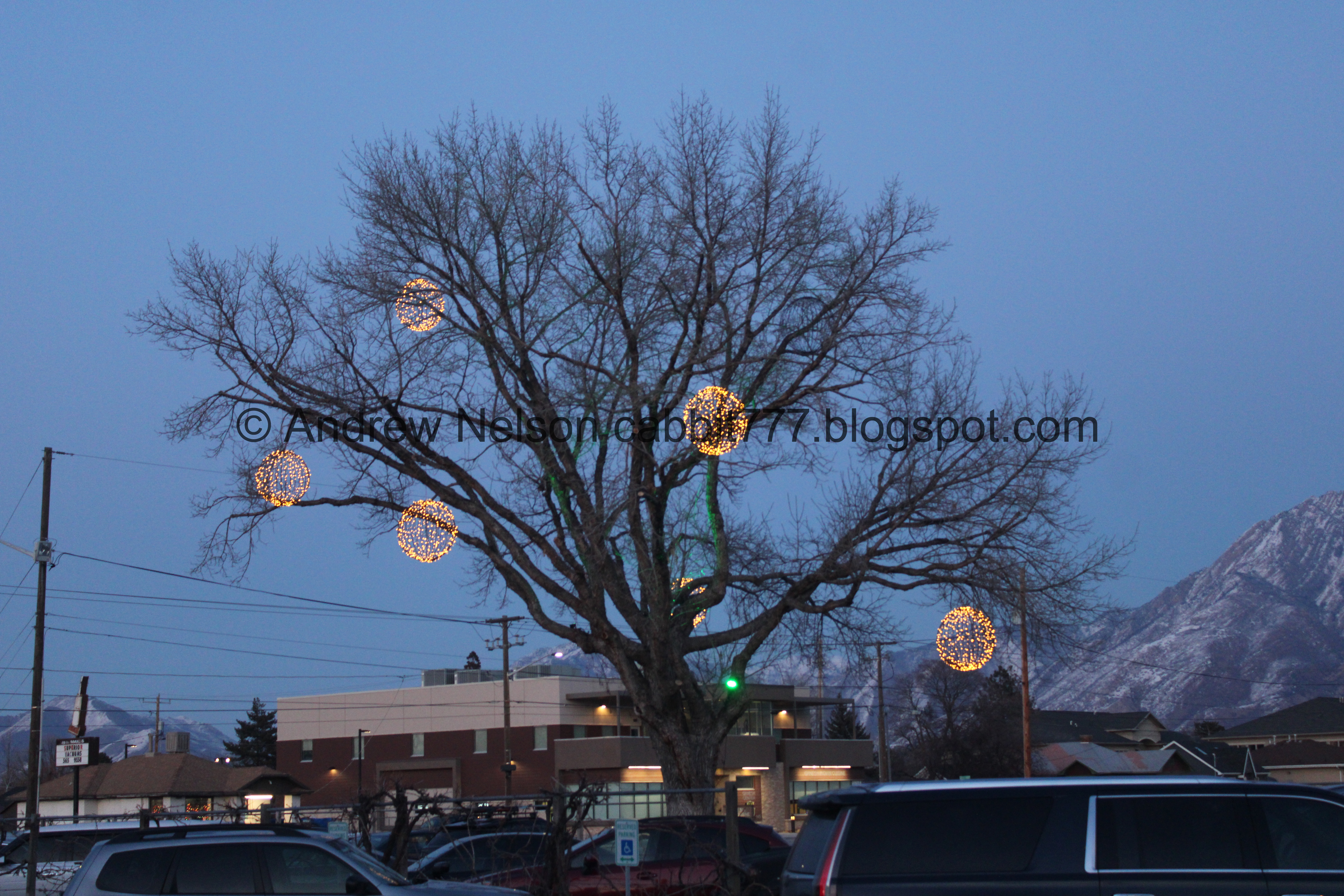
We decided to stop by The Bohemian for dinner tonight, which has this neat decorated tree. The fact that we are not sportsball fans, and well, are kind of irritated by sportsball fans (no offense intended, but dang yall are over the top loud) and with it being prime sportsball season, we struggled to find a good spot for dinner tonight. So we ended up here. They had the sportsball on some TVs, but it was muted or at least quiet, and we were not upset by any sportsball fans screaming here. Hooray! We chose wisely tonight.
Anyway, aside from not being disturbed by sportsball people, we had an absolutely amazing dinner! Landis had brats and perogies, I had stroganoff. Both were amazing. We happened to be seated right next to the kitchen and kept seeing the pretzels coming out and they looked so good. So we decided we needed to get one of them to take home and it was an amazing late night snack!

Same tree after dark. Amazing Christmas decoration!
Well dang! I liked the trail a little bit better than I have before today. The short addition on the west end is great. I don’t mind the business district so much, and honestly appreciate having options to stop and have a bite if I want. I have yet to do that on this trail, but I do appreciate the option if I decide to. It’s not busy, we only ran into a few people. I think I am gonna go with 7 out of 10 squirrels today.
As for difficulty, it is paved, with a mostly mild climb, but there are a couple hills that are a bit more steep, so DR3.
Dogs are allowed, leashed. Please clean up after your furry friends!

No comments:
Post a Comment