.jpg)
Bingham Creek Regional Park is a newer park located in South Jordan. It features a creek, a playground, a disc golf course, several bike paths, and a continuation of the Bingham Creek Trail. Something that I thought was special about this park is it appears to be generally wild terrain, and has not been covered in non native grass. I guess after years of severe drought, and facing the fact that the Great Salt Lake might dry up has finally pushed Utah to be a little more desert friendly. I was saving this one for a yucky weather day, but we had yet another super late start day so I thought this was a good last minute option for us today.

Quick Details:
Length: we did a weird 1.9 mile double out and back from an off central point.
Trail Type: Out and back, connector.
Difficulty: DR2. It is paved, slightly hilly, but not too bad.
Elevation Gain: About 100 feet.
Restroom: It looks like there is one at the SE corner of the park. Not sure if it is open in winter though.
Dogs? Yes, Leashed. Please clean up after your furry friends.
Other Info:
To Get Here:
Take Bangerter Highway to 90th south head west. Turn left on Old Bingham Highway. Left again on 48th west. Then the park will be on your right.
My original plan was to park on 48th West and just pick up the trail where we left off last time, but we discovered there were lots of 'no parking' signs along that area. Well, crap. So my next thought was to just park at the park, but the trail is a bit away from the parking lot so last minute messing around on the map, we found a small parking area next to a maintenance building of some sort near the NW part of the park. There were no signs saying we couldn’t, and there was even a handy capped spot. So we thought it would work. Plus, it was closer to the trail.
If you would rather not park at the maintenance building (but honestly it seems fine) It is about a quarter mile via a paved trail to another random spot along the trail from the middle parking lot, one way. Or about .36 miles to the northernmost part of the SE parking lot, one way. Or about the same from the western section of the SE parking lot, one way. It looks like there may be some shorter unpaved options too.
The Trail:

Random stone circle around this disc golf goal.

The sun slipping being the mountain. Yep, we got a super late start today.

Bingham Creek is quite dry up here. I am not sure what other creeks or springs join it, but it is definitely still flowing downstream. You can see where it joins the Jordan River at the Bingham Creek Confluence near 78th south.

Only about 582 feet (little over 1/10th of a mile) we reached the Bingham Creek Trail with crosswalk across 52nd west.
I was a little torn on what I wanted to do here. The trail to the west does not show up on google maps yet, so it is completely new, but I have absolutely no idea how far it goes. Or, do I just want to go east and connect to the part we left off on last time we did the Bingham Creek Trail? Ultimately I decided upon the latter, cause I am a crackhead that likes to continue where I left off. Now that we have done both options, I think I would have preferred to do it the other way around so we could keep going down the known section for a longer walk. But meh. It’s an adventure!

It’s a little hard to tell for sure with this lighting, but I am pretty sure this is a kestrel. Mostly due to the behavior I observed before managing this not so great picture.

Here we can make out some of the facial markings which is confirming it is a kestrel for me. Still not the best shot ever. I did get some great shots or a kestrel recently at Big Cottonwood Regional Park.

Heading east.

Houses off in the distance.
Bingham Creek and some storm drainage.

Field and mountains. I really love that they, at least for now, have left the park as a natural meadow. There are not a whole lot of places to see that around here. I also enjoy that it was made a big park instead of you know, another couple hundred condos.
.jpg)
Panoramic.
This is probably normally an excellent place to enjoy our scenic mountains. But with todays clouds, not so much.

Looking back towards the sunset.

Another disc golf goal. Man, This is a rather large disc golf course!

The bike Skills Course. It actually looks kind of fun.

Sunset.
The quite dry Bingham Creek.

A fast downhill bike trail called Rad Canyon Loop crosses here.

Mount Timpanogos came into view through the clouds. You have to be pretty far west to be able to see it from the SL Valley.

Dark clouds, blue skies.

Sunset.

Continuing down.

Sign for the Bingham Creek Bike Park. There is a Hills Course, and a Skills Course. Also some really helpful rules for the bike park. I.. I might have to come back with my bike some time.

The Hills Course.

Its a little harder to see the Skills Course form here.

More of the Hills Course.

Disc Golf launching pad.

The creek bed.

Fun bike bank.

Down to the tunnel under 48th west. this is where the trail left off before.

Looking back towards Bingham Creek Regional Park.

Here is what it looked like in 2023 when it was still closed.

Even though this is where we left off last time, I decided to go through the tunnel under 48th west. The creek will share the tunnel when it is active.

Inside.

Cliff swallow nests.

Uhm. Well. Hello there. I thought it was a little early in the season for the nests to be occupied, but well, here we are.

On the other side of 48th west. This was about .65 miles down. The trail currently continues generally northeast for about 1.35 miles to 40th West. I suspect they will likely try to get it to connect down to the Jordan River Parkway. Since the county has really been pushing for these alternate commuter trails. I am already seeing a couple spots that appear to be coming in.

This appears to be a trail counter. Nothing to worry about, it just counts how many people pass by it. This data is used to help determine how much the trail is used. Thus determining how much money the city or county puts into improvements. I know this, because of the amazing improvements they put in at the Alien Tower Trail.
But okay. I wanted to explore the west section too, so we decided to head back.

Occupied swallow nest. Hello little fella!

Back to the new section. You want to go forward. Right just connects to 48th west as a neighborhood connector.

Small patch of scrub oak.

Better look at the gnarly bike bank.

Better sunset.

Interesting lined cloud.

More sunset.
.jpg)
Panoramic of the mountains again.

The dry creek bed again.

Sunset.

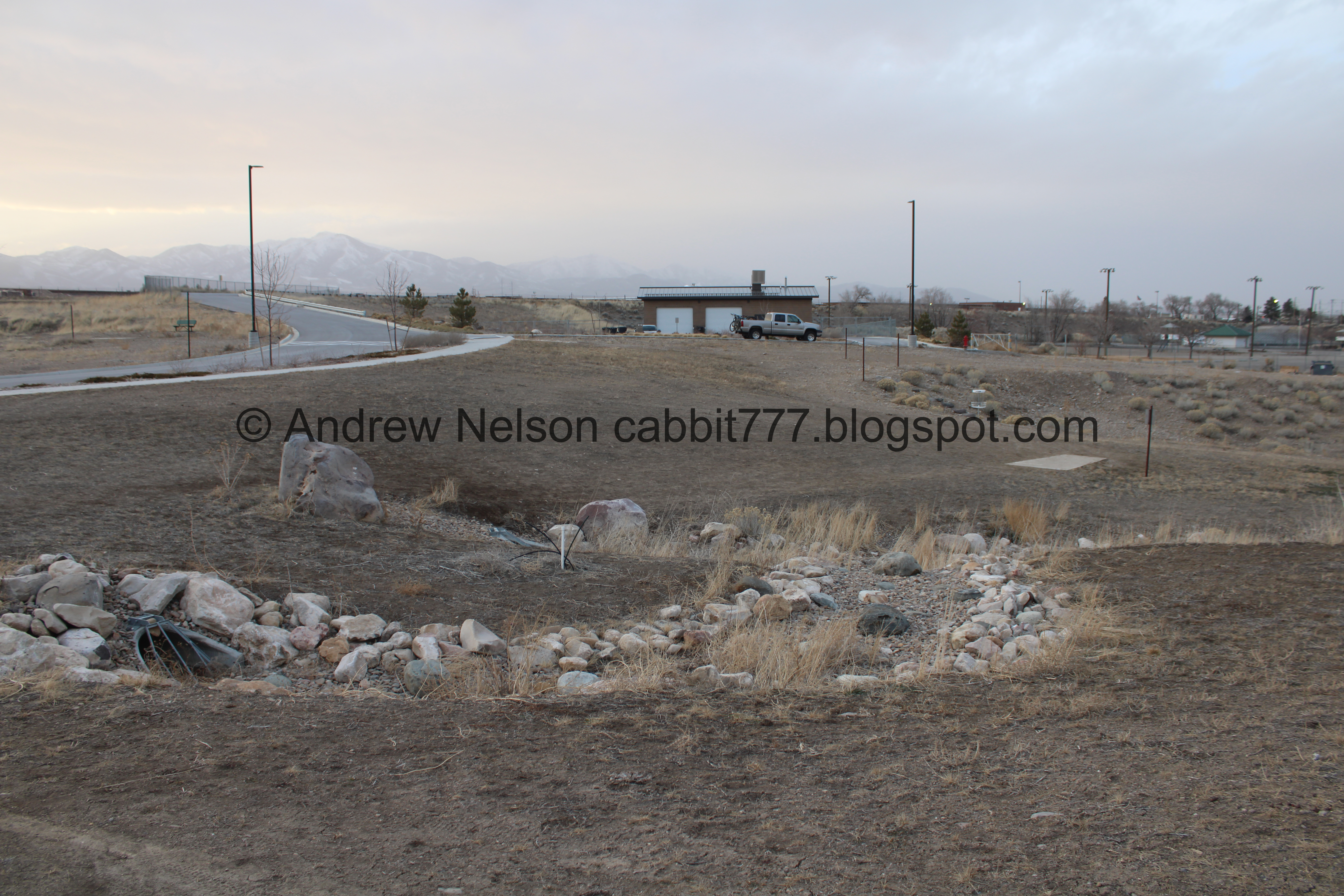
With the maintenance building we parked next to.
.jpg)
The mountains behind us again. Also showing the natural fields in the park.

What in the world is this? It appears to have bleachers and observation towers? My best guess was probably some rodeo grounds? However looking at the map it appears to belong to a group called Rad Canyon BMX. So I guess its a BMX racing track.

Crescent moon.

Back to the crosswalk that leads to the newer far west section. Currently this part is only about a quarter mile, or a half mile out and back.

The far west part.

A bunch of tumbleweeds piled up against the culvert.

I was wondering if this back section was part of the park, but the disc golf course continues through here, so I guess so.

Last of the sunset.

Okay, this is kind of freaking me out. I know for a fact the creek flows generally east through the park, but by some trick of the eyes it looks like downhill is west. I know it is the surrounding landscape is tricking my brain into thinking that, just like a Gravity Hill (outside link) including our local one above Memory Grove. Now I want to come back while the creek is flowing to see if that breaks the illusion.

Looking east, upstream doesn’t break the illusion for me either. I really need to come back when it is flowing.

The trail curves to the south, away from the creek here.

Those houses look like Daybreak houses. Yep, that is daybreak across the street. There a nice little walk around Oquirrh Lake over there.

Continuing south.

Big empty field.
.jpg)
Panoramic.

Getting closer to Daybreak. ♫Little boxes on the hillside…♫

East towards the park.

West is private property, which explains why the trail curved this way.

Currently, the paved trail ends at 102th South.
I suspect they might continue the trail a little further west. I suspect possibly trying to connect to the Mountainview Corridor Trail. Again because the county is pushing these alternate commuter trails.

Where the sidewalk ends.
I suspect you might be able to follow the side of the road, and connect back to the creek where there appear to be some desire paths, but I don’t know for sure. Also, at least right here it doesn’t look like a fun tromp.

We decided to just turn around and head back to the car before it got super dark.

Someone had fun with an ATV or maybe a motorcycle.

Back to the creek bed, which still looks like it would flow uphill. I am thoroughly interested in this.

So bizarre.

Even directly from the side it looks like it is going uphill.

The moon and Venus.

Looking back towards the creek.

Back to the crosswalk across 52nd west.

The creek heading east.

Back to the maintenance shed we parked at.
Phew! I actually quite enjoyed this section of the trail! I love how wild and natural it is. It does look like it was starting to be developed, hence the random road through it, but I think they stopped that for the park. Otherwise it is great. We only ran into a couple other people. The mountain views were great, but probably a lot better when it isn’t so cloudy haha. Also, as far as a commuter trail in the middle of the city, it doesn’t really feel that way for the most part. 7 out of 10 squirrels.
As for difficulty, it is a really gentle climb and completely paved. DR2.
Dogs are allowed, but should remain leashed at all times. Please clean up after your furry friends.

No comments:
Post a Comment