.jpg)
Dimple Dell Regional Park is a huge park in Sandy that features over 15 miles of trails. All of the trails offer excellent views of the mountains, some fun scrub oak forests, possible wildlife, and wildflowers in the spring. We have explored almost the entire canyon now, with a couple random side trails and loops we still need to check out eventually.
On our bonus day off of course we decided to get another hike in. After ruling out a few options due to where the storm clouds were, and then changing our mind a few times we once again ended up here. Dimple Dell does tend to be my general go to spot when I can’t think of anything else to do. We just kind of winged it a bit today. We started at the Dimple Dell Trailhead, however both trails can be accessed via the Wrangler Trailhead as well.

Quick Details:
Length: We did about a 3.11 mile loop, both trails continue down to the next trailhead for longer options.
Trail Type: Loop, out and back, connector options.
Difficulty: DR3. The Mountain View trail is gradual, and wood chip lined. The Dry Creek trail is a little more wonky, with a lot of up and down, and some of it in the creek bed itself, but it is pretty easy going.
Elevation Gain: We did about 360 feet, but we got off track a few times and turned back, so it should be less.
Restroom: Yes, there are year round flush toilets off of the Dimple Dell Trailhead, and the Wrangler TH too.
Dogs? Yes, leashed. Please clean up after your furry friend.
Other Info: Dimple Dell has a huge spiderweb of trails which can be quite confusing, particularly down along the creek. I recommend having the map handy for your first time on any of the trails.
To Get Here:
We accessed the trail via the Dimple Dell Trailhead: 2765 Dimple Dell Rd.
From i15, take the 106th south exit. Take that east to 2000 east, turn left. Pretty quickly the road will sharply curve to the right, going east again and becoming Dimple Dell Rd. Go about 1.1 miles and there will be a large parking lot on the left.
The Trail:

The paved trail out to the restroom, which is also the beginning of the Centennial Loop. Like I said we were just kind of winging it today. We decided we wanted to see the little pond.

A great view of Mount Jordan.

Quick muddy section as the trail dips into the gully.

Then we hit the bark chips so mud is no longer an issue.

Another newly replaced signpost. We noticed they had replaced a few of these on the North Rim Trail we did recently as well.

Fox Point above.

Another new trail marker post.

Heading towards the pond.

Someone or something left some bloody bones on this sign. Yuck.

The pond below Fox Point.

Darn. The pond is quite empty.

Bell Canyon and Dry Gulches. All the sources for Dry Creek through here.

They have worked out a deal to allow the creek to flow throughout the year, but I guess early winter is not a priority.

Bat house.

Short section along the Dry Creek Trail.

Fox Point again.

Continuing along.


Dry Creek living up to it’s name.

As of 2020 the city is working with various water rights to allow the creek to flow “year round” (obviously that is not the case right now). This not only beautifies the park, but also will help to recharge the ground water below the gully and surrounding areas. which is a win win situation for everyone.

Bridge over Dry Creek.
In addition to the giant web of trails, another factor that I find to be confusing is trails just change names, without there being an obvious junction. From what I can tell, after this bridge we will be on the Mountain View Trail.


The asphalt coating on the bridge appears to be crumbling away.

Dry Creek below.

Bit of a climb, but not too bad.
Don’t forget to turn around and take in the view of Mount Jordan once in a while. It isn’t called the Mountain View Trail for nothin!

View across the gully.

Nice wide trail.

Down into the gully.

Looking up on this side.

Landslide on the other side. It seems a little close to the road! I hope it is being monitored.

Not the best lighting today.

Looking back at Mount Jordan.
.jpg)
Panoramic.

Itty bitty peak, with a trail right up to the top of it. I thought about heading up there for a microsecond haha. Maybe one day.

This trail goes up and down a bit.

I was looking for ways to possibly make this a loop trail with the Dry Creek Trail and well, most of the trails heading down look like sketchy deer trails. And I know there are some drop offs. I certainly wasn’t mountain goating my way down to the bottom today.

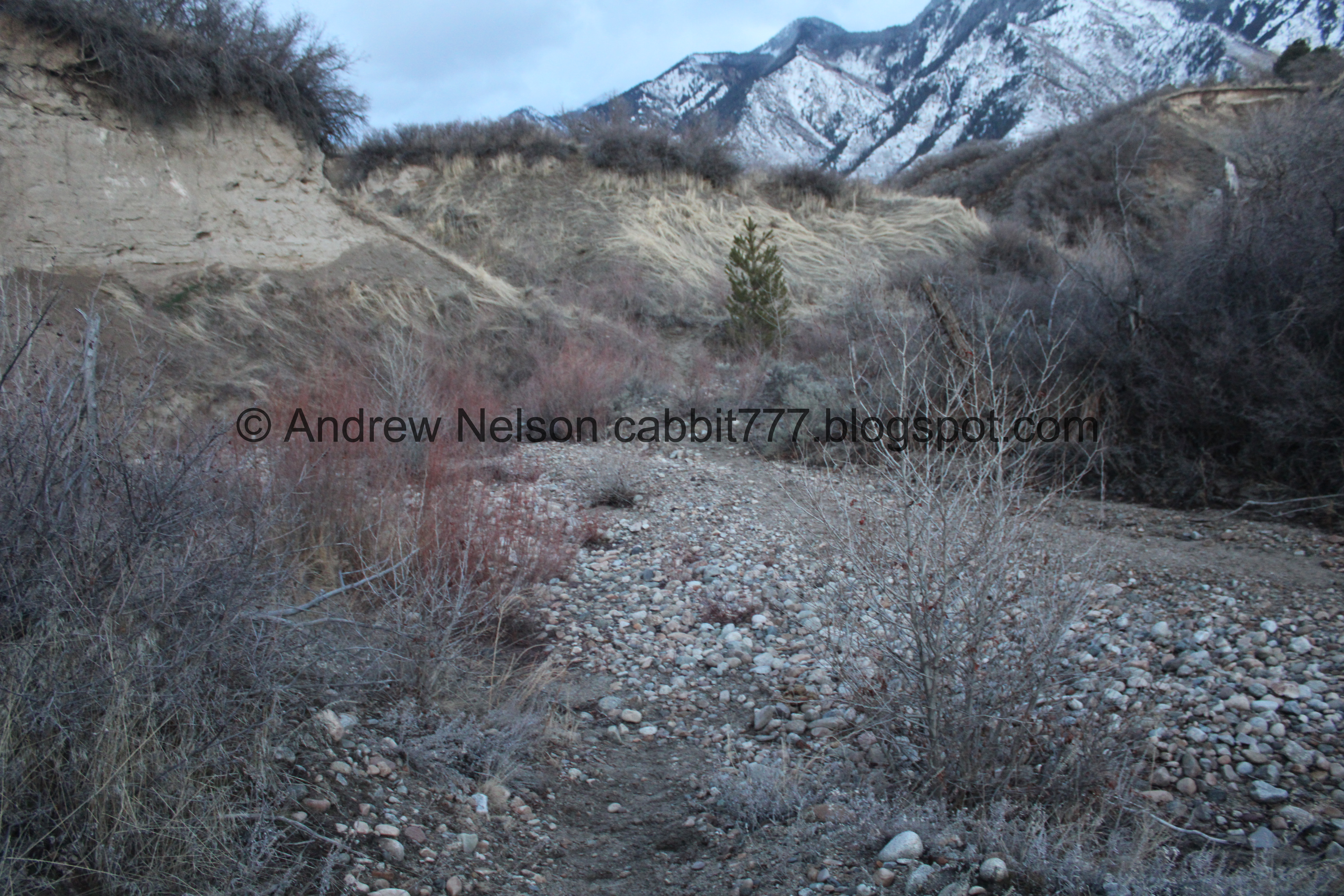
The gully below, which kind of illustrates the drop off.

Continuing along.

Mount Jordan again.

Another sketchy side trail.

Mount Jordan again.
.jpg)
Panoramic.

The sun behind some clouds.

The gully below.

Across the gully.

Continuing along.

More fun clouds.

Pink and purple clouds above the gully.

Mount Jordan again.

Meh… little bit of a sunset.

Oh! I am familiar with this connector trail between here and the Dry Creek Trail! We have used it a few times including just last year when we did the same 2 trails as a loop, but from the Wrangler Trailhead. haha. This was about 1.3 miles down so we pushed on for 2/10ths of a mile first.

Mount Jordan again.
.jpg)
Panoramic.

Gully below.
Well, we reached 1.5 miles so we decided to head on back. 3 miles round trip is our general preferred length if we aren't after a specific goal, particularly this time of year when we don’t have a lot of daylight.

Heading back down.

Dry Creek below.

Mount Jordan.

Down the connector trail towards Dry Creek.
Hind Sight being 20-20 I wish we had just returned the way we came today. I forgot what a mess of trails the gully bottom is.


It’s sandy, and a bit on the steep side but not too bad.

To the bottom of the gully. A little steep, but no crazy drop offs or scrambles.

Heading back east.

Crossing Dry Creek, which is currently living up to it’s name.

Upstream.

Downstream.

See, drop offs and steep hills. Not what I wanted to deal with. Although, one time we stayed in Oregon one of the neighbors we stayed next to totally rappelled down a much higher cliff like this to get down to the beach.

Bottom of the gully with Mount Jordan.

Cliff with nest holes. They could possibly belong to bank swallows or kingfishers (one of my favorite birds).

Oof. Some of the trail on the south side of the canyon is a bit muddy and icy. It was not very fun at all.

We saw quite a few bunnies along the way, but it was getting dark, and man, they are fast little buggers! So I got a quick bunny butt, that is the best I caught today.

Continuing along.

This is one of the trails down that I rejected, and I am glad I did. I am not a mountain goat!!!

Dry Creek again.
I noticed a trail on the north side of it, after being miserable with the muddy/icy trails on the south side for a minute I decided we should jump over to that trail.

Through the sage brush. But no ice or mud.

Dry Creek. The original Dry Creek Trail crosses, and uses the creek bed quite a bit.
However, as we learned not too long ago, when the creek is flowing that presents a bit of a problem, unless you happen to be wearing waterproof boots.

So I suspect some new alternate trails have since popped up. I mean, it has always been a confusing spiderweb of trails down here, so I really can’t say for sure, but it really did seem like some new trails have since popped up to help getting around the creek.

Some of the trails take us up a little higher than I remember.
Back down to the creek. Now that the creek is flowing more often some bridges need to be put in and the main trail needs to be made more clear.

Another cliff wall with nesting holes.

Mount Jordan.

One of these desire paths was taking us a bit higher than I would like, and actually kind of started looking like a deer trail, so we decided to go back to the previous split.

Previous split.

Walking along the creek bed again.

The little cliffs above.

Mountains.
Somewhere around here we took another trail split up and it really started to climb, and thin out looking like a deer trail, and again, we had to turn back. Oi. After that we decided to keep taking the lower split, or the creek bed. Which is what we should have just done to begin with but eh. Now I know.

The creek.
Just a little bit further we reached a point where I knew exactly where we were again, so I felt a little more confident getting us back to the trailhead without further issue in the dwindling light. I have a really weird good trail memory, but obviously it is not perfect. I only recently learned that not everybody can tell you what is down each trail split without there being a sign or looking at their phone. o.O

Almost back to the trailhead.
.jpg)
Panoramic.
After this it got pretty much too dark for any photos, but we were almost back anyway. One more dip, one more hill.

Little glimpse of the valley lights below.
Meh. Not the best hike in the world, particularly since we have done most of it before. Also, the mess of trails along the creek was a little frustrating today, but eh, it was our 3rd choice and we just kind of winged it today so I guess I can’t be too hard on it. The Mountain View Trail gets a good 8 out of 10 squirrels. The Dry Creek Trail gets a 5 today.
As for difficulty, both trails are pretty mellow. DR3.
Dogs are allowed, leashed. Please clean up after your furry friends.

No comments:
Post a Comment