Memory Grove is an absolutely beautiful park located in downtown Salt Lake City. It features some pretty grounds, 2 small ponds, City Creek, and some neat historical monuments. I normally access this trail from the mouth of the canyon off of North Canyon Road. However, today we decided to explore the State Capitol and I figured, we already fought for parking once, and I know there is a trail down into the canyon, why fight for parking again? So, here we are.
Quick Details:
Length: We did about a 1.9 mile loop, and you have the option to do more if desired.
Trail Type: Loop, out and back.
Difficulty: While the main, lower park is paved, the trail down to it, and the trail above it are not Also the trail down from the Capitol is a little steep. DR3.
Elevation Gain: 190 feet.
Restroom: Yes! I actually found them this time! I thought the city had been lying to me until now. I am not sure if they are open year round or just in the warm months.
Dogs? Yes, leashed in the lower section, off leash on the Freedom Trail upper section.
Other Info:
To Get Here:
From Downtown SLC, follow State Street north until you hit The Capitol. Park along the east side of it for easiest access to this trail.
The Trail:
View down into the canyon from where we parked. I don’t think I have ever noticed that trail all they way down from the other side before now. They appear to be called The Sweet Switchbacks. I am not 100% sure, but I think they lead down to the Austin Stairs, and up to A Street. Oh yes, confirmed that. and it was only recently paved back in January 2021 (outside link).
The east side of the Capitol. The top of this trail is pretty unassuming, but it is across from the southeast corner of the Capitol, and just a smidge south,.
I was a little nervous that this trail was going to be too much for me, and well, I did not like this initial stairs part, I would have really liked a handrail here. Otherwise it was not bad at all heading down to the bottom of the canyon.
Again, after the initial stairs, the trail is just fine for me.
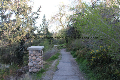
These pillars are neat, but I couldn’t figure out what they were for at first. I learned on the way back that they are lights.
Heading back the other way.
Another light pillar.
From here there is a 4 way split. 2 switchbacks heading down, 2 up. Both down switches lead to the same place in the park, so it doesn’t matter which way you go. Both ups do lead back to Capitol BLVD, but the south ones leads a little further south. Again, they both get you back, but depending on where you parked you might have a preference on which to use.
Continuing down.
Another switchback.
Continuing down.
These switchbacks are not bad at all. Even with the large crowds.
Down to the final staircase.
Oregon grape.
The last push down.
I guess they are called the Rotary Steps. Completed in 1997, rebuilt in 2002.
Looking back at the steps.
Park gate.
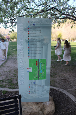
This little park map is new.
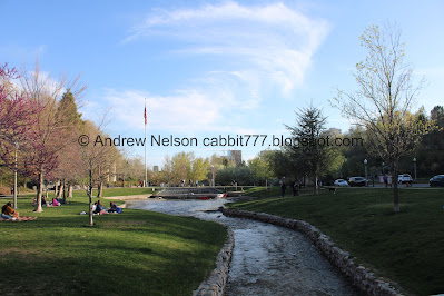
The park.
Salt Lake City acquired the land in 1902, due to a growing demand for park space. They did not develop it into a park until nearly 2 decades later, because they were not sure what exactly they wanted to do, just that it should be a park.
After World War 1 ended, they decided it should be a war memorial.
Memory Grove Park officially opened on June 27th 1924.
Additional info in this KSL article (outside link).
The Zucker Fountain.
Lone daffodil coming up.
Pagoda Memorial (AKA world War 1 Memorial, or World War 1 Monument. It was designed by architect and WWI veteran Slack Winburn. It and the main gate were built in 1925.
The lower pond. For some reason they appear to have it at a low level right now. Probably maintenance of some sort. Oh, I found a facebook post that confirms just maintenance.
Duckies.
The pond again.
The park.
The Korean War Wall of Honor.
Well, hello there! I found another patch of redwood trees!
With the distinctive needle.
Again.
The pair of them.
I am starting to understand that they are way more common in Utah than I thought, but I am obsessed with finding them. I am finding them in way more places than the original list I found.
Needles.
Pretty magenta flowers.
The Meditation Chapel. It was built by Mr. and Mrs. Ross Beason in 1948 to commemorate their son and others killed during World War II.
City Creek, upstream.
Downstream.
The Meditation Chapel again.
Little rapids in City Creek.
The Meditation Chapel again.
The 145th Field Artillery Monument. Dedicated in 1927, the monument was erected by the 145th Field Artillery.
Again.
You can see 3 of the little waterfalls from the bridge on the north end.
Downstream.
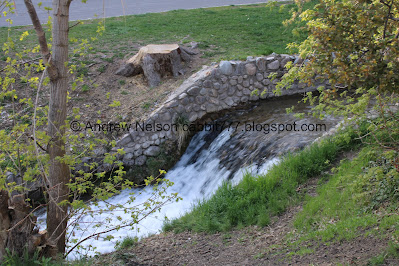
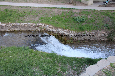
One of the waterfalls.
The Austin Stairs.
Fallen trees.
We spotted another redwood across the creek. We’ll come back to that on the way down.
Here we start the Freedom Trail, which is also an off leash dog area.
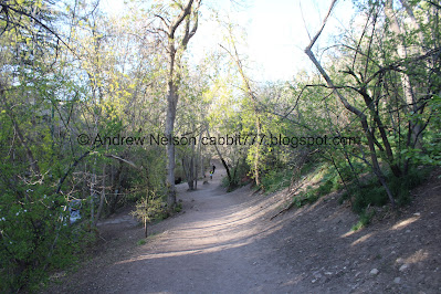
It is a lovely forested trail that follows the creek.
The creek.
It was surprisingly not very busy up here. Which was very much welcome after our previous, very crowded adventure.
Another little waterfall.
More forest.
Flowering tree.
The creek again.
Neat little archway tunnel.
Lots of myrtle spurge. This is a particularly nasty noxious weed that can cause rashes and burns. It should be avoided.
More forest.
American robin.
Little place where the creek fans out. Perfect for dog wading.
Creek and forest.
Heading up to what we have always just called ‘the witches hut’.
Another waterfall.
The '”witches hut” again.
The front.
Panoramic.
From the corner.
I still haven’t figured out what exactly this was. I suspect a mill, or power plant, but really have no idea.
Ah hah!! it is the remains of an 1862 home and nearby grist mill called the Empire Mill. Built by architect William Kessler. The mill used City Creek to help process wheat. Next to the mill was a home and garden belonging to the Sudbury family. Go me, I was correct! At least according to this source (outside link).
The mill was a 3 story wooden structure on a stone base. It had a massive 30 foot water wheel. It produced 100 sacks of flour a day.
It burned to the ground in 1883, destroying $8,000 worth of wheat and flour.
The city purchased part of the canyon land including the ruins of the mill and the Sudbury home in 1902 from the young family. They built a bandstand on the formation to celebrate the grand opening of City Creek Boulevard (now North Canyon Road) in 1914.
I am not 100% clear if these are the remains of the house, or the mill though, the way it is worded, it sounds like it was the mill? But I am not sure. Although I found another post that says it is the house (outside link). They posted historical images that seem to back that up.
This post also states that any salvageable machinery was relocated to the Chase Mill now in Liberty Park (technically the Tracy Aviary).
I am also a little happy to hear we were not the only ones who called it the Witches Hut. It is a common urban legend. There were also legends of spooky stuff happening here. Including disembodied lights and voices, usually associated with a witch. This is one of the few places that I will say that I truly experienced something otherworldly after dark that a friend confirmed feeling and seeing the same thing at the same time (some 20+ years ago). I am not saying any of the legends are true, but I am saying we experienced something that I can't easily explain away, but I will acknowledge, we were stupid teenagers exploring "spooky" places so we could have imagined it. While I love me some spooky stuff, in my older years I take all of it with a grain of salt (see my post about the Salt Lake City Cemetery).
Anyway, a little down canyon in City Creek Park is a marker for the site of another, older mill called Crismon Mill. Which leads me to say, why the heck is there not a historical marker here? I think an old building that there is still something left of is worthy of a marker. There is nothing left of the Crismon Mill and it got a marker!
Well, that was quite the rabbit hole I went down LOL.
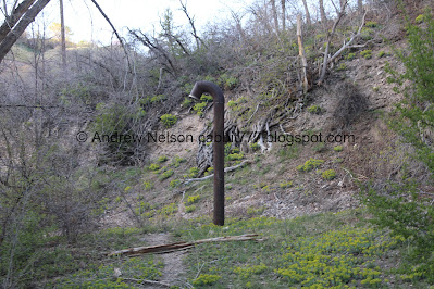
Random black pillars.
Continuing along.
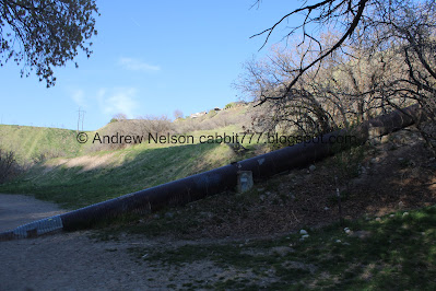
Random large pipe.
Cherry tree.
Well, this is new. A random pipeline across the creek.
With some stuff up above it.
Another little archway.
The creek again.
More myrtle spurge.
Another waterfall.
Well, that is new too. Some kind of drainage.
Another area with paver stones. I wonder if this is related to the mill site.
With a compass rose.
Gnarly tree trunk.
Stone pillars. Again, is this part of the old mill, or created afterwards?
The creek.
Gurgling pipe.
We decided to cross back to the old North Canyon Road and head back down. North Canyon Road (formerly Memory Grove Boulevard) has been closed to vehicles from Memory Park up to Bonneville Boulevard for as long as I have known. I am not having any luck discovering when, or why.
Upstream.
Downstream.
We decided to head back down the old road. The trail/road does continue up for about 6/10ths of a mile before it reaches City Creek Canyon from here.
The new spillway? again.
Below the little waterfall.
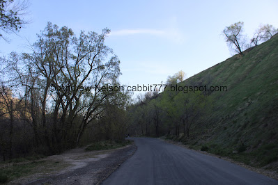
Heading down North Canyon Road.
I found a small redwood.
With the neat needles.
Fun wispy clouds.
Strange box.
Across from the new pipes.
Continuing down.
The creek. Here we see that the big pipe we saw earlier appears to be a big storm drain that comes out in the creek. I am pretty sure pretty much all of our storm drains lead directly into our creeks, but I mean, where else would they go?
Small patch of flowers with Bonneville Boulevard above.
Speaking of spooky places, on the other side of the canyon there is a section along Bonneville Boulevard that is known as Gravity Hill. There are also some urban legend/ghost stories about that, but as far as I can tell, it and many other "Gravity Hills" are just tricks of the eye due to the the surrounding landscape.
I like spooky stuff, I really do, if you can't tell from a lot of what I post, but I also take most of it with a grain of salt nowadays. So, yeah, I am the spooky nerd ruining the spooky fun now. But most of the places were super fun as a teenager.
Continuing down.
More flowers on the hillside. These appear to be some sort of balsamroot.
The creek again.
Another waterfall.
Continuing down the road.
Fanned out area of the creek.
Another waterfall.
Some erosion control walls.
One of the little archways.
Nearing the bottom.
Another waterfall.
Well, this is an interesting looking tree.
Google lens says it is a cedar of Lebanon. I guess that makes sense, it just quite a bit bigger than others I have seen recently.
Gold Star Hill. Dedicated in 1934.
Again.
Another set of redwood trees.
Needles.
The one we saw at the beginning of the Freedom Trail turned out to be a pair.
Again.
Needles.
The Austin Stairs again.
Back down to the main park.
Some adorable Boston mixes of some sort.
Another waterfall.
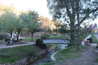
The bridge on the north side of the park.
Another waterfall.
The main park.
Folks, after a few years of feeling gaslighted by the city, I finally found the restrooms in the park! I guess I should have known they would be next to the other building that has plumbing, but it just didn’t seem like the place for them. haha. But, yes, I can now confirm there are restrooms here!
Not the best shot, but they are to the right here. They did appear to be open, so I am not sure why there was also a port o potty, but hey, there are restrooms!
They are connected to the Memorial House.
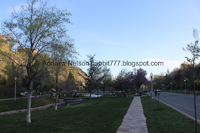
The neat stone paved sidewalk.
The park.
The lower pond and the redwoods we saw earlier.
The weird square drainage, and the ducks are still hanging out.
Liberty Bell Replica. Dedicated in May 1979.
With it’s stand.
Back to the climb up to The Capitol, with the Rotary Steps at the beginning.
Horizon Grove.
The Rotary Club built these steps in 1927.
Heading up the switchbacks. They are not as bad as we thought they might be coming back up.
Confirmed the stone pillars through here are lights. They do not seem to have adjusted for the shift in daylight.
The park below, with the shadow of the Capitol rotunda.
Lots of people to contend with here. I think it was a little more busy on the way up versus the way down.
I didn’t really notice it until Landis said something, but he was highly amused at the poor kid on this dads shoulder that kept getting smacked in the head by branches and eventually learned to cover his head. LOL We are total assholes for thinking that was funny, but it really was! I specifically remember a similar experience with my dad that was not really aware of how the surroundings affected me.
Phew, we made it to the top. Here is the east side of the Capitol.
The park below the Capitol, with it’s shadow.
Up towards City Creek Canyon.
Heading downtown (PSP).
We have done Memory Grove quite a few times, but this is the first time we have done it from the Capitol. So, that was a little bit of a different experience. The main park was quite busy, but the back trail was a little more quiet and nice. Splitting the difference at 8 squirrels out of 10.
As for difficulty, While the main, lower park is paved, the trail down to it, and the trail above it are not Also the trail down from the Capitol is a little steep. DR3.
Dogs are allowed, leashed in the main lower park, off leash in the back end.
.jpg)












.jpg)












No comments:
Post a Comment