.jpg)

Quick Details:
Length: The map says 1.8 miles (one way), there is currently a detour that put it closer to 1.9 - 1.95 miles.
Trail Type: Out and Back or connector with a shuttle.
Difficulty: DR2. It is paved and almost perfectly flat. Super easy going.
Elevation Gain: NA
Restroom: Not at the 1200 N TH but there is one at Riverside Park.
Dogs? Yes, leashed. Please clean up after your furry friends.
Other Info: Cities: Salt Lake
To Get Here:
City address: 1100 N Redwood Rd. Honestly can’t give much more info than that,
The Trail:
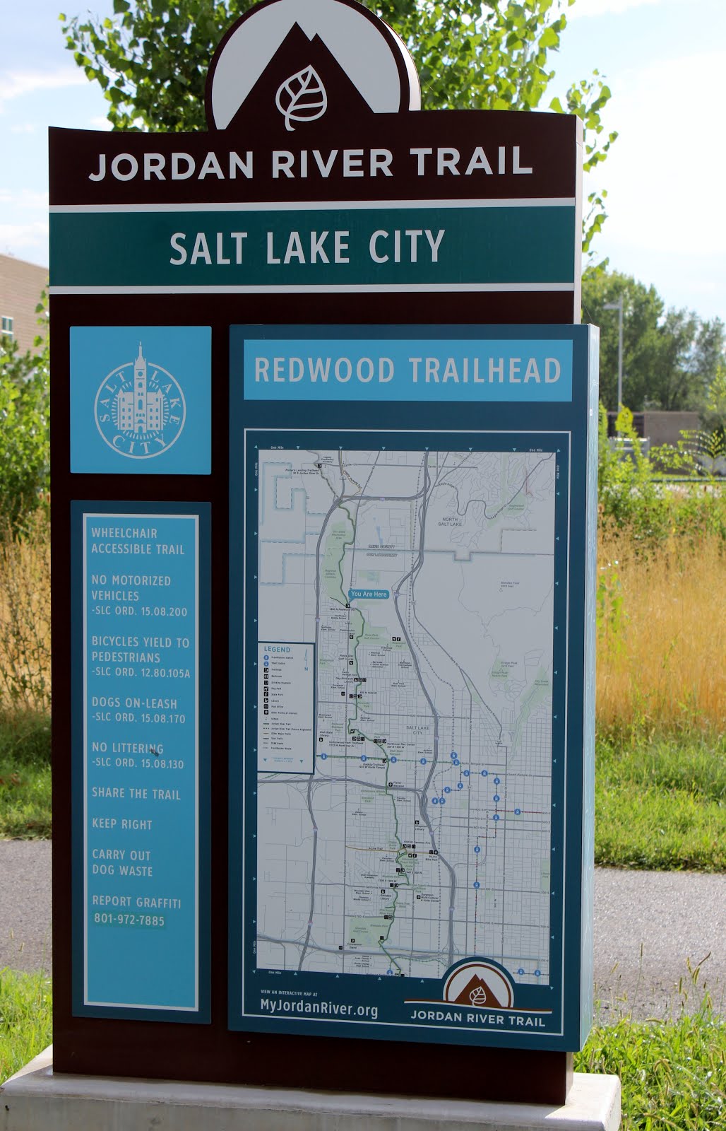
Trailhead sign.

There are 2 busy road crossings along this segment, both have pedestrian crosswalks.The first one is right here at the beginning.

Neat little memory from the 2002 Olympics.

The trail. This is a shared use path so remembering trail courtesy will keep you safe. Stay to the right. Pass on the left. Walkers have right of way over bikes, but they are going faster, and will generally pass walkers. I have noticed most bicyclists approaching from behind will give you a heads up, but still don’t count on that.

The river is mostly obscured by all the foliage around it, at least this time of year.

However, there are some spots to view it.

Most of this segment follows a golf course, and it even crosses through it eventually.

Some pretty daisies along the trail.

The river again.

Good spot allowed me to get in a little closer.

Wow! Look at the size of this amazing old tree. It’s huge!
This got me thinking how sad that this is a novelty and not the norm.

I think this is about where we turned around last time, so the rest will be new to me.

Riverbend.

Mile marker 42.

Right around here you cross through the golf course.

You want to cross the bridge here. The dirt trail seems to keep going for a little ways, but I have no idea where it leads.

View from the bridge.

From the other way.

Nice view of the mountains through here. You can see Ensign Peak on the right there and I have recently hiked up near those radio towers to the left here.

Another 2002 Olympics sign.

Oh. I didn’t realize there was more to it. Here are the winners that year for the alpine skiing event.

Another spot that lets you get close to the river.

Another one.

The trail again.

A little popup library. I love these things.

A little garbage trap around a mess of branches.

The river again.

Some little rapids.

Ruh Roh.

There is a detour from the main trail here. According to the sign they are making some changes to help control the quality of run off into the river here, as well as a couple of other improvements.

The detour takes you through a kind of sketchy looking neighborhood. I considered turning back here, and honestly probably should have. The destination I had in mind was at the end of this anyway.
I didn’t take any other pictures through here. The detour signs were adequate enough to get to back on track.

Little bridge at Riverside Park.

View of the river from it. You can see the trail fenced off to the right here.

Riverside Park and the mountains above.
Well, this was the destination I had in mind for today. Time to head on back.

A bunch of pigeons hanging out under the 1000 S bridge. This was pretty much the only wildlife I saw today. Not even any ducks, I usually see ducks on the river.

Other than the swifter section by the bridge, the river seems quite still.

Back to the golf course. Some fun clouds leftover from the storms earlier.

Back to the bridge to the other side of the river.

View to the south.

View to the north.

Back to the large, gnarly tree.

Interesting purple flower in the river. I didn’t want to slip in so I didn’t get much closer.

The river again.

The high water line.

Near the Olympic marker towards the beginning. Here are the freestyle Skiing winners.

Good spot to view the river again.

Just on the other side of the trailhead is another bridge. I thought I remembered the view being good here so I popped over to check it out again. Really didn’t add much at all, and it is a nice view.
This certainly is not my favorite trail. But it’s a good easy option that, well, doesn’t even leave the city. I am going to remove an additional 2 squirrels for the detour though. 4 squirrels.
As for difficulty, it's paved, and generally flat. DR2.
Dogs are allowed, but must be leashed.

No comments:
Post a Comment