Wasatch Hollow is a small hollow on Emigration Creek located in Salt lake City. It features a creek and a small nature preserve. I happened to notice this on the map when I was looking at nearby Allen Park. Without finding a whole lot of additional information, I decided to just come check it out. I was hoping to find something a little easier today, and well, this was definitely easier. Not a whole lot to it, however I am willing to come back to check it out in the spring.
Quick Details:
Length: .95 miles, with a slightly longer option.
Trail Type: Triple Loop, Figure 8 or Out and Back options.
Difficulty: DR3. Pretty flat and easy going.
Elevation Gain: About 40 ft.
Restroom: Yes.
Dogs? Not for most of the trail, however there are designated dog areas (south of the creek).
To Get Here:
Take i80 to the 13th s. Exit. Head north to 1700 S. head east for about a half mile and the park will be on the left.
The Trail:
The area was very likely about to go to developers. Luckily locals worked with the city and county open space programs and in 2009 it was set aside as a preserve. I love these kinds of stories. The very same thing happened to the special Allen Park.
Helpful map shows you where you can and cannot take your dogs.
Looking into the hollow.
By the way there is a playground at the beginning of the park (kids playing = no picture) we happened to notice the signs to the right just after the restroom.
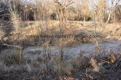
Emigration Creek.
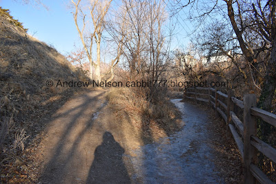
The trail.
The creek again.
Crossing into the no dogs area.
I love the clever social distancing sign. It says: 2019: Respect wildlife from a distance. 2020: Respect each other from a distance.
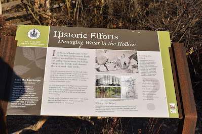
While building the temple, early pioneers built canal from Big Cottonwood Creek in an effort to transport the granite from Little Cottonwood Canyon via boat. It crossed Emigration Creek here. Ultimately, that effort failed.
I also see that Red Butte Creek, Emigration Creek, and Parleys Creek all join before joining the Jordan River. I’ve been wondering about that so, cool.
Downstream.
Little frozen pond.
Very icy trail! Luckily it seems enough dirt has been worked in that it didn’t seem very slippery.
Looking back at the pond.
How humans have disrupted the natural evolution of the creek, and how this preserve aims to restore some of it.
The creek is frozen up here.
I wondered what it is about this ivy that allows it to stay green through winter. Turns out there are evergreen ivies. Huh. Learn something new everyday.
There were a lot of trail splits. But looking back at the map there are just a couple loops. After crossing the creek, I generally just kept right.
All 4 creeks in Salt Lake City spend the end of their journey underground. Emigration goes underground about a mile from here where it joins Red Butte Creek. They pop up again for Liberty Lake and then gone until they (and I assume Parleys Creek) join the Jordan River at about 1300 S. I honestly do not understand the early pioneers desire to bury creeks. But that is what they did. Here, Draper, Bountiful. I am happy to see in more recent years the desire to restore areas along creeks.
Another fun thing this sign confirmed for me, emigration Creek does indeed originate in Killyon Canyon.
Open clearing. Looks like they are revegetating the area. I did see a sign that said they are making improvements to the park.
One of 2 areas that allow you access to the creek.
Which is still quite frozen.
Looking down stream.
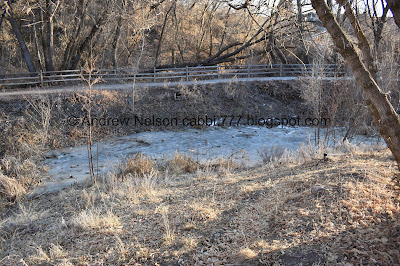
Upstream. I like the layers of ice and you can see the stream flowing over them.
Downstream again.
I think we are nearing the end of the hollow.
Yep, looping back around.
More woods.
Birdhouse.
Back to the clearing.
The creek again.
More of the evergreen ivy. I took a stab and guessed English Ivy, which is where I learned of the evergreen ivies. But, I am not sure if that is what it is.
Back to the pond.
The different animals that use the different layers of life.
The trail again.
The creek below.
After this we passed through another gate and it seemed we were in an off leash dog area. Which the map appears to confirm. Then the park again, and then the parking lot. These parts were quite populated, and I generally try to avoid taking pictures of strangers.
I enjoyed getting to explore more of Emigration Creek, and happy to learn some new facts and confirm a few suspicious. I didn’t particularly love this trail, but I didn’t hate it either, and am willing to return in the warmer months and enjoy it while it is more alive. The park at the beginning was a bit more crowded than I would like, but the back trails were pretty deserted. 7 out of 10 squirrels today.
As for difficulty, it was pretty mild and not much elevation gain. DR3.
Dogs are not allowed for most of the trail, however there is a designated dog section, and what appears to be an off-leash area as well. Pay attention to the signs.
.jpg)


No comments:
Post a Comment