.jpg)
Slate Canyon is a steep, steep climb up an old ATV trail located near Provo. It features a dry creek bed (might have some water in early spring), wildflowers, and some neat rock formations towering above you. I thought with it being an old ATV road it wouldn’t be as steep as described, but boy was I wrong. That was a long hard climb. Granted we did not finish this trail, but it is definitely not my favorite. The effort far outweighed the reward. So it wasn’t really worth the drive for me.
Last fall a hiker filmed as a cougar chased him up the trail here to protect her cubs, the video went viral. Me being the nerd that I am, while fascinated by the cougar, I couldn’t help but notice how pretty the hike looked. So, here we are.

Quick Details:
Length: 7.2 out and back or you can make it an 8.5 mile loop by adding Slide Canyon. We ended up doing about 3 miles out and back today.
Trail Type: Out and Back or Loop.
Difficulty: DR5. This is seriously a climb!
Elevation Gain: about 4000 feet. We did 1000 today.
Restroom: Yes, there are pit toilets at the trailhead.
Dogs? Yes, leashed.
Other Info: There is not a lot of shade on this trail. Summer wasn’t the best time to do it.
To Get Here:
From i15, take exit 263 (us 189/N University Parkway) in Provo. Turn right on Lake View Parkway just after completing the loop. Head east for 3.1 miles (the road will change to 1860 S, then to Slate Canyon Dr,) turn right following signs for Slate Canyon Park. Head up the hill, the upper parking lot is closest.

Keep an eye out for this sign after the road becomes Slate Canyon Dr. (PSP).
The Trail:

View of Utah Lake from the parking lot.

I’ve mentioned it before, but when you start seeing these sunflowers showing up all along the roadways and parking lots, it is nearing the end of wildflower season.

View up into the canyon.

Trail split. I think they reconnect eventually, but uh, take the right fork. We went left a smidge and saw that the trail went down into the creek bed and back up, so we regrouped and went right.

Right off the bat it is pretty steep, and absolutely no shade for the first little bit.

Fun rock formations.

Looking back towards Utah Lake.

Uh oh. There seems to be some construction up ahead.
Like I said, we did not complete the trail, but we did not see any construction on what we did.

Trail sign. This puts the mileage a bit longer than other sources. However, I do note my other source is to the junction, so this might go a little higher up.
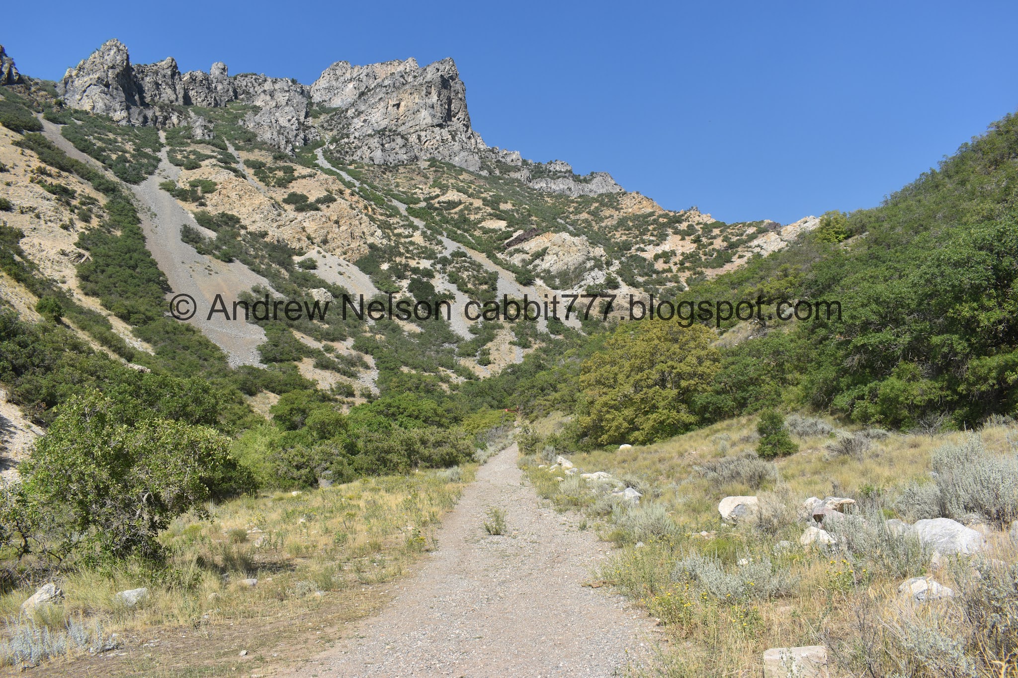
The canyon again.

Looking down canyon.

Before long you will encounter this gate. It’s really only there to stop atv’s from going up the old path.

Starting to encounter some shade. Not a lot, but at least some.

Fun peaks to the south.

To the north.

A nice short flat section.

The first of many times we cross over the dry as a bone creek bed.

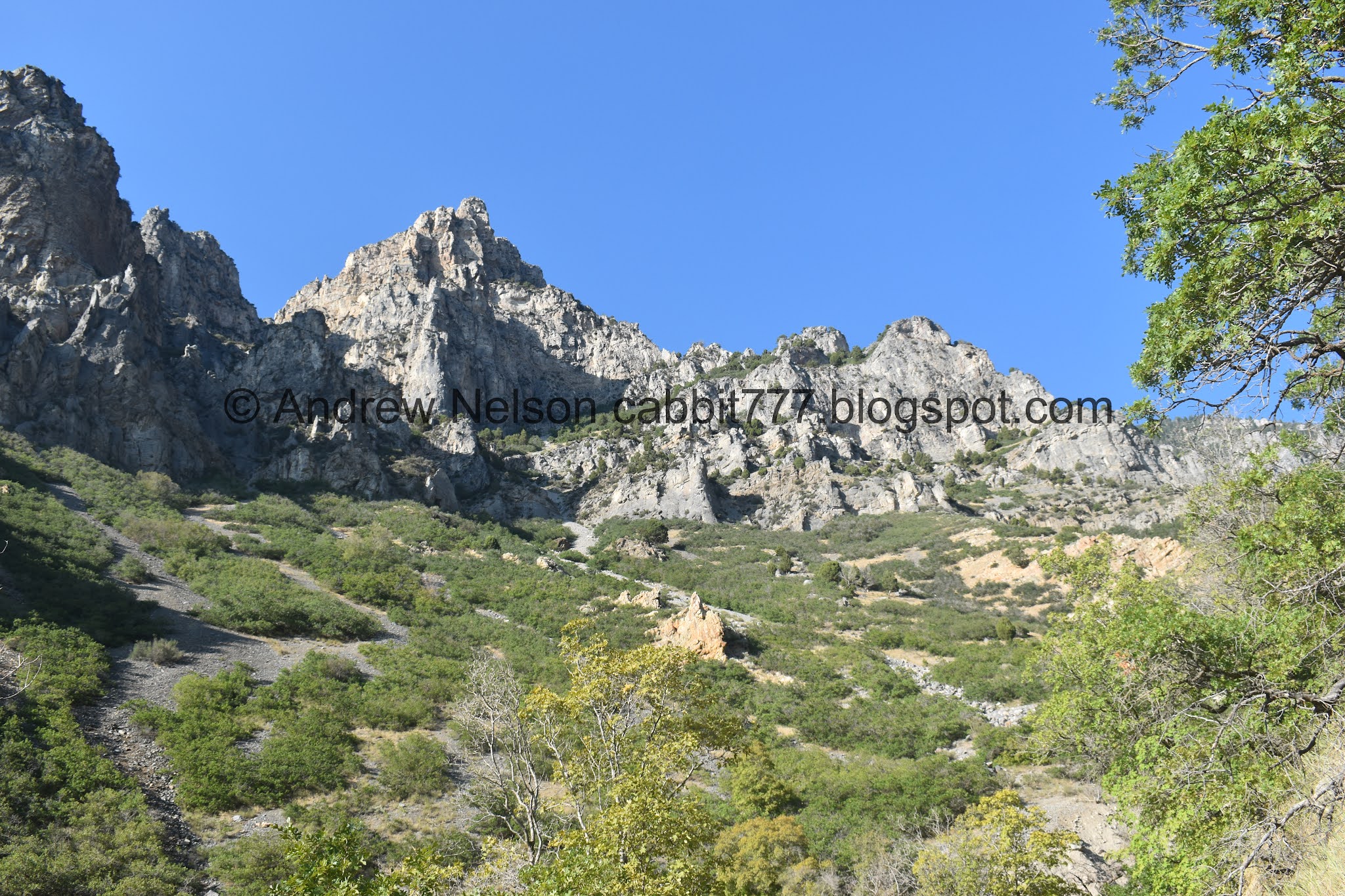
Peaks above.

To the north.

Trail.

Got a view deeper into the canyon.

Cliffs above.

Sunflower.

Second creek crossing.

Up creek.

More climbing.


Fun cliffs.

Lizard.

Cliffs.

Third creek crossing.

With some springs. If google maps is accurate this is Hathenbrook Spring. This is almost a mile up.

It is absolutely surrounded by bees and wasps, and it looks a little gross.

Couple of empty ones.

Kind of neat.

Looking upstream again.

Rather quickly we come to the fourth crossing.

Some neat looking rocks up ahead.

More cliffs.

Fifth crossing.

Pretty butterfly.

Sixth crossing.

Fun rocks.

With a little alcove.

Hanging plants.

More fun cliffs.

Oi. More climbing.

Fun fin.

A couple sporadic wildflowers left to be found.

View down canyon.

Another layered fin of rocks.

Little side canyon.

View up.

View back down.

Found a little camp site.

Daisy.

Seventh crossing.

More cliffs.
Well, we made it about 1.5 miles up. It was a little hotter than anticipated, there was not a whole lot of shade and this was a constant climb, so we called it a day.

This tree is starting to turn already.

Forest.

The rock fins below.

Little lower.

Layered rock fin.

Another cliff wall.

Another little alcove.

View down.


Back down to the spring.

For being in an extreme drought, it is surprisingly green up here. Might be due to the recent rain though.

Cliffs above.
Again.

The other side.
Creek bed with some peaks.

Cliffs to the south.

With the little horn.

To the north.

This rock kind of resembles a grumpy old man.


View down canyon with a nice view of Utah Lake.

Some wildflowers.


We saw a couple turkey vultures at the mouth of the canyon.

View down again.

Panoramic.

Looking back into the canyon.

More sunflowers.
Well, like I said, I didn’t particularly care for this trail. It was a constant climb, without enough shade. Maybe this would be better as a late fall or early spring trail. There were also.. a… lot… of… bees. I don’t know if this is always the case, or just an end of the flower season flurry or what. I did enjoy the various cliffs and rock formations though, and it wasn’t super busy. 6 out of 10 squirrels.
As for difficulty, wow this was a climb. DR5.
Dogs are allowed, but must remain leashed.

No comments:
Post a Comment