.jpg)
Rocky Mouth Waterfall is a beautiful waterfall located in Sandy. It is a super short trail, that is a bit of a climb. Aside from the waterfall the trail features a pretty wooded canyon, a pair of tiny caves (at least 1 of them was a mine), and some wildflowers.

Quick Details:
Length: About 3/10ths of a mile, 6/10ths round trip.
Trail Type: Out and back
Difficulty: DR3. Its definitely a climb, however it is short.
Elevation Gain: About 300 feet.
Restroom: No. Closest one is at Hidden Valley Park to the south, or the Granite Trailhead to the north.
Dogs? No. This is considered watershed.
Other Info: It’s been years now, but just in case you haven’t been here in a while, you can no longer park on Eagle View Dr. And instead have to park at the small trailhead on Wasatch BLVD.
To Get Here:
Take i15 to 90th south in sandy. Follow that east to Wasatch Blvd, turn right. Go about 2 miles and you will see the trailhead parking on the left.

Storm in Little Cottonwood Canyon (Passenger Seat Photography (PSP)).

A little closer (PSP). Looks like it might be snowing up there. Glad I didn’t plan on heading up that way.
The Trail:

Trailhead sign.

Trail rules.

The stairs of doom, part one.

Seriously, how many signs do they have to put up to get through to people?

After the first stairs of doom, there is a short jaunt through the neighborhood on Eagle View Dr.

Switchbacks for the new Bonneville Shoreline Trail (BST) section that leads to Big Willow Canyon.

The original trailhead.

Stair of doom part 2. Oi.

View of the valley below.

After the 2nd stairs of doom, the trail levels out for a bit, and also starts to enter the pretty forest.

Trail split. Forward leads to the waterfall, right is the BST to the south. Eventually there will be a BST to the north here as well, I think in the not to distant future.

Valley view again.

Starting to hit the canyon proper.

The creek below.

Pretty forest.

The first little cave.

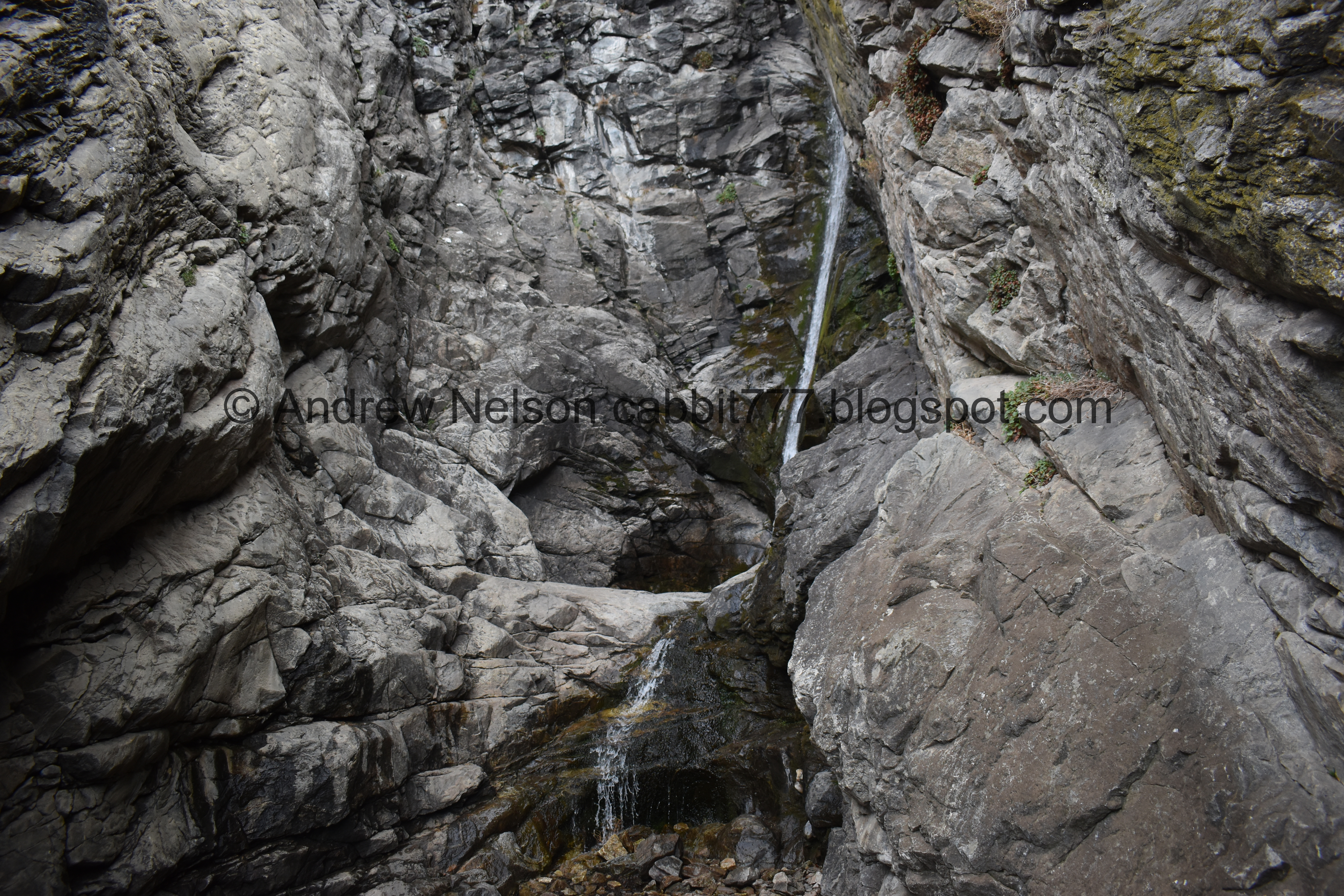
First glimpse of the waterfall.

The second little cave.

We made it, and we have it to ourselves for once!

It’s a thin little guy, but it’s still lovely.
Little closer.

It is set back in a narrow granite alcove.

Landis decided to scramble up to the upper section today. I have done that, way back when I was a teenager, but I don’t think I could manage it now, so I stayed at the bottom.


Landis took a couple of photos while he was up there. I love the little pool.

The lower tier, longer exposure.

Longer exposure of the upper tier.

The full thing.

Looking out of the granite alcove.

Moss and plants.

Top of the waterfall. It looks like the water is running under a wedged boulder.

Full thing.

The alcove again.

Different angle.

The full alcove.
.jpg)
Panoramic.

Looking down canyon.

Moss and plants.
Alright, time to head on back.

The upper cave, which appears to be a sealed off mine.

The creek.

Again.

Down to the lower cave.

Not much to this one either.

Some phlox up on the hill.

Some more.

View of the valley.

We decided to check out the newer BST trail heading south.

Well this is an interesting bridge.

Are those knights? Neat.

I love when they stylize bridges a bit.

Upstream.

Continuing along the trail.

View of the valley again.

Mountains to the north.
.jpg)
Panoramic view of the valley.

Antelope Island.
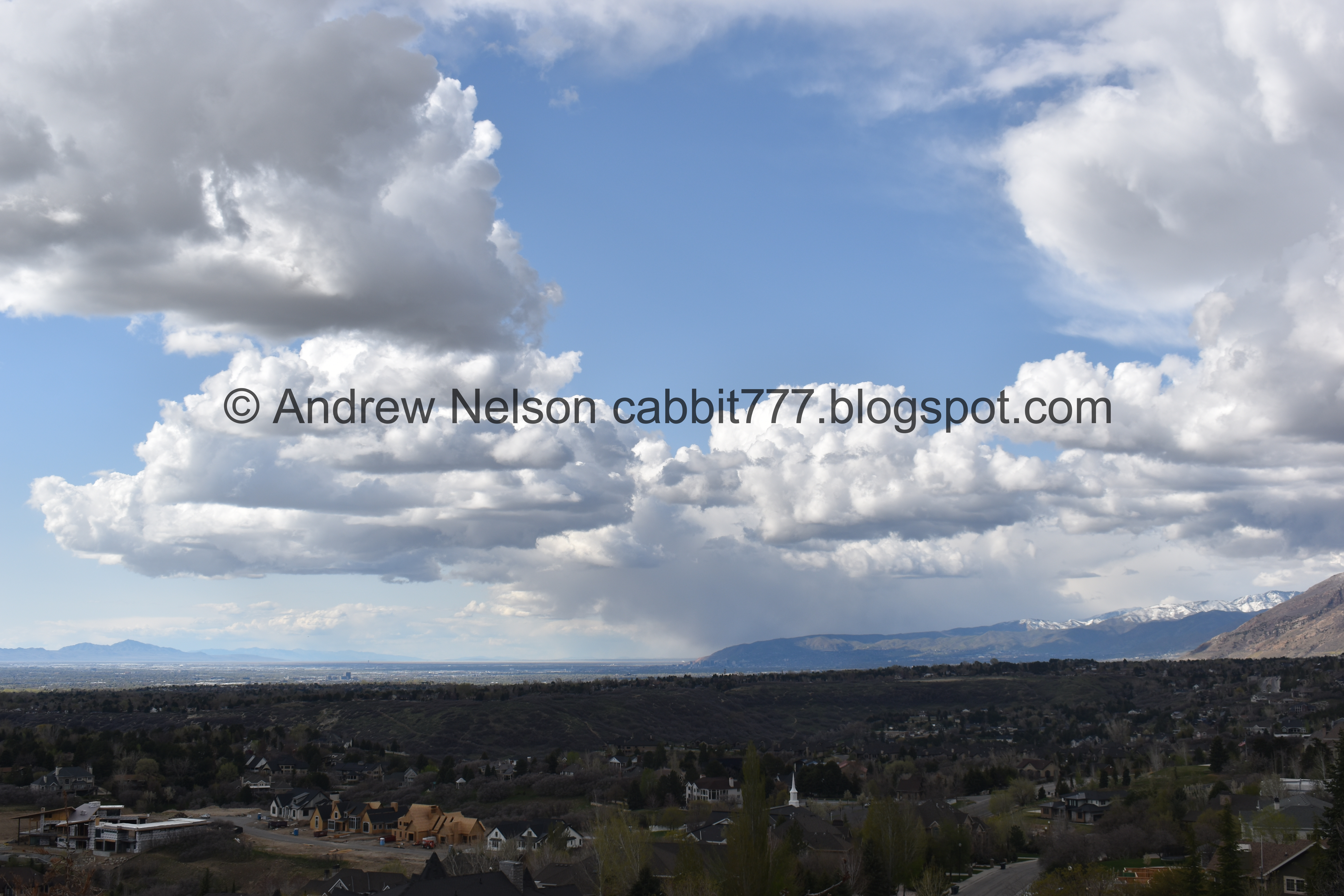
Downtown, with some fun clouds.
Well, I didn’t know anything about this trail and decided it wasn’t worth dealing with the switchbacks unless there was something amazing to see, so, we turned back.

Back to the bridge. 2018 is not so old.

I really just love the bit of whimsy added here.

Minor sign fail here, it appears the BST continues north, by heading right here. The plan is for the BST to continue north from here, but it does not do so at the moment. I think this sign is meant to point back this direction, but doesn’t quite do that.

Valley view again.

Heading down the stairs of doom part 2.

The short jaunt through the neighborhood.

The stairs of doom part 1.

Back to the trailhead parking. Woo.
I love this trail, I have been hiking it since I was a teenager, in fact as far as I can recall it was not named back then, so I always just called it my waterfall. I don’t remember how I found it, but when I did I dragged any and all of my friends and family up to it with me that were willing. It’s been a long time since I have had some alone time with the falls, so I loved that today as well. 10 out of 10 squirrels.
As for difficulty, it is quite a bit of a climb, but it is short. Finalizing on a DR3 today.
Dogs are not allowed due to watershed restrictions. Please leave Fido home for this one.

No comments:
Post a Comment