.jpg)
Bourbon Lake is a absolutely stunning lake located in the High Uintas. The trail features a lovely mixed forest, a creek, wildflowers, and a pair of high alpine lakes with a scenic peak as a backdrop. Unlike many of the other trails in the Uintas that are becoming increasingly more crowded, this one is still a little on the quiet end. We have done this one before, but my camera died, so I wanted to come back.
I have been trying to get us up into the Uintas like, all summer. With the holiday weekend, It finally happened today and I was super glad we got up there at least once. We didn’t go at all last year.
.jpg)
Quick Details:
Length: It is about 1.6 miles to Bourbon Lake and about 3/10ths of a mile around the lake and to the 2nd lake and back to the trail for a total of a 3.49 miles balloon. Or you can do a 3.2 mile out and back.
Trail Type: Out and back, balloon option.
Difficulty: DR3. It’s a bit of a climb, but fairly gentle switchbacks.
Elevation Gain: About 860 feet.
Restroom: No. I am pretty sure there is one in the Sulphur Campground across the street, or next one I can think of is at Ruth Lake to the west.
Dogs? Yes. I do not believe there are any leash restrictions. But please clean up after your furry friends.
Other Info: Fee area. Surprisingly it is still $6.00 per car for a 3 day pass. I expect that to go up before long though.
To Get Here:
From Kamas drive up the Mirror Lake Highway, head over Bald Mountain Pass, and continue past Mirror lake. The small parking lot is exactly at Mile 39, on the left, across from the Sulphur Campground.

Heading up Parleys Canyon (Passenger Seat Photography (PSP)). Look at all of that traffic coming down! I bet every single dad rushed their families this morning saying “We gotta beat traffic”.

Passing Jordanelle (PSP).

On the the Mirror Lake Highway (PSP).

Super pretty up here (PSP).

Those bushes are starting to turn (PSP).

They are cleaning up the trees along a long stretch of the road (PSP). I am sure they know what they are doing but 100’s of piles of drying wood doesn’t seem very fire safe.

Starting to become nice and green (PSP).

I believe this is Mount Watson (PSP).

Then as you swing around you can see Reids Peak and Bald Mountain (PSP).

.Bald Mountain Pass (PSP). 10,759 feet in elevation. I believe it is the highest paved pass in Utah. For some reason they don’t have the elevation on this side, but they do on the other side.

More pretty mountains (PSP).

You pop in and out of Summit County a few times (PSP).

Mile Marker 39 right across from the trailhead.
The Trail:

Trailhead Sign.

A reminder you are in bear country. I have never seen a bear in Utah. I’ve seen them in Yellowstone, but never here. But that doesn’t mean they aren’t here.

An aspen tree starting it’s change.

View across the canyon.

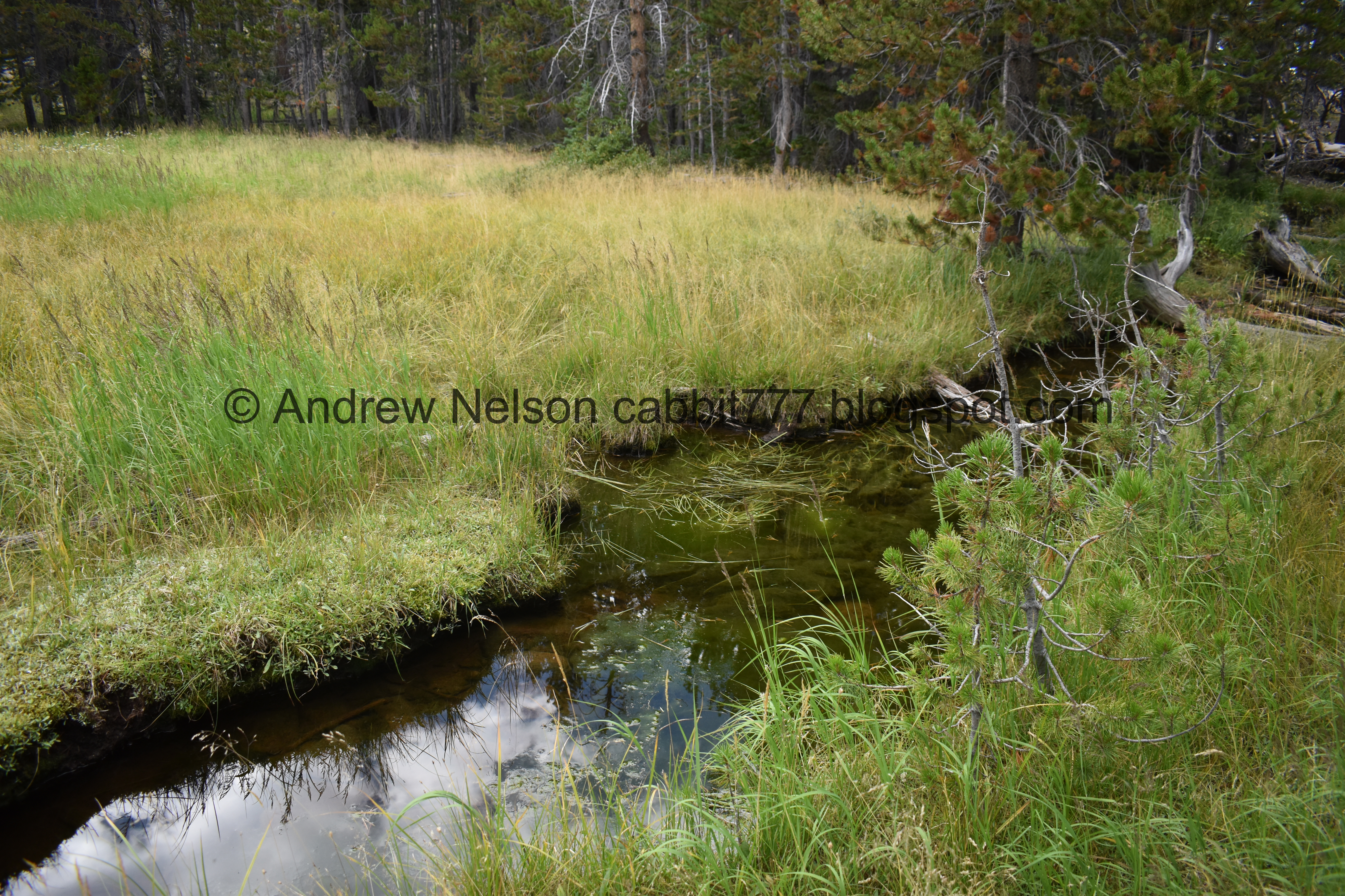
Whiskey Creek.

They have shored up a couple parts of the trail.

Found some paintbrush.

Pretty forest.


A more aspen filled section.

A downed tree. There are quite a few fallen trees up here. Probably not a great place to be on a particularly windy day.

More signs of the incoming season changes.


Whiskey Creek again.

Mixed forest.

Small side stream that was dry today.

I’m still not sure what this is supposed to be. I am sure it is meant to keep wildlife out, but for what? My only guess is maybe the stream comes from a spring in there? and for some reason they don’t want animals in it?

These kind of look like lodgepole pines to me.

Split rock.

Super thick forest through here.

This trail is really pretty.

Another little stream. I think this is what comes out of Bourbon Lake, and eventually joins Whiskey Creek.

Eventually we cross it.

With a lone flower.

A fallen trees giant root ball.

A tree fell over the main trail so there is a new desire path around it. I’m pretty sure this wasn’t here last time.

Cute white flowers.

Landis found a cute little stump seat to rest on.

Then the switch backs start. As far as switchbacks go these are fine. The first time I did this trail I got a little nervous (for the unexpected), but they are not bad at all.

Nearing the top. Seriously, whoever navigated this trail did a good job of getting you up the hill without making it too rough, or scary (for people like me, with a fear of heights).

After the switchbacks you get a break from the climb for a little bit.

And are treated to another section of thick thick forest.

Lots of fallen trees.

There a little clearing back there.


More thick forest.

Another little clearing.

Another section of trail with a tree fall blocking the path. Two here! We watched the couple ahead of us go back and forth here and were wondering what the hell they were doing, but now it makes sense haha. We opted for the left side where the trees were the lowest to step over. I’m fairly certain this was new too.

We noticed quite a few burned trees. I guess there was a fire up here at some point.


More forest.

Looking up.

And… more switchbacks. These ones are even more mild than the previous ones.

I’m pretty sure we are almost there.

The little stream again.

The first little lake. We’ll come back to that.


More forest.

We made it! Bourbon Lake.

I don’t know if that peak is named, but it makes a pretty back drop and nice reflection.
.jpg)
Panoramic.

It is really a nice lake.
Another panoramic.

The peak again.
Last time we were here my camera decided to take a dump just as we arrived to the lake. So I got frustrated and we just went back. Today we opted to go around the small lake.

Nearing the far end.

The trail around is a little faint, but it is there. There was also a trail split. It look like the other direction leads to some small clearing? Or possibly elsewhere.

From the far end.

One of the inlets.

The lake again.

Another inlet.

The lake again.

Nice reflection.

Looking up at the un-named, er well, unknown by us name, peak.

The lake again.

I love the way trees look reflected in lakes. It looks like a sound wave.
.jpg)
Another panoramic.

A final look back at the neat peak.

Nearing the front of the lake again.

The outlet.
The trail continues along the outlet for a minute and I was hoping that it would just lead us to the smaller lake. It did!


Lovely forest.

The smaller lake. I don’t know if it is named.

With some reflection.

The lake again.

Inlet.
About here the trail kind of fizzled out. But I knew there had to be a way back to the main trail. We’ve been out to this little lake before.

Forest.

We did find the main trail again before too long.


More forest.

Some new growth.


It is just so pretty up here.

Down to the flatter section.

Down to the double tree barrier. From this direction we went to the right where the trees are lowest.

Super thick forest!

Looking up.

A big fallen tree caught by a split tree.

Little meadow.

With that random peak.

Thick trees.

At the top of the ridge we have a pretty good view.

Back to the switchbacks. I lost count of how many there were both on the way up and down haha. But this is seriously the worst of it.

The next one.

Some more forest.

Another switchback.

4th one.

5th one.
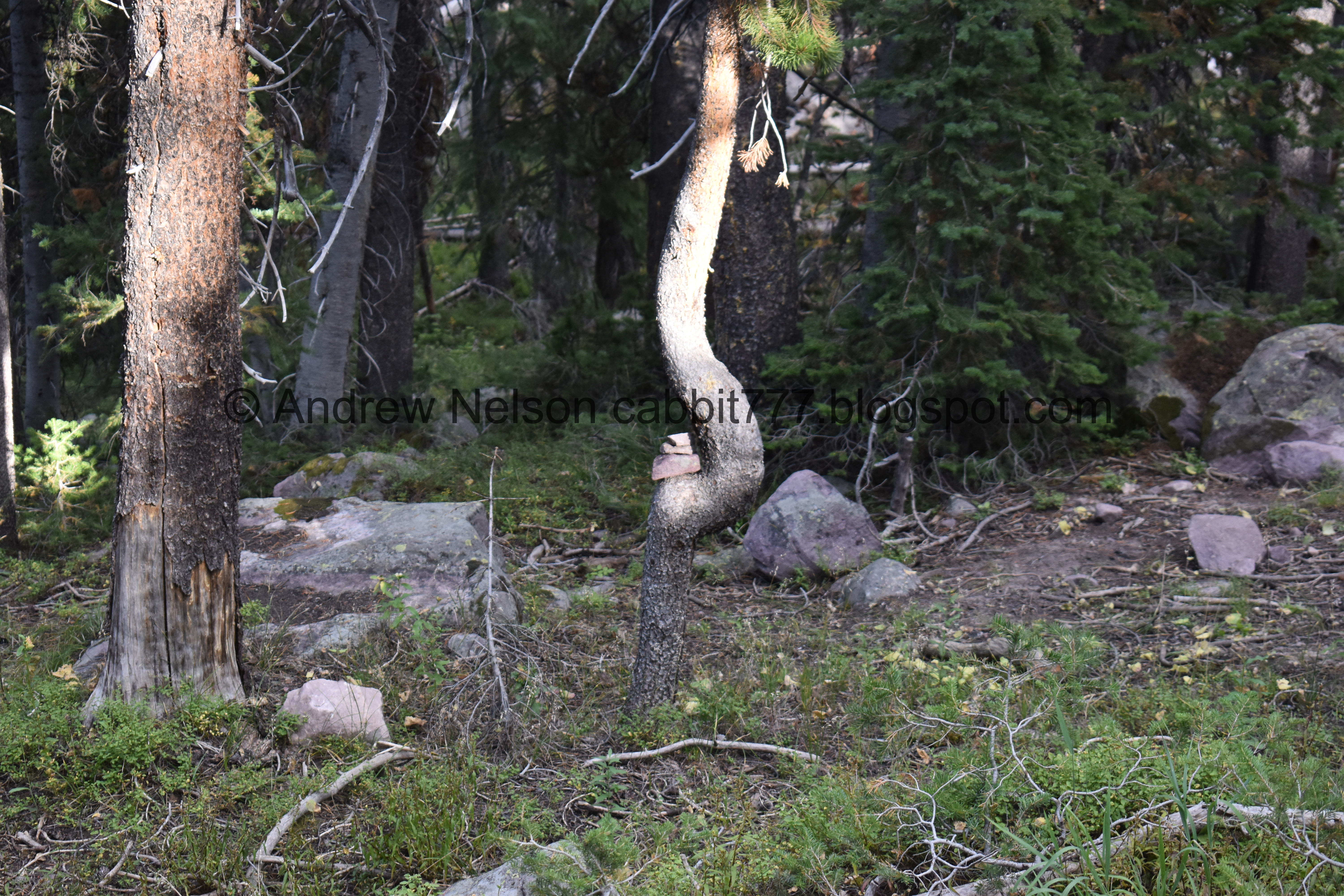
Little cairn on a curvy tree.

6th switchback. I think there are 2 additional ones, not sure if I caught them all.

New trail around another fallen tree.

More forest.

Crossing the little creek again.


More forest.


Back to the random circle of fence.

More new growth.

8th switchback (I am certain I missed at least 1) with a view of Whiskey Creek. I am certain there is at least 1 more, so 9ish switchbacks for the lower section.
This switchback is a little sketchy, but not like super dangerous sketchy. Just a short drop off to the creek below.

The creek again.

Paintbrush.

An aspen starting to turn.

Hitting a more aspen thick area.

View across the canyon.

The creek again.

Pretty thistle.

View across canyon again.

I wasn’t quite sure what these were at first.

But now I just think they were unopened daisies.

Purple and yellow.

Some more plants changing color.

Clump of mushrooms.

Angry squirrel at the trailhead.

Heading back down the Mirror Lake Highway (PSP).

Moon rising (PSP).

Bald mountain (PSP).

The summit of Bald Mountain Pass (PSP). 10,759 feet. Whew!


The long drive down (PSP).

Painted cattle guard (PSP). Random fact I learned, these painted cattle guards work just as well as regular cattle guards, without being a rumble strip for cars. I guess the cows see the painted lines, and assume there is a gap like, well, I guess the now old fashioned cattle guards. It is neat to see one in the wild.

We saw a deer next to the side of the road and Landis came to a stop (PSP). It decided to turn around and bolt way rather than cross. Either way, thanks for not jumping in front of us!
We have a spot that we like to stop and take a break, stretch our legs etc. There is a big tree that I have spotted an owl in once, so I was looking for an owl when I suddenly spotted this.

Well hello little guy.

An adolescent racoon! Since he isn’t harassing my dogs, and is just being chill in in the tree, I can totally appreciate the cuteness.


After a moment, I decided to grab the telephoto lens and got to watch him giving himself a bath. Very cat like.

Eventually I got a nice shot of his cute face.


Soooo cute!
Then because the sun was in our faces, we decided to stop in Park City for some supper.

Heading down Parleys Canyon with a smidge of sunset (PSP).

The Salt Lake valley at the tail end of sunset (PSP).
I really hate the drive, but I love the Uintas! It is seriously so pretty up there and makes the drive worth it. I really need to get up there more often. I also really like this particular trail. Its not super busy, but it is super pretty. We didn’t see any wildlife on the trail, but I did appreciate what we saw elsewhere. It was a bit of a climb, but not too bad. 10 out of 10 squirrels.
As for difficulty, there is a bit of a climb, but its not too bad.
Dogs are allowed, but I am not 100% sure on the leash rules. It seems like leashes are optional, but again, I can’t confirm that. When in doubt I tend to err on the side of caution and leash, but that’s me.

No comments:
Post a Comment