.jpg)
Willow Heights it an absolutely incredible trail located in Big Cottonwood Canyon. The trail features some beautiful mixed forests, wildflowers, a nice little lake, and a good chance of seeing wildlife. That combined with the fact it’s not too tough makes this one of our favorite hikes and lately we have been doing it a few times a year.

Quick Details:
Length: The east trail to the crossroads is about a mile. The west route is 9/10ths of a mile. And the loop around the lake is about 8/10ths of a mile. For a total of 2.7 miles.
Trail Type: Loop, Figure 8, out and back options.
Difficulty: DR3
Elevation Gain: About 650 feet.
Restroom: No. Closest one I can think of is at the Solitude Nordic Center (Silver Lake).
Dogs? No. Big Cottonwood Canyon is watershed.
Other Info:
To Get Here:
Head up Big Cottonwood Canyon about 11.6 miles up from Wasatch. It is just past the Silver Fork Lodge. About halfway between mile marker 13 and 14 there will be a boulder on the left (north) side of the road. If you reach Solitude you went too far, but don’t worry. the canyon ends at a loop that will easily turn you around.

Wildfire smoke blowing in from Idaho has made the air pretty nasty (Passenger Seat Photography (PSP)).

Mouth of the canyon (PSP).

The split rock you drive through (PSP).

The new Brighton Sign (PSP). We noticed this for the first time last time we were up here. Apparently they voted to incorporate into a town in 2018, and it took effect January 2020.

Heading up (PSP). There was a marathon this morning, which looks like they stopped the infernal construction for the day, so that was nice.
The Trail:

The trail marker stone.

Into the woods.

Not far up you will come to the trail kiosk. They still have not updated the sign with the new trail re-routes.
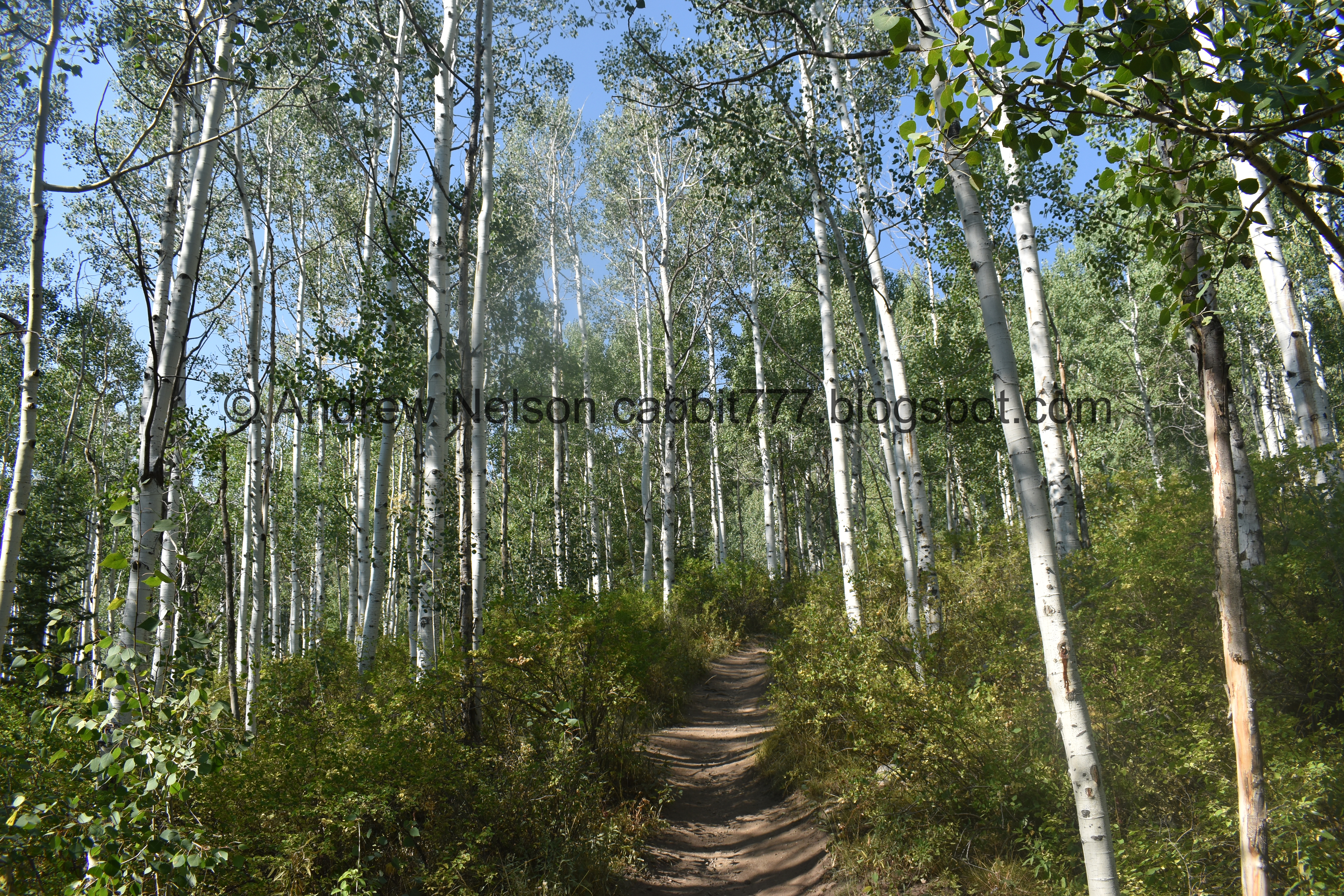

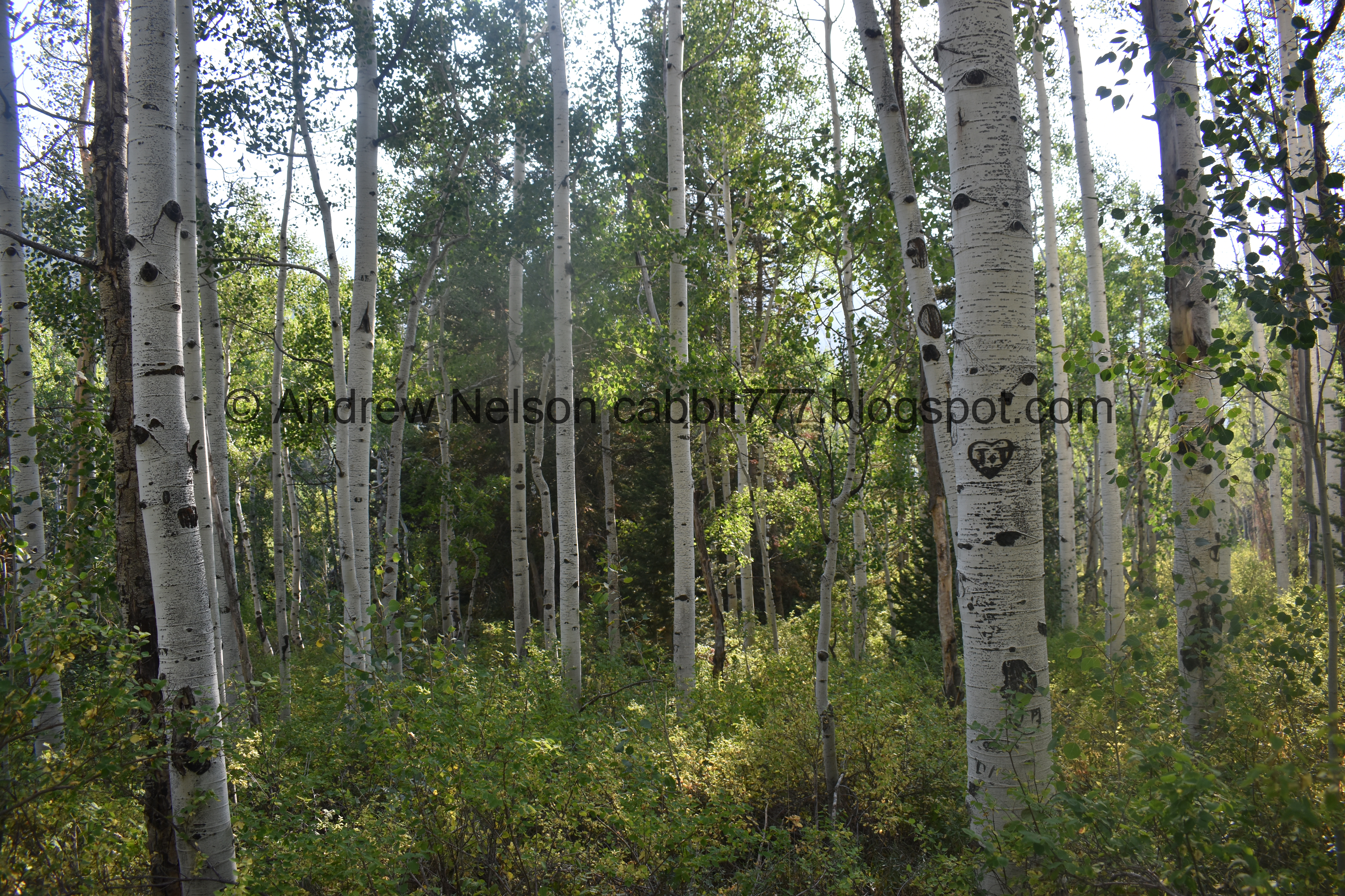
Aspens.

We were curious what might have made these holes. Seems to big for squirrels, and I’ve never seen potguts up here.

The old route, and the reroute. The old route was a a steep rocky climb. I like the reroute.

More forest.

The new trail split. I have done both ways several times now, and I really prefer to go up the east route to the right. It is a little bit longer, but it is so much easier.

More forest.

The old trail appears to be filling in nicely.


Small patch of early changers. I bet we’ll start seeing some more color next week.

You do most of the climbing on this first switchback, Towards the end of it I get a little iffy with my fear of heights, but I did better today than last time cause I know it’s short.

View down.

The first switchback.

Still a bit of a climb on the 2nd switchback, but it’s not too bad.


There are still some wildflowers to be found.

Looking across the canyon towards Silver Fork. Still quite smoky, yuck.

Hitting the really thick stand of aspens.

This is new, but easy to step over.

The old trail again.

More aspens.

The 2nd switchback.

Passing the original trail again.


More forest.

3rd switchback. After this the trail is a cakewalk.


Cute little butterfly. I think it is a woodland skipper.

More aspens.

4th switchback.


The aspens are super thick through here.

Some nice flowers.

The 5th and final switchback.

Looking up.

More forest.

Where the reroute meets the original route. So we’ll be on the original route for the rest of the way.

More aspens.


Starting to hit a mixed forest.

Eventually you will hit the big meadow. This means you are almost there.

Some flowers with a bunch of bumblebees.

The big meadow.


I love the cone shaped peaks up here.

Creepy looking cricket.

Down canyon.

Little depression. Earlier in the season this is a little pond.

About a mile later we reach the crossroads.
Left leads back down to the trailhead via the west route. Forward and right go around the lake. I generally prefer to go the forward route, towards the west side of the lake. It offers the best view.

View back across the canyon.

More flowers.
First view of the lake.
.jpg)
Panoramic.
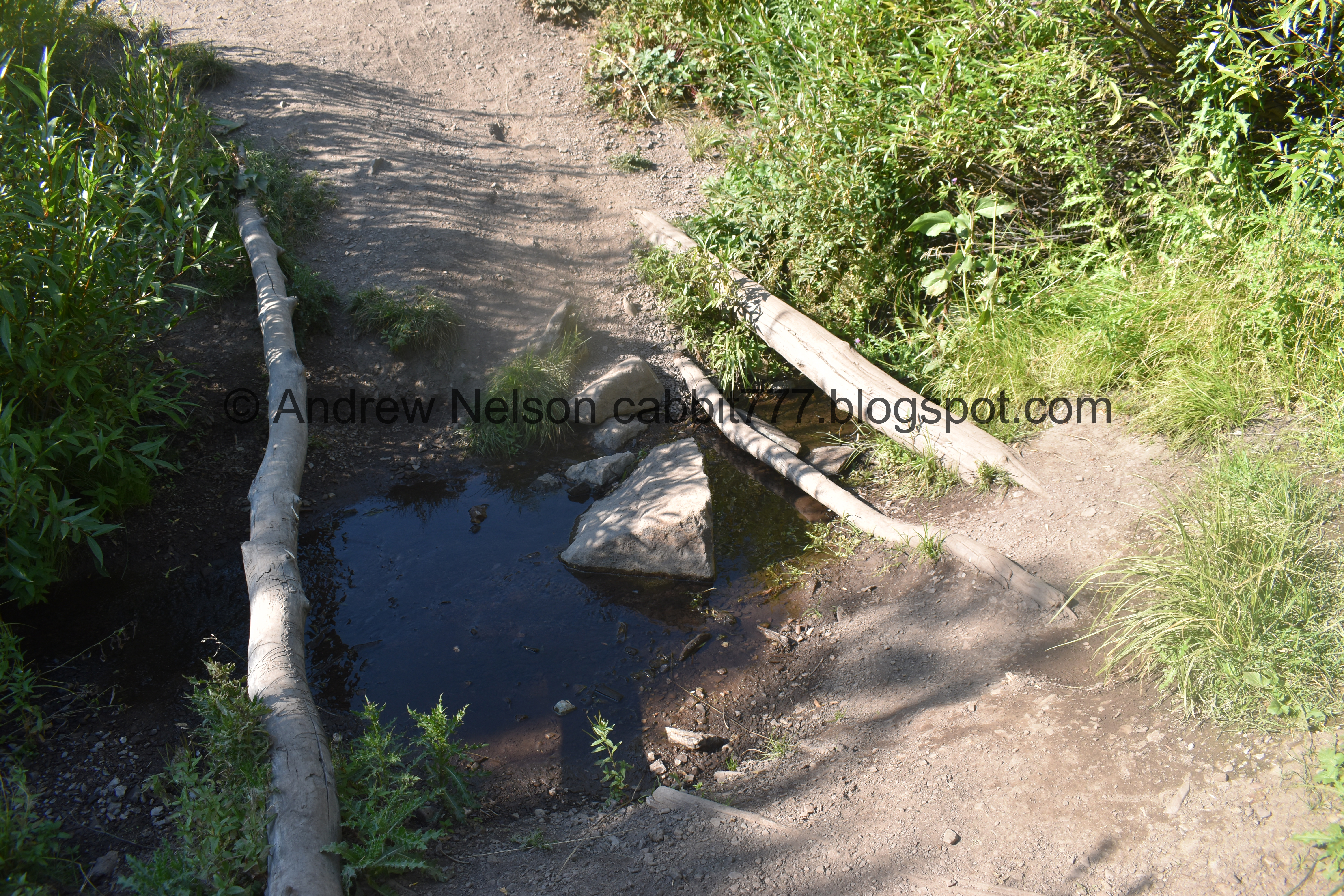
Crossing the outlet. There is currently not a bridge here, but with the improvements they have been making I would not be surprised if there is one eventually.

Thistle.

The lake again.

Western cone flower.

We found one that was split open, so this is what it looks like inside.

Paintbrush.

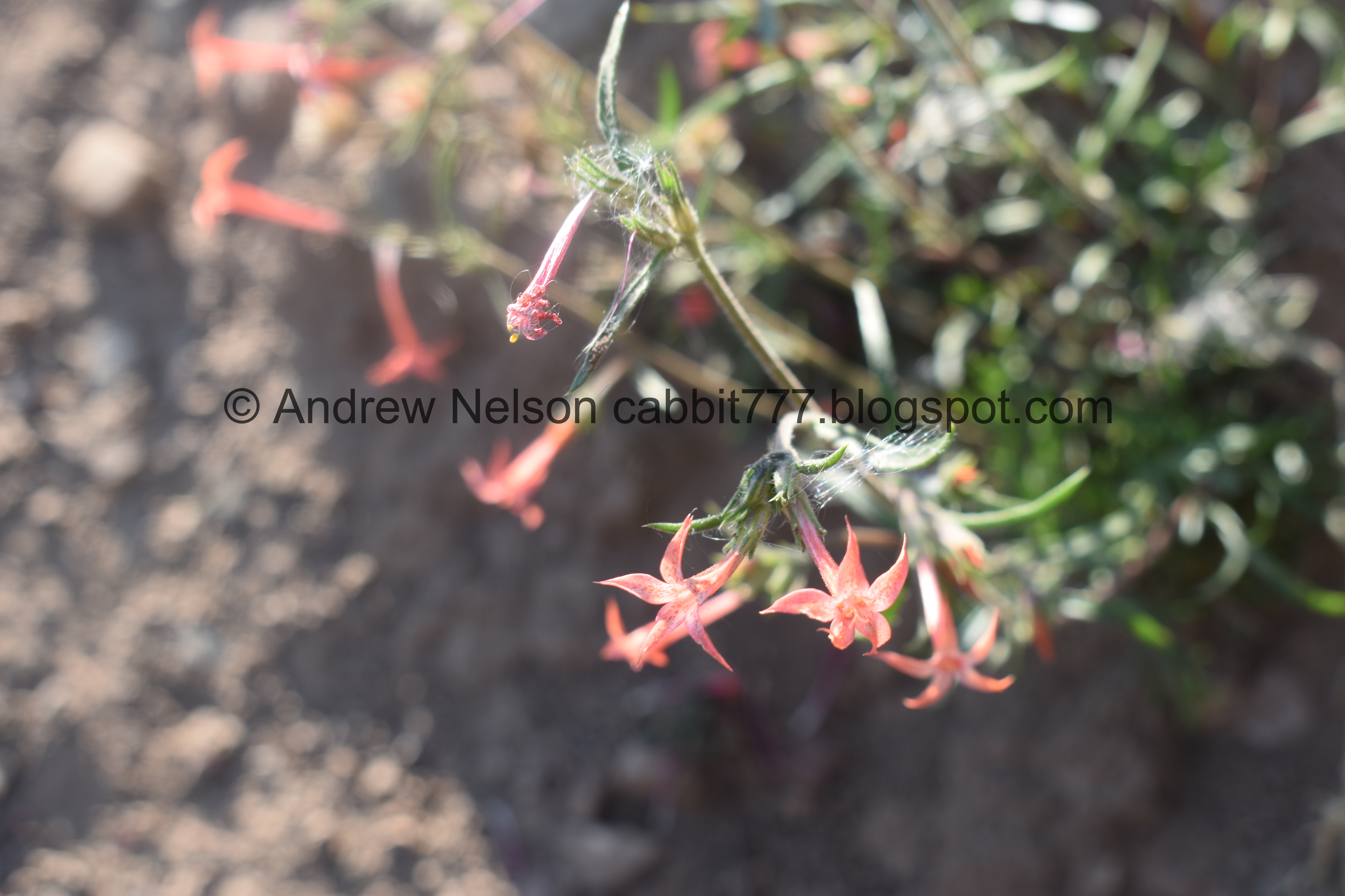
Skyrocket.

And even a geranium. Nice little pocket of wildflowers still holding out.

Duckies!

The lake.
.jpg)
Panoramic.
Another couple that was up here let us know we just missed a moose. And then…

This cute little guy popped out for a second, then went back in. So we decided to go around the other way to see if we could spot him again.

All the way on the other side of the lake and no moose. Damn. Well, we decided to continue the loop from this side.

More forest.
The loop around the lake, does not actually skirt the lake. It goes into the woods behind. I believe this is due to the fact that the area is quite swampy in the spring.

Quite overgrown.


Pretty woods.

There are quite a few fallen trees that happened during the big wind storms we had in September 2019.

More forest.

Looking up.

Willows.

In spring this will be full of water.

Back to the lake.

Again.


Duckies!

And look who’s back?

Had to pull out the telephoto lens.

This sparked a debate about whether or not he was big enough to be separated from mom yet. We eventually got our answer to that.


I thought he was heading back into the woods, but was mistaken.

He was looking for a snack.

Duckies!
We decided to go around to the other opening to see if we could see the moose better. It seemed far enough away.
We couldn’t see if from the alcove so we slowly crept around the bushes.

Oh he had laid down.

Oh shit, he got up to look at us. We’re too close! We backed up immediately. I feel bad. I really do try not to disturb them. Plus, I know they can completely ruin my day if I do so.
The general rule of thumb is: If they stop what they are doing to look at you, you are too close.
Anyway, after that we decided to head down.

Then we found mom in the trees. Terrible shot, but I am not going to get any closer to try and get better.
So that answered that question of whether the baby was old enough, he’s not. I of course had to know when they are, and I found that calves will stay with mom all the way up until just before the next calves are born. So spring, and they are pretty much full grown.

Back to the crossroads. Left goes back around the lake, forward goes down to the trailhead via the east route, and right goes down to the trailhead via the west route. We decided to go that way.

View across canyon.
.jpg)
Panoramic, which shows both trails as they cross the big meadow.

Back into the woods.

Short reroute.

The new upper bridge.

The creek looks pretty dried out through here.

Paintbrush.

Some mint starting to dry up.

Geranium leaf that has turned.

The old route, and the longer reroute to the left.


More early changers.

More forest.

The underbrush is starting to change color.

View across the canyon.

This side of the trail is a bit steep and rocky.

Keep an eye out for this sign that will get you back to the trailhead. It is after the 4th switchback, and makes the 5th. If you miss it, its not the end of the world, but that will add a bit extra, you will have to walk through a neighborhood and then walk up Big Cottonwood Rd for a bit. We actually did that once by mistake.


More thick aspens.

The new lower bridge.

Just after the bridge is the split for the two trails. Right is the way back.

Aspens.

Oh, we found a trail counter. This just counts how many people pass by it.

More aspens.

Back to the trailhead.

Up canyon.

Down canyon.


Heading down (PSP). Oof it is smoky!

Storm Mountain (PSP).
I love this trail! I love it even more with the reroutes. I just really enjoy walking through a thick aspen forest, I love the wildflowers, I love that we often see moose up here. The lake is not shabby either. It was not terribly busy today either. 10 out of 10 squirrels.
As for difficulty, the west route is tougher than the east route, but both are not too bad. DR3.
Dogs are not allowed in Big Cottonwood Canyon due to watershed rules, so be sure to leave Fido home for this.

No comments:
Post a Comment