The Big Rock Fork in Yellow Fork Canyon is a wonderful stroll through the woods. The trail features a beautiful forest, and a creek. It is a great option to take in the fall color as well. It’s also not very busy so you have a higher chance of seeing some wildlife along the way. The Rose Canyon/Yellow Fork Canyon area has lot and lots of trails to explore so we find ourselves here fairly often, including doing this fork before.
Quick Details:
Length: We did about 3 miles out and back, but it does keep going.
Trail Type: Out and back, longer loop and balloon options.
Difficulty: DR3. It really is just a light climb.
Elevation Gain: We did about 475 feet today.
Restroom: Yes, there is a vault toilet at the trailhead.
Dogs? Yes, leashed.
Other Info:
To Get Here:
Oh boy. From i15 take exit 289 for Bangerter Highway. Go about 5 miles and turn left on 13400 S. Go about 3 miles and turn left on 6400 W,/Rose Canyon Rd. .6 miles later turn right to stay on Rose Canyon Rd. 1.4 miles later turn left to stay on Rose Canyon Rd. About 2 miles later will be the trailhead parking.
If you are starting from Bangerter and are north, Start from 13400 S. But turn right, then follow the rest of the directions above.
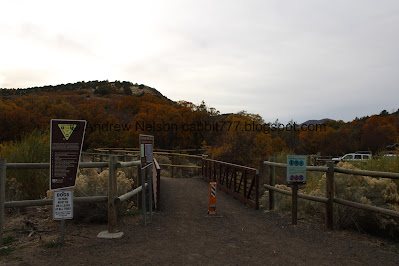
From there, cross the bridge over the creek and take the right fork. Or you can hike up the dirt road on the right (north).
The Kennecott Pit Mine as we head west (Passenger Seat Photography (PSP)).
Heading up Rose Canyon Road (PSP).
As far as thin canyon roads go, this is not bad at all (PSP).
Step Mountain and some color from the parking lot.
The Trail:
Rose Canyon (left) and Yellow Fork Canyon (right). Both look pretty colorful right now. We opted to do Yellow Fork again. So, across the little bridge we go. One of these days I will amp myself up enough to hike the ridge between them called Water Fork Ridge.
Rose Canyon.
The bridge over Rose Creek.
Rose Creek.
We finally got a closer view at the artistic directional marker. Here is the east side.
The north side.
The fencing is new.
Yellow Fork Creek.
Some color.
The color looks way more vibrant on the other side of the canyon. Man, I swear that is the story of my life chasing fall color, its always better on the other side.
Yellow Fork Creek is at the bottom of a 20ish foot deep gully through here.
Across the canyon again.
Forest.
Nice color.
An analog beaver dam. They build these to reproduce the effect of beaver dams in the creek, which benefits the entire ecosystem.
The trail.
Neat rock.
The big clearing.
Color on the other side.
Some color on this side.
The gully that Yellow Fork Creek is in slowly working its way up. If you stay on the main Yellow Fork Trail you will see the gully pretty much disappear. All I can figure is the type of soil changes.
More color across the canyon.
More color.
Some reds.
The ridge between the next fork.
Panoramic. The main Yellow Fork Canyon to the right, and Big Rock Fork to the left.
More color.
At about a half mile you reach the trail split. We’re going left onto the Big Rock Fork. Right will keep you on the Yellow Fork Canyon Trail.
This is a pretty canyon.
A particularly large lean-to structure. Holy crap.
More color.
A very dry creek bed. I guess it is likely just a run off channel.
More color.
The trail.
Color.
Again, the color on the other side of the canyon looks better.
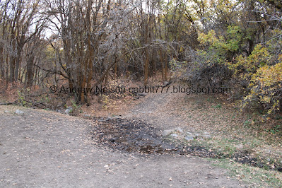
Well how convenient. The one place where there is water in this stream, is where we have to cross it LOL. It is easy enough to step over though. There must be a spring up there somewhere.
Into some thicker woods.
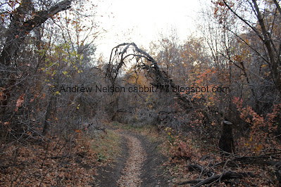
You know, this is what I was kind of hoping to find for my Halloween weekend hike. Just some dark twisted woods, without anybody around. A perfect kind of spooky hike!
Looking up.
Some color.
Most of the reds are pretty much done.
Twisted woods.
More color.
The creek bed is back to being dry.
Color.
Looking up.
Color.
Well, hello there!
Color.
I love the leaf littered hillsides.
Color.
Looking up.
Spooky woods.
Hillside.
Forest.
Hillside.
Leaf littered tree tunnel.
Color.
Evergreens on the ridge.
Well that is a spooky looking tree.
At 1.5 miles you reach this big clearing with another major trail split. Right will continue the loop around Big Rock and eventually connect to the main Yellow Fork Trail. I believe that is approximately 6.8 miles. Left looks like it will connect to Rose Canyon for another longer loop option.
Found a couple more deer up here.
The clearing and some color.
Panoramic, which shows both trail options.
Okay. We got a late start today and were losing light, so we decided this was a good spot to turn back.
Heading back down.
Twisted woods.
The spooky looking tree again.
Color.
Looking up.
More color.
Spooky tree tunnel.
Hillside.
Forest.
The dry creek bed.
Hillside.
Color.
Some more deer friends.
More woods.
I guess I liked this spot.
Color.
More deer friends.
Color.
Twisted woods.
Color.
Tree tunnel.
Color.
More deer friends.
Color.
Forest.
Looking up.
Creek crossing.
Color.
Random crow to add to the fun Halloween hike. All we are missing is an owl or a bat.
Little clearing.
Color.
Back to the big clearing in Yellow Fork Canyon. Just a half mile to go.
Clouds.
Color.
Up Yellow Fork.
Down.
Its starting to get a little dark for decent photos.
Color across the canyon.
Continuing down.
Color.
Yellow Fork Creek in the bottom of it’s little gully.
Back to the trailhead. Hooray, we made it back before dark dark. haha.
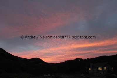
Not a bad sunset!
Well, that was a great little Halloween hike! Nice and spooky, but also pretty. We ran into a few people in Yellow Fork Canyon, but absolutely no one on the Big Rock Fork. There was still a little bit of color to enjoy, but we have definitely seen it more vibrant than today, but they generally seems to be the rule this year. The particularly warm fall made for a weird leaf peeping season. Anyway, 10 out of 10 squirrels today.
As for difficulty, it is a very mild climb DR3.
Dogs are allowed, but should remain leashed. Please clean up after your furry friends.
.jpg)


.jpg)


.jpg)


