The Lower Bell Reservoir in Bell Canyon is a particularly stunning reservoir located near the mouth of Little Cottonwood Canyon. The trail features great views of the Salt Lake Valley, and the mountains above as well as a pretty reservoir. Above the lower reservoir this canyon offers 2 waterfalls and an upper reservoir, so it is a very, very busy trail. But, it is one we rather enjoy and tend to do pretty often. Today we decided to go up to the lower reservoir, and then do the long loop of the little valley around it.
There are now 3 trailheads to access this trail system. The newest one being the Bell Canyon Preservation Trailhead. The other options are the Granite Trailhead and the Boulders Trailhead. I used to prefer the Boulders trailhead, before they rerouted that trail, and before this one existed. But now that this trailhead exists, it is my preferred route up.
Quick Details:
Length: We did a 2.3 mile balloon today. But it is about 6/10ths of a mile just to the reservoir.
Trail Type: Balloon, Out and back option.
Difficulty: DR3. This one is quite a climb in the beginning, but it mellows out.
Elevation Gain: About 518 feet.
Restroom: Yes, there are flush toilets and running water at the trailhead.
Dogs? Bell Canyon is watershed.
Other Info:
To Get Here:
Take the 90th south exit from i15 and head east up to Wasatch Blvd. Turn right. Go about 600 feet and turn left. Head up the hill. There is a big parking lot at the top, and 2 smaller lots just below. Both access the trail, but the upper lot is shortest.
Well sad. Yet another old plot of land apparently got bought up by a developer (Passenger Seat Photography (PSP)). All the remains of the neat old cabin is an old chimney. So, by this time next year there will be 20 houses stuffed in here. The same thing just happened to another old plot of land just slightly west of here.
I found what used to be here on google maps.
The view from the upper trailhead.
Downtown.
Little Cottonwood Canyon.
The ridge we will be climbing. You can see it is a busy trail!
The Trail:
From the upper parking lot the trail starts out pretty wide.
Pretty quickly it connects to the original trail from the Granite Trailhead. You want to swing right here.
Speaking of the Granite Trailhead, every time I pass by it, it is still absolutely packed! It really baffles my mind that it is still so popular with this new trailhead now available! From what we have seen there are no foreseeable plans to close that trailhead. Which is totally the opposite of what I was expecting when this trailhead was completed.
Little bit of color on the hills.
The valley below.
The trail is quite rocky.
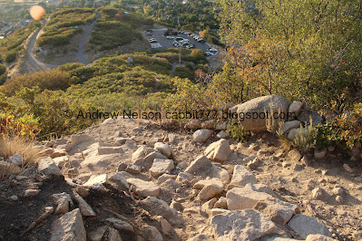
Looking back down at the trailhead and the Nature Trail.
I would say there are at least 6 switchbacks up the mountain, this one is the worst and kind of freaks me out. But I can push myself through it.
After that you get a little break from the climb. I think you gain most of the elevation in the first quarter mile oof.
The little side canyon we have to cross.
Then there is a short downhill segment. It’s not bad at all, but just keep in mind you have to climb back up this on the return trip.
A couple small patches of color, but otherwise it is still quite green up here.
Another short section that triggers my fear of heights a bit, but I am able to push myself through it as well.
More patches of color.
These rocks are a fun side trip if you have extra energy. We didn’t today though.
More faint color.
Giant split boulder. This is at the elbow where the trail switches and starts to climb the other side.
Heading back uphill.
Maple leaf.
Some muted color. We have decided the leaves just don’t know what to do with the weird weather we have had this year.
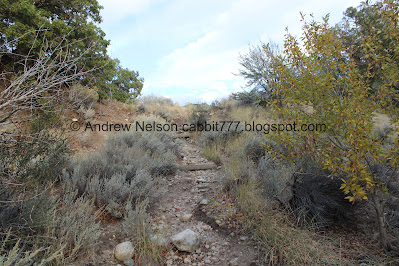
Rocky trail.
Looking back at the ridge and the short downhill section.
Drill holes in the granite. This is a good sign they tried to quarry this rock. You can learn more about that at the nearby Temple Quarry Trail.
Continuing up.
View of the valley.
Downtown.
Panoramic.
A somewhat vibrant tree.
About 6/10ths of a mile we made it to the lower reservoir! If you are after the Lower Waterfall, or any of the other upper canyon features, you want to hang a left here. We did not plan on going into the upper canyon so we went right.
The reservoir.
The trail through here is nice and wide.
Also, the Bell Bottom Twins as I have dubbed them. They look more twin like from the other side haha. But we have climbed up the right one.
The reservoir again.
Upper Bell Canyon.
We came up here right around this time last year, and the color was at prime. This year it appears to be just getting started.
The reservoir and the upper canyon.
This is the little canyon that Dry Creek heads down and the Boulders Trail comes up.
The reservoir again.
The depth gauge shows it to be about 9 feet deep right now.
Panoramic.
The reservoir and the upper canyon.
Nice reflection.
Another panoramic.
We decided to keep going around the loop.
Some bright yellow.
Some leaves starting to change.
Found some little flowers hanging on.
Little bit of red.
Crumbling ridge. I wonder how much of that is natural, and how much of that is due to man.
Tree tunnel.
Canyons to the south.
Dry Canyon.
The reservoir from the back side.
Little bit of color.
There are a couple of shorter loop options, but we chose the longer one today and went right.
Short little hill of doom.
The upper canyon.
Closer.
More color.
The upper canyon.
This is labeled on google maps as Bell Canyon Spillway. I am not sure exactly what it is for.
Where Dry Creek enters it.
The creek and some color. If I understand the map correctly if you don’t cross here and keep following the trail up it eventually connects to the main trail into the upper canyon. But, that was not our plan today, so crossing here will get us on a return path to the lower reservoir.
Now we just follow this old service road back down to the reservoir.
Little bit more color.
Looking back towards the upper canyon.
More color.
The trail to the upper canyon.
1.2 miles to the lower waterfall. It is very steep and very rocky. But it is a pretty waterfall. However not in our plans today.
Continuing down.
Starting to get glimpses of the lower reservoir again.
With some color.
The reservoir.
We took a short spur out to an overlook.
Not a bad view.
Little further down.
Panoramic.
The Bell Bottom Twins (as I have dubbed them) again.
The trail back down. Note, it is next to the watershed sign. Be sure to avoid following the old service road down as that will put you in a random neighborhood.
View down.
Trail on the other side of the little side canyon.
More signs of attempted quarrying.
Continuing down.
Trail on the other side.
Some more color.
The short section that goes back uphill.
Nearing the top of the ridge.
Antelope Island across the valley.
Scrub oak.
Now down the switchbacks. The top switchback that I don’t like.
Panoramic view.
The upper and middle parking lots.
Looking back into the side canyon.
The turn off back to the upper parking lot.
Which is by the power pole, if that helps you find it. I counted at least 10 switchbacks on the way down. Phew!
Back to the wide path just above the parking lot.
Back to the parking lot.
Animal Dangers.
Little Cottonwood Canyon.
Fun clouds on the way home (PSP).
Clouds and rays (PSP). Not a bad little sunset.
Even though there are a few spots that I don’t like, overall I really like this trail. it’s not too rough, and it leads to a stunning reservoir. It is a busy trail up to the reservoir, where most people tend to stop. Beyond the reservoir it is a very quiet trail. It is a really scenic reservoir to get to without a whole lot of effort too. Going with 9 out of 10 squirrels.
As for difficulty, its not too bad, little bit of a climb in the beginning. DR3.
Dogs are not allowed in Bell Canyon due to watershed restrictions.
.jpg)


.jpg)


.jpg)


.jpg)


.jpg)


No comments:
Post a Comment