.jpg)
Willow Heights, AKA Willow Lake is a great little hike near the top of Big Cottonwood Canyon. The trail features a fantastic mixed, but mostly aspen forest, a creek, wildflowers, and of course a nice little high alpine lake. It is a great hike anytime of the year, but it is particularly stunning in fall, when the aspens turn a bright yellow. We really enjoy this trail, even if it is a little tougher and we tend to do it fairly often. Including just a few months ago!

Quick Details:
Length: The west fork is about 9/10 of a mile to the crossroads. The east fork is closer to a mile. Then it is about 3/4 of a mile around the lake for a total of a 2.65 mile loop. We went up and down the west fork so it was about 2.5 miles today.
Trail Type: Balloon. Out and back, loop, and loop de-loop options.
Difficulty: It is quite the climb. DR4.
Elevation Gain: About 650 feet.
Restroom: No. The closest public one I can think of is up the canyon at Silver Lake, or down canyon at Mill D.
Dogs? No. Big Cottonwood Canyon is watershed.
Other Info:
To Get Here:
Head up Big Cottonwood Canyon about 11.6 miles up from Wasatch. It is just past the Silver Fork Lodge. About halfway between mile marker 13 and 14 there will be a boulder on the left (north) side of the road. If you reach Solitude you went too far, but don’t worry. the canyon ends at a loop that will easily turn you around.

The mouth of Big Cottonwood Canyon (Passenger Seat Photography (PSP)).


It is so pretty up here right now (PSP).

Mill D with some reflection, oops (PSP). This area was a bit of a cluster today.


More canyon color (PSP).

Both sides of the road (PSP).


The Silver Fork Lodge (PSP). The future of this long standing restaurant is in the air now as the owner is retiring.

Some color at the trailhead.

I have never seen this trail as crowded as it was yesterday and today. Holy crap!
The Trail:


Into the woods.

The trail kiosk is set back just a bit. And is a bit out of date. The original trail has been closed off and there are 2 rerouted trails now. As I mentioned the west fork is about 9/10ths of a mile, and the east fork is about a mile.


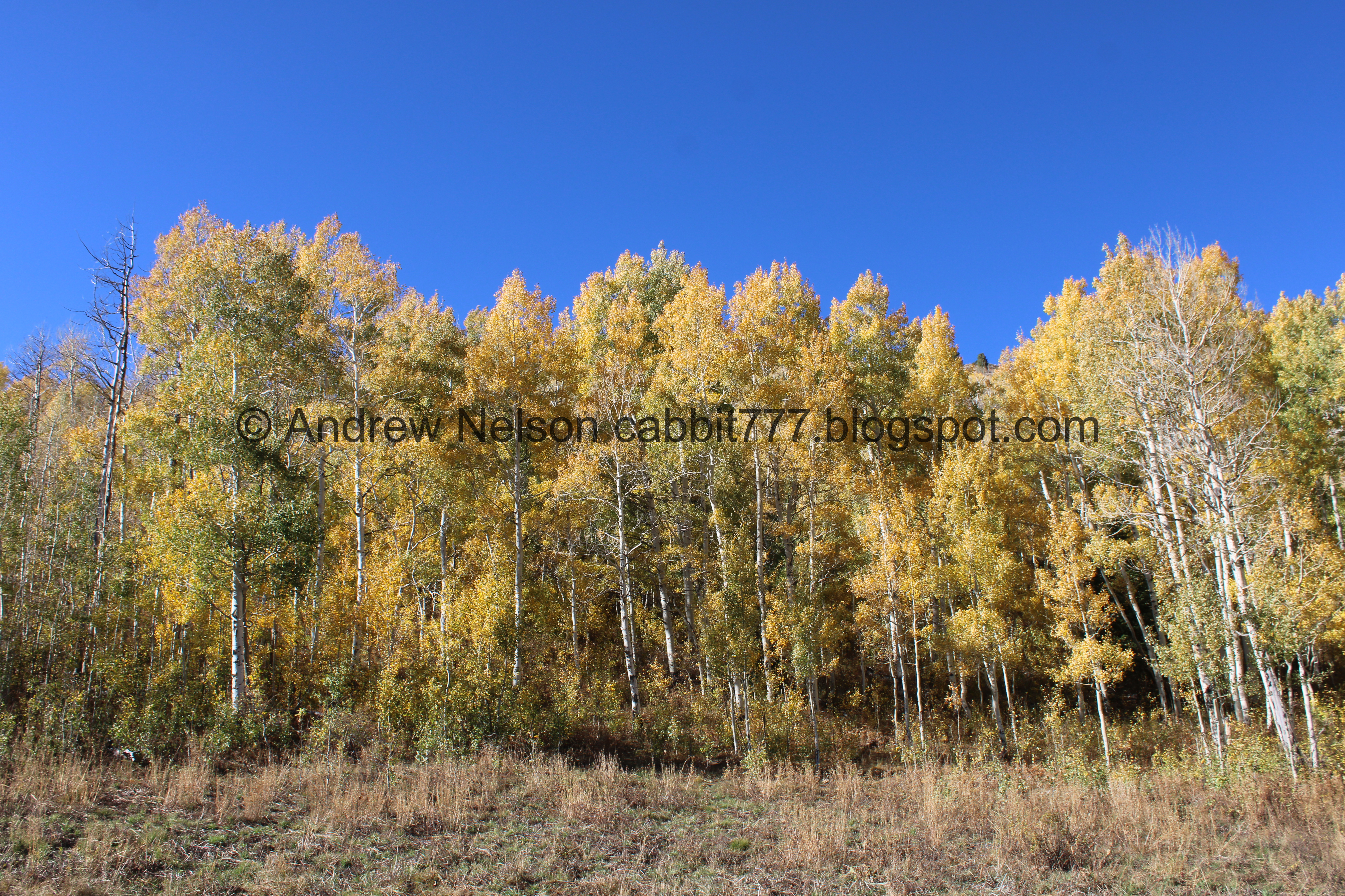
The aspens are certainly turning.

The original trail. As you can see they have piled it with debris to detract people from still using it. It was shorter, but man was it rocky and tough! So I actually like the reroutes.

Nice patch of golds.

The trail split for the east and west forks. Right goes to the east fork, which is slightly longer, at a mile but is overall a little easier. But, there is one short spot that triggers my irrational fear of heights. I am always able to get myself through it, but some days I just don’t feel like dealing with it. So, we went left and did the west fork, slightly shorter at 9/10ths of a mile, and a little tougher.
Ultimately, I think it is best to go up the east fork, and down the west fork if you want to experience the whole thing.

The lower bridge.

The creek is just a little trickle here.

Some backlit aspens.

More aspens.

Silver Fork on the other side of the canyon.

Aspens.

Not much further up we reach the old dirt road. If you plan of coming down this way pay attention to this so that you can find it on the way down.


Aspens.

More gold ones.

The first switchback.

Looking back at the golds.

It is a little interesting. There appears to be a lot of leaves in prime color today, quite a few dropped and bare trees, and quite a few trees that are still green. I would guess there might be another good week up here.

Backlit aspens.

Bands of color on the hills above.

Backlit aspens.

The second switchback.

Aspens.

Here you get a nice break from the climb for a minute.

Aspens.

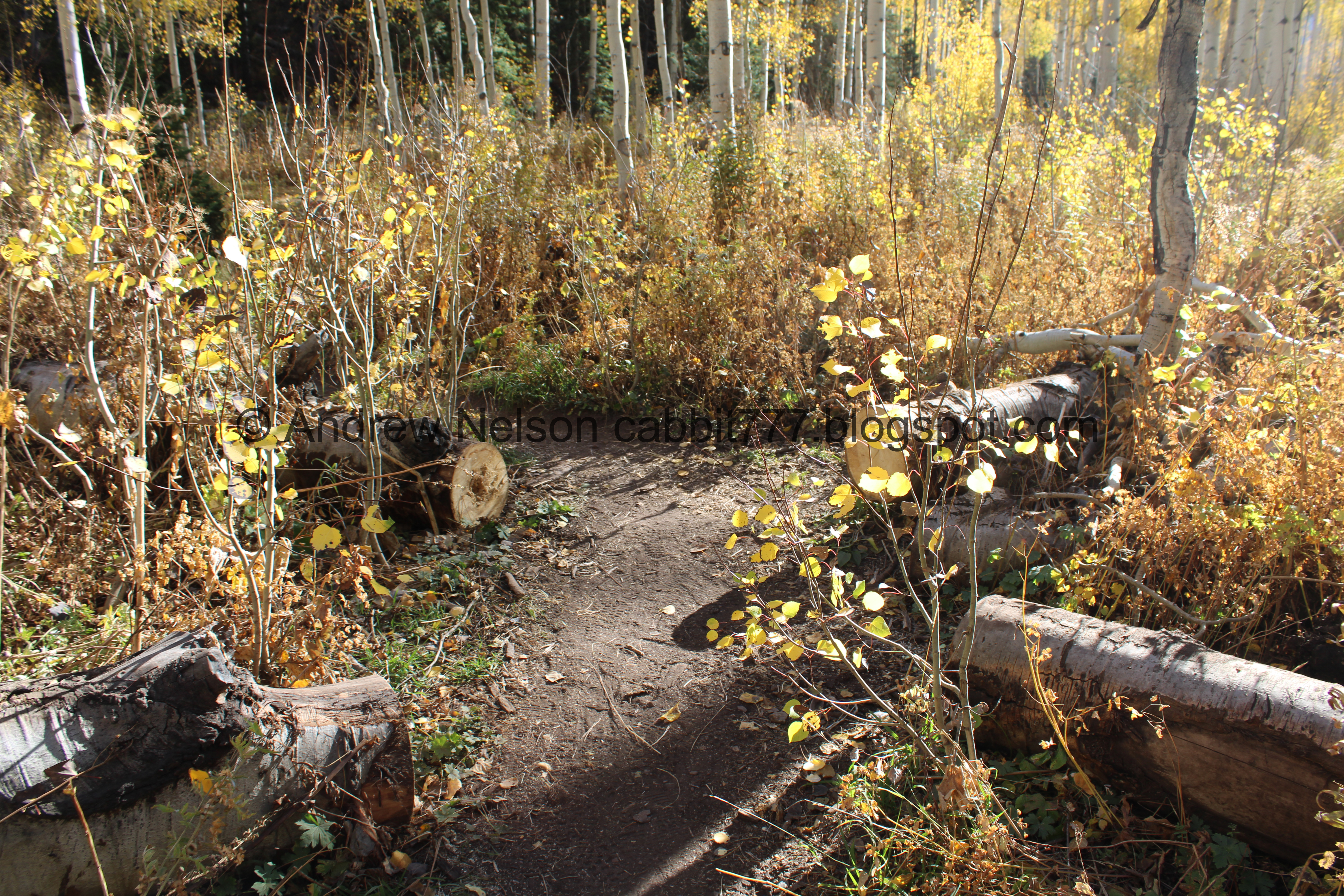
A couple short spots along the west route have also be rerouted. Not as much as the east route though.

Third switchback.

Aspens.

Fourth switchback, which is at the top of the rerouted part.

Some golds.

Yellows.

Then the climb picks up again. Oi.

Tiny clearing.

Nekkid aspens. This had me a little worried about what it might look like at the lake. But, just a couple bare patches.

A hairy woodpecker. Hairy and downy woodpeckers look very similar and can be hard to tell apart. Hairy woodpeckers are bigger, but the clue that is making me sure about this one is the long beak. Downy woodpeckers have a much smaller beak.

Geranium hanging on.

Color.

The upper bridge.

Still not a lot of water in the creek.

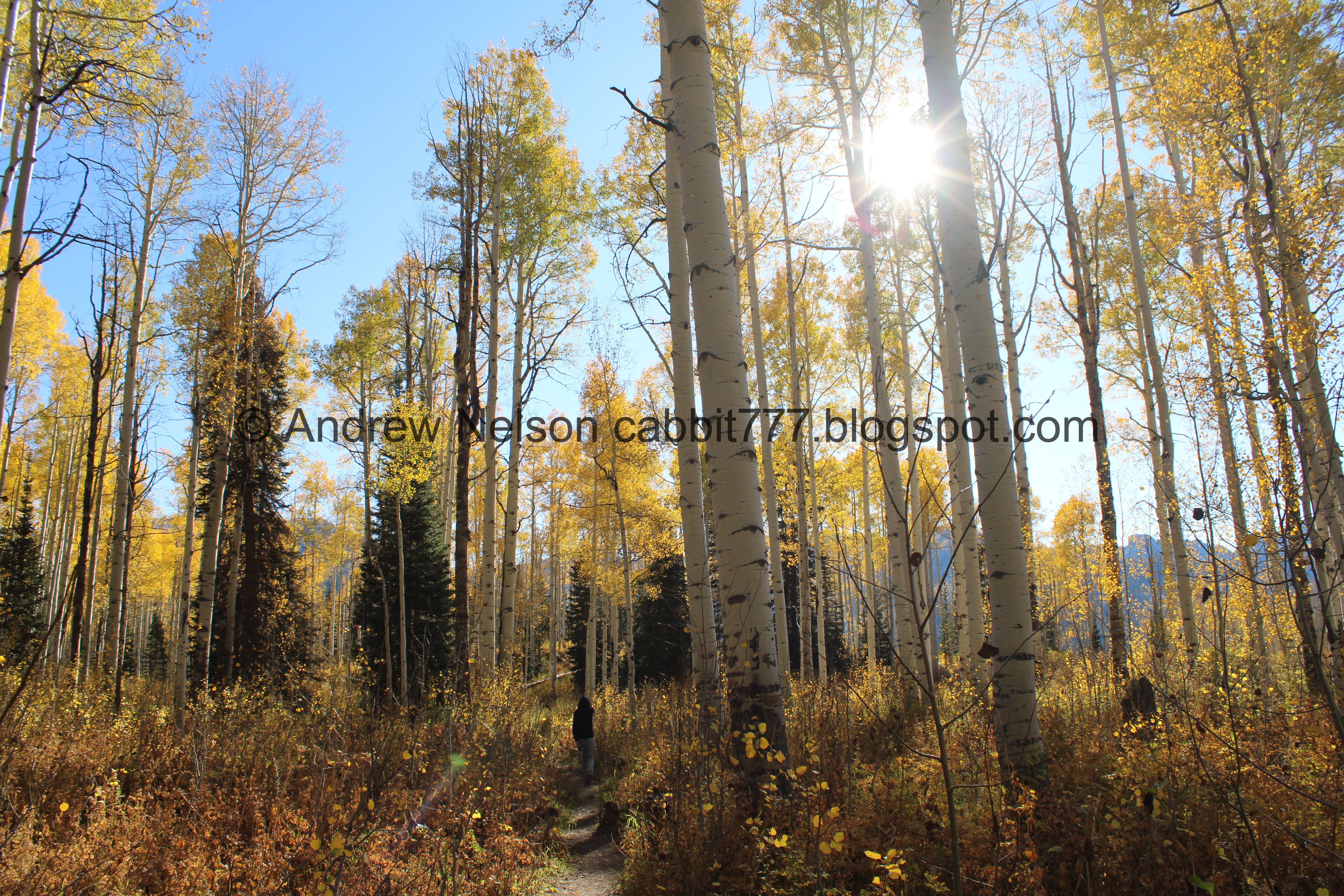
Then we made it to the big clearing. This means you are almost there.
.jpg)
Panoramic.

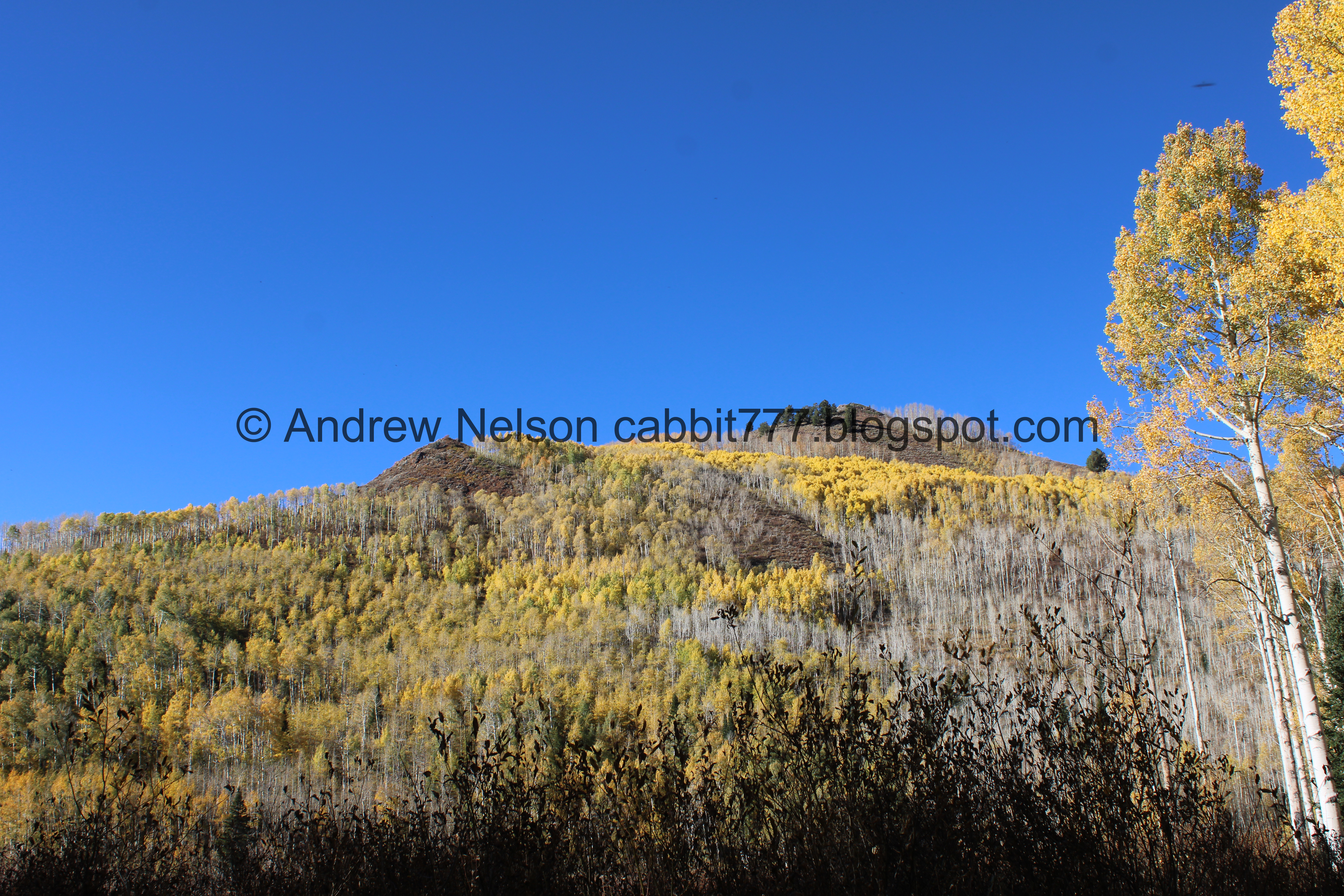
I love the cone shaped peaks.

Continuing up.

The crossroads. Either way will get you to the lake, but to the left leads to a nice little beach to enjoy the lake. So we tend to go that way. To the right there is a lot more vegetation and it is harder to see the lake. But you can go either way if you want to walk around it, which is about 3/4 of a mile from and back to here.

More color, and one of the many neat cone shaped peaks up here.

Another cone shaped peak on the other side.

The final bridge is a makeshift log bridge. I am not a huge fan of these as I don’t trust my balance very much but, I made it across.
I thought for sure when they were doing the rerouting and putting in the lower bridges that eventually they would get around to putting a good bridge here too, but it has been a couple years and so far no bridge. Maybe one day still.

Color.

Willow Lake. Whew, we made it! Wow, The aspens around the lake appear to be at prime color today too. Hooray!
Down to the beach and lake shore. I would show the beach, but it was a little busy today. Not too terrible considering all the cars at the trailhead, but still, quite a few groups.

From a little ways back where we found some good rocks to rest on for a minute.

From the shore.
.jpg)
Panoramic.

There the duckies are! They are usually hanging out on the shore here, but I guess too many people for them today.

Chipmunk.

The lake again.
.jpg)
Another panoramic.

Aspens.

The lake again.
We decided to continue the loop around the lake. It’s pretty flat, and super pretty so it is a nice add on once you are up here. When I say around the lake, it doesn’t really go around the shores of the lake like most lake loops. There is a massive swampland above the lake, so the trail is set back into the woods.

Lots of bare trees, but still some color.

This patch is pretty vibrant.

The back of the lake, with the mountains across the canyon.

Aspens and willows.
Aspens on the other side.

Back to more aspens and willows.

Looking back towards the lake.

More aspens and willows.

With some peaks across the canyon.


Into the woods!


Lovely aspens through here.

This section is super wet earlier in the year but dries up sometime in the summer.


More aspens.

You can catch a glimpse of the lake through the trees.

The very thin trail that leads to Dry Lake above.


More aspens. It is so so pretty back here.

Looking up.

Mixed forest.


Aspens.

I just noticed that someone has come through and cut out sections of the fallen trees across the trail through here. Quite a few trees fell in a nasty windstorm we had a few years ago, and since then you had to climb over them, or follow some desire paths around them, but now the way is clear again. Thanks kind strangers, likely the forest service or maybe the Cottonwood Canyons Foundation. I couldn't really find who was responsible, but I appreciate it anyway.

Aspens.

I love when they are backlit.
More cut away trees.

Another dry stream bed to cross.


Aspens.
We almost never see anybody back here, and today we ran into 3 or 4 groups of people. But I mean, they are just doing what we are and are trying to enjoy the amazing color up here.

Mixed forest.

So pretty.

Little side canyon.
Cone shaped peaks on the other side.

More aspens. My crazy … SQUIRREL mindset goes a little nuts this time of year. Ooh, what’s that? Ooh! what’s that! So, sorry I keep flipping around from side to side haha.

Cone shaped peaks again.

Looking up again.

The east side of the lake. See, it’s not as great from this side.

Back to the crossroads. You can either go left down the east fork for about a mile, Or forward down the west fork we came up at about 9/10ths of a mile. Right will take you back around the lake. We decided to go back down the west fork.

Which is above the big clearing, and offers a view across the canyon.
.jpg)
Panoramic.

In the early season this little depression is a small pond.

Aspens and another cone shaped peak.

Back into the woods.

This is a short rerouted section. It looks like some fool has taken the debris they put down to deter use and made a sketchy bridge here which is dumb because…

Like 10 feet to the right is an actual sturdy bridge.

The small clearing with some beyond prime aspens.

With a bright spot in the corner.

Crazy fallen trees.

Geranium leaf.

Mostly nekkid section.

Continuing down.

Down to some happier aspens.

Geranium.

The first switchback on the way down, which is above a rerouted section.

Aspens.

Second switchback (first one next to the creek).

This switchback is pretty flat and nice.


Pretty.

Some kind of aster.

More aspens.

Third switchback. I generally like to count the switchbacks, and I think it probably started with this trail because sometimes doing so can help you find where you need to be. I will explain more at the next one.

Pretty aspens.

This one is a little more steep and rocky.

Silver Fork on the other side of the canyon again.

Aspens.

Geranium leaf.

Aspens.

The fourth switchback (second one next to the creek). Here is where you want to start paying attention to the trail split on the left that will get you back down to the trailhead. It is about 1/10th of a mile past this.

Continuing down.

Aspen leaves.

I may have gone a little crazy with all the pictures of the aspens today, but man, I just love this time of year!

Here is the trail split you are looking for, that is normally only designated by this little sign. Someone, has added a log across the trail that is a little helpful today, but you can’t expect that to always be there. If you happen to miss it, its not the end of the world, but it will be a random adventure down into a neighborhood, and then having to hoof it back up Big Cottonwood Road to the parking area. We made that mistake once, so I am like, hyper vigilant about not doing it again.

While a lot of the trees are at prime, and a lot of the trees have lost their leaves, there are still quite a few green trees. So I suspect there might be another good week of good color up here. But, this year is super weird. It is ridiculously warm still (15 degrees or so above average), and we haven’t had a storm system in weeks.


Another bright patch.

Down to the lower bridge.

Just beyond is the trail split. Right will get you back to the trailhead. Left goes back up the east fork.

Yellow.

Green.

Bare.
Autumn is truly a weird beast.


More color.

Back down to the trailhead.

Thistle.

Pretty purple asters.

View up canyon.

Heading back down (PSP). Great colors on both sides of the road.

Some nice patches of red and orange.

Annnnnnd a traffic jam (PSP).
I don’t know if anything happened, or if it was just super busy but there were some officers manually directing traffic down at Mill D. In the end it really only took us about 10 minutes to get through today. We have been through worse with construction projects in this canyon in years past.

I love these moose crossing signs they added a couple years ago (PSP).

Yellow hill (PSP).

More color (PSP). You can also see how busy it is up here today. Oh boy.

More color (PSP).

The mouth of the canyon (PSP).
That was a good hike. We found ourselves at the lake with the prime fall color surrounding it. It was a little busier than I am used to, but not as busy as other hikes we have done. It helps that there are two trail options to kind of thin the crowds. Plus it is prime leaf peeping season so it is not a surprise it is a little busier than normal. I am going with 10 squirrels today.
As for difficulty, oh boy this is quite a climb. DR4.
Dogs are not allowed in Big Cottonwood Canyon due to watershed restrictions. Be sure to leave Fido home for this one.

No comments:
Post a Comment