.jpg)
The Stone House (AKA the Quarry House) in Red Butte Garden is a neat old stone structure within the Red Butte Garden property. It is pretty easy to get to in the Natural Area above the Gardens Area. We saw it from outside the property on the Red Butte Skyline Trail a few years ago and I thought it was neat looking, so I made a mental note, if we ever found ourselves inside the gardens that we would come check it out. Well, we came here for the Blooming With Pride event and I decided we should check it out. Even though we were not really dressed for it, or had proper shoes, and it was hot as hell today. But, it was pretty short and I thought it was pretty neat so, totally worth it!

Quick Details:
Length: It is about 4/10ths of a mile from the Visitor Center, plus whatever exploring you do. We did about a mile.
Trail Type: Out and back.
Difficulty: DR3. the first bit is paved, the last bit is an old dirt road and pretty mellow.
Elevation Gain: About 300 feet.
Restroom: There are at least 2 flush toilets along the way.
Dogs? Only service animals. Please leave Fido home and definitely not in your car.
Other Info: Fee area. $16.00 per person.
To Get Here:
Take i215 to Foothill Drive heading north. Go about 3.3 miles and turn right on Wakura Way. Continue up that for 9/10ths of a mile and it will be on the left.
Make your way through the Garden and up towards the Natural Area.
The Trail:
I have a pretty good sense of direction for the most part, but it took using google maps GPS to get us there. Lucky the trail is popular enough that google did get us there successfully. We just had to kind of find the shortest switchbacks up through the maze of the Gardens.
The map we got today was more focused on the artists, so it only featured the lower Gardens Area and not the Natural Area. I didn’t find the full map until we were done. (Tip: There is a map on the brochure rack in the doorway).

Heading though the Gardens area. I knew it was on the far southeast part of the property, but at this point it is just heading up.

Neat statue of some oak leaves.

Neat fireplace thingy. This is entering the Children's Garden area, which we did not see earlier.

Neat little dripping rock. It doesn't look natural, but I’m not 100% sure.

On the other side is a neat little splash pad.

Continuing up.

With a view of Red Butte Canyon.

Peaks above.

Downtown Salt Lake City.

I think we are in the Water Conservation Garden section now. It is another area we missed earlier.

The canyon and Mount Van Cott across the way.

I had to look at a map to figure out these terraces appear to be supporting a giant water tank.

Neat gazebo.

Then we are onto the dirt trails of the Natural Area and heading back towards where I was wanting to go.

Downtown again.
.jpg)
Panoramic.

The climb.

Downtown again.
.jpg)
Another panoramic.

Downtown.

Some nice stone benches.

Trail map. Phew, that reassured me we were going the right way. There is also a huge web of trails up here and not a lot signs.

Rounding the corner into Soldiers Hollow and/or Seepy Hollow?

Fun red rocks.

The hollow again.

The climb. Oof. This was a little bit more than I was anticipating. Made much worse by the fact that we weren’t really dressed for a hike and absolutely were not wearing the right shoes. I mean, they weren’t flip flops but, they were definitely not hiking shoes.

The fence line. The Red Butte Skyline Trail is next to it. The Living Room is on the front of that ridge too.

Starting to hit some greenery.

Wait.. what? We haven’t hit the fence line yet! I guess maybe this sign is pre-fence? Whatever the case, it means you are getting close.
I did find an answer. I guess technically it was/is on forest land, but it had become a place for college students to party at and it was getting vandalized and damaged. So Red Butte offered to extend their fence line around it to protect it,
From the article I read, back in 2021 it was discovered that it was technically illegal to have fences across National Forest Land. So, they were trying to work out some land swap so Red Butte can continue protecting it but that is the last I could find about it so… I don’t know if that happened or they figured something else out.
I don’t know how I feel about it. On the one hand, I would prefer not to have to pay to see a neat historical building, but on the other, people are trash. If we don’t protect them, they get damaged (see The Lime Kiln at nearby Limekiln Gulch).

Big scree field.

Neat flower.

First little glimpse of it peeking out above the trees.

The ridge.

Alfalfa.

The climb is mellowing a little bit.

The Stone House above another small scree field.


Some pretty penstemon.

The fence line. Plus a random stone structure of some sort. This means you are almost there.

More forest.

Getting closer.

Some benches to rest on.

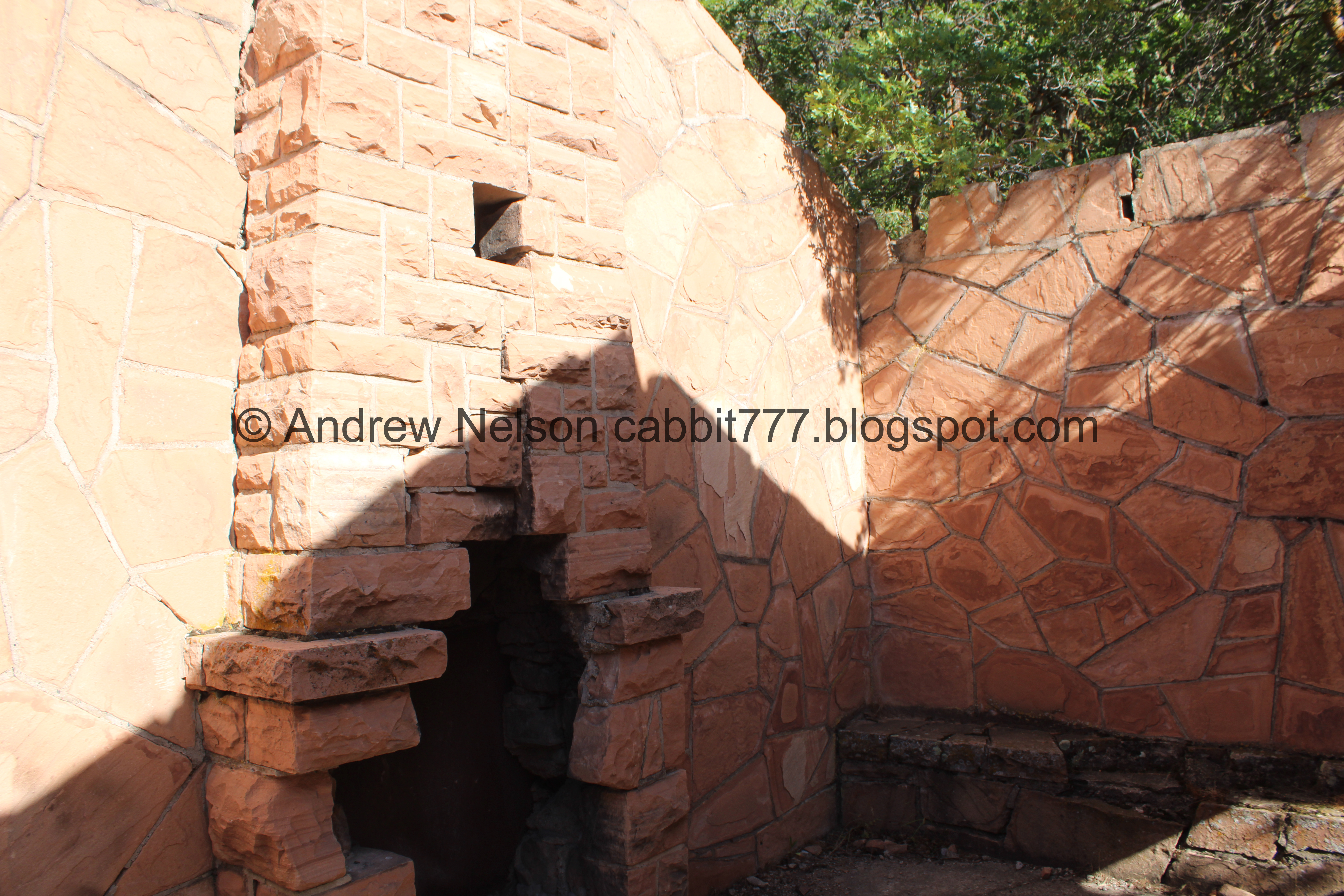
We made it! Phew. If it was much further we would not have made it. It is super hot today! But anyway, look how cool this is!

Again.

Windows along the east side.

The west side. It appears to be a duplex, with this west side, while being a little smaller appears more… homeish? and the east side looks more garageish?
I was really hoping there would be a plaque with some historical information but sadly there was not. That is frustrating within a fee area. But, after some googling…
The Works Progress Administration (WPA) built a blacksmith shop to serve the quarries in Red Butte Canyon, It was used to sharpen and repair tools used to cut and move the sandstone blocks found up here. (This is fun, you can see more of the WPA projects in Miller Park).
I can’t find the exact date it was built but the WPA was active between 1935 and 1943 according to a sign I saw at Miller Park.
It is made of the same red stone they quarried here to make buildings at Fort Douglas and the University of Utah. As well as some older houses in SLC including the McCune Mansion. The federal government took ownership of it in 1940.
Fort Douglas closed in 1991 and what remains is a historic site within the U of U campus.
Source (outside link). Unfortunately I have not had much luck finding much more information on this neat little building.
Side note: The forest service acquired the land in Red Butte Canyon in 1969 and declared it to be a Research Natural Area which is why you cannot explore much of it outside of Red Butte Garden, and the Skyline Trail.

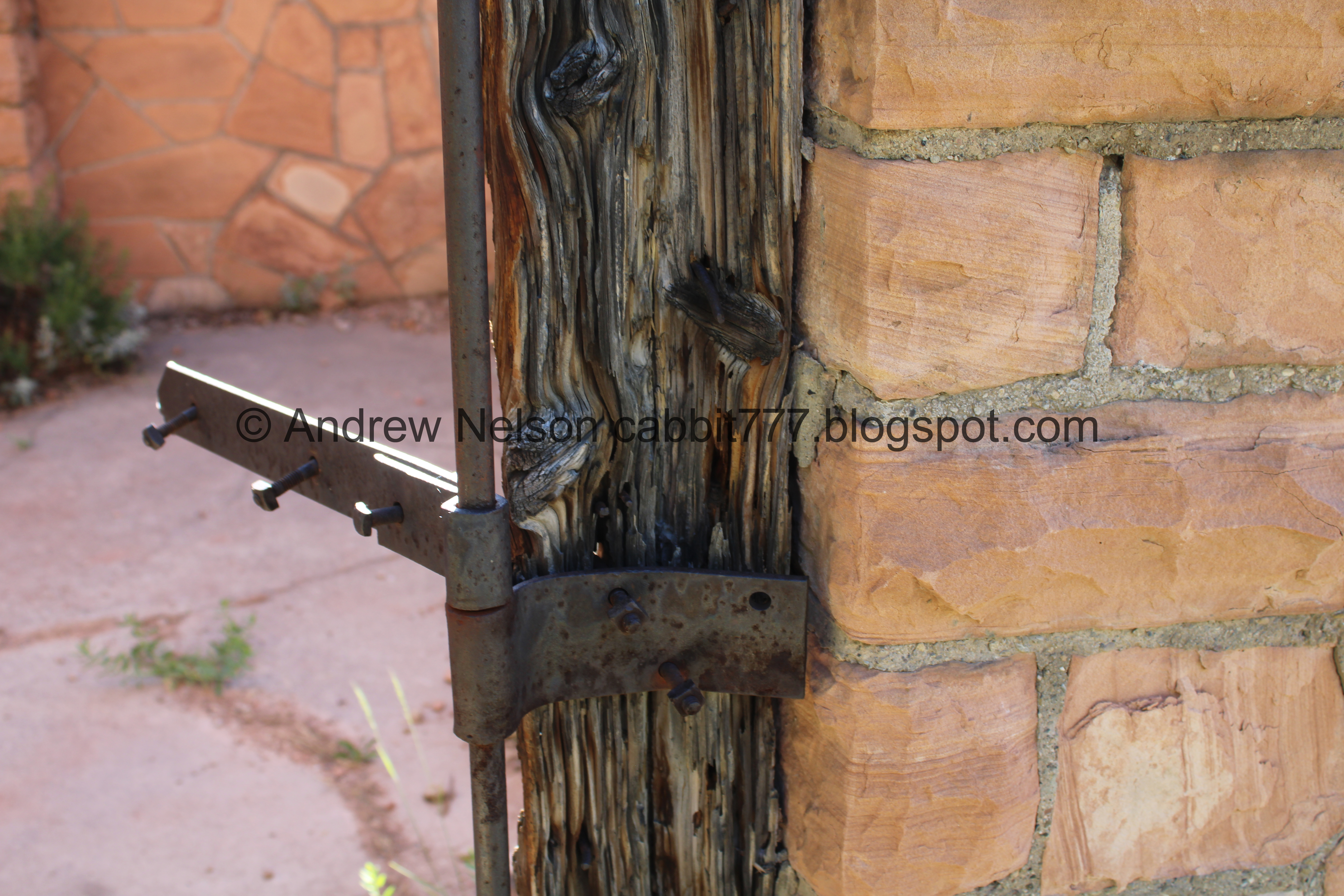
The fireplace on the west side. The twin fireplaces share a single chimney between the rooms.

So, this was a curiosity to me. Did they add this metal thing to represent how tall the chimney was, or did they line chimneys with metal back than and this is what remains? Or, now that I am really thinking about it, is it merely a divider? Either way, it has been shot to hell, like most signs on public land.

Window.

Window and door.
Fireplace and bench.

Back to the east side. Again, without more information I assume this was the shop side.

With the “garage” or more likely barn door opening.

The fireplace on this side.

The bullet riddled chimney again.

Closer view of the fireplace.

The barn door opening.
Another fun fact I learned at Miller Park, The WPA were not formally trained stone masons and often learned on the job. However, as you can see they did beautiful work and it is absolutely amazing that so many of their projects are still standing!

The other side of the barn door.

Windows with benches.

Crumbling benches on the other side.

Lupine.

What is left of the hinges.

On the other side.

Walking along the back side.

The central chimney again.

Lupine.

The wall between both sides, with the chimney.
.jpg)
Panoramic of the back side of the building.

The west side.

The crumbling windows.

Back to the front.

The missing roof.

The west side, which I assume was likely living quarters.

East side.


I noticed the crumbling remains of a foundation next to it.

One last look before we head back down.

Heading back down.

Downtown.

Continuing down.

The little hollow.

Again.

The stone benches. This is at a big trail split It looks like we could have gone down the Seepy Hollow trail to make it a kind of loop, but we just went back the way we came.

“Paul D Schettler 1908 - 1990. I need a great view” haha. Me too man, me too.

It is a pretty great view!

Continuing down.
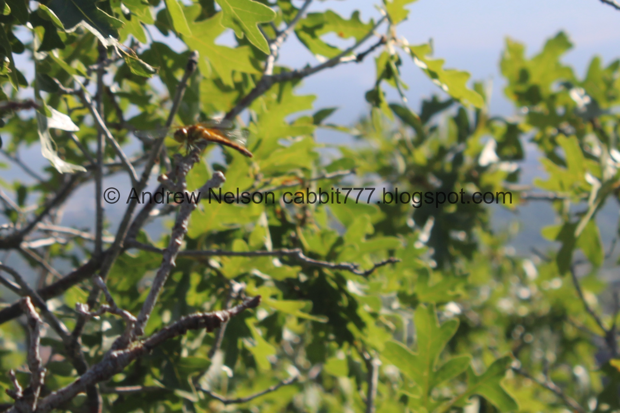
Dragonfly.

Downtown again.

Little gazebos below.

Back to the paved trail as we re-enter the Gardens section, with Red Butte Canyon and Mount Van Cott.

The Water Conservation Garden.

Super pretty purple penstemon of some sort.

These look like skyrocket, but I have never seen it orange. So yeah, no idea what this one is.

Little pink roses that were quite fragrant.

Stairs.

Milk weed.

Little bridge as we pass through the Children's Garden area.

The dripping rock thingy below.

Above a little pond with koi.

I think these are Indian blankets.

Pretty red flowers of some sort.

Back to the Visitor Center. In the Gift Shop I found a nice magnet and had a hard time deciding which Mini Block set I should have haha. They had a lot of cute ones! I ended up with a hummingbird and a butterfly. I didn’t see the bad ass owl my friend found. Oh well, we will just have to come back.

The front of the Visitor Center.

Passing by the new south end zone at Rice Eccles Stadium (Passenger Seat Photography (PSP)).

The 2002 Olympic Torch (PSP). They moved it here when they redid the south end zone.

Again (PSP).

Fun fluffy clouds (PSP).
That was a great addition to our adventure at the Blooming With Pride event. There are some more trails I want to check out but it was hot, and we were getting hangry This short trail led to a really neat old building I have been wanting to see for a few years now, so I was glad we added it on. Once we got to the Natural Area we didn’t pass by any other people, so that was a plus too. I’m going with 9 squirrels today. Losing one for the fee area.
As for difficulty, it is a little bit of a climb, but not too bad. DR3.

Dogs are not allowed, so be sure to leave Fido home for this one.

No comments:
Post a Comment