.jpg)
Silver Lake is an absolutely stunning alpine lake surround by scenic peaks located at the top of Big Cottonwood Canyon. The boardwalk trail features a nice mix of lakeside wetlands, and thick forests with wildflowers and a good chance of seeing wildlife of all shapes and sizes including moose! We tend to do this trail fairly often, usually on our way to the back trails. We have had a really busy month so far this year, that included a lot of walking. So, while we wanted to be in the mountains, we also wanted something a little easier. Plus, I figured we would pick up our annual forest pass, since this, and quite a few other areas we frequent are now fee areas.

Quick Details:
Length: It is an 8/10th of a mile loop.
Trail Type: Loop, connector option.
Difficulty:
Elevation Gain: About 60 feet.
Restroom: There are flush toilets in and just outside of the Visitor Center.
Dogs? No. Big Cottonwood Canyon is watershed.
Other Info: This is now a fee area. $10.00 for a 3 day pass. $20 for a 7 day, and $60 for an annual. As I mentioned we decided we might as well get an annual since we tend to visit these areas often.
To Get Here:
Drive to the top of Big Cottonwood Canyon. When you hit the one way Brighton loop road, the Solitude Nordic Center (AKA Visitor Center) will be on the right. There is overflow parking across the street by the Brighton Store. You can pick up a recreation pass at either site, or online (Note: for some asinine reason you cannot get the annual one online).

Heading up Big Cottonwood Canyon and into the Wasatch National Forest (Passenger Seat Photography (PSP)).

Continuing up (PSP).

Beaver pond and dam (PSP).

Mount Millicent above Brighton (PSP).
Unfortunately the Visitor Center was closed so we ran across the street to the Brighton Store to get our forest service pass.

Back to the Visitor Center.

Fee area sign. You can go into the Visitor Center, or the Brighton Store for all 3 pass options, or scan the QR Code here for the 3 or 7 day use passes.
The Trail:

The wetlands below the unnamed peak.

We decided to go right or counter-clockwise. Probably more out of general habit due to that being the quickest way to the back country trails.

The boardwalk has been sectionaly closed for a few years while it was rebuilt. It was finally completed last year. Here you can see it was shifted over a bit.

Wetlands and the unnamed peak.
For whatever reason Landis suddenly decided to ask me what moose tracks look like. I said, well, they look like large deer tracks…. in fact there is one right there. Talk about convenient lol. It is a little washed out though.

The new boardwalk, and where the old boardwalk was.

Mount Millicent.

Beaver dam.

More boardwalk.

Flooded old boardwalk scar.

Starting to be able to see the lake.

The new bridge/dock combo. Surprisingly not completely covered in people.

Beaver lodge.
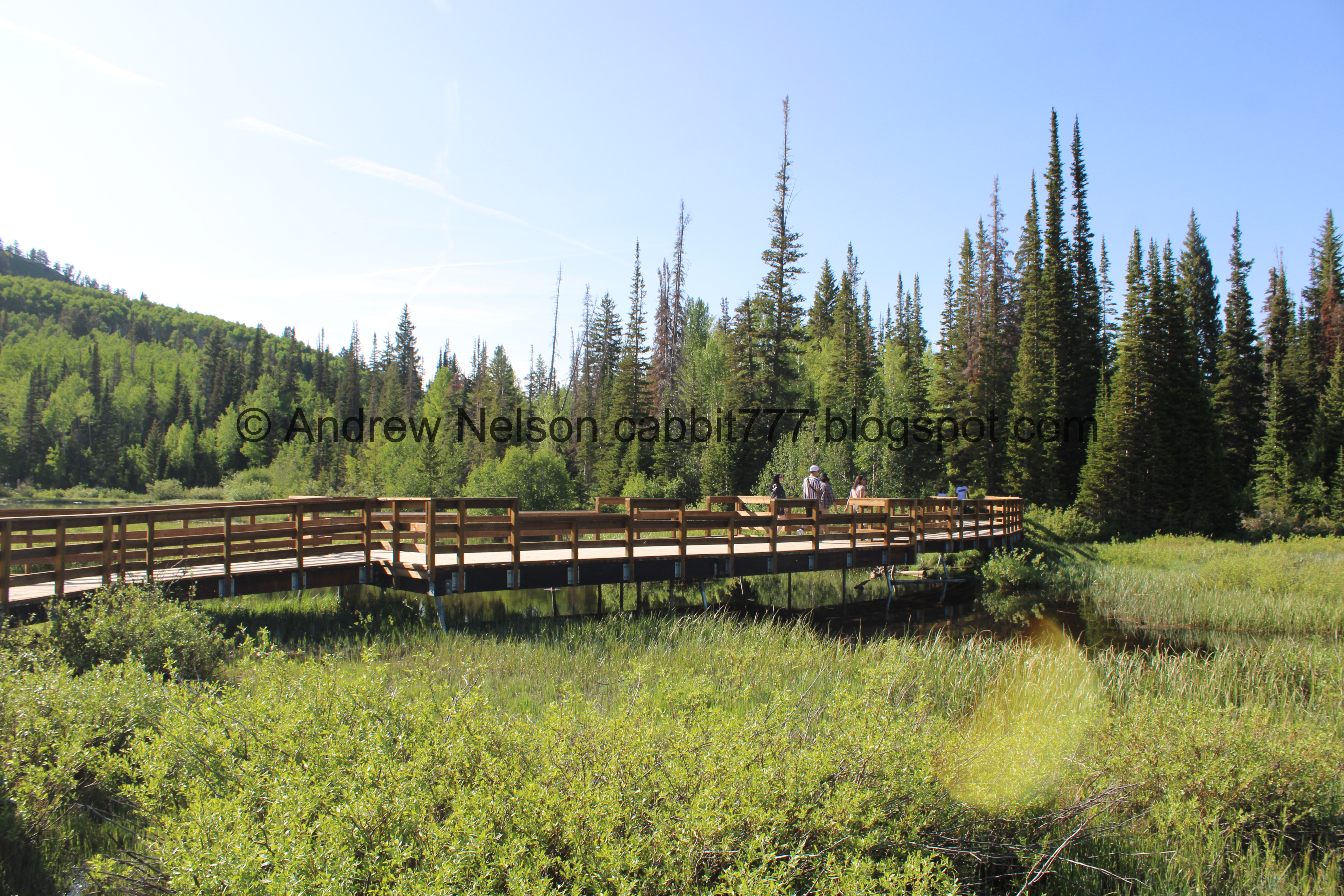
Closer to the bridge/dock which is over the outlet.

Downstream Big Cottonwood Creek with a beaver lodge.

Closer look of the beaver lodge.

Upstream, leaving the lake.

The lake.

The bridge/dock again. I had to remove a few people, but otherwise it was surprisingly empty.

The outlet and the lake.

Nice clear water.

Onto the dirt trail. I couldn’t tell you want it is, but it appears they have applied some sort of material onto the dirt trails.

Pretty forest.

This little dock is new with the rebuild. It appears to have been a kind of trade off with the removal of a dock on the other side.

It does offer a nice view.

More clear water.
.jpg)
Panoramic.

Super pretty forest.

The lake again.

Forest.

The lake again.
.jpg)
Panoramic.

The back trails at the north end of the lake. This leads to Twin Lakes above Silver Lake and Lake Solitude to the west.

Trailhead sign.

I do like both of those trails, but like I said we were taking it easy today, so we continued around the lake.

Forest.

Another dock. All of the remaining docks were rebuilt with the boardwalk rebuild project. As I mentioned, one was not but two new ones took it's place.

The lake.

Nice clear water.

Mount Millicent above.
.jpg)
Panoramic.

Docks on the other side.

Boulder under the clear water.

Beaver lodge on the side of the lake.

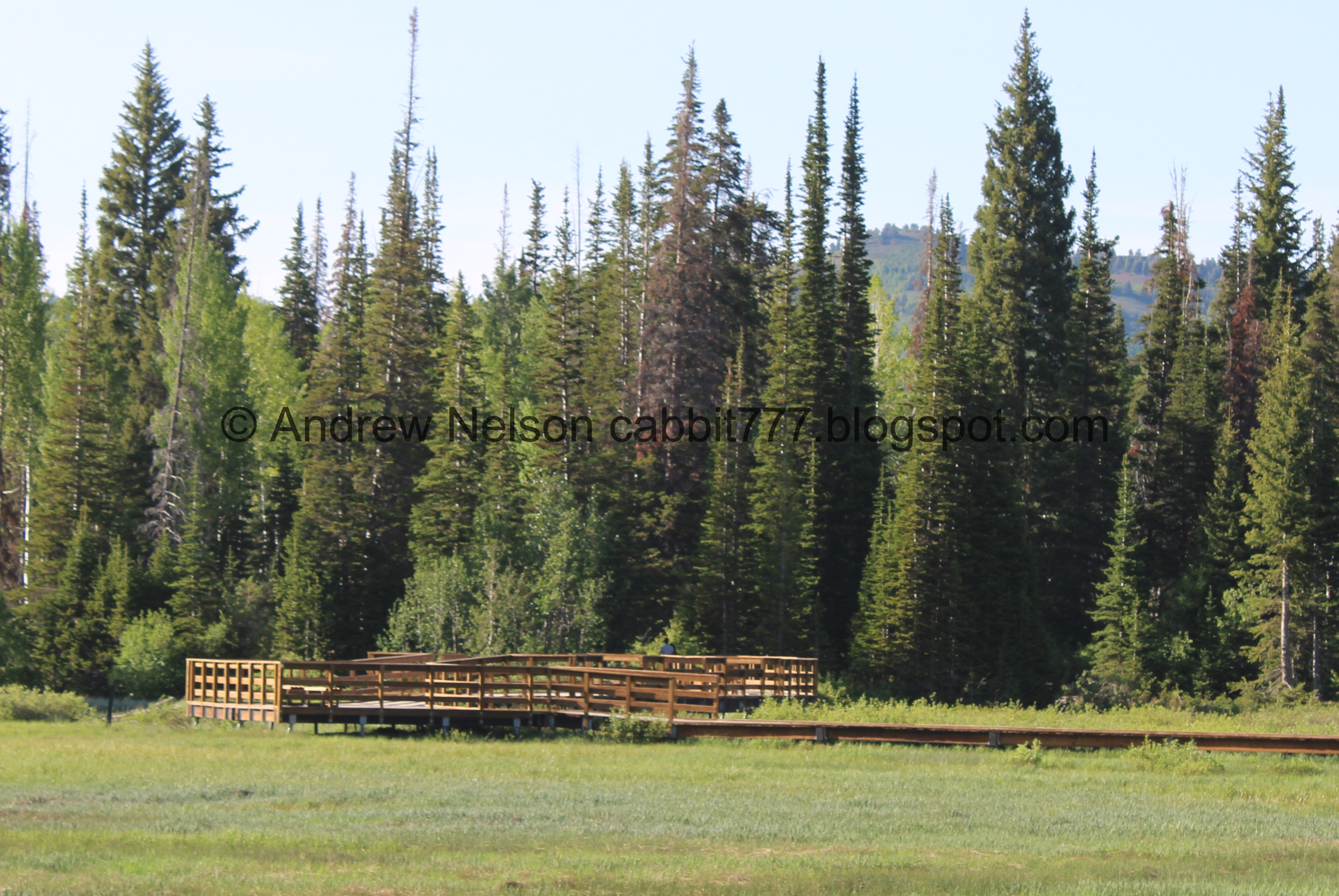
Another little boardwalk area.
There used to be another little dock around here, but it was not restored. As I mentioned earlier, I think it was traded with the new dock on the other side of the lake.

The lake.
.jpg)
Panoramic.

HOLY CRAP!!!! Look at the bugs!

The beaver lodge again.

The lake.
.jpg)
Panoramic.

The beaver lodge again.

Another forested area.

Beaver activity.

The beaver lodge again.

The lake.

Blue bells.

The beaver lodge again.

The lake.
.jpg)
Another panoramic.

Looking up at the unnamed peak. The trail to Twin Lakes crosses through up there.

Entering another wooded section.


It’s pretty in here.

Neat giant boulder.

The lake.
.jpg)
Panoramic.

Scott Hill with the Mickey Mouse shaped tailings piles.

More forest.

The lake.

Forest.
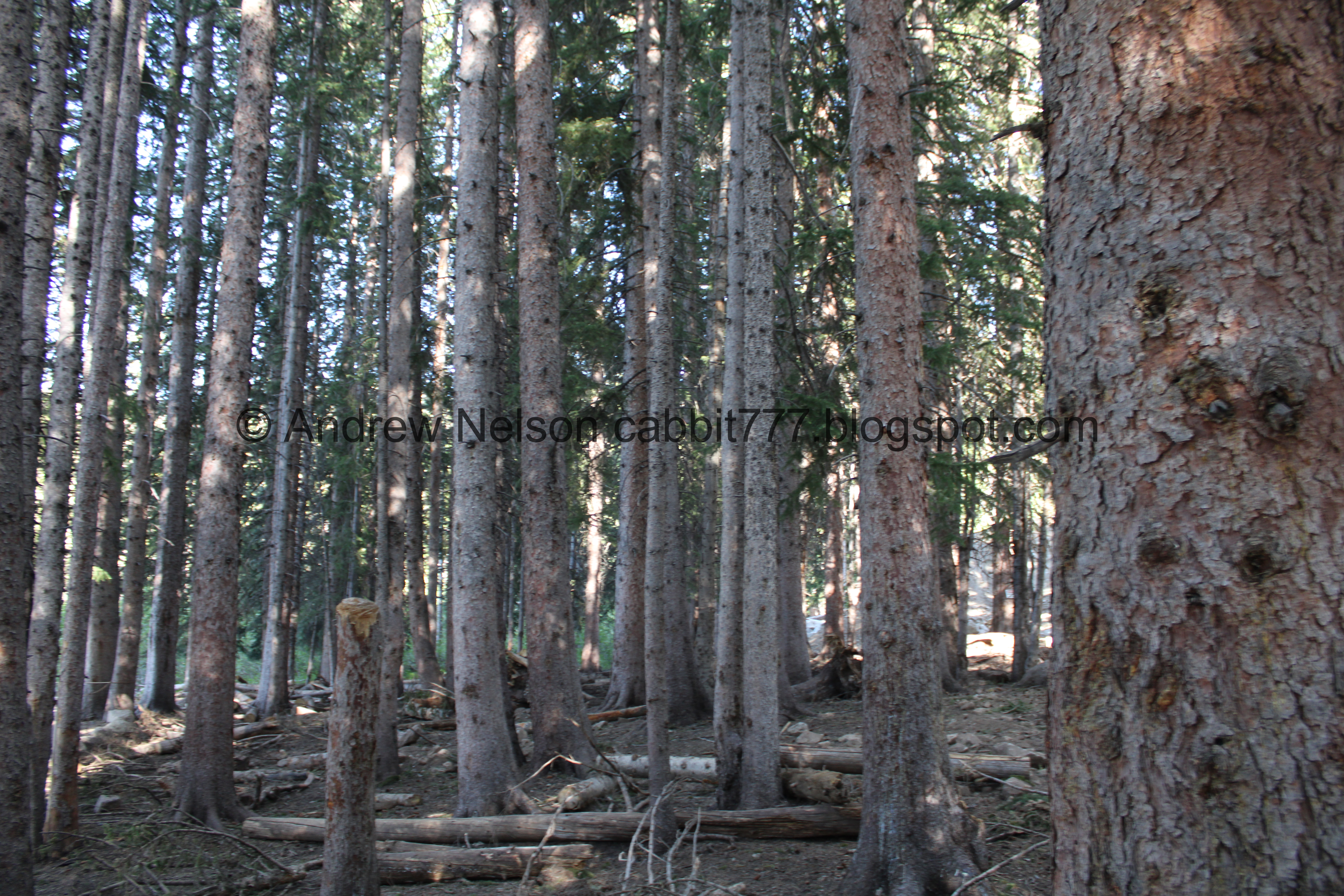

It is quite thick through here.

We found a patch of snow hanging on.

Hitting the boardwalk again.

Back out in the wetland.

Big Cottonwood Creek entering the lake.
Depending on who you ask, Silver Lake itself is the headwaters of Big Cottonwood Creek. Or, what I think is more accurate, all of the Brighton Lakes (Silver Lake, Lake Mary, Lake Martha, Lake Catherine, Dog Lake, and Twin Lakes). But I mean, the rest of those lakes do release water that flows down into Silver Lake so… I guess the former is kind of technically true as well.

Upstream.

The boardwalk.

Well camouflaged duck.

The beaver lodge on the other side of the lake again.

Another fishing dock.
.jpg)
Another panoramic.

This is another new dock that did not exist before the boardwalk rebuild. It lies over another inlet.

The inlet going into the lake.

There is another beaver dam upstream.

Pretty mountain views.

Continuing along the boardwalk.

Looking back at the lake.

Another little nook with benches.

The wetland.

Scott Hill above the dock/bridge.

More peaks.

Mount Millicent.

Hummingbird hanging out at the top of a dead tree.

It is just so pretty up here.

Another alcove with benches.
Looking across to the dock/bridge.

The wetlands again.

Scott Hill again.

Welcome sign with the area rules and a fun fact: Water from here takes 24 hours to travel down the canyon and out of our faucets. Help keep it pure by following the rules.

Another sign with the rules. Also a specific warning about watching your step due to boreal toads. They are a species of concern. As the sign says: Do not touch them!

This restroom was just rebuilt a few years ago and is already damaged from the heavy winter snow we get up here. I would have thought they would know how to prevent that kind of damage by now.
Well, that was a fun, easy adventure! It was time we got going.

Heading back down the canyon (PSP).

It so green and pretty right now (PSP).


Going down (PSP).

Nearing Storm Mountain (PSP).

Down to the mouth of the canyon (PSP).
As always, that is a great option when I want some mountain time, but don’t want anything too strenuous. It is just super pretty up there. I was actually rather surprised it was not busier than it was. Perhaps the new fee system is thinning the the crowds some? Anyway, I do love it up here. 9 out 10 10 squirrels losing one for the new fee.
As for difficulty, the boardwalk is wheelchair accessible, and the non boardwalk section is fairly flat, and hard packed earth. Going with a DR2.

Dogs are not allowed due to watershed restrictions. Be sure to leave Fido home.

No comments:
Post a Comment