.jpg)
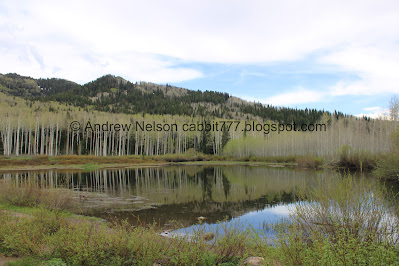
Willow Heights AKA Willow Lake is a a lovely trail system in Big Cottonwood Canyon. It features a beautiful alpine lake, a lovely aspen forest with loads of wildflowers, willows, and a good chance of seeing wildlife, including moose fairly often! This is one of our absolute favorite trails, so we tend to do it at least once a year, if not more often. So on the first 90+ degree day of the year we wanted to get up into the mountains and this seemed like a good option.
Quick Details:
Length: The west fork is about 9/10 of a mile to the crossroads. The east fork is closer to a mile. Then it is about 3/4 of a mile around the lake for a total of a 2.65 mile loop. We went up and down the west fork so it was about a 2.5 mile balloon today.
Trail Type: Out and back, loop, balloon, figure 8 options.
Difficulty: Oh boy it is a bit of a climb. DR4.
Elevation Gain: About 650 feet.
Restroom: No. The closest one is at Solitude. Or if heading back down canyon Mill D.
Dogs? No. Big Cottonwood Canyon is watershed.
Other Info:
To Get Here:
Head up Big Cottonwood Canyon about 11.6 miles up from Wasatch Boulevard. It is just past the Silver Fork Lodge. About halfway between mile marker 13 and 14 there will be a boulder on the left (north) side of the road. If you reach Solitude you went too far, but don’t worry. the canyon ends at a loop that will easily turn you around.

Big cloud above Mount Olympus (Passenger Seat Photography (PSP)).

More mountains (PSP).

I just love this time of year when the mountains are so green (PSP). Like fall, it just feels so fleeting.

Heading up Big Cottonwood Canyon (PSP).


The part that goes through a giant rock (PSP).

Continuing up (PSP).

I really just missed being in the canyon (PSP).

Entering the town of Brighton (PSP). The residents voted to incorporate in 2018, and it took effect in 2020.

Mill D South between Reed and Benson Ridge and Kessler Peak (PSP).

Pretty mix of trees (PSP).
The Trail:

Bluebells.

The dedication stone. This area was set to be developed, but Salt Lake City purchased it to allow us, and future generations to enjoy the area,

Into the woods!

The trailhead sign is set a little bit back, and still has not been updated after the trail reroutes. Although, from what I have seen, it probably never will be.

Beautiful aspen forest.

So pretty.

Twin tree gate.

Bluebells.

Old trail that they don’t want you to use anymore to the right, and the reroute to the left.

More aspens.

I just love being in the forest.

Before long you come to the newer trail split. Right is the east fork and is a little easier, but slightly longer at about a mile to the crossroads. Left is the west fork and is a bit more tough, but slightly shorter at about 9/10ths of a mile to the crossroads. There is a spot on the east fork that I don’t like very much, so we went left.

Immediately after the fork is the lower bridge.

There is a small waterfall upstream.

Downstream.

The forest.


Forget me nots.

Silver Fork on the other side of Big Cottonwood Canyon.

Forget me nots.

Aspens.

Some yellow flowers coming up.

Then we reached the old dirt road. You want to go right here. Left connects to a neighborhood below.

And the real climb starts.

Pretty forest.

Continuing along.

This rock looks very happy.
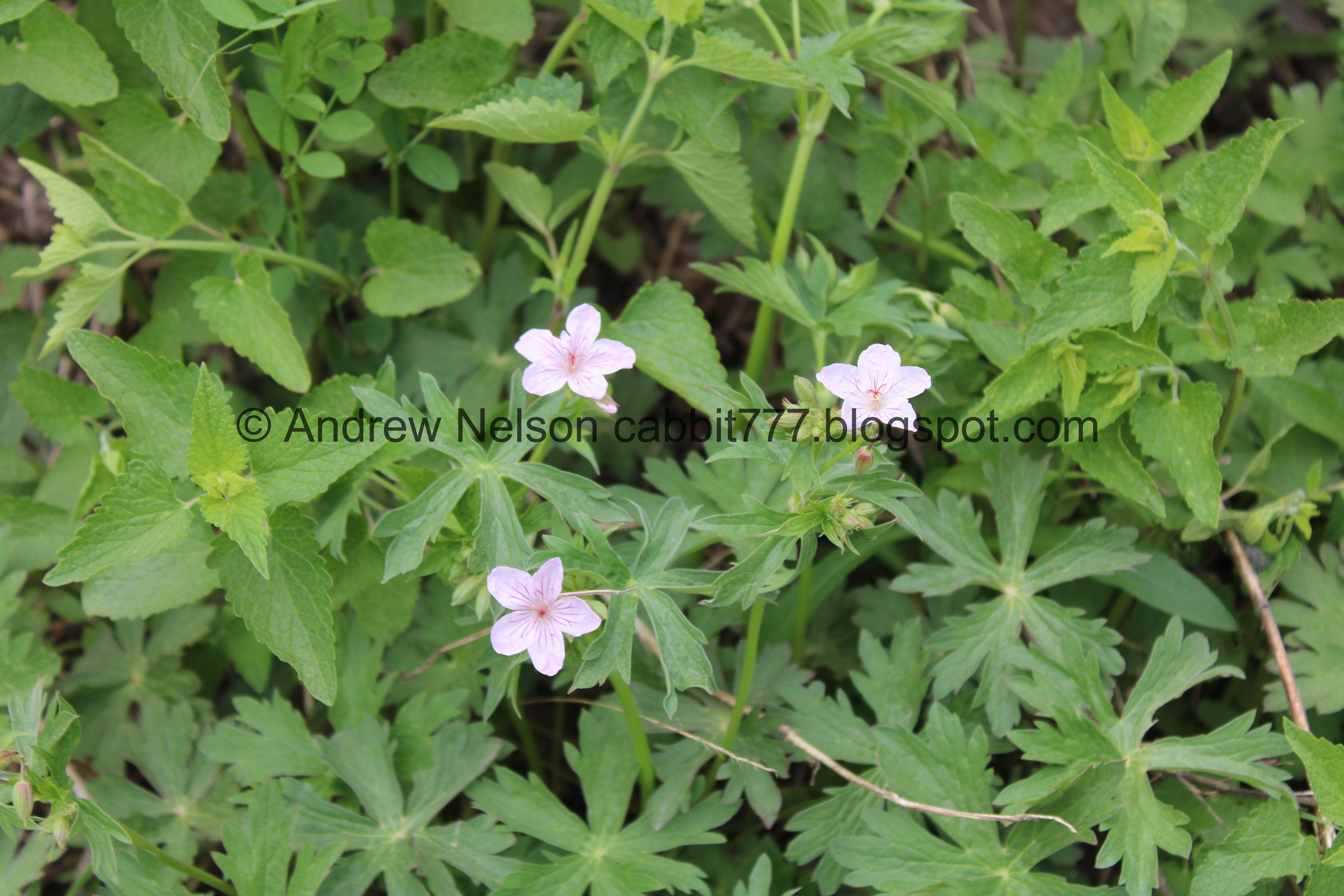
Some early geraniums.

Dead tree that looks like the woodpeckers love.

Bluebells.

Awww, little baby larkspurs! They grow to be quite a lot taller on this trail a little further into the season.

The first lazy switchback. It is near the creek.

Then more up.

Down canyon… through the aspens.

Another baby larkspur.

Better view down canyon.

Silver Fork across the canyon again.

Pretty flowering tree.

The next lazy switchback.

View up canyon.

Silver Fork again.

Forest.

Mountains across the canyon.

Here you get a break from the climb for just a minute. Plus some just starting to green up aspens.

Just starting to bloom bluebells.

I love how they start out pink.

More aspens.

A minor trail reroute to the right. The old route to the left is closed for revegetation.

The next switchback is by the creek again.

Quick little spur out to the creek.

Again.

Back to the main trail from the short reroute.

View down canyon.

This last switchback is the worst part of the climb.

Mixed forest.

Flowers.

A small clearing.


Forest.

Bluebells.

Larkspur.

A more purple one.

Eventually the trail flattens out and you get a break from the climb.


Somebody went nuts with a chainsaw up here, clearing away fallen trees.

Another little clearing. This means you are almost there!

Aspens.

The creek.
Now. The main trail is to cross the upper bridge here and climb the small hill into the big meadow, eventually leading to the crossroads. Where going left will be the quickest way to the lake.
I however noticed a random side trail and made an educated guess it might get us there, while accepting the possible fact that it would take us somewhere else entirely haha. So, I don’t normally recommend doing that, but it worked out for us today.

Vole tunnels.

Its a little thinner, but still a strong trail.

Pretty aspens.

The thin trail let out right where I thought it might. Hooray!

The creek.

Log bridge you normally have to cross.

Lots and lots of bluebells.

First view of the lake.

Closer.

Little yellow flowers.

Duckies.

The lake.
.jpg)

Pretty sure these are strawberry flowers.

Ducky friends.

The lake.

Crow friend.

The ducks again.

The lake again.

One of the cone shaped peaks. I love them.

We decided to do the short loop around the lake. Its super easy, so it’s quite welcome after the long climb up.
.jpg)

The lake and the peaks on the other side of the canyon.

Potgut squirrel.

Another.

Super cute.

There are a bunch of them running around up here. Holy cow. We are used to seeing them up here, but not quite this many!

One of their dens.

Cone shaped peak again.

Back end of the lake with another cone shaped peak.

Potgut prairie dogging.

The lake and the peaks across the canyon again.

Buttercup.

Another potgut.

Heading into the back woods.


Willows. Also, this is why the loop around the lake is not directly around the lake. This back area is quite swampy this time of year.

Quite swampy.

The creek.

Some corn lilies starting to come up.

Back into the woods.

White flowers.

Its pretty back here.

The stream.

The springs area. I was a little worried this might be worse with how much water we were seeing below, but it wasn’t too bad today. Just a little muddy.

There are some well spaced rocks through the worst of it.

Downstream.

Aspens.

More.

Looking up.

Its super pretty back here.


So… I don’t know if this is related or not, but the 2020 windpocolypse knocked down a bunch of the aspen trees back here, then the epic 2022/23 winter took out a few more. Now it looks like a bunch of new aspens are popping up. I know it is 1 organism so it kind of makes sense? But obviously I really have no clue.

One of the fallen trees.

A few more.

The forest service, or some volunteer group, has been busy up here clearing away fallen trees. There are only a few you have to step over anymore, and none that require much effort.

Forest.

Dry streambed. I very rarely see this one flowing.

Another cut away fallen tree.

More forest.

The dry stream bed again.

Naked aspens that haven’t starting budding yet.

Forest.

More buttercups.

A little saddle on the east side.

Big patch of snow hanging on.

Willows.

Cone shaped peaks to the west.

Willow Lake from the east side. There is no beach, and a lot of foliage, which is why I generally tend to start on the west side.

The clearing and beach on the west side.
.jpg)
Panoramic.

Leaving the forest and entering the big meadow.

Silver Fork on the other side of the canyon.
.jpg)
Panoramic.

Gnarly twisted aspens.

The crossroads. Right will lead back to the west side of the lake. Left down the east trail, and forward down the west trail. So forward it is.

Little ephemeral pond below. This usually dries up before long.
.jpg)
Another panoramic. You can see the east trail to the left and the west trail to the right.

Heading down the west fork.

Silver Fork again.

The little pond. It sounds like it is absolutely teeming with frogs!
A quick video with sound.

With the cone shaped peaks above.

Another potgut.

Back into the forest.

Willow Creek.

The upper bridge.

Upstream.

Downstream.

Little clearing.

Cleared away logs.

Forest.

Forget me nots and bluebells.

The other little clearing.

Continuing down.

Flowers.

Down canyon.

Short trail reroute to the left. Old route to the right is closed for revegetation.

Forest.

The first switchback brings us back to the creek.

Aspens starting to green up.

The bottom of the old route that is closed for revegetation.

Forest.

Forget me nots.

Forest.

The 2nd switchback on the way down.

Bluebell.

The mountains on the other side of the canyon.

Uh oh. Somebody is not having a good day (that is a medical helicopter).

Forest.

Silver Fork across the way.

Flowers.

Aspens.

Continuing down.

The 3rd switchback, 2nd one next to the creek. You want to start paying attention for the trail split to get you back to the trailhead here. It is about a 10th of a mile from here.


Super pretty.

Silver Fork.

You want to look for this small trail marker pointing you left. Unfortunately is is directly after this large tree so it can be missed. Someone has also added a log across the trail to help, but you can’t count on it always being there. Anyway, go left here. If you miss it, its not the end of the world. You will just have to hike down through a small neighborhood, then back up Big Cottonwood Road to where you parked.

More aspens.

More yellow flowers.

Forget me nots.

Super green.

The lower bridge.

Down stream.

Upstream.


Forest.

Little white flowers.

Wallflower. I managed to get these to grow in my garden 2 years ago, but they didn’t come back.

Bluebells.

Back down to the road. Woo!
We decided to do a quick trip up to Solitude.

Heading up canyon (PSP).

The Moonbeam Lodge. I love the little clocktower.

Big Cottonwood Creek along the front of the property (PSP).

Heading back down the canyon (PSP). Love the mixed trees up here.

Continuing down (PSP).

Pretty white cliffs (PSP).

I really missed it up here (PSP).

Where they blasted through the rock to get the road through (PSP).

The Stairs Station Hydroelectric Power Plant Est. 1895.(PSP). One of these days we might explore it more.

Nearing the mouth of the canyon.

Oof. There is a nasty haze in the valley today (PSP).
As always, I just love that trail! It is super pretty the entire way, plus a nice end prize, without a ton of effort. It is usually a bit busier than it was today, but I enjoyed the solitude today. I think I am going with a solid 10 today. There is a reason we do this trail so often.
As for difficulty, it is a bit of a climb. DR4.

Dogs are not allowed in Big Cottonwood Canyon due to watershed restrictions. So be sure to leave Fido home for this one.

No comments:
Post a Comment