.jpg)

Quick Details:
Length: About 3.6 miles out and back.
Trail Type: Out and Back. With Balloon, and Balloon + Spur options,
Difficulty: DR5. That last quarter mile was a serious scramble!
Elevation Gain: about 1400 feet.
Restroom: No. There is a Chevron just south of the TH with one (need to ask for key).
Dogs? Yes, leashed.
Other Info: Not a good option on a hot summer day. There is very little shade.
To Get Here:
From i15 take take the 12th St exit in Ogden. Take that to Harrison BLVD. After passing the Chevron on 2nd St look for the TH on the right located at about 425 N Harrison BLVD.

The Ben Lomond High School BL (PSP). Landis tells me they are no longer allowed to paint it so it is fading quite a bit.

Little closer.
The Trail:

The trailhead. Jump-off canyon is there to the left.

Trail map.
I mentioned you have a couple trail choices. This sign says the canyon is 1.2 miles from the south trail, and 1.3 miles from the north. Their measurement obviously ends before where we got today, but the point is, the south section is slightly shorter.
Another option is to just do the loop which, according to this is 1.6 miles. Which, I don’t think is quite right either as my app put it at almost exactly a mile to the spur up the canyon. So it is probably closer to 2 miles.

I’ve said it before, and I will say it again. Ogden is absolutely killing it with their trail signage!

The trail starts between a couple private yards. Remember to be respectful and stay on the trail.

Before long you get a great view of the valley.

If you are close enough to the trailhead on the hour, you get to hear a lovely bell tower song from the nearby St James Church.

The first trail split. Head left here.
Now I am curious about the North Polk Trail, might have to look into that.

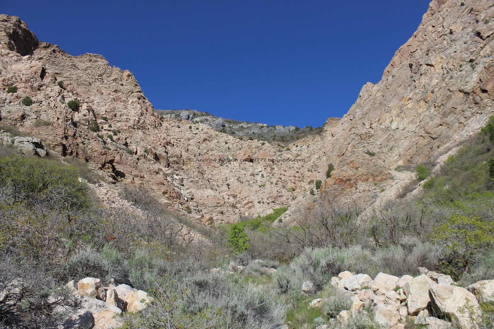
The canyon we are heading towards.

The trail so far is quite lovely.

The 2nd trail split. Keep right to stay on the main trail. Left will still get there going along the north route, but it is a little bit longer.

The 3rd trail split is what you need to watch for. Here we will take the right fork towards the Jump-off Canyon South trail. North will get you there as well. But that is what we did last time so I wanted to go up the south trail today.

Some lovely wildflowers.

The canyon again.

Ben Lomond looking majestic.

There are a couple spots with random side trails they are trying to re-vegetate. Please do your part and avoid following these older paths.

Into the scrub oaks.


More wildflowers.

Before long you will reach the old aqueduct road. The trail continues directly across the road.

There is water running in the aqueduct this time. That is a good sign. I kind of want to float down this, but I am certain you are absolutely not allowed to do that. Not to mention the sign below says is is very dangerous so yea, no.

Scree field.
Not long after this the trail will swing back north towards the canyon.

Ben Lomond again.

Valley view again.

Panoramic.

The next trail split. You will want to keep left, north. Now we will be hiking along the Bonneville Shoreline Trail (BST).
I didn’t take a picture of the next split but it said Bonneville Shoreline Trail North and North alternate. We keep to the main trail (left).

Cool alcove.

Cool pocked rock.

Nearing the canyon we are after.

Juniper tree.

First little bridge is over a dry creek bed.

The 2nd bridge. Hooray there is water running today. We might get to see the waterfall! Hint, if you are after the waterfall, and this is dry, it's probably not going to happen.

Just after the 2nd bridge, which is almost exactly a mile up, you will reach the spur trail into the canyon. The sign says waterfall (in season). This is an ephemeral waterfall, or seasonal waterfall. meaning it only lasts for a little while. Most ephemeral waterfalls only go during run-off, like Ghost Falls and others only after a good rainfall examples of those can be seen in places like Zion and we saw traces of some in Rock Canyon.
Oh and uh, here is where the climb really starts!

The creek again.

More wildflowers.

I think this is where the alternate trail connects. I am not sure how much this adds though.

Heading into the canyon.

The 2nd creek crossing, first without a bridge. There will be quite a few more of these.However, they are all easily done without getting your feet wet.

The cliffs above.

The creek.


Turkey vulture. I didn't think we had vultures in Utah until I ran into one on a road years ago, and then a few more years until I was able to identify them when they are soaring to realize they are actually pretty common. particularly along the foothills.

3rd creek crossing.

The creek is quite pretty.

We crossed it again. It was like, cross the creek day on this trail. oi.

Another crossing.

Cliffs above.

The view below.

Up canyon again.

Pretty yellow buds.

Thin, thin trail trough the scrub oaks.

If you have noticed a crazy amount of butterflies lately, it is the Painted Ladies Migration. They don’t sit still for long, but I did capture one of them.

Another scree field.

We just need to get around that fin before we will be able to see the waterfall.

Looking out of the canyon and across the valley. That definitely is not Antelope Island. I am thinking Freemont Island.

Ooh! The first little glimpse of the waterfall.

Looking out again.

Cacti!

The creek again.

We can see most of the waterfall now. This is cool.

Waterfall and creek below.

The trail getting more and more steep.

Getting closer.

Oh boy. This trail is kicking our butts.

Neat flat rock that the creek runs over.

The creek again.

The waterfall.

Cascades.

Side canyon looks like a slot canyon.

We can finally see the entire thing! Wow! That is awesome! It’s going quite a bit stronger than I anticipated.

With the cascades below.
The main falls again.
So I am just going to put out there that I think this is the best view you can get of it. You can see the entire waterfall. You can get up to the base of that final drop, but it is a serious scramble, and the view isn’t that great. So, if you struggle with steep slopes, know this is definitely the best view.
But you know, I had to see that for myself. We already came this far, why not go just a bit further?

The last stretch is boulder scrambling up the stream bed pretty much.

And I really mean a scramble!

The slot canyon again.
I had to take a break from the climb it was intense.

Looking down.

I thought that was pretty cool. A square shaped boulder made a triangle alcove.

Another flat rock with the creek flowing over it.

The previous slick area that caused us to need a break.

This was a high as I could muster, I was really struggling on this last section. I was just too steep and slick.
So, since Landis is more mountain goat that I am he took the camera up while I retreated to more stable footing.


He took some good shots. He also noticed an alternate trail hiding behind the trees. We’ll come back to that.
One of the other hikers up here must have noticed that I was struggling and gave me a congratulatory high-five for making it as far as I did. It’s silly, but I appreciated it. Humans lifting each other up. We need more of that. So thanks random dude. Made my day!

It is not obvious at all, but right behind where I was catching my breath there is access to the forest away from the creek. We had hoped it would be a little less intense and connect to the top. Spoiler, it did! It also offered a nice view of the cliffs.

The trail is thin, but it is there.

Success!!! I made it to the top! I am super proud of myself.
It’s cool to get closer to the waterfall, but as I suspected, now all we can see is the lowest drop and can’t see any of the upper falls. It is neat, but I am not sure if it was worth the scramble.

Faint waterfall-bow.

Splashy splashy.

The main stream and side stream.

With the cliffs above.

Looking down canyon.

I like all the side drips.

Better shot of the waterfall-bow.
Well, we had our fun but it was time to start heading back.

Uhg. Why do people have to ruin nice things.

Little alcove.

A square alcove.

I love the striping along the cliffs.

Back to the creek, and the scramble.

Back down to the better view point. As I mentioned earlier, I think this is a perfectly fine stopping point. No need to scramble just to see a ~15 foot drop up close.

View down again.

The final creek crossing. I don’t think I got this on the way up.

The creek through the woods.

Looking back towards the waterfall.

The creek again.

Cliff and trees.

View down again. We both marveled at how big the old army depot is. Wow.


The flat rock again.

Another view of the waterfall.

The creek again.

Freemont Island again.

Down canyon.

This canyon is just incredible.

Nice cascade.

Probably the last good look at the waterfall.

View down again.

Yup. Now the waterfall is hidden again.

Into the scrub oak.

I love these weird conglomerate rocks.

So pretty.

A trio of vultures.

I was taking a picture of the vultures, but I noticed to neat face in the rocks.
Looking back towards the cliffs.

Panoramic.

The creek again.

With the cliffs above.

Neat triangular pool.

Down to the lower cliff wall. I think this might be sandstone.

With the creek.

Itty bitty little window.

Neat vein of pebbles.

The creek.

Another itty bitty window.

One last parting shot of the cliffs.

View below again. Now we can see Antelope Island to the left.

Green slopes. This actually worked for me, I was wanting to do something in the SLC foothills today before I randomly thought to come here instead.

Back down to the BST. I had originally planned on continuing the loop to the north, but our legs were basically wet noodles at this point so we just went back the way we came.

Last shot of the creek heading down.

Ben Lomond peeking out from behind the ridge.

Okay, another shot of the canyon cliffs.

More fun windows.

Juniper trees.

Peak above.

Antelope Island again.

Through the scrub oaks again.

Little alcove again.

Trail split head towards the Jump-off Canyon TH.

Flat rock on some boulders.

Ben Lomond again. I still haven’t explored that particular mountain. I am not a peak bagger, at all, but I would like to see what else it has to offer eventually.

Back down to the open canal.

Reminder that the trail picks up again directly across the dirt road.

Into the scrub oaks again.

One of the many terrible shots I took of the very fast moving painted lady butterfly's.

Fun switchbacks.

More wildflowers.

Looking back towards Jump-off Canyon again.

Beautiful green hills.

Back down to the main loop split.

I love this time of year when everything is green and pretty.

Pretty trail.

I love this idea! Provide a bowl and do the leave a little use a little option for thirsty dogs!

Why the Ogden trail signage is amazing. The City, the Mayor, RAMP, The Climbing Club,and WSU. I really appreciate the hard work that went into it. Good job guys.

Back down to the parking lot.

One final look at the canyon.
That trail kicked our butts, but it was incredible! I am so glad I decided to try it again this year and see the seasonal waterfall! It was not terribly crowded but boy oh boy was it steep! My legs are still complaining about the work we put in to get there. Unfortunately, the mileage at the kiosk was really off, but it wasn’t too much further. But this climb took us quite a bit longer than we are used to because we had to stop and catch our breaths a few times. Last time I gave it a 9, and even though we saw the neat waterfall this time, I am going to leave it at a 9 due to just how rough it was and the thin trails.
As for difficulty, this trail kept getting tougher and tougher until a crazy scramble at the end. Going with a DR5. A little easier if you don't go all the way to the top, and even easier if you just do the lower loop.
Dogs are allowed, leashed.

No comments:
Post a Comment