.jpg)

Quick Details:
Length: we did about a mile and a half before turning back, It looks to be another mile or so to the lake shore from here.
Trail Type: Out and back.
Difficulty: DR3. It’s flat, but this time of year it can be pretty muddy.
Elevation Gain: eh… 20 feet or so.
Restroom: No.
Dogs? Yes. Not sure about the leash rules though.
To Get Here:
From Salt Lake City, take I-80 to Exit #111, 7200 West. Turn right at stop sign then immediately turn left onto the frontage road that parallels I-80. Drive west on this road about 4 miles to a small parking area to the north of the road.
The Trail:

The trail starts on this old dirt road. Be sure not to veer east as that would go into Kennecott owned land.

There is access through this old cattle guard. It is pretty wide. I have certainly squeezed through tighter ones.

The nice flat dirt road.

Looking back, honestly, if you notice an opening in this fence, that is the way to go.

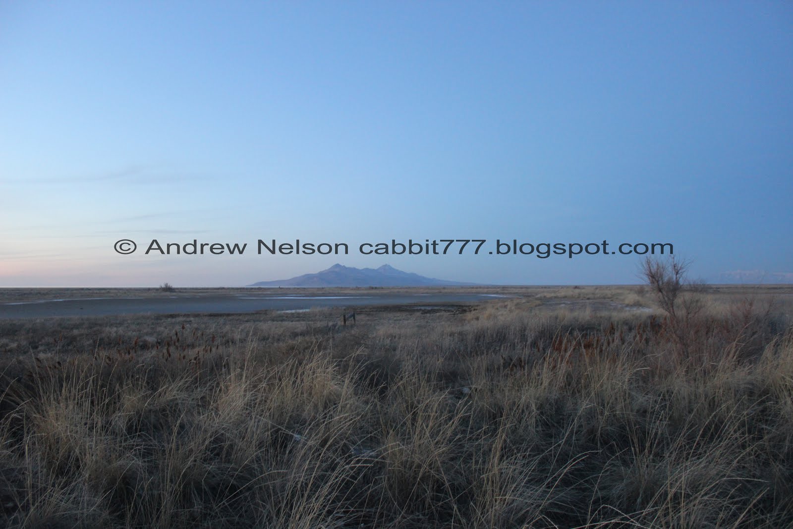
Antelope Island off in the distance.

For the most part the trail was fine, but there were quite a few sections that were sloppy, sucking mud.

Stansbury Island. Looking a little faint through the inversion.

Last time we were here there was an old ‘No Trespassing’ sign. It confused me as I thought the map displayed at the west section clearly showed the area being part of the conservation area. So we ended up going east, which we shouldn’t have done. However, now the sign is gone so I feel okay continuing along.

Some ponds to the east. Reminder, don’t head towards them.

With the mountains to the east.

View of Downtown SLC.

The trail starts to degrade to a twin track jeep trail.

View of SLC again.

The trail degraded down to a single track.

Antelope Island again.

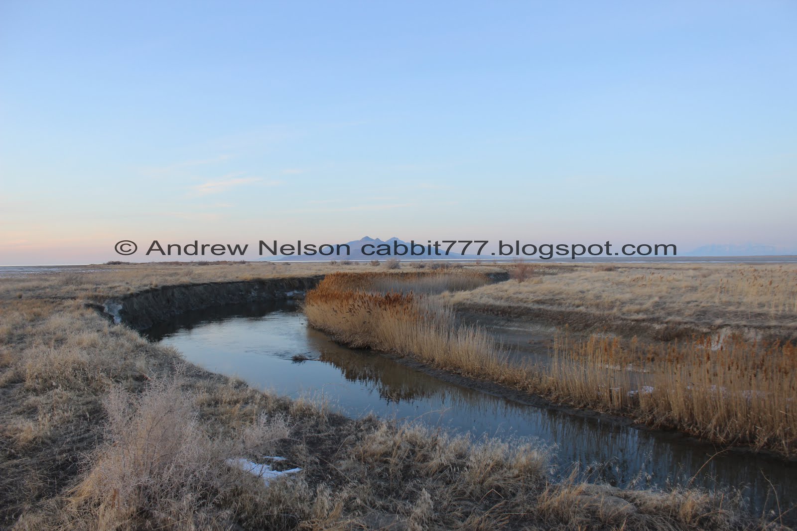
Eventually we reached Lee Creek. This is the first time I have actually seen Lee Creek after multiple attempts in this area.

Looking upstream.

Downstream.
The trail continued following the creek downstream. Considering there are no ‘No Trespassing’ signs, and I know that the area is the Lee Creek Conservation Area I figured we were okay to keep going.


The creek is quite a bit bigger than I thought it would be.

Following the creek west.

This is a really bizarre landscape. There are tons and tons of these little runoff channels heading into the creek.

Some of them get pretty deep.

Looking back east.

The current is producing little whirlpools here.

Continuing along.

Another view of Antelope Island.

Another channel.

Super muddy spot this was probably the worst spot. If the entire trail was like this, we would have turned back long ago.

Another channel.

Well this is neat. A bunch of small rocks sitting on the sand.

Some bigger channels.

Antelope Island again.

A particularly deep channel. o.O

It looks like some people just jump across but uhm… no. just no.

It gets a little more shallow and narrow a little further up. Not much of a detour at all.

Little waterfall.

Another wide channel.

Stansbury Island.

Where the creek curves back to the north.

Another super deep channel.

The riverbend again.

Mini canyon.

Had to do a small detour again to get to a more narrow, more shallow section. I did experience a small slip resulting in a somewhat muddy hand. Not too bad considering, but it did reinforce our reasoning to detour to the smaller sections of these deeper channels.

Beginning of a sunset.

Looking out across the incredibly flat landscape out towards Stansbury Island.


Old piers going off in the distance. I think it may have been the original train line out to Saltair.
Speaking of which, if you use the west entrance to the Lee Creek Area, you can see remnants of the original Saltair. There isn’t much left, but it is still kind of neat.

Another little channel.

Lee Creek heading north towards Antelope Island.

Random duck cutout. It crazy, no matter how remote a trail might seem, there is always some random garbage.

Some green clay at the bottom of this one.

The creek again.

The flat expanse of the lake bottom and Stansbury Island.

Antelope Island again.

The mountains to the east.

Random pieces of dishes.

Stansbury Island again.

The Kennecott Smelter Stack.

Random tire. This made me wonder if it was lost out here, or if it fell off a car on i80 and rolled out here.

Looking back east.
Looking north towards Antelope Island.
Well, I was really hoping to make to where Lee Creek meets The Great Salt Lake, but it was starting to get late, and it looked like there was still quite a ways to go. I guess we shouldn’t have spent so much time at The Great Salt Lake State Park. Anyway, we decided it would be best to head back. We went about 1.5 miles out and upon reviewing the map, I think there is another mile or so to go.

The sun is getting ready to set.

Starting to get a nice sunset.

The creek again.

Back to the line of piers.

The creek.

One of the deeper channels.

I don’t remember if this is the same one, or another one.

The creek again.

Short set of rapids here.


Heading back east.

The runoff channels heading into the creek.

Looking back west.

Such a bizarre and fun landscape.

One last look at the creek before we swing back south.
Last view of Antelope Island.

Heading south again.

The inversion lit up from behind.

Back onto the dirt road, and almost back to the trailhead. Phew, we will make it back before dark dark.
That was actually a rather interesting and fun trail, even if it was basically flat. The landscape was interesting, the creek was nice and bigger than expected. It was super peaceful and quiet, we didn’t run into any other people. I was disappointed in the lack of birds, as that was one of the reasons I wanted to reach the creek. Might not be the right time of year for it. Going with 7 squirrels today. I think if I would explore this area again, I will start at the west trailhead and try to do a diagonal B-Line to the mouth.
As for difficulty, it was flat and easy going, but there were some obstacles, and some parts the mud was pretty bad. DR3.
Dogs are allowed. Not sure what the leash rules are here though.

No comments:
Post a Comment