.jpg)

Quick Details:
Length: 1.3 mile loop.
Trail Type: Loop with connection options.
Difficulty: DR3. It’s flat, like paved, and paved for some of it.
Elevation Gain: NA its flat.
Restroom: I saw a porta potty, but not sure if it is always there.
Dogs? Yes. I think it is leash required though.
To Get Here:
Take i215 to the 3500 S exit. If you came from the north, it will be easier to turn left on Decker Lake Drive. Take Decker Lake Dr just over a mile and turn left on Research Dr. Take the very first left on to Decker Ln. You will see a large parking lot off to the right just before the gate.
If coming from the south, getting the 3 lanes over to the left to turn left onto Decker Lake Dr is, well, pretty impossible. You have 2 options. Turn right there, and turn around… or continue down to Redwood Rd and turn left. Turn left on Research Dr. Left on Decker Ln.
The Trail:

There are a couple little openings in the rail to get through then you just have to walk… 50 feet or so through the grass to reach the trail around the lake.

First view of the lake.

Gravel lined path. We decided to go clockwise.

The lake again.

Panoramic of the eastern end.

Lots of seagulls.

I pulled out the telepohoto lens to get a little closer to what I initially thought were wood ducks, but I think they are northern shovelers.

Yep, I am fairly confident they are northern shovelers.

They are super pretty.
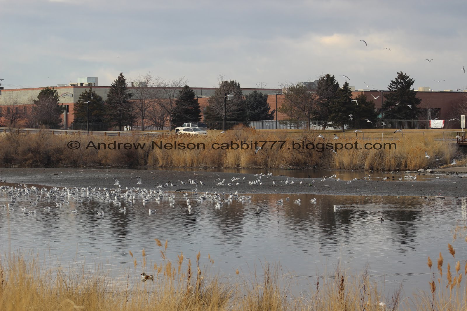

Loads of seagulls in the western segment.

Long faded informative sign. All I can make out of tiger beetle. Looking that up solved a random mystery beetle from when we did Killyon Canyon that I just could not identify. Love when odd mysteries randomly get solved. Other than the fact that these beetles tend to like to live on sea and lake shores, I am not sure why it is mentioned here. I would guess there is a good population of them here.

This trail is under a major flight path for the airport. Little noise pollution, but you can see the planes fairly closely, which is cool.

Little wooded section.

Making our way around the western section.

Starting to get a view of the mountains.

The far west end of the trail follows fairly closely to i215 and, well, that is all you can hear for the moment.
The lake looking east.

More of i215.

The lake again.

Panoramic of the west side.

Little wetland peninsula.

River on the other side. I wasn’t entirely sure which direction this was flowing, but I think it was flowing in, maybe.

Old sign with a ton of graffiti.

North western corner with a little sandbar and a view of the mountains.

Little speck of light on the mountains.

Nice little bridge on the north side.

Lots of ducks and some American coots in there too.

The trail is paved on the north end.
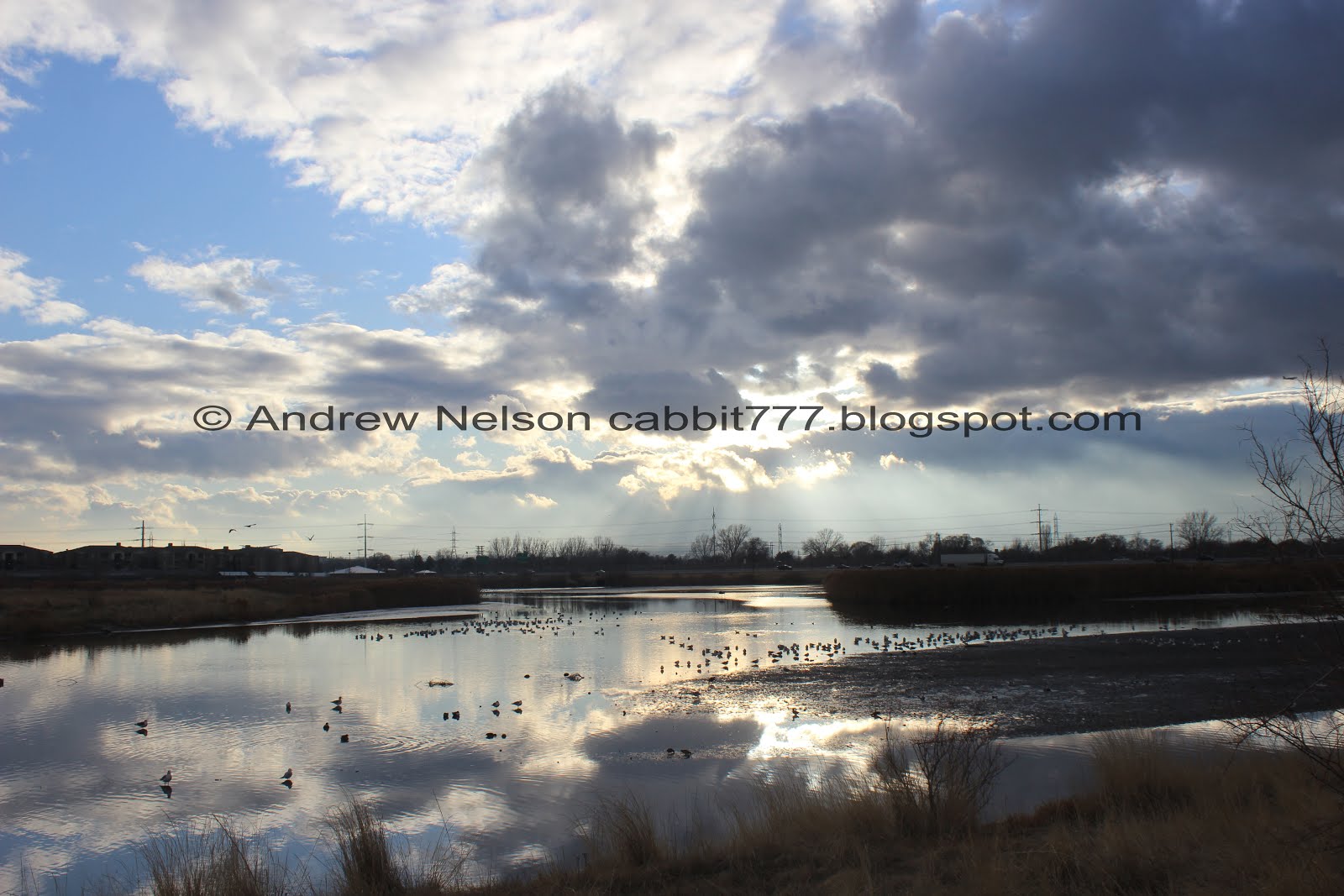
Beautiful back lit clouds.

Which created some cool sun rays.

The eastern section.

Amazing clouds.

More sun rays.

Geese.

Panoramic from the east end.

That is a very bright ray of light.

This is the benefit of going out when the weather isn’t perfect you get some cool clouds and lighting.

The seagulls like that schools parking lot.

Near the far eastern tip you will depart the pavement again to keep going around the lake. You can, of course, stay on the pavement and walk back up Decker Ln. back to the parking lot if you desire. It might add a 10th of a mile or so.

The far eastern tip. Again, the water is too still so I am not sure if this is an inlet or and outlet, I would imagine it's likely an outlet to head towards the Jordan River though.

More fun clouds.

The lake again.

More geese.

The lake with a flag.

Some more coots.

One last parting shot.
Well, its just about as long as Bountiful Lake, and just as easy. The views are just about as good, but i215 is a lot louder than Legacy, well, at least than it was. Like I said, I will give it another shot, but might have to keep looking for my peaceful pond to enjoy. But, I didn’t hate it. Going with 7 out of 10 squirrels.
As for difficulty, it is flat, partially paved, and well packed gravel for the rest. DR3.
Dogs are allowed, but them must be leashed. Please clean up after your furry friends.

No comments:
Post a Comment