.jpg)
Scenic Drive Details
Length: The causeway is approximately 7 miles. Then the island can be split into two sections for driving. The north end has a 4 mile loop with about 2 miles of spurs up to Buffalo Point and down to White Rock Bay. Then the East side down south is about 10 miles down to Fielding Garr Ranch with an additional 1.5 miles further south on dirt roads, if the gate is open, as well as a few spurs out to a few items of interest.
Time Needed: Probably at least 2 hours on the island, plus travel to the island.
Road Conditions: Paved, generally flat. Some well graded dirt roads that are not required to enjoy the island.
Summit: NA
Restrooms: Plenty. Mix of flush and pit toilets.
Interesting Things: Mostly the wildlife and history
Other Info: Fee area $10.00 per car.
To Get Here:
Take the Antelope Drive exit 332 in Layton. Head west.for about 6.8 miles to the fee booth. After paying your fee go across the causeway.
The Adventure:

Well crap. I have never seen the line to the fee booth go back this far! It was almost a mile out and took us about a half hour to get through. (Passenger Seat Photography (PSP)). Either its a beautiful day and everybody had the same idea we did, or all the people who didn’t have to go to church today came here instead, or both. If I knew how crazy it was I probably would have decided to go elsewhere. I still feel safe to go hiking but maybe not busy trails right now.

I got excited when I saw the sign thinking we were close, but see the yellow sign on the left? That’s an 800 ft. warning for the gate. Oi. (PSP).

Since we were stuck in slow moving traffic, I was hoping that I might see some hawks, or other neat birds. Guess I will have to settle for this killdeer (PSP).

Finally out on the causeway (PSP).

Approaching the island (PSP).
The North Island Loop:
We decided to start with the north end of the island today. When you hit the fork, you can go either way, but right is the quickest way to reach the Visitor Center (currently closed due to the pandemic concerns). We went left today.

Already seeing bison (PSP).

A little closer (PSP).

First view of White Rock Bay as we descend into the White Rock Bay Campground.

At the north west end of the parking lot is the Lakeside Trail.
We continued to the south west end of the parking lot where there are 3 trails. White Rock Loop, a trail out into white rock bay, and Bone Road Trail. We haven't done any of them yet, but we decided to to do the Bone Road Trail today.

View from the Bone Road Trail.

Heading back out of the White Rock Bay Campground (PSP).

Bison (PSP).
We didn’t do the full loop on the north island, but I'll borrow couple pictures from some other posts to show some of the other fun destinations:
The Visitor Center from 2015

Lady Finger Point. This is probably the shortest hike on the island. Definitely worth checking out.
Bridger Bay 2015.
Buffalo Point. you can drive up and experience this view as we did in 2016, or, you can hike out to the point as we did years ago in 2009.
Now we will do the east side of the island down to the south.

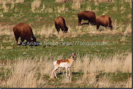
Bison and stormy weather.

If you are lucky, you might spot a great horned owl. If you are luckier than I am, you might even spot a burrowing owl. Actually, I think I saw one briefly once, but didn't manage to get a picture of it.

Faint rainbow.

Before long we passed below Beacon Knob.
View from Beacon Knob. There are a few ways this can be reached, but the most direct is a trailhead just north of here called the Gravel Pit Trailhead.

Frary Peak (the highest on the island) Stringham Peak, and Dooley Knob (PSP). These are reached from the next trailhead.

Me at the top of Dooley Knob.

Looking back towards Beacon Knob (PSP).
I didn’t get a picture but we passed by the historic Frary Homestead on the way. There isn’t much left of it, but it is still kind of neat.

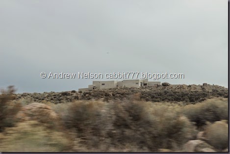
Before long we arrived at Fielding Garr Ranch.

The side of the barn.

Some of the other buildings. They are are closed due to the current social distancing measures being taken.

Spring House. The natural humidity of the fresh spring water kept milk fresh longer. This is what they used before refrigerators.

Where the spring comes out of the spring house.

Downtown Salt Lake.

With more of the mountains.

Twin peaks.

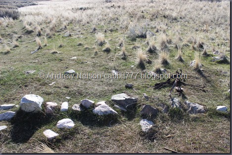
Old corral.

Old wagon. You can see a little more of the ranch on my post from 2015.

The sentry. The trailhead for this is about 6/10ths of a mile south of here on a dirt road (closed winters).

View of The Sentry from the trail.

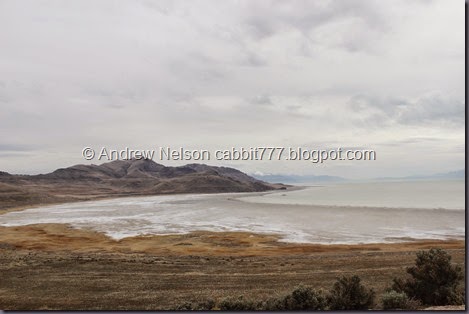
View of the south island. You can do more of that on the South Island Trail. There is about 1.5 miles of dirt road which is closed in winter.

Dirt road down to the South Island trailhead from 2016.
You might even see some wildlife down here.
Well, we had our fun, but it was time to head on back.

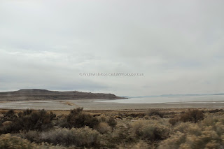
The lake is pretty much the Jordan River making it’s way across the lake bed this far south (PSP).

The lake again (PSP).

Enjoying the scenic drive (PSP).

Dooley Knob again (PSP).

Another look at the dry lake (PSP).

Beacon Knob again (PSP).

The lake looking more lake like near the north end of the island (PSP).

The opening in the causeway (PSP).

Bison on the beach (PSP).

Bison near the road (PSP).

The lake again (PSP).

We got stuck in a bison jam so I took advantage and took a few pics (PSP). The bison jams are not as bad as they can be in Yellowstone, but they can stop you for a few minutes sometimes here on the island. I try to be patient and understanding, some people have never seen a bison before. But please, if you visit, and get excited about a bison, do try to pull off to the side so traffic can keep moving.

Now on the causeway heading back towards civilization. Here is the lake again. (PSP).

The causeway (PSP).

I asked Landis to pull over so I could get a proper shot of this neat storm across the lake.

Fun storm.

A look back towards Lady Finger Point here it is along with Egg Island.

Looking back towards the island (PSP).

More fun clouds as we get back to civilization (PSP).
I still have quite a bit of trail to cover before I can say I have fully explored the island, but we have done quite a bit! I love coming out here to enjoy the wildlife and the pretty landscapes. Definitely recommend doing it at least once!
No comments:
Post a Comment