.jpg)
The Yellow Fork Canyon County Park area is a huge area of open space that Salt Lake County has set aside and offers a ton of trail options. In fact, quite a mess of trail options I am pretty sure we took a wrong turn from the route I had planned. However it is pretty and we enjoyed what we did today. The main trail was a little busier than I would have wanted, but once we veered onto the Big Rock Trail we didn’t see very many people at all. I totally forgot about the fact that this time of year the lower sections of trail are extra crowded with people taking cute fall color with the family photos. But most of those people don’t venture up to high. Today was a great day for wildlife! We saw loads of deer, hawks, cows, and even an owl! We also heard turkeys, and coyotes.

Quick Details:
Length: I think the full loop we ended up on is 6.8 Miles, we ended up doing 5.42 miles out and back.
Trail Type: Out and back, loop options
Difficulty: DR3. This was pretty easy.
Elevation Gain: 1354 for the full loop, we did 1062
Restroom: Yes. Pit toilets at the trailhead.
Dogs? Yes. Leashed.
Other Info: I did not follow my own advice today, but I recommend having the area map handy. (External Link).
To Get Here:
Oh boy. From i15 take exit 289 for Bangerter Highway. Go about 5 miles and turn left on 13400 S. Go about 3 miles and turn left on 6400 W,/Rose Canyon Rd. .6 miles later turn right to stay on Rose Canyon Rd. 1.4 miles later turn left to stay on Rose Canyon Rd. About 2 miles later will be the trailhead parking.
If you are starting from Bangerter and are north, Start from 13400 S. But turn right, then follow the rest of the directions above
From there, cross the bridge over the creek and take the right fork. Or you can hike up the dirt road on the right (north).

The Kennecott Copper Pit (Passenger Seat Photography (PSP)).

I am pretty sure every single time we have come up here we have seen deer (PSP). Be on high alert for them.

As far as canyon roads go, this one isn’t too bad (PSP). A little windy, but not steep.
The Trail:

Rose Canyon to the left and Yellow Fork Canyon to the right.
The parking lot was completely full. We considered going somewhere else, but I remembered the huge mess of trails so I thought we’d be fine. It did however make me make a last minute change in my plans. I was originally planned on just doing Yellow Fork again.

Crossing Rose Creek.

Which is barely a trickle.

Yellow Fork Creek. the 2 creeks combine just below and continue on as Rose Creek.

They made the short re-route more permanent. I didn’t take a picture of the sign but it says no trail building $500 fine. Guess they are trying to get a handle on the confusing web of trails.

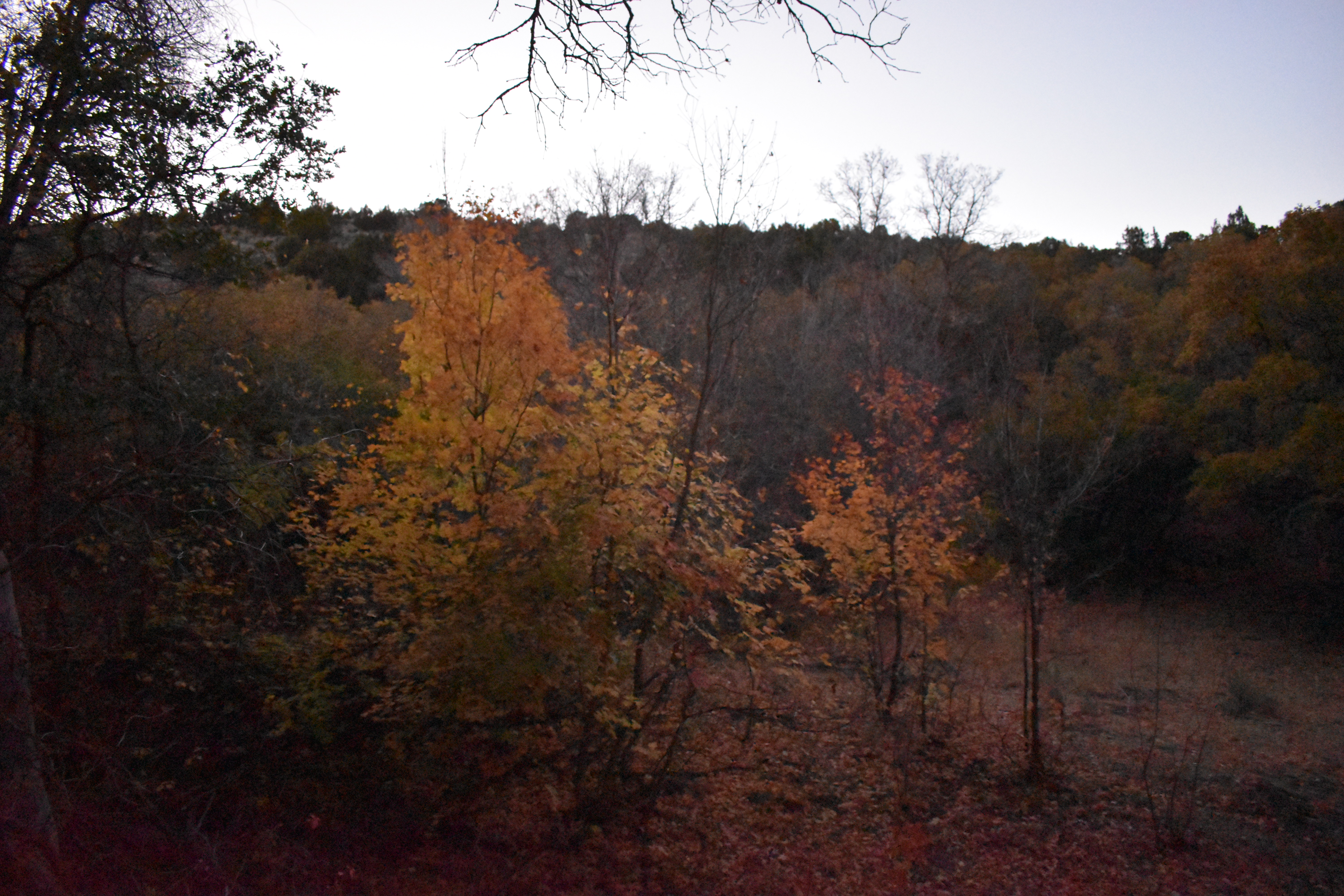
There is a little color left up here.

The creek below.

More color.

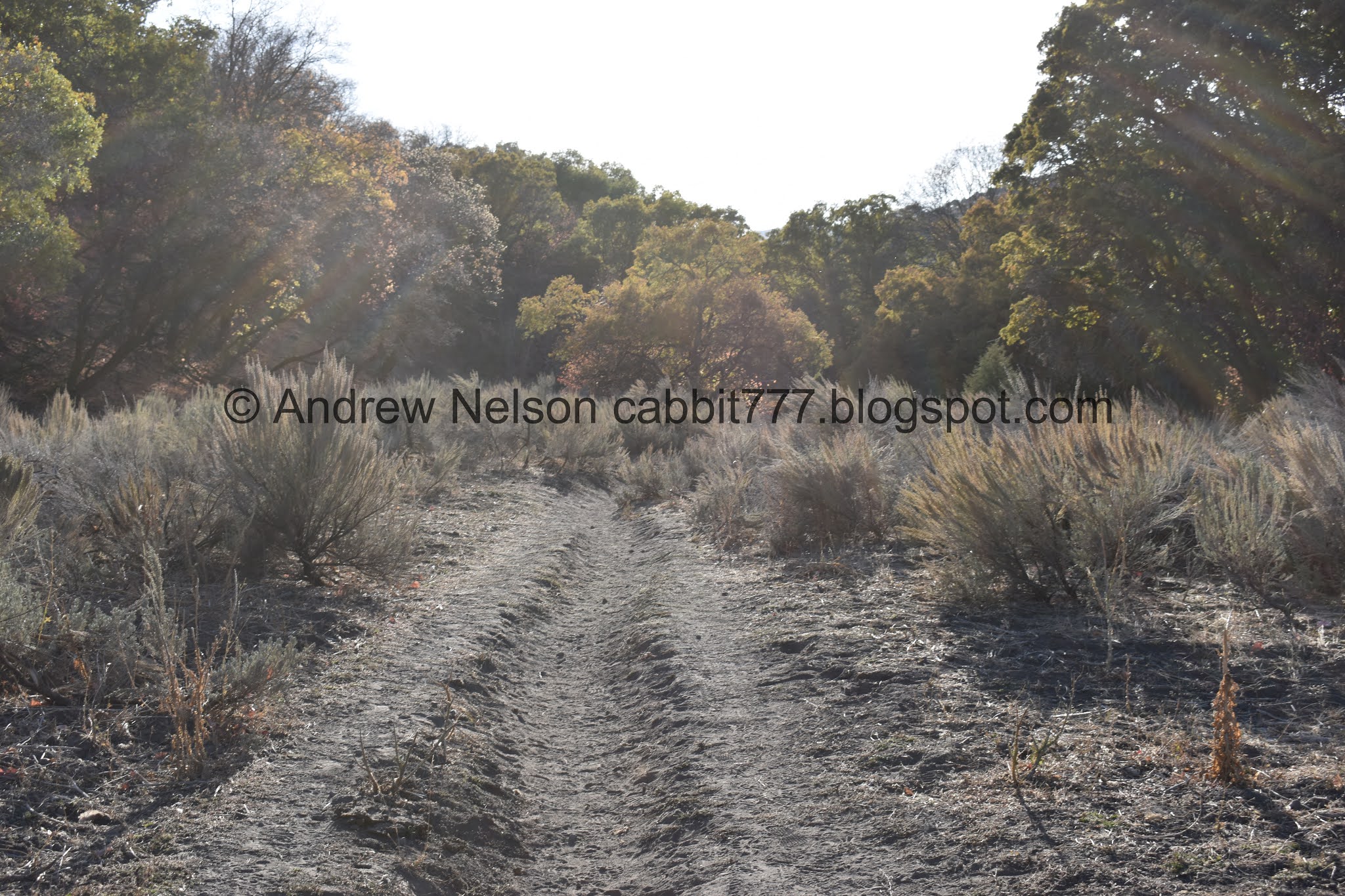
Reaching the big clearing.

More color.

The creek has worn its way down pretty far in a narrow gorge. We got to talking about what might cause this. And I remembered a little further up it seems to not have much of a bed at all and just goes over the ground. Ultimately we concluded just different material that it is cutting through, My total not scientific guess is it looks like beach sand. I think this might be near or on the Bonneville shoreline so that would make sense to me at least.

Another view.


Some more color.

The ridge I had, last minute mind you, decided to circumnavigate. The trail split is here where the 2 canyons converge. Just under a half mile up.
Now we are on the Big Rock Trail, and uh, hiking directly into the sun.


More color up here.

This is a lovely side canyon.


Hiking into the sun is fairly unpleasant, however the backlit color is great!

Lovely forest.

Dry creek bed.


I am really enjoying this canyon.


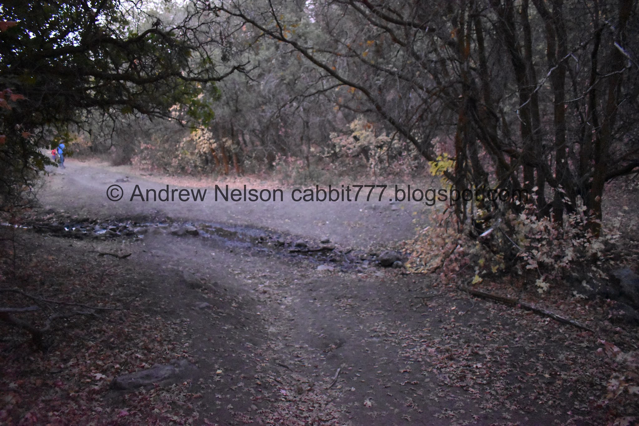
Oh, now there is water in the creek? Weird. We didn’t realize there was a trail split here so we crossed over the creek and kept going. But you can keep to the left here too and not cross. Both trails converge.

Then we enter a nice thick forest.


Lovely thick forest.

Looking up.

I am particularly fond of trails that appear to go through natural tunnels.

Looking up again.


More tunnel.

Looking up.

Nice little clearing.

The source of the little bit of water in the creek bed. A small spring.


A particularly colorful section.

The gully narrows a bit through here.

Completely covered in fallen leaves.


Really enjoying the forest through here.


More color.

The gully below.


More forest.

I like the lens flares.

Forest.


Some more color.

I wonder if this is the big rock the trail is named for. Probably not, its not that big.

At almost exactly a mile from the previous trail split you come to another trail split. Hang a right.

The split is at this big clearing but something else had my attention at the moment.

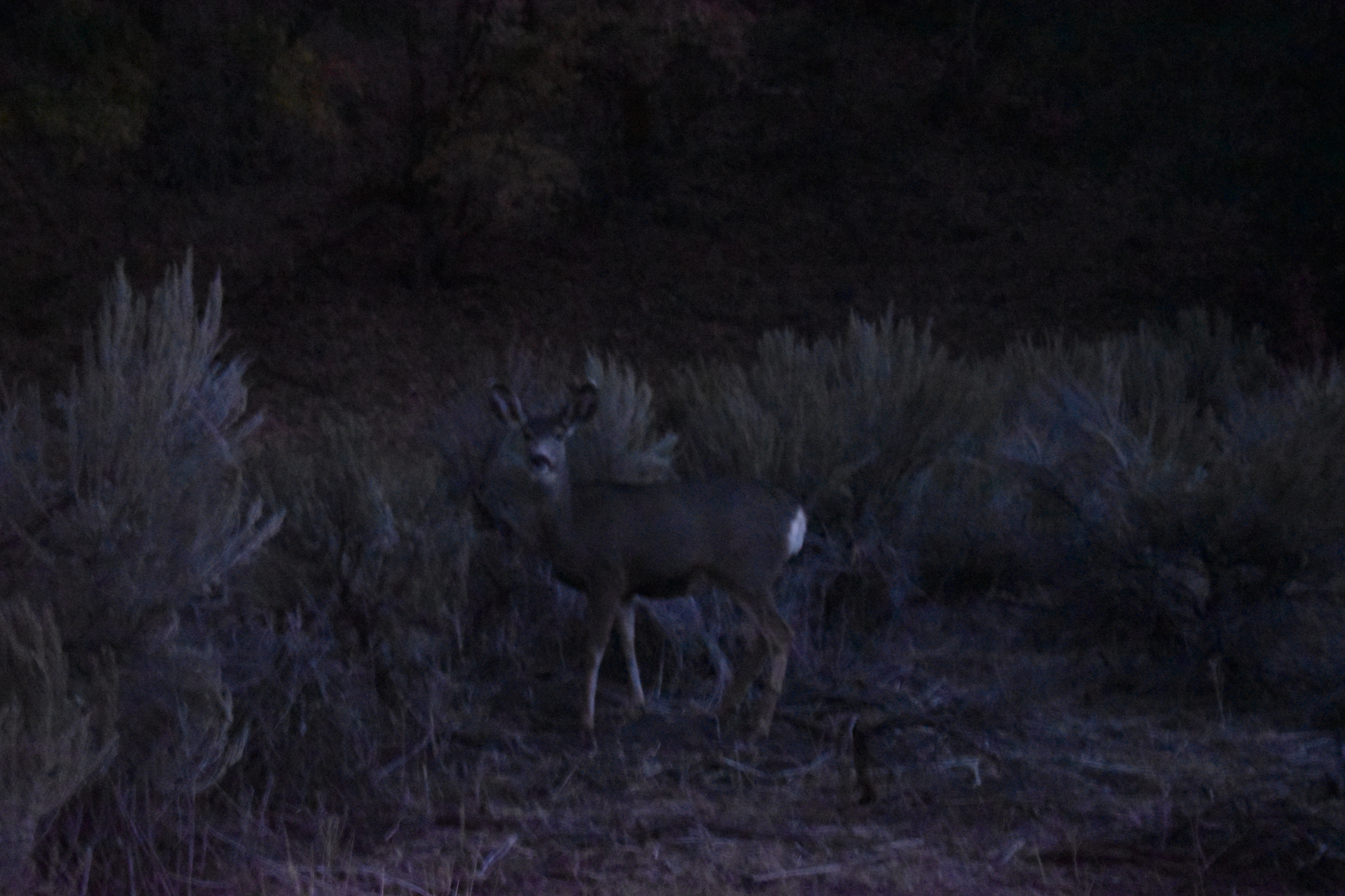
Deer!

I don’t care how common they are, I love any encounter I have with wildlife.

I generally try not to get too close, but these guys are right on the trail. They usually spook and run off before you get too close.

Looking back down.


Aww, it’s just a little one.


These guys are not as skitzi as most deer.

There they go.

The last little straggler.

More of the clearing.

A hawk of some sort. Little too far away to identify.

Looking back down.


Oaks.


Little bit more color.

At some point the wide old ATV road trail will swing to the left or west. I guess the trail I wanted to take split off somewhere around here. So, unexpected detour.


Some more color.

After the curve to the left the trail remained very wide, but It very slowly and subtly start getting more and more steep.


Small clearing.

This happens at least once every fall hiking season, but it still amuses me.
There was one time I accumulated a whole stack of leaves.


Hard to see through the trees, which is why I initially thought this was a moose. Nope, cow. I was not expecting to run into any cows.


Looking back down we are able to see some of the peaks rising above the ridge below.


Then the trail curved to the right and started heading north again.


This is where the trail gets quite steep.

Neat rock formation at the very top of the canyon.

Looking back down and across the valley.

Steep!
Somewhere along here we reach 2 miles. We agreed if we didn’t see the fork at about 2 miles we would turn back. But, we figured we could make it to the ridge at least.

The side canyon we just climbed.

Again.

Nearing the ridge.

Twin Peaks, Lone Peak and Box Elder Peak.

Mount Timpanogos.

Oh boy. We can see the plume of smoke from the Range Fire.

We reached the ridge.

The trail dips down into the next canyon and then up over the next ridge. I was hoping it would go to an area I was already familiar with.
For some reason my trail app was not working on GPS so I couldn’t confirm we were where I thought we were. So after a little back and forth we decided to turn back and return the way we came. I am super glad we did because, we weren’t where I thought we were and this route would have been a lot longer than I planned.

Its amazing how much of the Wasatch Front I can see from here. From Ensign Peak to Mount Timpanogos and beyond.

Looking up the ridgeline towards the peak.

Fun pinwheel looking clouds.

Another view down canyon.

More color.

The steepest part.


Some more color.


Deer butt.


Oh, hello there.


More color.

I know domestic cows are not a crazy as bison, but they are just as big so uh… this makes me a little nervous.

Nice girl….
Actually talking to it seemed to attract it. I also know that cows, like most animals enjoy a good scratch. I was tempted for a minute, but, I don’t know this cow. And have a good healthy respect for large animals.


Nearing the trail split where we saw the deer earlier. It would seem this is a bed down spot.

Just passing through, yall can relax.


More forest.

Another deer.


More forest.


More forest.

The gully.


Trying to enjoy the remaining color in the dwindling light.

Looking up.


Back down to the creek crossing.


Looking up... for a reason this time.

We started to experience a really odd encounter with an owl whom seemed to take an interest in us and started flying pretty close overhead. I didn't think I managed to capture it but, oh snap, I did get a shot, although a terrible one. It swooped over us a good 3 or 4 times.


Some more color in the dwindling light.

More deer. this is near the lower trail split.


Landis noticed the owl ahead of us. My shots are very grainy and blurry, but it looks like our little owl friend is a great horned owl.
After letting us try to get a proper shot of it for a few minutes, and failing due to low ight, it flew off. However it gave us one final buzz by.
Another weird thing, the few minutes we tried to get a good shot of the owl, the deer around us were acting.. really weird and were running and leaping past us. Seriously, what the hell is going on?
Deer normally don’t allow me to be this close.
After this it really got to dark to attempt any more pictures. About halfway down I thought I heard a cougar and my heart just dropped into my stomach. after stopping we realized it actually was a group of coyotes. So, that might explain why the deer were skitsy.
I enjoyed this trail a little more than I anticipated and might have to come back in the spring. Plus I would like to find the route I had originally planned. It wasn't very crowded which is a particular plus right now. And all the wildlife, holy crap it was a good day for wildlife. Going with 9 out of 10 squirrels.

As for difficulty, Most of the trail was pretty easy going and would fall into my DR3 category. The last bit we did would fall under DR4.
Dogs are allowed, leashed. Please clean up after your furry friend.

No comments:
Post a Comment