.jpg)
The Primrose Loop is a nice short loop that lets you explore a small sample of Dimple Dell Park. It features some nice views of Dimple Dell, the mountains and the valley below. Like the Fox Point Loop we did last month, there is a huge mess of trails and we had trouble staying on the intended path. Comparing my route to the route highlighted on the cities map I think we were pretty close, but cut off the far east tip.

Quick Details:
Length: We did about 1.34 miles today. I would wager the extra tip would add about 2/10ths of a mile.
Trail Type: Balloon
Difficulty: DR3. Most of it is pretty easy peasy but there is a good climb.
Elevation Gain: About 200 ft.
Restroom: Not at the neighborhood connector trail we used. But there is one at the nearby Wrangler Trailhead (currently closed in winter) or there’s always Smiths.
Dogs? Yes, Leashed.
Other Info:
To Get Here:
I saw 2 options that looked like they would offer easy access. At the end of Flanders Rd. Or Approximately 1850 E Sego Lily Dr, I chose the latter for reason I will express later.
From the north, take i15 to 90th South. head east to 13th east, turn right. Go about a mile and turn left on Sego Lily Dr. Go about 8/10 of a mile, and park on the road.
From the south, take i15 to 106th South. head east to 13th east, turn left. Go about a half mile and turn right on Sego Lily Dr. Go about 8/10 of a mile, and park on the road.
If you prefer Flanders Rd. it just a little shorter off of Sego Lily Drive, then just head south to the end.

Boy is it hazy today, yuck (Passenger Seat Photography (PSP)).
The Trail:

When you arrive you will be next to this empty lot, that you will trek across to get to the gully.

I decided to do this loop from this neighborhood connector because I wanted to see this. The reason this lot is empty is because they have set it aside to continue 20th East/Highland Drive across the gully. Hopefully that doesn’t happen in my lifetime but it could. I mean, I am biased cause I like Dimple Dell but I really don’t think we need another way across it. We have 13th, 7th, and Dimple Dell Road and Wasatch to the east. It is pretty well crossed by road.

It looks like this is a popular sledding hill. Again, I grew up by a lot bigger hills so I feel spoiled, however, like I mentioned last week, maybe a shorter hill is a good option as trudging back up the longer hills was a bit of a chore. Yup I need to pick up a sled and bring my inner child back out.

Starting to get a peek at the mountains.

Some of the infrastructure already built in.

I was wondering why the packed down trail curved to the left, was starting to assume everybody before us wanted to go east. But then I noticed the fence and the gate is over this way.

Said gate.

Now we are on the North Rim Trail for just a moment. I decided to go counter clockwise today because it looked easier to find the loop this way.

Yucky haze.

Looking back towards Mount Jordan.

Looking down in the gully.

Before long we found the turn off we needed. It is labeled as the Mountain View Trail, and it does connect to that for a minute.

Heading down into the gully.

Mount Jordan again.

Sun going down. Part of why I decided on this trail was because we got a bit of a late start.

Before long the trail switches to the east.

Then we connect to the Mountain View Trail briefly.

Initially I missed the turn off we needed. However luckily I have a GPS map in my pocket and I was able to get us back on track.

It’s faint, but has been used enough to follow.
Mount Jordan again.

Little ravine.

Beginnings of a sunset.

Back up the hill. The trail is pretty faint here, but with the help of GPS we were able to stay on track.

Oof, more up.

View back down into the gully.

Sunset.

The haze again.

Final push.

View towards the Jordan Narrows. Or as Landis calls it the toilet drain. He explained that the way he sees it the valley looks like a big toilet from above, and well, that is where it would drain out.

Last light on Twin Peaks.
.jpg)
Panoramic.

Human and dog prints.

Sunset again.
.jpg)
Another panoramic with Point of the Mountain.

More last light on Twin Peaks.

Sunset in the Jordan Narrows.

Mount Jordan again.

Faint trail.

I think these might be bunny tracks.

More sunset.
.jpg)
Another panoramic.

Another trail split. I guess the main loop would have been right here, but we went left. This cut off the far east tip of the main loop we were trying to follow, it looks like we cut off about 2/10ths of a mile.

Before long we were back on the North Ridge Trail.

We found another option to access this trail at approximately 2026 Ashley Ridge road.
Heading down the North Ridge Trail.

The clouds are starting to envelope Mount Jordan.

The Jordan Narrows again.

Again.

Clouds coming into Bell Canyon.

The valley below.

Getting a little bit more sunset color.

Mount Jordan again.

The valley again.

The clouds are now obscuring Lone Peak.

Into the gully again.

Now we just need to find the gate.

Another sunset shot.

Ah, here we go.

Now we just have the short ~2/10th of a mile connector back to the car.

It sure got gloomy in a hurry.

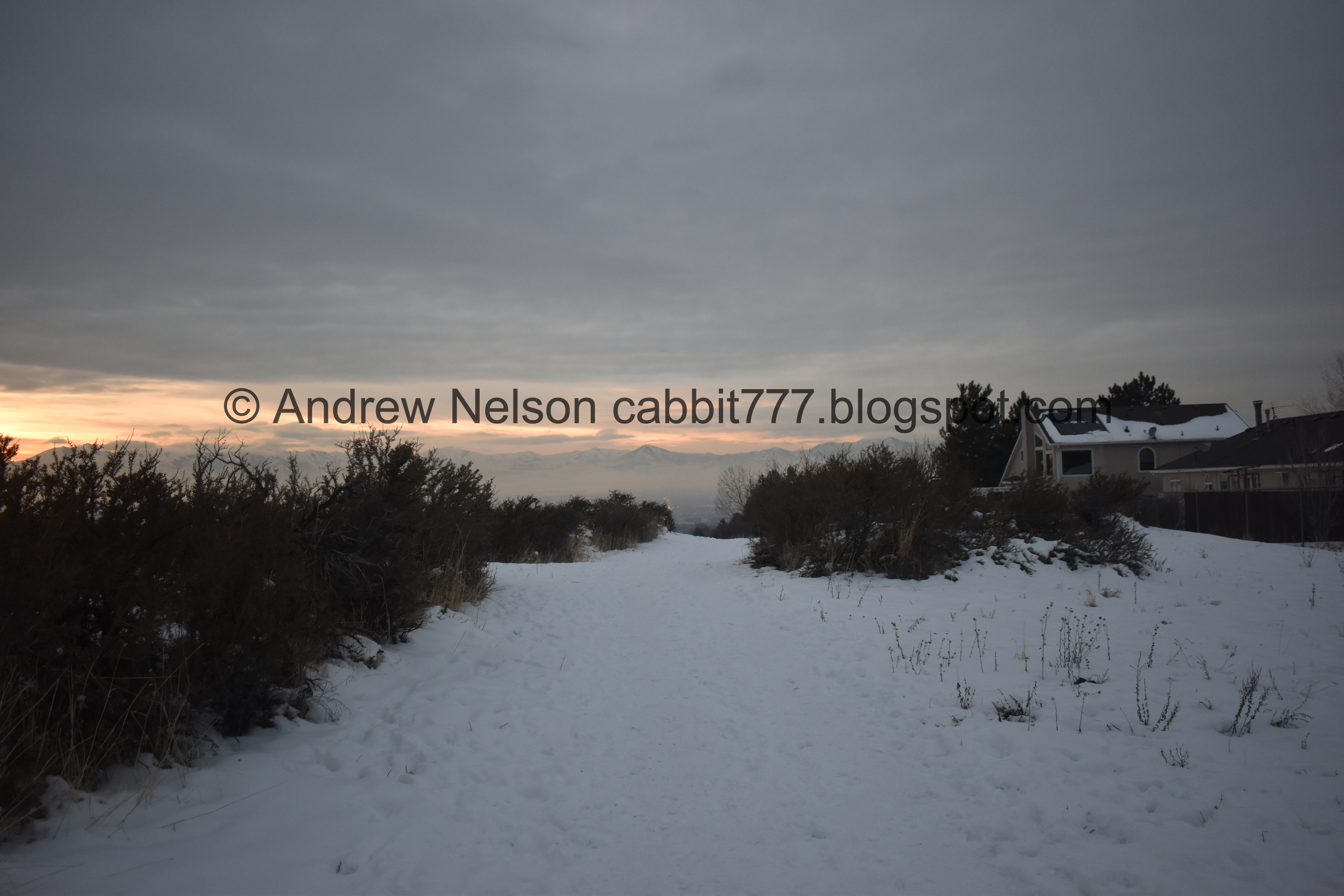
Okay a little better bit of sunset peaking out beneath the storm clouds.

This undeveloped strip continues all the way to 9800 south where it connects to 2000 East/Highland DR. As I mentioned it has been set aside to extend Highland DR. out this way.
Eh, all in all it was not a bad loop. Nice views etc. Not at all busy. But nothing particularly special. 7 out of 10 squirrels today.
As for difficulty, it is mostly pretty easy going, but there is certainly a climb!
Dogs are allowed, but must remain leashed. Please clean up after your furry friends.

No comments:
Post a Comment