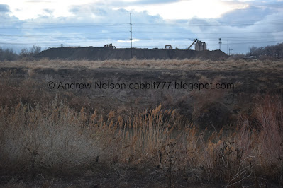
Valence Pond is a small pond located near the end of a neighbor hood connector trail off of the Jordan River Parkway. The fully paved trail offers so nice views, some forest, the river, and the pond. Our previous adventure was a bit short again, so we added this on, even though we have done it before.
Quick Details:
Length: 2.22 miles out and back.
Trail Type: Out and back, connector, Balloon option (with walking along busy roads).
Difficulty: It’s paved and fairly flat. DR2.
Elevation Gain: About 26 feet.
Restroom: No.
Dogs? Yes, leashed.
Other Info: Cities: Midvale. JRP Mile Markers: 24. One of the few trailheads accessible via Trax.
To Get Here:
From i15 take the 7200 S exit. Take the first left south towards 7800 S. Head west. You will see the TH on the left just before the overpass. If you pass Gardner Village, you went to far.
7800 S. and approximately 1000 W.
The Trail:
They are doing some construction at the trailhead. This trailhead was closed last summer for a while.
Onto the trail.
A Gold Medal Mile. I have found quite a few of these, including several along the Jordan River Parkway. These were added during or after the 2002 Olympics.
Oh fun, Midvale has added some information signs. This one talks about the restoration efforts.
Random ramp that I can’t imagine many people would use, but it looks like it connects to the Trax Station, so maybe the employees of the building above might use it.
This bridge is new. The old one was a little.. old.
The river.
Fun clouds.
Every city did different things to provide benches along the parkway. Midvale opted for these red rocks, at least through here.
High bank with what appear to be kingfisher and/or bank swallow nests.
Redevelopment of Jordan Bluffs.
It took over 30 years for Midvale, the EPA, and Utah Department of Environmental Quality to redevelop the former Sharon Steel Superfund Site.
The trail again.
The river.
Here is the Bingham Creek Confluence. Funny that a park named Bingham Junction Park is about 1.5 miles to the north.
There is a little island with a duck in front of it.
Mile Marker 24, with a lost cat sign.
“Bench” and sign.
This one talks about doing your part to ensure storm water that runs into the Jordan River is pollutant free. Something it mentions you can do to help are: Keep dogs on leash, be aware of noxious weeds so you can pull them, and stay on designated trails to avoid trampling sensitive plants and prevent erosion (this will be ironic in a moment). It also mentions some places you can go to learn about native flora and fauna such as the Conservation Garden Park, Utah Native Plant Society, and Tracy Aviary.
Side note, these signs are brand new and the text is already failing.
The trail.
Local flora.
The half mile marker for the Gold Medal Mile. I think its funny it doesn’t tell you which way you need to go to complete it because it’s right before a trail split.
Trail Split. Right will stay on the main Jordan River Parkway and leads to 90th south. Left is the neighborhood connector, and the way you need to go.
Bridge over the river. Don’t go that way haha.
This “bench” is carved with the Rotary Clubs of the Salt Lake Valley.
This sign is either missing or has yet to be installed.
Random patches of snow.
Here the trail starts to curve to the east.
Part of the superfund remediation included an impermeable liner to prevent water from percolating deep into the soil. So plants with shallow root systems were selected for most of the area.
Biodiversity at Jordan Bluffs.
Starting to be able to see the mountains.
The river again.
You can see the pond in the not yet opened, Big Bend Park.
Transitional Habitat between the Jordan River and the Jordan Bluffs Uplands.
The mountains and low clouds.
The end of the Golden Mile.
Random cat. Note: it does not match the picture of the lost cat sign we saw earlier.
The river again.
With the mountains.
River bend.
Panoramic.
Looking east.
Some wildlife you might see along the Jordan River.
Valence Pond, well, the west part of it. Due to it’s shape and proximity to the river, I suspect this might be an oxbow lake. Or possibly it was cut off when then channelized the river.
Again.
Well, we made it to the pond, but were quickly losing daylight so we decided to head on back.
Another random patch of snow as the trail curves to the north.
One last look at the mountains.
The trail.
Back to the trail split.
One of the bridges.
More trail.
Mile marker 24.
Back to the Bingham Creek Confluence.
Nearing the trailhead.
Back to the trailhead.
Even though we have done it before it was nice to do again. This part is usually a little busier, but I guess the weather scared off most people. I like that they have added the information signs that mostly talk about how the area has been restored. 7 out of 10 squirrels.
As for difficulty, it is fairly flat and paved. DR2.
Dogs are allowed, but should remain leashed.
.jpg)


.jpg)


No comments:
Post a Comment