The Little Cottonwood Trail follows Little Cottonwood Creek up Little Cottonwood Canyon in Sandy. The trail features some great views of the cliffs at the mouth of the canyon, wildflowers, lush forests, and of course a creek. This is another one of my go to trails so we do it fairly often.
Quick Details:
Length: 2.8 one way. We went about 1.5 or 3 out and back.
Trail Type: Out and back, connector.
Difficulty: DR3.
Elevation Gain: 1090 feet, we went about 480.
Restroom: Yes
Dogs? No. Little Cottonwood Canyon is watershed.
Other Info:
To Get Here:
Head to the mouth of Little Cottonwood Canyon. If approaching from 9400 south, just before the stop sign to turn onto the canyon road, there is a small lot on the right hand side. If coming from Wasatch BLVD. you will turn right where the 2 roads merge, and then immediately left into the small parking lot. If you pass the Park and Ride Lot you went to far. The trail is on the east end (heading up canyon).
The Trail:
Trailhead sign.
Trail at the bottom of the canyon.
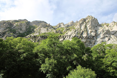
The south cliffs above.
Some larkspur.
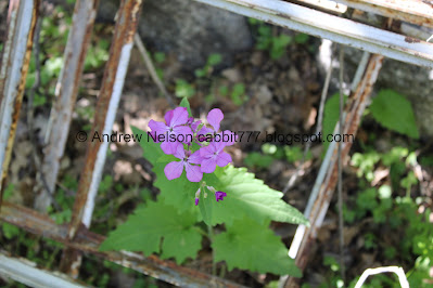
I think this is bitter berry, but not 100% sure. Its weird, they are super fragrant, until you get in close. Meaning they “stink” up the air as you walk by, but when you go in for a closer sniff, nothing. Weird.
Stream coming down the trail.
Which appears to be coming out of this.
The cliffs again.
Cliffs to the north.
You can kind of see the U shaped canyon here.
It looks more and more like the stupid gondola is happening (yay corrupt, pocket filled politicians). I know it will ruin the views, but now I can’t help but wonder how much it will affect this trail.
It is really so lush and green up here!
A hummingbird moth. I love these guys! He was being a little more elusive than the last one I saw.
Neat old machinery of some kind.
I think this might be a woodland star.
This rock shows signs of quarrying. You can learn more about that at the Temple Quarry Trail which happens to be at the bottom of this trail from the same parking lot even. I actually decided to do a quick run through there on the way down.
Another spring, or leak from the pipe.
The trail passes through this little neighborhood for a quick minute. Its hard to see but that lower sign is pointing you to the left here.
Then right at the next fork.
The south cliffs again. I just love them!
The creek going through the power plant.
The trail goes to the left of the gate here.
Woo, the creek is really raging!
We went down a random side trail and found this old cellar.
Money plant. I love these so much I got one for my garden this year. They aren't native, but seem to do well here and we see them on quite a few trails.
It is so lush and green!!
Wow. The epic snowpack we had this winter really did some damage to the trail here.
So pretty. I love hiking in May.
New power poles. It seems they have been recently replaced.
I had the most bizarre experience on the trail today. Twice, twice I got a whiff of something that immediately made me think of Yellowstone. I wish I had located whatever the source was but it was a really weird experience.
Raging creek.
Small but crazy waterfall. It’s so crazy to see it like this after seeing it being 4 tiny trickles just last year.
The lower bridge.
Upstream.
Downstream.
The waterfall again. Wow.
Downstream again. Look at that mist kicking up.
Cliffs to the north.
The super green forest again.
The raging creek.
More forest.
We made it up to Moon Rock. There are a couple drill holes that show they thought about trying to quarry it, but stopped for some reason. I am glad they stopped, cause it is a cool rock!
Little trail split. Doesn’t matter which one you take as it is just a short loop.
There used to be an old, old pavilion here that me and my friend used to hang out in when we were teenagers. However other teenagers then, and until it was torn down used it as a tagging spot so it was torn down. Now they are trying to revegetate the area.
More water coming down the trail.
“The Pipe” this is what we used to use to cross the river to here. I don’t think I could muster the courage to do it now. Particularly not while the creek is this high.
Even this little overflow creek was running high.
More water coming down the trail.
Well, we decided 1.5 miles was our goal today and this was it, so we turned back.
The water from the other direction.
More lust forest.
Another attempted quarry attempt.
It looks like they successfully got a block off this one, and then gave up as well. However this is a good example of the process they used to quarry the granite into building blocks.
Particularly deep drill hole.
More forest.
Back down to Moon Rock.
More pretty forest.
The creek again.
Forest.
Here is a good example of a rock they tried VERY hard to quarry but were unsuccessful.
Panoramic.
Back down to the lower crossing.
Moss covered pipe.
The little waterfall again.
Lizard.
Super green!
The washed out part again.
Forest.
Forest and cliffs.
Back down to the power plant.
Which we just noticed is owned by Murray. Weird.
So Murray has a power plant on Little Cottonwood, and own water rights next to Big Cottonwood Creek, both outside the city limits. I mean, both creeks do run through Murray, but it’s still kind of weird. But I guess Murray was just smart about acquiring resources while being in the middle of the valley. Kind of impressive.
The south cliffs again.
Old equipment.
North cliffs.
More greenness.
The old tractor again.
North cliffs again.
Larkspur.
South cliffs.
I love the way water comes down them this time of year.
Still some snow up in those crags.
Panoramic.
I decided to swing into the Temple Quarry Trail to see the creek again. Some nice forest.
The creek.
Cliffs again.
We took a small side trail down to the creek.
Little rapid.
The perfect U shaped canyon. I really hope we can defeat the stupid gondola plan and not have this ruined.
Panoramic.
Remnants of an old dam.
More greenery.
Cliffs again.
I thought I saw a mountain goat, but it was just a rock catching extra light. I know they generally vacate the area by April, but I thought maybe with the long winter maybe they would still be here. Sigh, unfortunately no.
Another short side trail where we can see the creek with the cliffs above.
Another shot.
Pile of quarried stones.
Larger quarried stones. You can see the drill holes.
So basically how it went was one guy held a big drill bit, and another guy hit it with a sledge hammer. They would keep at it until with a mighty crack, the stone would split. They the transported the stones downtown via a couple different clever methods and built the Salt Lake Temple and a number of other building with these quarried stones. More info at my separate Temple Quarry Trail post.
A much larger quarried stone.
The cliffs again.
Woo! I really do enjoy this trail system! I love the sights of the cliffs, and the roar of the creek. I love how green and lush it is right now and it wasn’t terribly busy, even though we got the last available parking spot. 10 out of 10 squirrels today, even without an amazing end destination.
As for difficulty, it is a bit of a climb, but it is wide, and mostly like paved. DR3.
Dogs are not allowed in Little Cottonwood Canyon due to watershed restrictions. So be sure to leave Fido home.
.jpg)


.jpg)


.jpg)


.jpg)


