.jpg)
The Deer Ridge Loop, AKA Deer Ridge Off Leash Dog Trail, AKA West Bluff Off Leash Test Area is a nice little loop located in Draper. The trail features amazing valley views of both Salt Lake County and Utah County as well as great views of the mountains. This trail system is also what you would use to get to Alien Tower, however we opted to not do that today. The inversion is really bad right now so I was hoping this would get us up above it, and boy was that a good gamble today.
Reviewing the post I made today, I was definitely more interested in the inversion than I was the trail. So, for a better trail guide see my previous post.

Quick Details:
Length: It is about a 2 mile balloon.
Trail Type: Balloon, with out and back options.
Difficulty: DR3.
Elevation Gain: About 350 feet.
Restroom: Yes! They just put in flush toilets.
Dogs? Yes, they can be off leash for nearly the entire way (short bit at the beginning they should be leashed).
Other Info:
To Get Here:
Take exit 288 for 14600 So. Head east. Turn right on Traverse Ridge Rd, turn right on Deer Ridge Dr . Take that to the end. You will hike the old dirt road behind the gate.

You can barely make out Steep Mountain through the smog (Passenger Seat Photography (PSP)).

Passing by Potato Hill as we head up Traverse Ridge (PSP).
The Trail:

WHAT?!?!? Check out the improvements to the trailhead! Actual parking spaces, drinking fountains, flush toilets, picnic areas wow. When did they do this? There wasn’t even a hint that they were going to do this when we were here in May. They got it done fast!
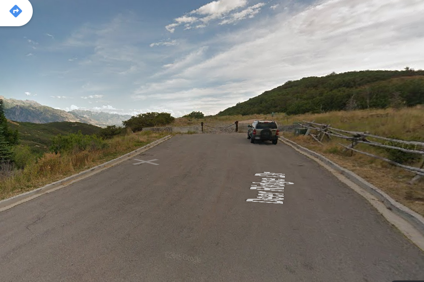
Here is what it used to look like, courtesy of Google Maps.

The trail is to the right of the restrooms.

New gate. With the old configuration I thought I recall that they ask you to keep you dogs leashed until after the second gate. That may have changed with the updates, as I didn't see a sign this time.

Trail rules and other signs. I love the poop fairy signs I see at various trails around Salt Lake County.

Heading up the hill.

Alien Tower off in the distance. We were still debating if we wanted to head up there at this point.

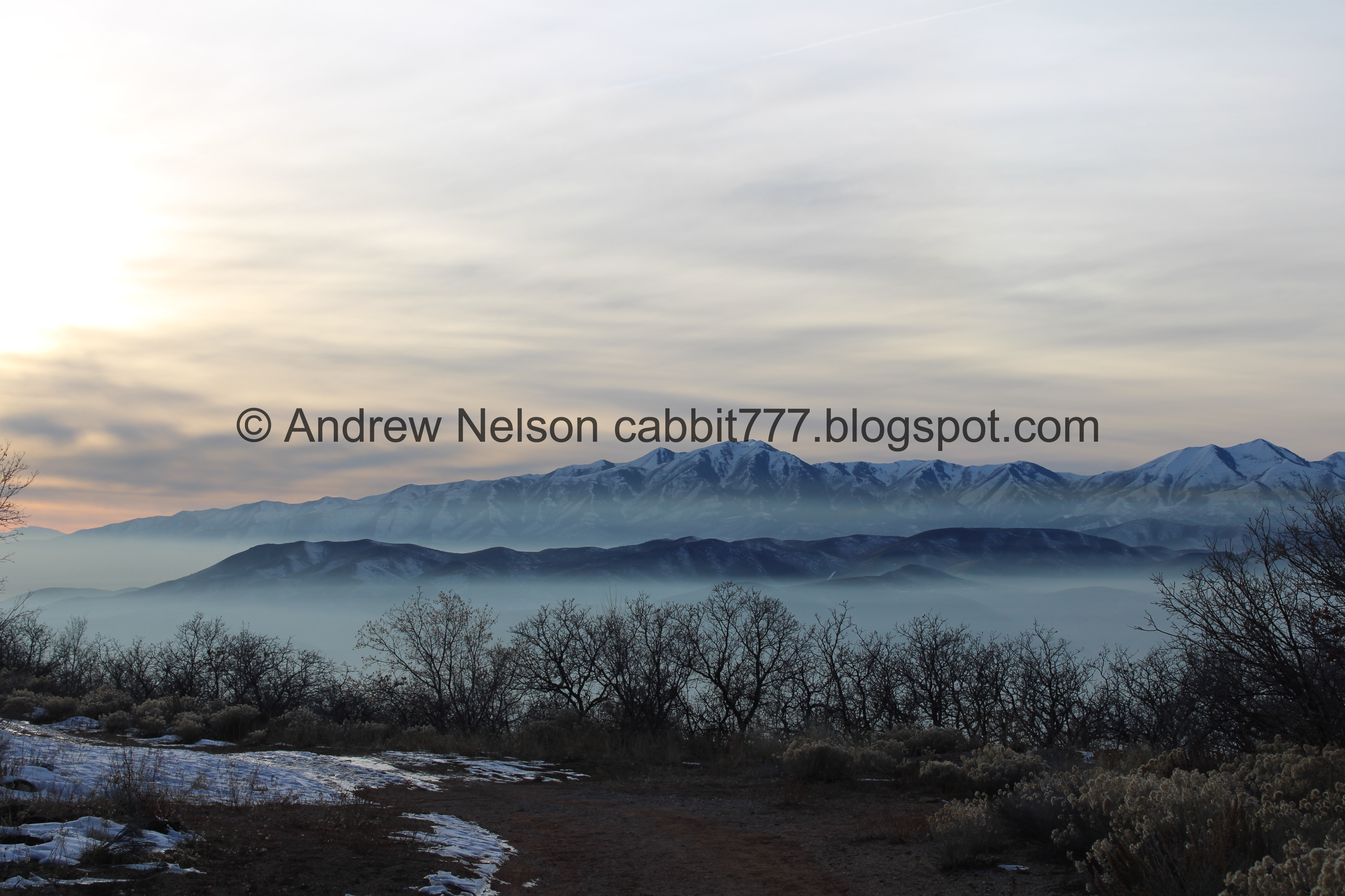
Wow! I was hoping this was going to be high enough to get us up above the inversion, and well, it definitely was! It’s honestly kind of beautiful from above. Then I remember that we are breathing that back home. Yuck!

The Salt Lake Valley is under that! We had this thought on another trail but looking down on the inversion makes we wonder if it is similar to what it would have looked like if Lake Bonneville was still here.

It is just so neat.

So neat.

Before long we get a look into Utah County. It seems a little better on that side, but it might just be the lighting.

Salt Lake County again.

That little blip of an island out there is Frary Peak, the tallest peak on Antelope Island.
Also if you look really closely you can just make out The Claw through the smog, lower centerish.

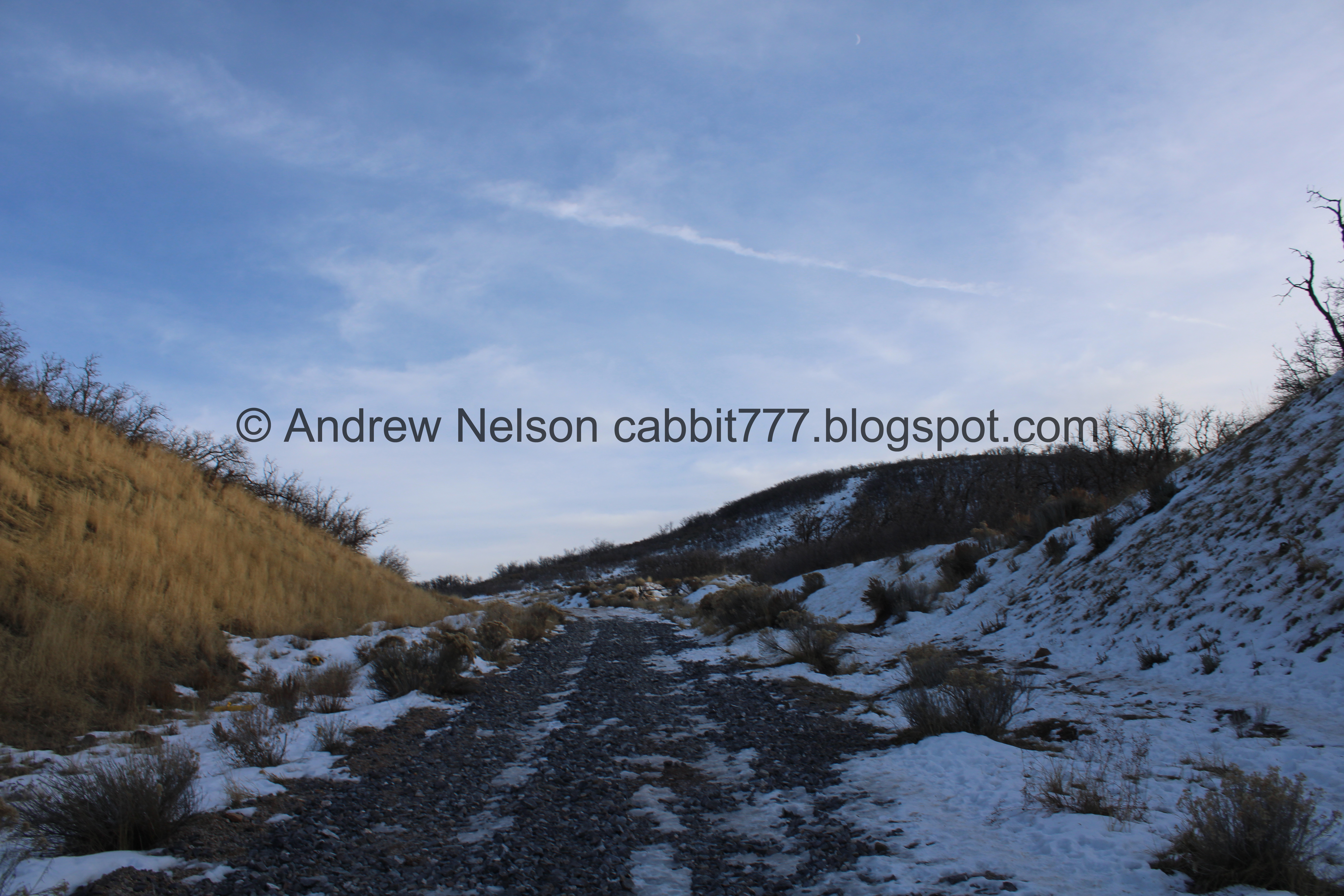
There was a little bit of mud, and a couple of icy spots, but for the most part it was not too bad. We had our micro spikes just in case, and I did contemplate putting them on once or twice, but decided against it due to the conditions changing so much and I didn’t want to play the put them on, take them off game all day.

Here is where the loop splits off. I think left is a little more steep so we prefer to go right.

The trail and the inversion.

The inversion.

Closer.
.jpg)
Panoramic.

Amazing blue skies above, and horrible funk below.
.jpg)
Another panoramic.

Approaching another climb.

The inversion again.
.jpg)
Another panoramic.

Starting the big climb.

Inversion again.
.jpg)
Panoramic.

More inversion.

The tip of Antelope Island again.

The valley.

Again.

Continuing the climb. This part they have filled in a bunch of rocks. Not sure why, but they make the climb a little rough.
Nearing the top.

Looking back down.

The top! Phew!

I don’t really know where this trail leads. It looks like it goes down the other side.
It did offer this neat view though.

Little closer.
.jpg)
Panoramic.

Continuing along the top.

Alien Tower.

Looking back towards the Salt Lake Valley.

This is the turn off for the spur trail out to Alien Tower. It would only add about 3/4 of a mile out and back but there is a bit more of a climb. We decided we have seen it and didn’t do it today. Mostly due to the fact that we were running out of light, and also cause I didn’t want to hassle with the micro spikes.

Continuing around the other side.

Mount Jordan.

The Salt Lake Valley again.

With the top of Antelope Island.

Mount Jordan and Dry Creek Canyon to the right.

The smog wrapping around Mount Jordan.

Mount Timpanogos.

The Salt Lake Valley.

Smog wrapping around Mount Jordan again.
.jpg)
Panoramic.

The turn off to head back down is a little hard to spot, if you miss it, it isn’t going to add too much as the main road will end not much further along. It is a little steep here, but there is a slightly less steep way down just 20 or so feet further.

The slightly less steep way down. Plus it had a snow free shoulder to use, so win win.

Continuing down.

The inversion again.
.jpg)
Panoramic.

Lots of snow.

Mount Jordan.

Undercut slope that is crumbling down.

Utah County again.

Salt Lake County again.
.jpg)
Another panoramic.

The last of the climb down before rejoining the main road.

The main road.

Mountain views.
.jpg)
A kind of unique view of the mountains above the Salt Lake Valley, and the mountains above Utah County.

Alien Tower again.

A faint sunset above the inversion.

Utah County again.
.jpg)
Panoramic.

Back to Salt Lake County.

Nearing the trailhead.

Found another trail counter. Seriously, it seems like almost every single trail we use has one of these now. It just counts how many people walk past it. I imagine they use that data to justify making improvements such as the ones we saw here today.
I accidentally confirmed that trying to find some other information in this article here.

Back to the lower gate.

Back down to the new parking lot. It is still kind of blowing me away how quickly they got this all built, I wonder if it disrupted trail use very much. I guess it started in June, and completed in October. Aside from the new running water restrooms, drinking fountains and picnic areas, they added 44 paved parking spots, according to the article I linked above.

Mount Jordan.

Nearby Maple Hollow Trailhead Park.

Neat old water tower on the way back (PSP).


Heading back doing into it (PSP).

Passing Potato Hill again (PSP).


And we’re back in it (PSP).
That was fun. I really enjoyed being up and out of the inversion and being able to breath and see blue skies. Plus it is always neat the see the inversion from above. For a very popular trailhead it wasn’t too busy today. I usually like going up to Alien Tower, but even without doing that it was an enjoyable walk. 10 squirrels today.
As for difficulty, its a bit of a climb, but not too bad. DR3.
Dogs are allowed, even off-leash for almost the entire way.

No comments:
Post a Comment